Welcome to Breakfast in America
I’m a Brit who unexpectedly emigrated to the USA in 2008, and this is my photo journal.
It’s an eclectic mix of things; there’s no guiding theme or topic. It is whatever catches my attention, what I’ve been thinking, doing, or piques my interest. Currently that’s mainly backpacking and clearing some of the backlog on my ‘honey-do’ list.


Memories
A dozen pictures, picked at random from my favorite memories. You can see my portfolio here.

Communications Director with the WEMO Youth

Blessing of the Animals #1

Labor Day Weekend With The Parents
Empty Chair

Evening Prayer at Kanuga

Breakfast in America
Gary at the Big Paddy Creek Scenic Overlook, Paddy Creek Wilderness

Smoke, No Mirrors – Reprise

Mike and Diffi’s Wedding – The Reception

Hercules Glades Wilderness from the Pole Hollow Trail – Looking east

Lunch in the shade by Paddy Creek.

Across The Tracks
Recent Posts
-
Catching my breath
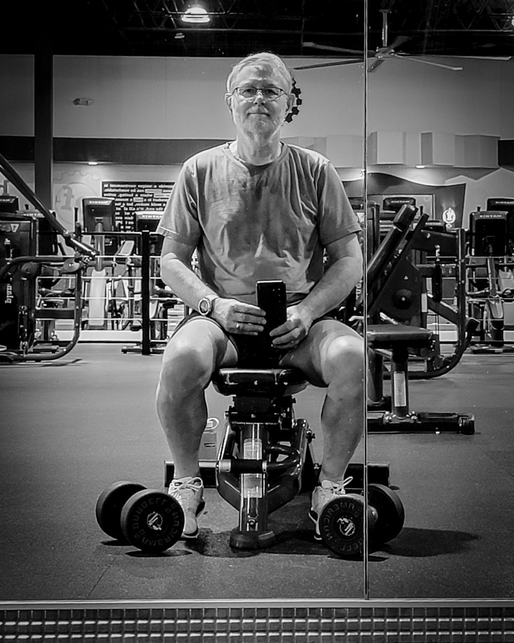
Catching my breath — I don’t think I’m looking too shabby at 70. Copyright © 2026 Gary Allman, all rights reserved. In a good week, I manage three or four visits to the gym. On each visit, I walk/run 3.1 miles (5k) and then spend 30 minutes strength training.
My current goal is getting back to my December 2024 condition and running 5k in under 36 minutes. It’s proving much harder than I expected. There was a two-month illness break, several medication changes, and a right knee injury that took months to resolve. I’m currently dealing with what appears to be aerobic deconditioning, and possibly statin-related muscle fatigue.
I’m now switching to a more structured run-walk program before maybe adjusting my CoQ10 supplement dosage.
-
Lanie, April 2026
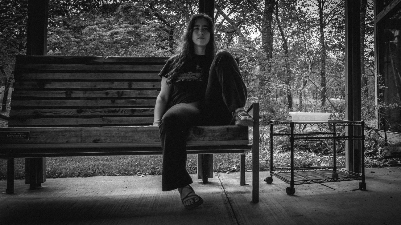
Lanie, April 2026 — Botanical Garden of the Ozarks, Fayetteville, Arkansas, April 2026. Copyright © 2026 Gary Allman, all rights reserved. I grabbed this candid shot of Lanie while we were taking a rest in the shade outside the butterfly house at the Botanical Garden of the Ozarks.
Unfortunately, the butterfly house was closed for renovation.
-
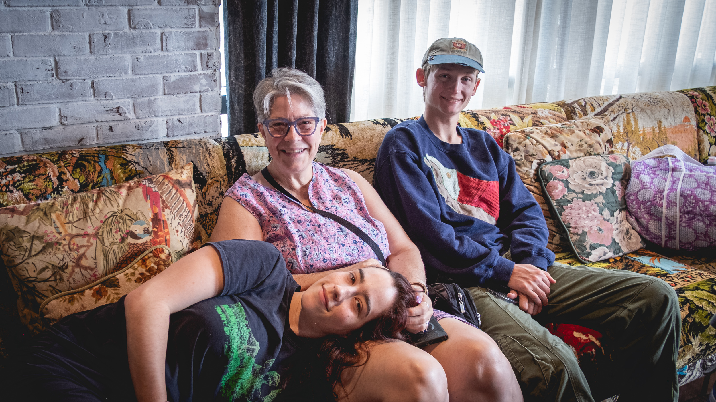
Making plans

Making plans — Graduate Hotel, Fayetteville, Arkansas, April 2026. Copyright © 2026 Gary Allman, all rights reserved. Lanie and her bf Lewis joined us for our ‘mini-break.’ We took a few minutes before we left the hotel to decide what to do with our day. Most attractions around Fayetteville are closed on Mondays, which limited our choices. We decided on visiting the Botanical Garden of the Ozarks. It turned out to be a great choice.
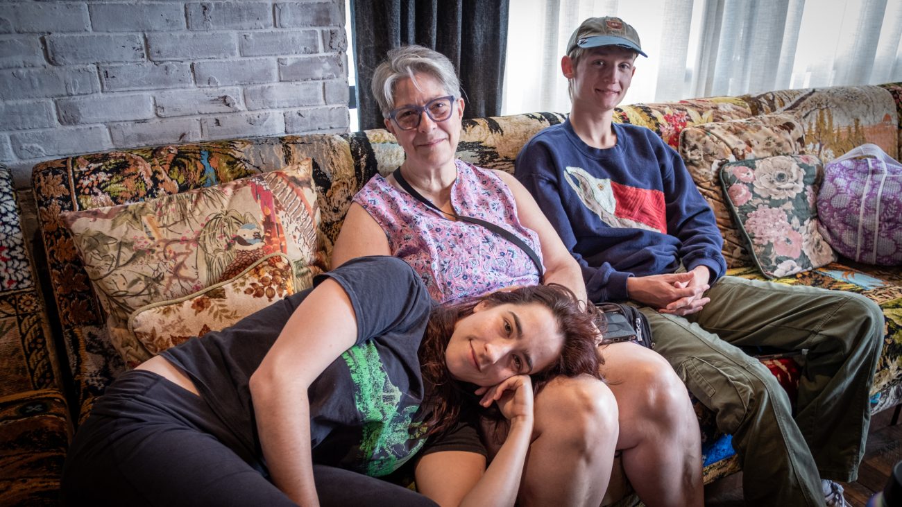
Making plans — Graduate Hotel, Fayetteville, Arkansas, April 2026. Copyright © 2026 Gary Allman, all rights reserved. -
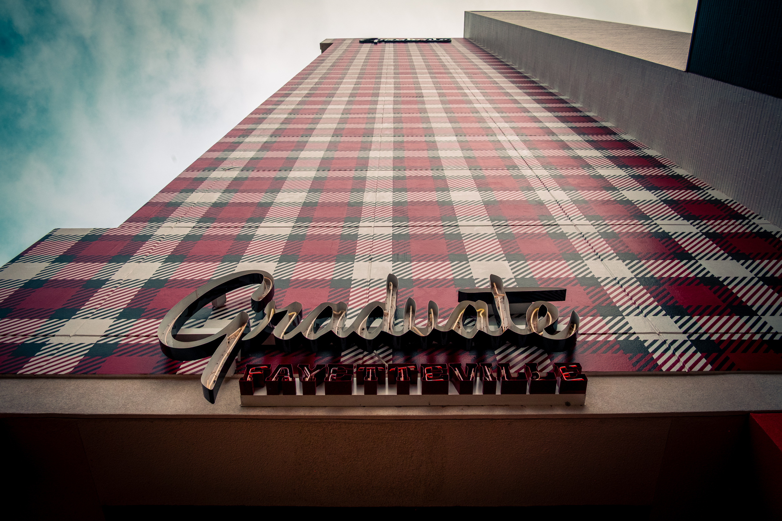
Well plaid
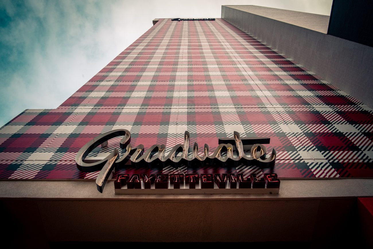
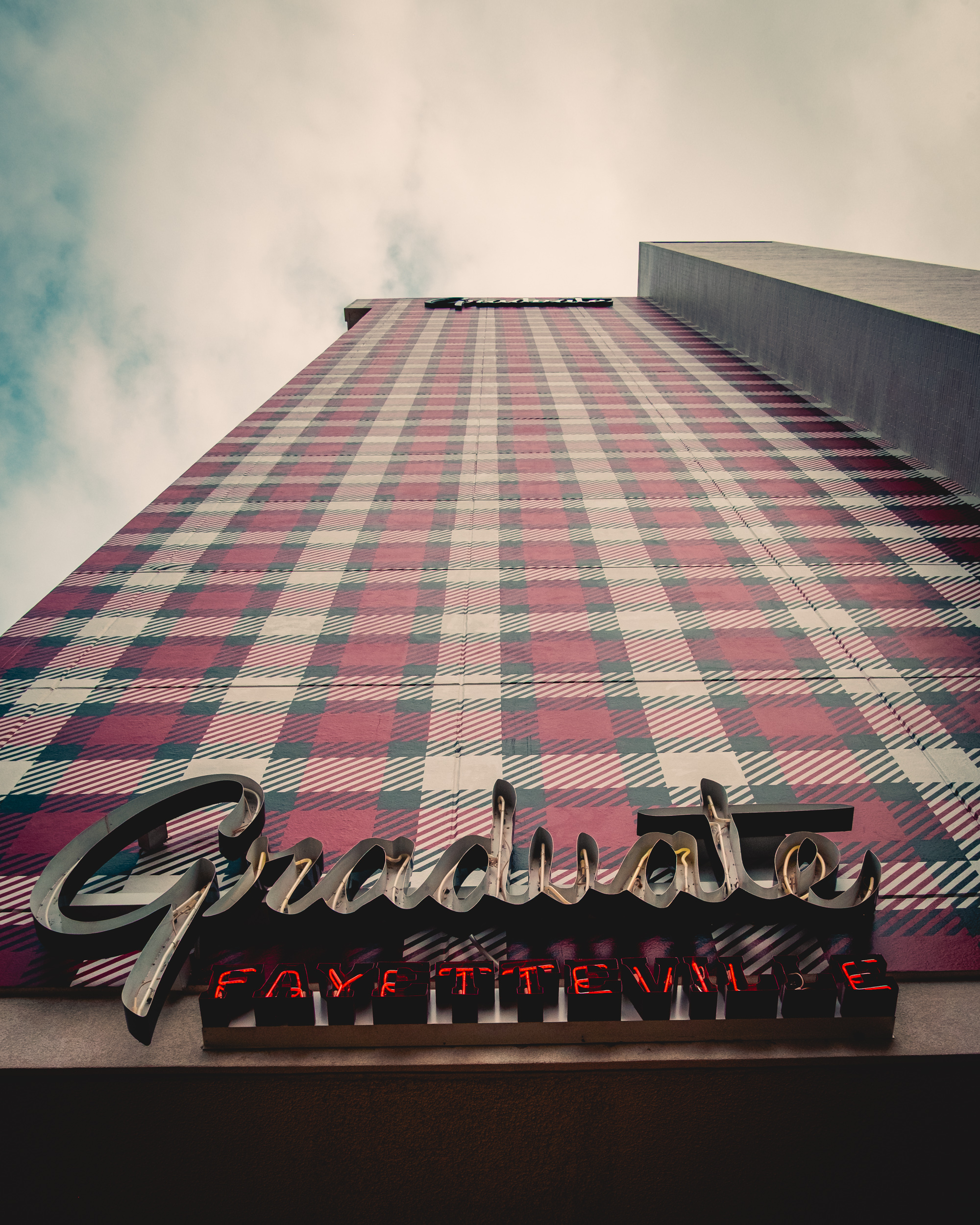
Well plaid — When we arrived at the hotel on Sunday, I knew I wanted to get this picture. Monday, I grabbed it. I had to lie down in the road to get the picture, but it was worth it. Graduate Hotel, Fayetteville, Arkansas, April 2026. Copyright © 2026 Gary Allman, all rights reserved. 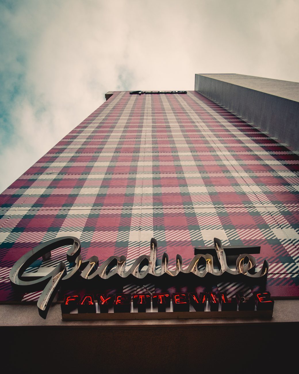
Well plaid too — When we arrived at the hotel on Sunday I knew I wanted to get this picture. Monday, I grabbed it. I had to lie down in the road to get the picture, but it was worth it. Graduate Hotel, Fayetteville, Arkansas, April 2026. Copyright © 2026 Gary Allman, all rights reserved. -
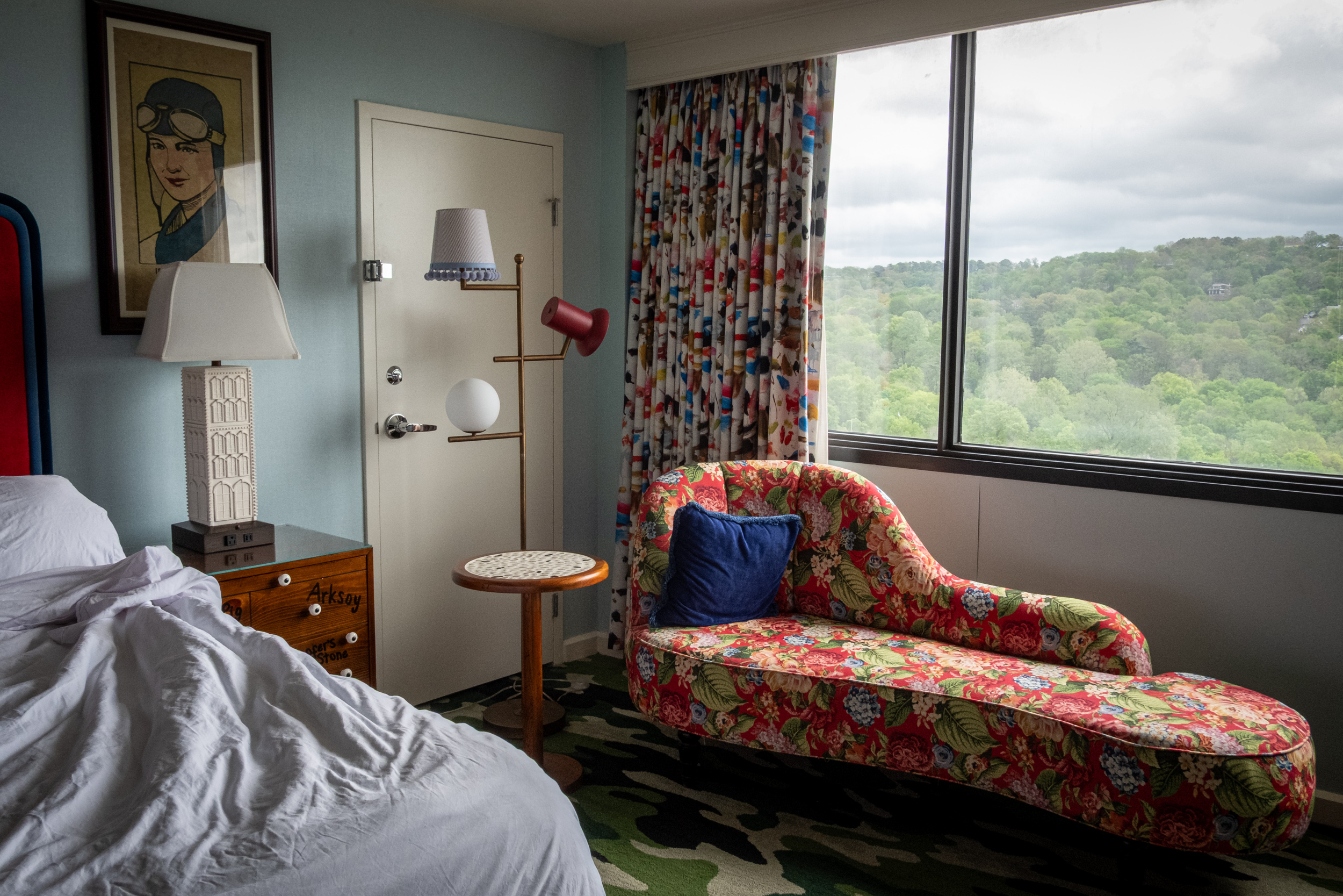
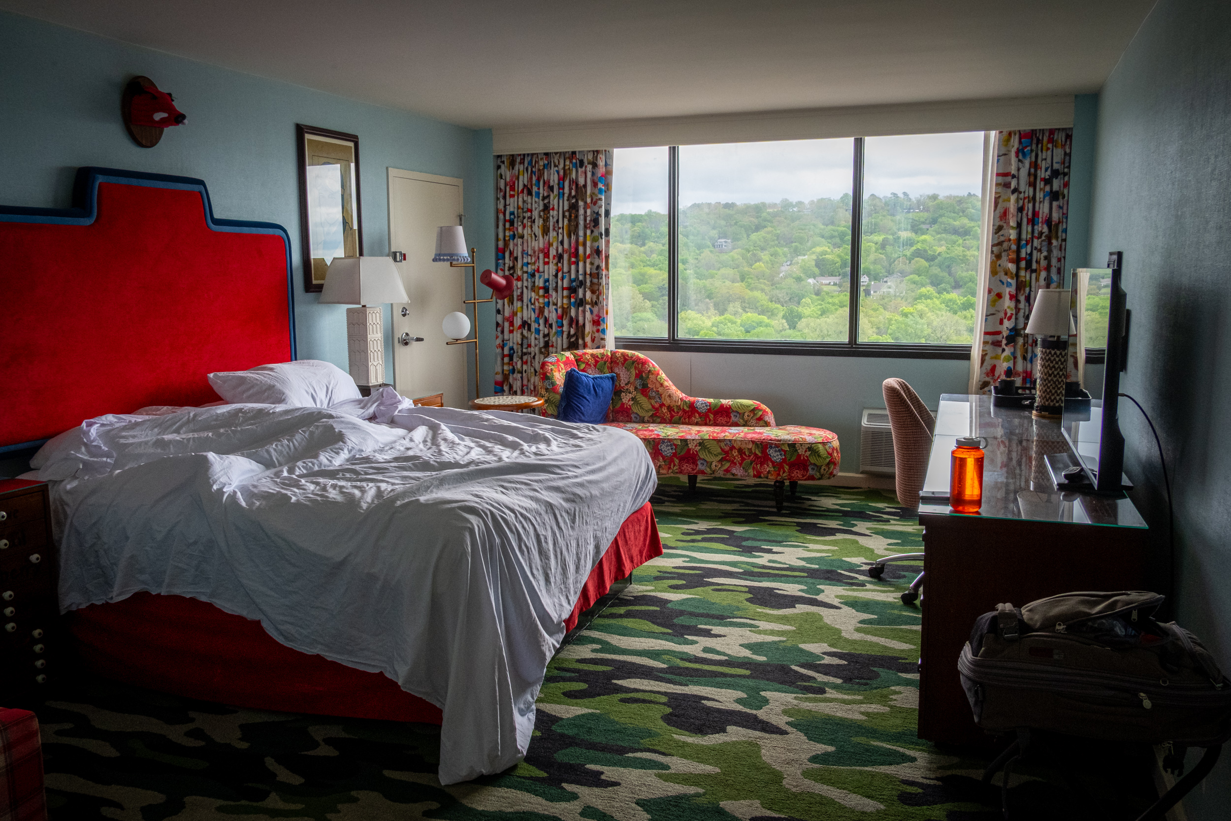
Decor, the Graduate Hotel, Fayetteville

Decor, the Graduate Hotel, Fayetteville — Not only was I enamored with the camo carpet, I also love the colorful curtains. Fayetteville, Arkansas, April 2026. Copyright © 2026 Gary Allman, all rights reserved. 


-
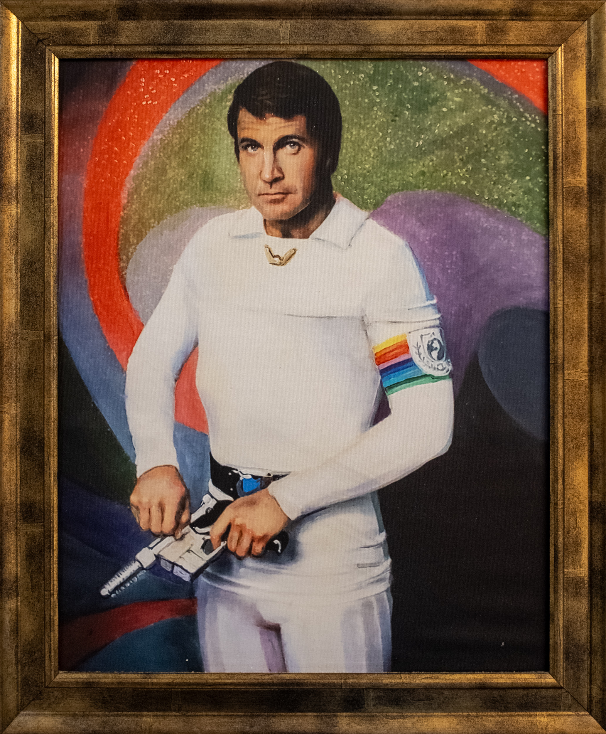
Buck Rogers, Artist unknown

Buck Rogers. Artist unknown — Graduate Hotel, Fayetteville, Arkansas, April 2026. Copyright © 2026 Gary Allman, all rights reserved. Welcome to our hotel bathroom art. I was not familiar with the film or TV series until now and initially thought that the picture might be of Lee Majors. Ginger put me right by identifying the local (Little Rock, Arkansas) actor Gil Gerard, 01-23-1943 — 12-16-2025.
Something was troubling me about this picture, then I realized. Buck is left-handed, which made me do some research. I’ve found copies of the original photograph this picture was copied from oriented both ways round, which seems to be a common practice in promotional imagery and fan art. The image is definitely reversed, because the hair parting is on the wrong side, and the arm patch should be on the right arm. I’ve looked at many pictures and a couple of videos to check — the lengths I go to in order to fact-check things.
Whatever, the character’s got another four centuries to go before he arrives in the twenty-fifth century, so maybe he’ll swap handedness in his frozen sleep.
-
Eclectic Decor, Graduate Hotel, Fayetteville
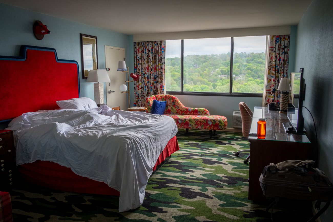
Eclectic Decor, Graduate Hotel, Fayetteville — Fayetteville, Arkansas, April 2026. Copyright © 2026 Gary Allman, all rights reserved. The theme is upmarket seventies/eighties student accommodation, but clean and tidy! The camo carpet had me sold and the hotel was full of nice little touches. The room key cards were student ID cards.
-
After the concert

After the concert — Fayetteville, Arkansas, April 2026. Copyright © 2026 Gary Allman, all rights reserved. We were in Fayetteville for a Chris Thile concert. We enjoyed seeing him at the Kauffman Center, Kansas City in February, and booked tickets when we saw he was going to be in Fayetteville.
We had not been to Fayetteville before, and it must be said that we were very impressed with both the concert (as expected) and Fayetteville. We’ll be looking for more opportunities to come and visit.
-
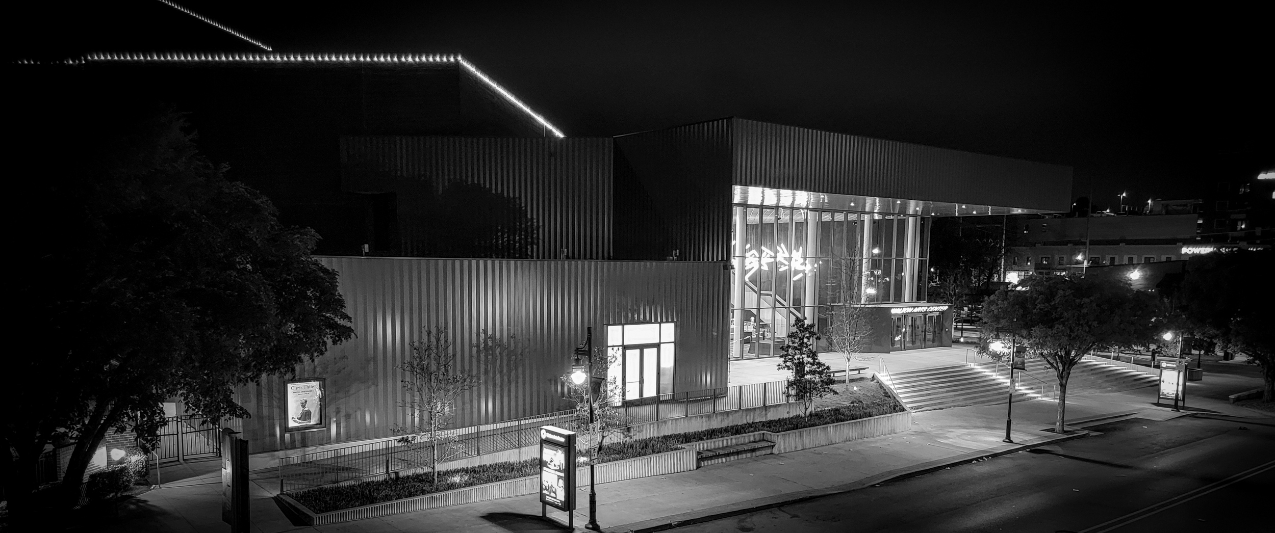
Walton Arts Center, Fayetteville, Arkansas
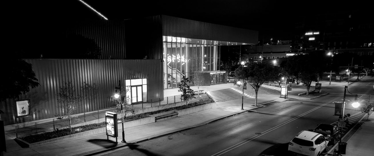
Walton Arts Center, Fayetteville, Arkansas — Fayetteville, Arkansas, April 2026. Copyright © 2026 Gary Allman, all rights reserved. We were in Fayetteville for a Chris Thile concert. We enjoyed seeing him at the Kauffman Center, Kansas City in February, and booked tickets when we saw he was going to be in Fayetteville.
We had not been to Fayetteville before, and it must be said that we were very impressed with both the concert (as expected) and Fayetteville. We’ll be looking for more opportunities to come and visit.
-
Old and new
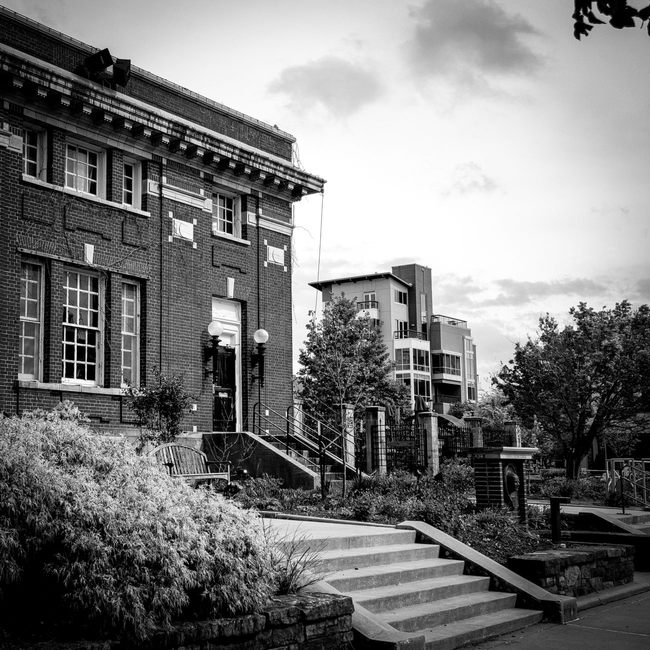
Old and new — Fayetteville, Arkansas, April 2026. Copyright © 2026 Gary Allman, all rights reserved. The older building in the foreground appears more substantial and has much better proportions than the newer building in the background. The latter looks insubstantial, flimsy, and ill proportioned.