Welcome to Breakfast in America
I’m a Brit who unexpectedly emigrated to the USA in 2008, and this is my photo journal.
It’s an eclectic mix of things; there’s no guiding theme or topic. It is whatever catches my attention, what I’ve been thinking, doing, or piques my interest. Currently that’s mainly backpacking and clearing some of the backlog on my ‘honey-do’ list.
Popular posts
Trending pictures and short posts.


Popular pages
Trending longer content.


Memories
A dozen pictures, picked at random from my favorite memories. You can see my portfolio here.

How near, how far?

Gary and Ginger at the Pole Hollow Cairn

Little Sac River, near Willard, Missouri

Thanksgiving 2016 – Family Picture

Piney Creek Wilderness at Table Rock Lake

Gary and Sprinky (365:278)

Choices: Hiking the Silver Trail at Busiek State Forest and Wildlife Area

Small Falls on ‘Cab Creek’

Hitachi C10FR Table Saw — My next project

March Hibiscus

Looking up Long Creek

Sunset – Cedar Ridge, Stockton Lake, Missouri (#2)
Recent Posts
-
Cascade on Chalk Creek

Cascade on Chalk Creek. Day 6 – Road Trip October 2025. Copyright © 2025 Gary Allman, all rights reserved. I’m feeling pretty good after a few days of acclimatizing to the altitude — over 9,000 feet at the Cascade Campground. It’s time for a hike, and to see how it goes. There’s a short hike on the Cascade Creek Trail to see the Agnes Vaille Falls. Too short, so I’m leaving the car at the campsite and walking along the road to the trailhead, and I’ll also do some exploring while I’m out.
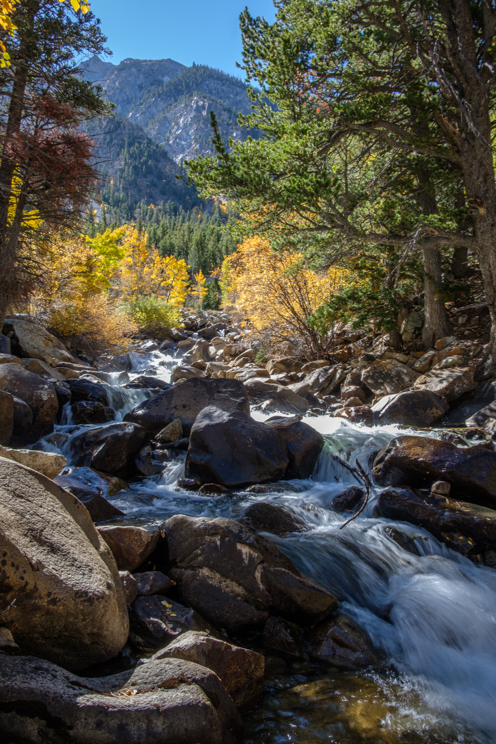
On the way to the trailhead, I passed the Cascade Viewpoint and went down for a closer look at Chalk Creek. The picture is slightly blurry because I didn’t bring a tripod, and I used a long exposure — handheld — to soften the flow of the water.
-
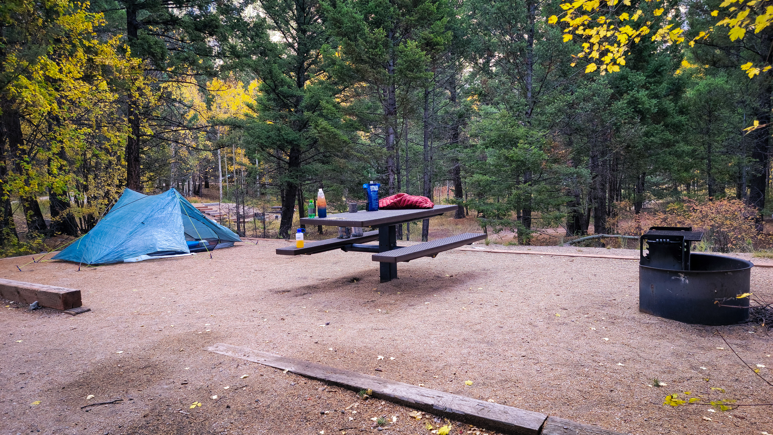
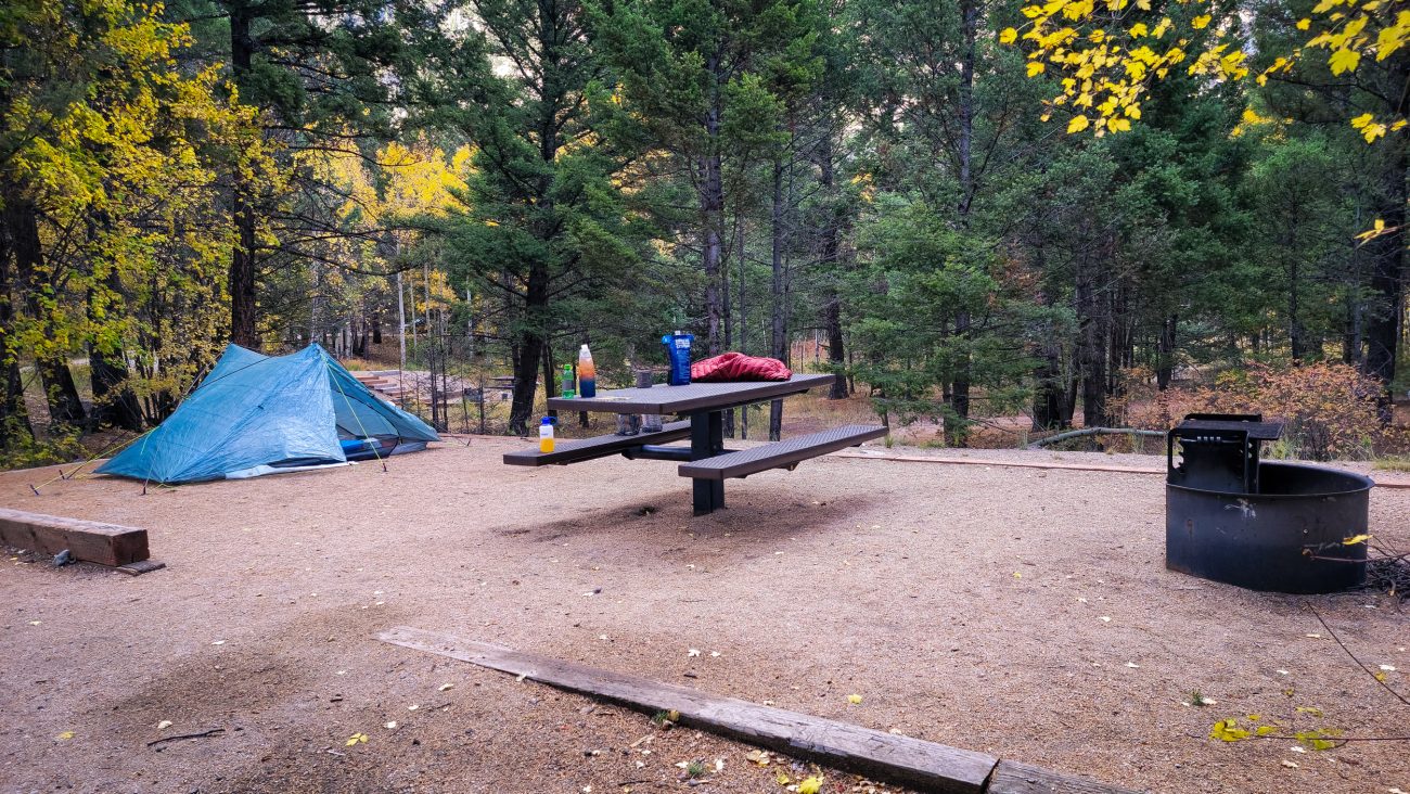
Camped at the Cascade Campground

Camped at the Cascade Campground, Chalk Creek Canyon, San Isabel National Forest. Day 6 – Road Trip October 2025. Copyright © 2025 Gary Allman, all rights reserved. -
Camped at the Cascade Campground

Camped at the Cascade Campground, Chalk Creek Canyon, San Isabel National Forest. Day 6 – Road Trip October 2025. Copyright © 2025 Gary Allman, all rights reserved. -
Camped at the Cascade Campground
Camped at the Cascade Campground, Chalk Creek Canyon, San Isabel National Forest. Day 5 – Road Trip October 2025. Copyright © 2025 Gary Allman, all rights reserved. -
Chalk Creek Canyon, San Isabel National Forest
Chalk Creek Canyon, San Isabel National Forest. Day 5 – Road Trip October 2025. Copyright © 2025 Gary Allman, all rights reserved. -
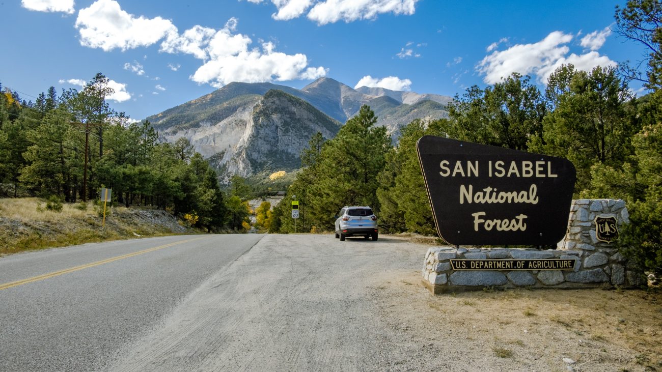
Approaching Chalk Creek Canyon

Approaching Chalk Creek Canyon. Day 5 – Road Trip October 2025. Copyright © 2025 Gary Allman, all rights reserved. They call these the Chalk Cliffs. This area has hot springs, which caused a chemical reaction that created the chalky-looking rocks, resulting in various features being named after their chalky appearance. Chalk Creek runs down through Chalk Creek Canyon, and there’s a Chalk Lake too.
But there is no chalk… The cliffs are made of a soft, white clay mineral called kaolinite, not chalk, which is a limestone (calcium carbonate) deposited in a sea. In the picture, you can see Mount Antero, 14,269 ft. (left) and Mount Princeton, 14, 204 ft. (right, behind Tigger Peak).
-
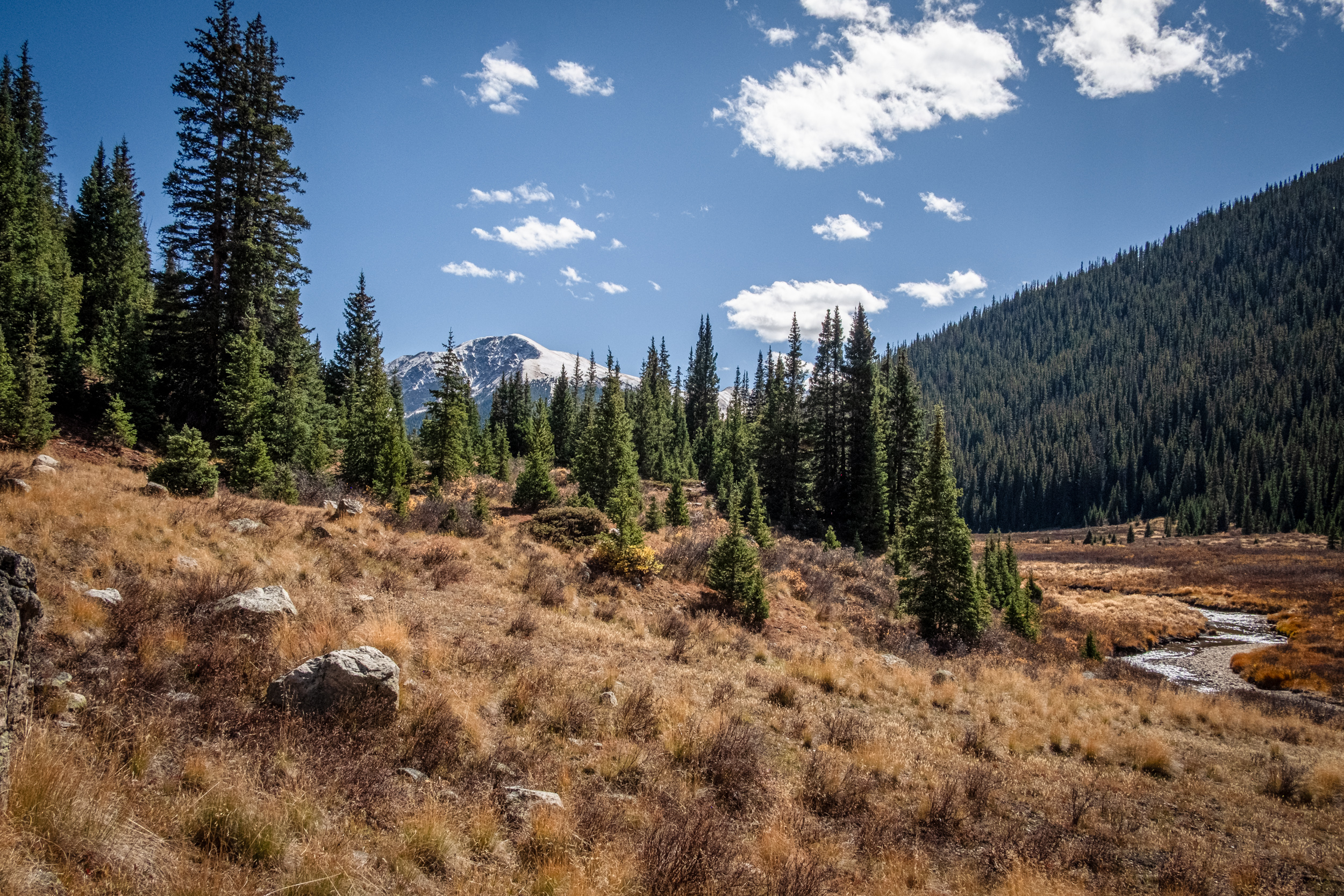
Snow on the mountain tops

Snow on the mountain tops. Day 5 – Road Trip October 2025. Copyright © 2025 Gary Allman, all rights reserved. -
Snow on the mountain tops

Snow on the mountain tops. Day 5 – Road Trip October 2025. Copyright © 2025 Gary Allman, all rights reserved. -
Heading east on Independence Pass

Heading east on Independence Pass. Day 5 – Road Trip October 2025. Copyright © 2025 Gary Allman, all rights reserved. -
Heading east on Independence Pass
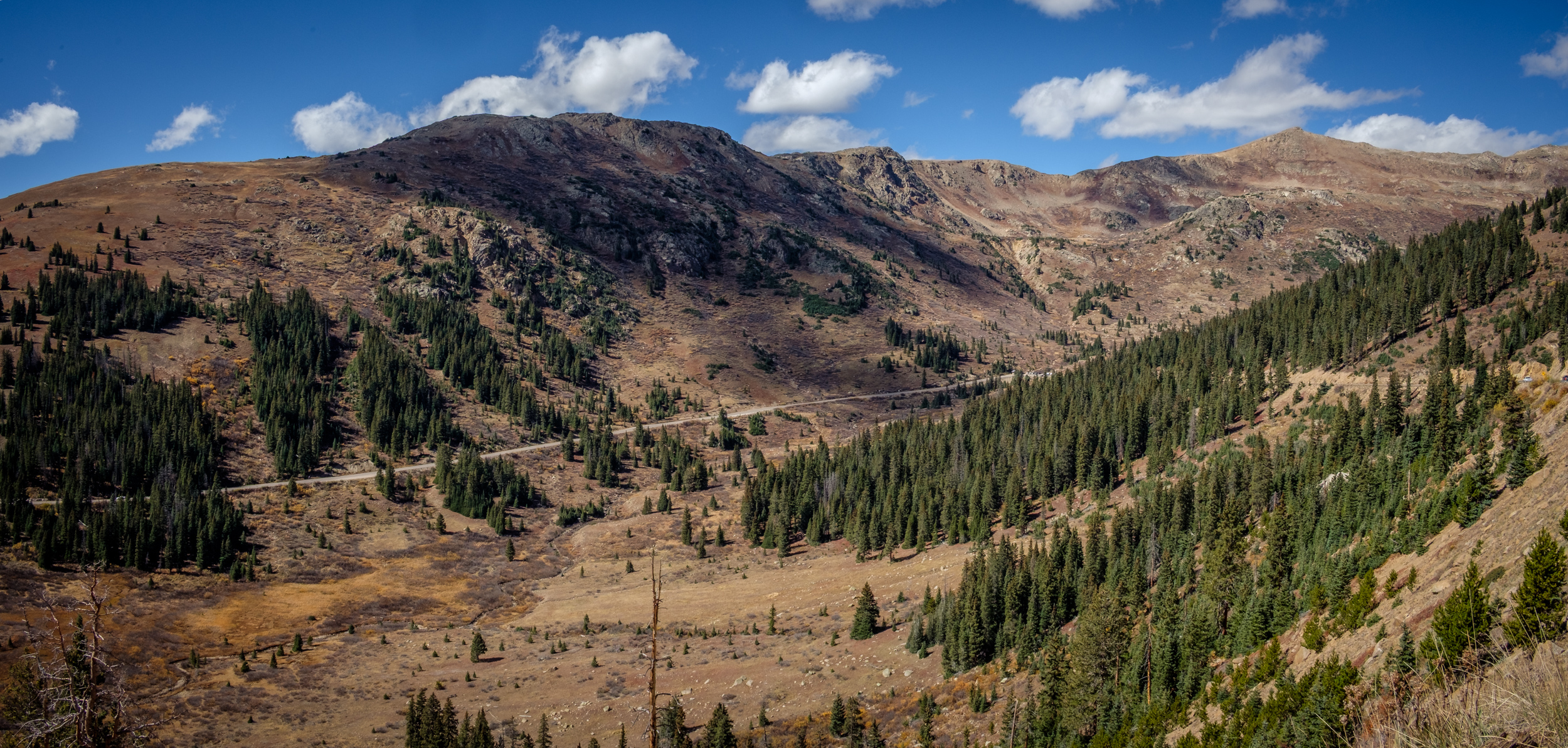
Heading east on Independence Pass. Day 5 – Road Trip October 2025. Copyright © 2025 Gary Allman, all rights reserved.