-
Ready for the trail

Ready for the trail. Copyright © 2021 Gary Allman, all rights reserved. Only two or three miles left to go. Don’t come to me for outdoor fashion guidance. I hike to my own tune, and I like mixing my metaphors!
-
The view from my chair – Stereo image


-
And very tall trees too

Copyright © 2021 Gary Allman, all rights reserved. Vertical panorama of five images.
-
Trees, trees, and more trees

Trees, trees, and more trees – And my mini tripod (front and center) is fastened to one of them. Copyright © 2021 Gary Allman, all rights reserved. -
Lunch break, and I’m showing a bit too much thigh

Lunch break. I’m showing a tad too much thigh. Copyright © 2021 Gary Allman, all rights reserved. I had a choice of routes to take today. The short route takes the North Fork Loop east back to the Ozark Trail, where I could get back to the trailhead. The longer route goes south, and into the Devil’s Backbone Wilderness, and returns to Highway CC via the McGarr Ridge Trail (and a 300 foot climb up onto McGarr Ridge). This route crosses Highway CC near its bridge across the North Fork River, runs through the recreation area to Blue Spring (it seems nine out of ten springs in the Ozarks are called ‘Blue Spring’). The problem with the southern route is that it is several miles longer, and from what I had seen, there is no trace of a crossing point on Highway CC, so it quite possibly doesn’t even exist anymore. I decided I’d make my mind up when I got to the trail junction.
I never did see the trail junction, and I looked carefully, so I ended up on the North Fork Loop heading east back to the Ozark Trail. As that route was significantly shorter, I decided to stop for an hour (or more) for a cup of tea, some lunch, and to just enjoy the forest in the sunshine.
-
Day Three – Back on the North Fork Loop Trail

Back on the trail. Copyright © 2021 Gary Allman, all rights reserved. -
Nothing but trees

Nothing but trees. Copyright © 2021 Gary Allman, all rights reserved. Camped in Mark Twain National Forest, it was a wonderful morning in a rejuvenating spot.
-
Dappled

Dappled. Copyright © 2021 Gary Allman, all rights reserved. -
Hammock Camping

Chameleon Hammock – And Hammock Gear under quilt and tarp. I didn’t need the tarp. Copyright © 2021 Gary Allman, all rights reserved. 

-
Stereo Image – Just Trees


It’s difficult to see the trees for the woods in a normal forest photograph, you need your full 3D vision to be able to separate things.
-
Breakfast comforts

Breakfast – A cup of tea, South West Breakfast Skillet followed by a cup of coffee. Copyright © 2021 Gary Allman, all rights reserved. A cup of tea and Mountain House South West Breakfast Skillet, followed by a cup of coffee, and all enjoyed from the comfort of my camp chair. I did a lot of staring into space, admiring the view, as the trees swayed, shining dappled sunlight while the breeze blew. I doubt this spot has seen a human visitor in many years.
I am thankful that I am fortunate enough to be able to get out into the woods to sit quietly and enjoy nature.
-
Eight O’Clock and I’m finally camped for the night

Camped for the night above North Fork River – not that I could see it. I was over 200 ft above it. Copyright © 2021 Gary Allman, all rights reserved. Climbing up away from the North Fork River I finally found an area with lots of short leaf pines (and ticks as it happened). I had to go about a quarter mile off trail before I was satisfied that I was well away from the trails and horse trails in the area.
Yes, the LED light-string is back, at a couple of ounces why not? With the trickle charge feature on my new battery pack I don’t need to carry any batteries for the lights, so packing them was a ‘no-brainer.’
Once more, hammocks for the win. The hillside was very steep, and wouldn’t have worked with a tent.
-
Glimpse

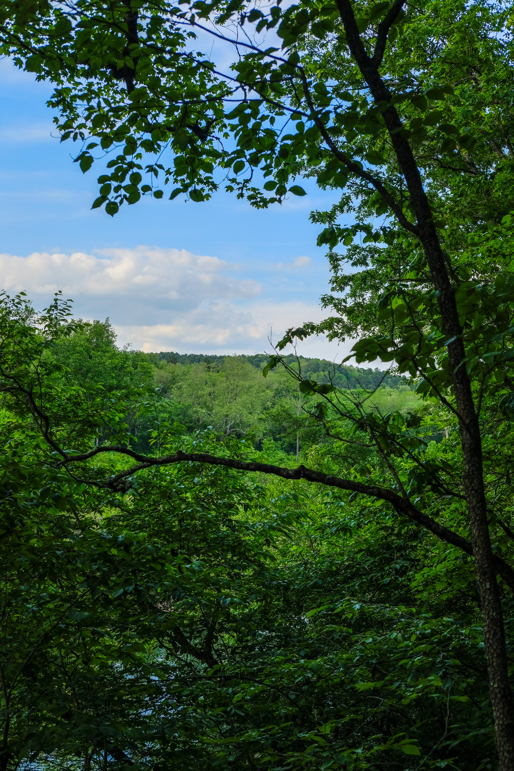
Glimpse – A glimpse of the sky, and the river can just be seen through the leaves. Copyright © 2021 Gary Allman, all rights reserved. As in my recent trip to Irish Wilderness, picturesque views were hard to come by. To have any chance of seeing the North Fork River I am going to have to come back in the winter when there are no leaves on the trees.
It doesn’t look it, but the trail is 60-100 feet above the river.


-
Steam Mill Hollow Creek Crossing

Steam Mill Hollow Creek Crossing – This is where the main North Fork Loop Trail crosses the creek in Steam Mill Hollow Copyright © 2021 Gary Allman, all rights reserved. I’m back on the main North Fork Loop trail. It took me an hour and a half to hike to where the North Fork Loop trail crosses the creek from the north (left of frame) heading south. This was my second preferred spot to camp. Well, actually, the spot I’d seen on the satellite images was several hundred yards to the northwest (behind me) near the North Fork River.
I tried bushwhacking to my destination, but the area was so overgrown I gave up on that idea. I had my first encounter with American stinging nettles while bushwhacking here. Ginger has previously told me that American nettles were much more painful than UK nettles. From my own experience, they’re the same. They are both ouchy! Though these nettles didn’t bring up the huge white welts that UK ones have. But maybe that was because I washed my legs down in the creek as soon as I got out of the undergrowth.
Now for plan ‘C’ for today’s camp. Follow the trail south, up onto the ridge and find a nice stand of pines well off of the trail and stop there for the night.
-
Overhang

Overhang, not very spectacular, but the sides of the hollow were impressively steep. Copyright © 2021 Gary Allman, all rights reserved. It looked a bit too low and damp to make a good camping spot for anyone with a tent.
-
Spring on Steam Mill Hollow

Spring – closer inspection of the map showed that I’d missed this spring when planning my trip. Copyright © 2021 Gary Allman, all rights reserved. It wasn’t a raging torrent, but it was putting out several gallons a minute. The spring is right by the trail, and the outflow runs along the trail for a few yards.
-
Lunch break by the creek in Steam Mill Hollow

Steam Mill Hollow – Cool and pretty, but very overgrown, and I decided to fill up with water and camp somewhere else. Copyright © 2021 Gary Allman, all rights reserved. Not that I knew it was the creek in Steam Mill Hollow at the time. It seems I need to learn several more lessons in checking my compass and map before I assume I know where I am. This was the area I had originally picked as my preferred stopping point for the day. But it was far too overgrown for my liking, and I decided I’d rather fill up with water and carry a gallon-plus of water on the trail up to the top of the ridge and camp among the pines. It was several degrees cooler down in the hollow, but upon the ridge, there would be a breeze to cool things down.

Filtering water. Three hours later and I’m at one of my potential destinations for the day, and there is a good water source. Copyright © 2021 Gary Allman, all rights reserved. Now would have been a good time to check the map I picked up at the trailhead. There wasn’t any trail leading down to this hollow, I used an old forest road to get here. The area was crisscrossed by horse trails, so I had no concerns about finding a trail back out to the main North Fork Loop, but had I checked, I would have found out that the trail I planned to hike out on no longer exists.
I spent an hour or more enjoying the scenery and eating my lunch of Tuna, noodles, and nuts & raisins, having a cup of tea, and filtering water for the night and the next day.
Knowing I was on a small creek to the east of the ridge I’d just come down, all I needed to do was hike back to where the creek joined and turn right, and I’d be on my way. Perfect, if I had indeed been on that creek. Rationing my GSP batteries meant I didn’t bother to check my location, and no, I didn’t bother to check what direction I was headed in with my compass.
So I did exactly that, and I was bumbling along at a fair clip when I thought things weren’t quite right. Firstly it didn’t feel like I was hiking in the right direction, and secondly I was hiking upstream when I should have been going down stream.
A quick check on the compass showed I was going northeast. Really? I reluctantly go out the GPS and discovered that I was now going up the creek I thought I’d stopped for lunch on. Oh well, time to turn around and find the right way out of here.
Thanks to the compass and map I was soon on the correct trail and heading west — the right direction — the trail was very easy to follow, as it is heavily used by horse traffic. I wasn’t too disappointed when I couldn’t find any sign of trail leading off to the north heading up back to join the main loop. I decided to follow the horse trail, which I guessed would be heading to the North Fork River (it was) and back on to the North Fork Loop Trail there.
-
Nice Trail (but you may have trouble following it)

Nice Trail (but you may have trouble following it). Copyright © 2021 Gary Allman, all rights reserved. The map I was using was slightly under twenty years old (and the best I could find online). I should have cross-checked it against the trail map at the trailhead. If I had, I would have seen that the objective for my day’s hike was no longer on the trail system. I would also have noticed that at least one of the trail’s many loops into hollows had been replaced by a shortcut. Knowing that would have saved me a mile or more of bushwhacking.
The above picture is fairly typical of the trail conditions, though in several places it was completely overgrown by encroaching vegetation. I need to come back in the winter when it will be possible to see the views across the hollows. from what I could make out in the gaps in the leaf cover, it was quite impressive.
A fair way along this section of the trail I was to encounter the only people I met in my two-and-a-half-day trip. It was a group of five people on horseback. I was more than happy for them to overtake me and clear the trail of spiders webs for me.
-
Trail junction, there goes the Ozark Trail

Trail junction – Here I leave the Ozark Trail. Copyright © 2021 Gary Allman, all rights reserved. Now I’m off on the lesser-traveled and not well-blazed North Fork Loop Trail. From the trail junction, it’s easy to see that this trail might have some challenges.

Not the Ozark Trail – But at least it has a blaze (they put lots near some of the junctions to give you a false sense of security). Copyright © 2021 Gary Allman, all rights reserved. -
Cairns, cairns, and more cairns

Cairns – there were lots in this area, but I couldn’t see any side trails or other blazes. Copyright © 2021 Gary Allman, all rights reserved.