-
Fallingwater — Frank Lloyd Wright

Fallingwater. Bear Run, Fayette County, Pennsylvania. Copyright © 2018 Gary Allman, all rights reserved. We didn’t book early enough so we only got to go on the ‘short’ (90 minute or so) tour. We’ll be back for the extended tour. I’ve been O.D.-ing on FLLW and the history of
Fallingwater .(Three
image portrait orientation panorama. Tricky to get handheld, especially when there are people in the shot).- Fallingwater website
- Fallingwater Wikipedia entry
- More by Frank Lloyd Wright on Breakfast in America

Fallingwater. Bear Run, Fayette County, Pennsylvania. Copyright © 2018 Gary Allman, all rights reserved. -
Vanishing Point

Vanishing Point. Sunset, Pymatuning Lake, Pennsylvania. Copyright © 2018 Gary Allman, all rights reserved -
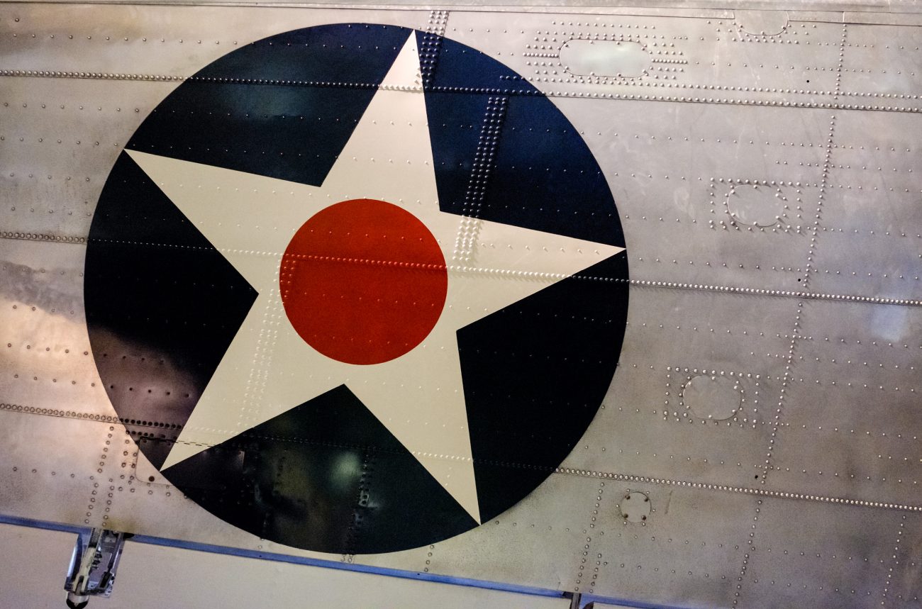
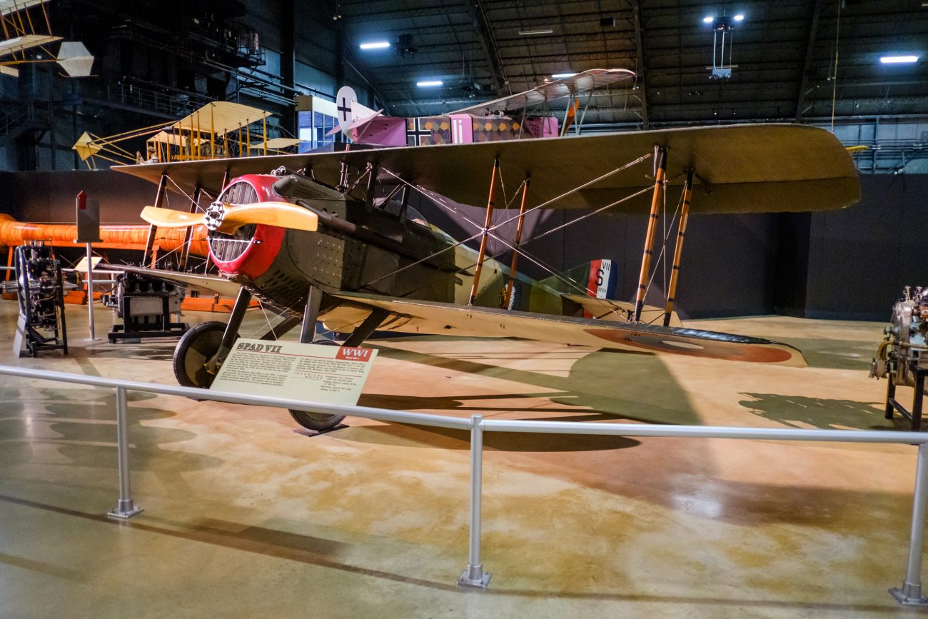
Cold War Era Gallery

Cold War Exhibits at the National Museum of the US Air Force. Copyright © 2018 Gary Allman, all rights reserved. National Museum of the US Air Force
Not one of my usual posts, but I couldn’t visit this museum without taking lots of pictures.
As with all my posts, click on any image to see it full screen and kick off a slideshow of all the images.
It was interesting to note the differences between this museum and the Imperial War Museum at Duxford. I mean apart from the size — this hanger alone has a maximum capacity of 10,000 people! There was a lot more emphasis on the people including displays of personal items belonging to ‘famous’ pilots and flight crews, and
lot less about the engineering and development.B-2 Stealth Bomber + added SR-71

B-2 at the National Museum of the US Air Force (where’s Ginger?) Copyright © 2018 Gary Allman, all rights reserved. I couldn’t get far enough away from it for a non-distorted picture. Ginger loves these because they used to buzz her parents’ house on training runs.
She also has a thing about the SR-71 Blackbird, and there was one tucked in behind the B-2. It looked like the SR-71 hadn’t been cleaned since its last flight.

B-2 and SR-71 Blackbird at the National Museum of the US Air Force. Copyright © 2018 Gary Allman, all rights reserved. 
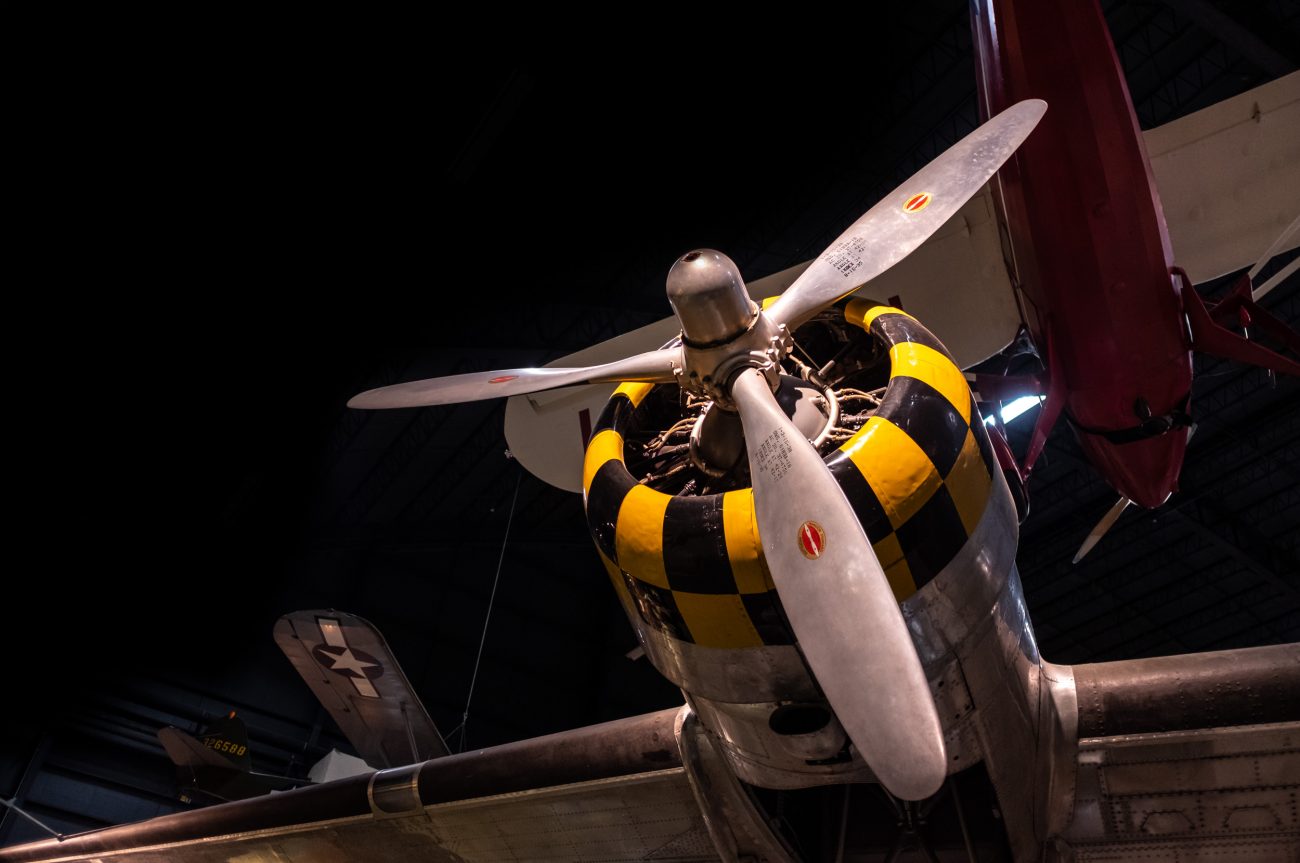
SR-71 Blackbird at the National Museum of the US Air Force. Copyright © 2018 Gary Allman, all rights reserved. A-10A Thunderbolt (Warthog)
I took a shine to these watching them on training flights along Stockton lake. One passed a hundred feet or so above me when I was out in my kayak. The kayak shook. And I know it was low because it had to pass over an island and that is 60′ tall. Unusually on that occasion there were three of them — they normally practiced in pairs — The first two passed further out in the lake. The last one made me jump, as I wasn’t expecting it, and the first I knew about it was when it crested the island about 100 yards from me. I could count the rivets…
Their training flights along the lake were
cancelled when one hit a powerline. So, yes they flew low.
A-10 Thunderbolt (Warthog) at the National Museum of the US Air Force. Copyright © 2018 Gary Allman, all rights reserved. 
A-10 Thunderbolt (Warthog) at the National Museum of the US Air Force. Copyright © 2018 Gary Allman, all rights reserved. And lots more …


Convair B-36 PeacemakerThe B-36 really is unique. What with the pusher props and jet engines as well.
It wasn’t until after I visited the museum that I read up about it. It even had a tiny fighter that was carried inside and launched and recovered in-flight!

Unfortunately, the fighters (Avro CF-100 Mk.4A Canuck nearest to the camera) get in the way of the huge and different Convair B-36 at the National Museum of the US Air Force. Copyright © 2018 Gary Allman, all rights reserved. -
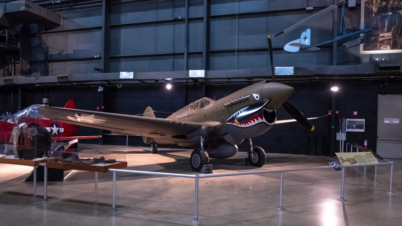
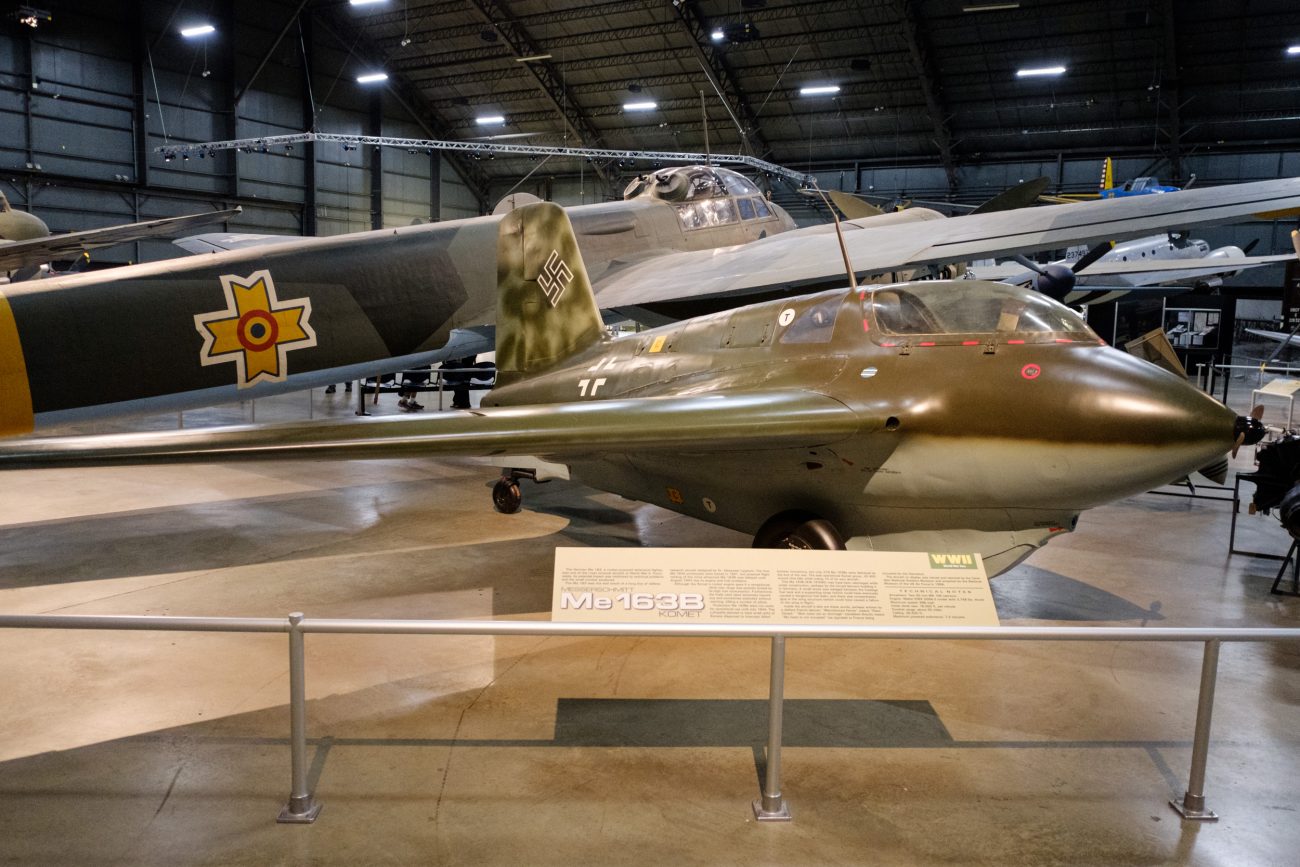
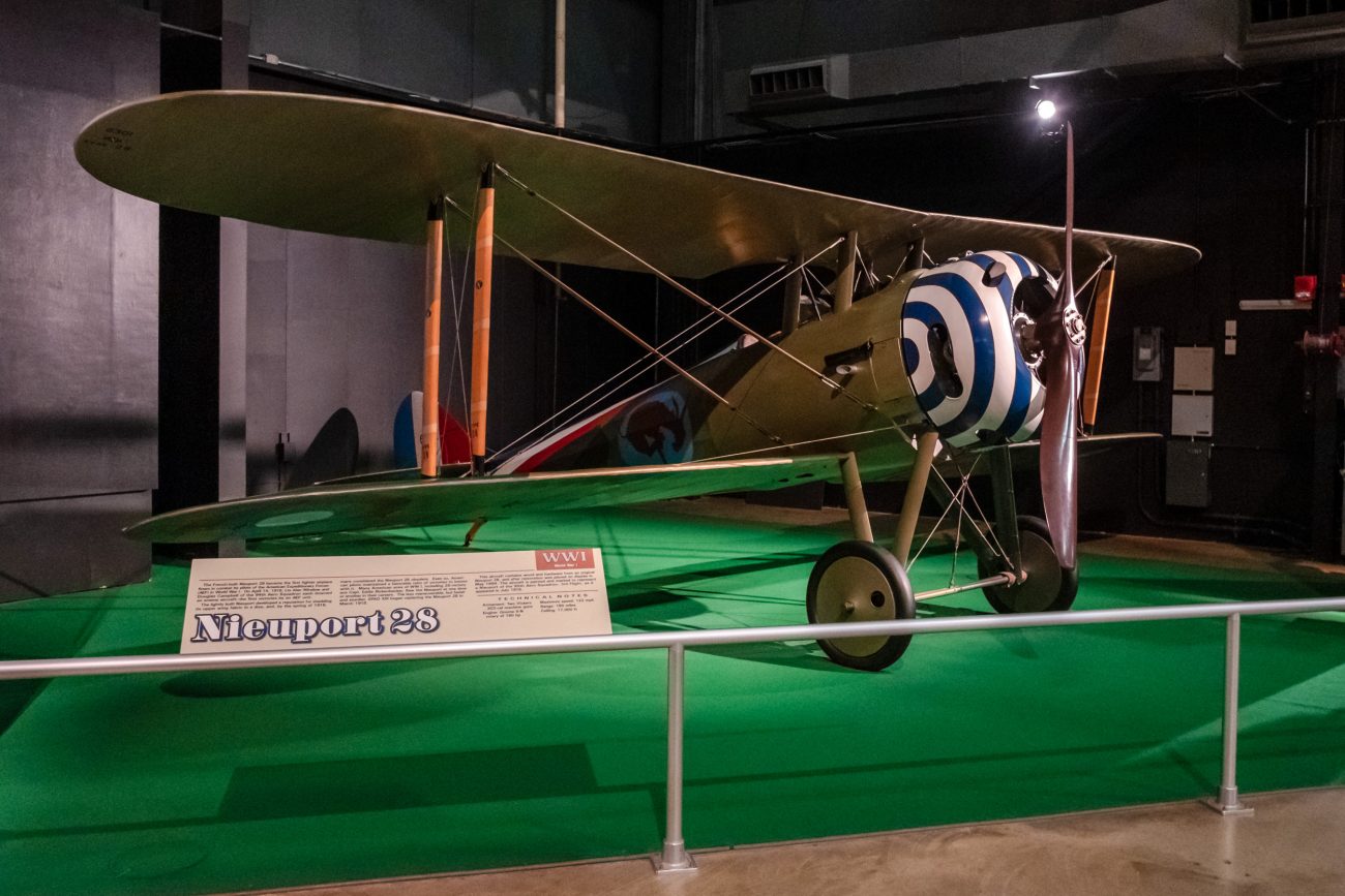
WWII Gallery

Messerschmitt Bf 109G-10 at the National Museum of the US Air Force. it was really difficult picking a representative picture for this post. I didn’t take pictures of the aircraft that were typically a part of my youth, (Spitfire, Hurricane, Beaufighter, De Havilland Mosquito, Northrop P-61C Black Widow — don’t ask.) so it was down to the ME 109 to take the lead spot.
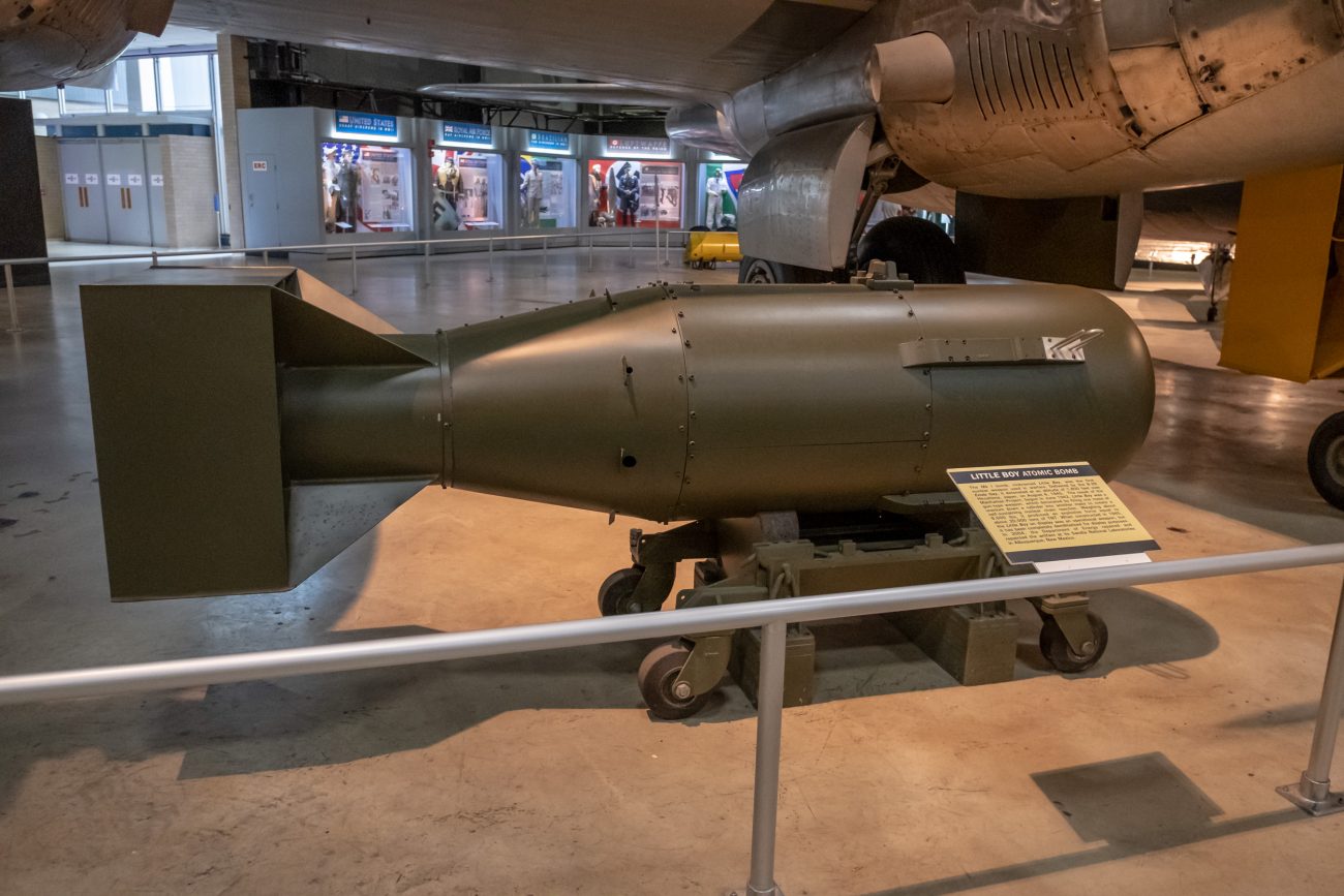
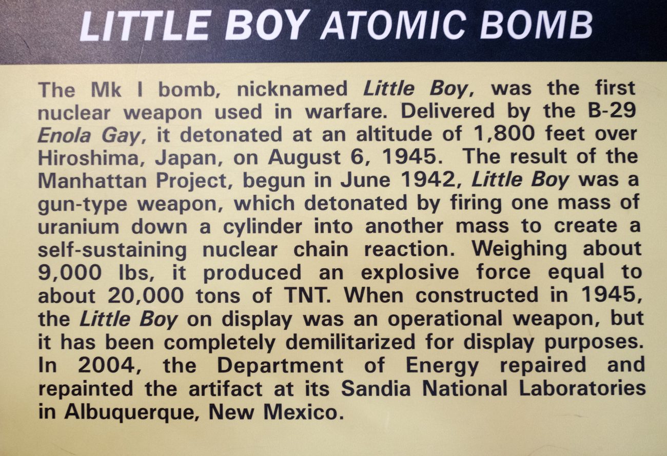
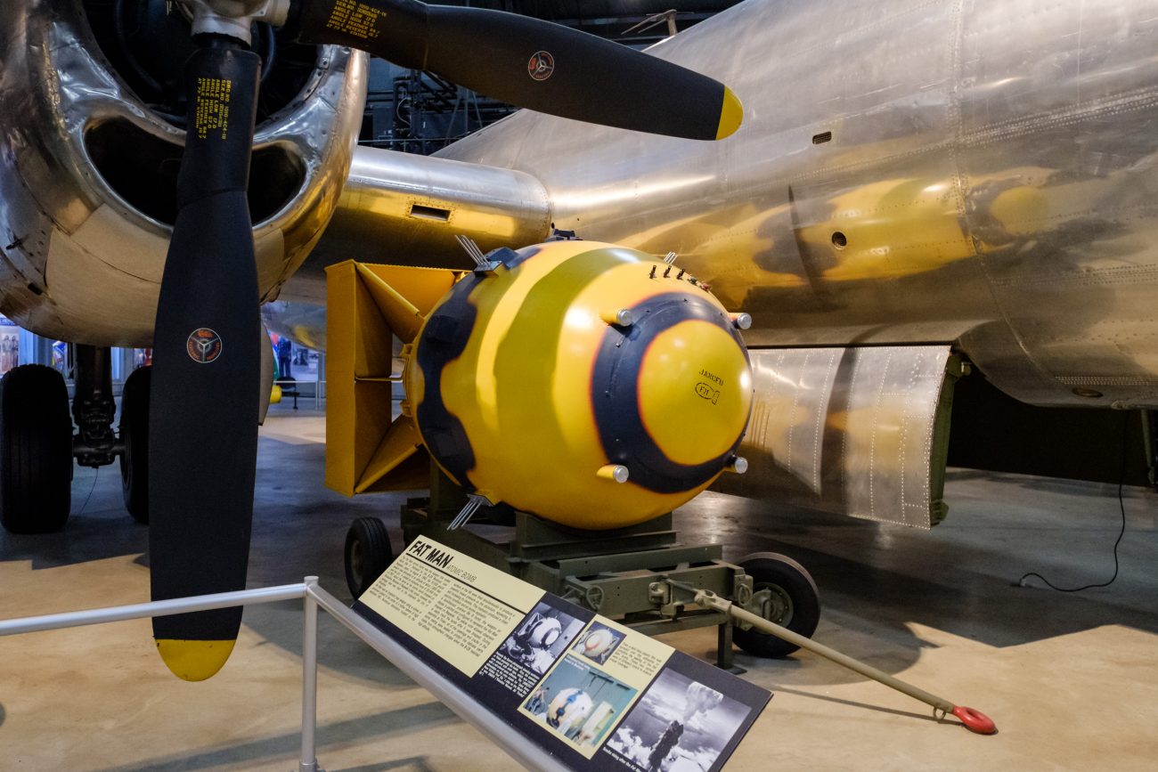
The most sobering moment was realizing that I was standing in front of what was once
a live nuclear bomb (now decommissioned of course), of the type used to bring the war in the Pacific to a close.The most surreal moment was when I did a double-take upon seeing a couple of Chinese guys taking selfies in front of the Boeing B-29 Superfortress and Fat Man atomic bomb.
As with all my posts, click on any image to see it full screen and kick off a slideshow of all the images.


-
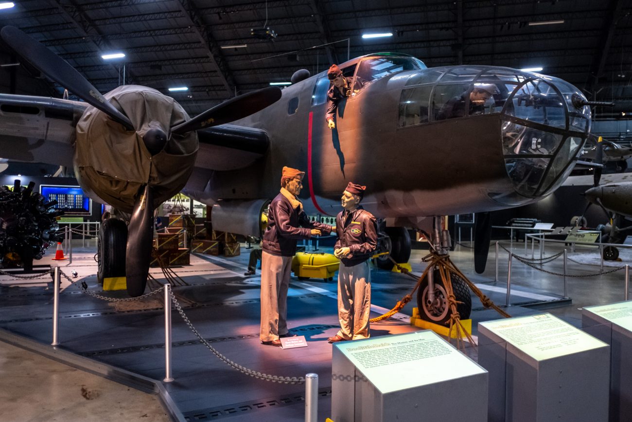
Memphis Belle

Memphis Belle at the National Museum of the US Air Force. Dayton, Ohio. Copyright © 2018 Gary Allman, all rights reserved. Our visit to the National Museum of the US Air Force couldn’t have been better timed. In May 2018 the restored Memphis Belle was put on display.

Memphis Belle at the National Museum of the US Air Force. Dayton, Ohio. Copyright © 2018 Gary Allman, all rights reserved. 
Memphis Belle. Copyright © 2018 Gary Allman, all rights reserved. -
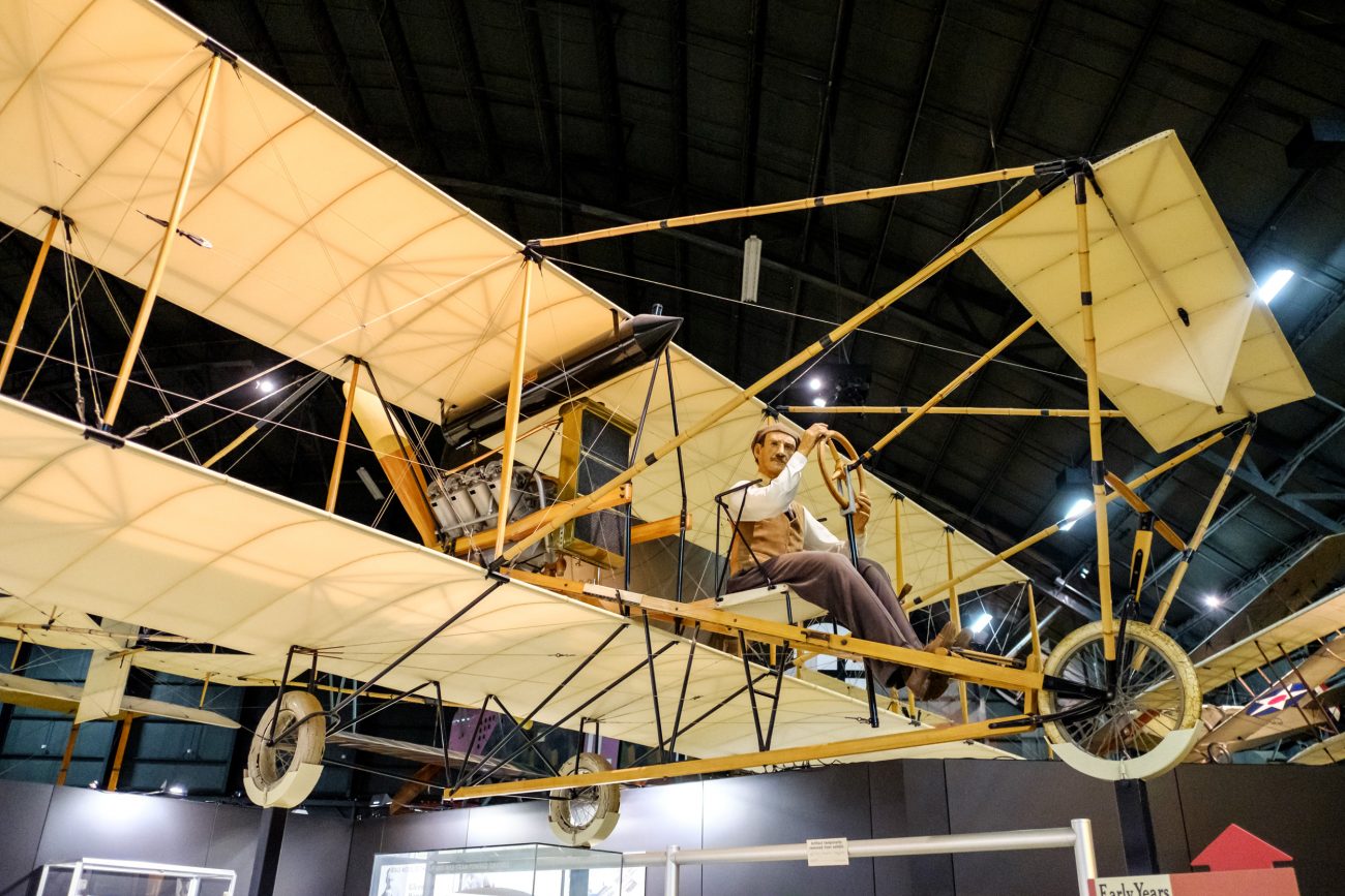
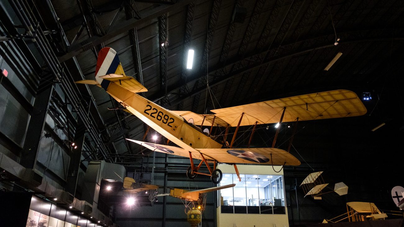
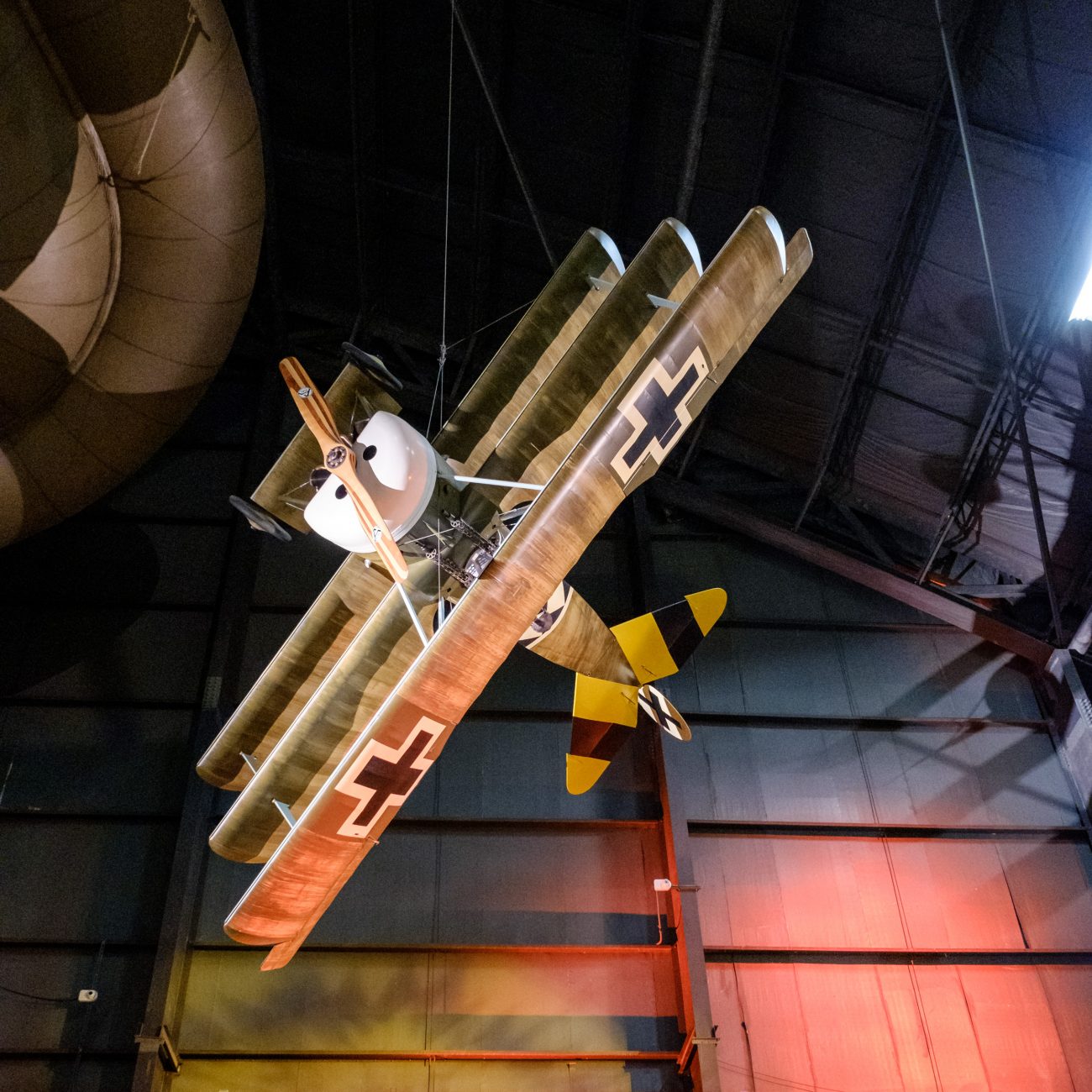
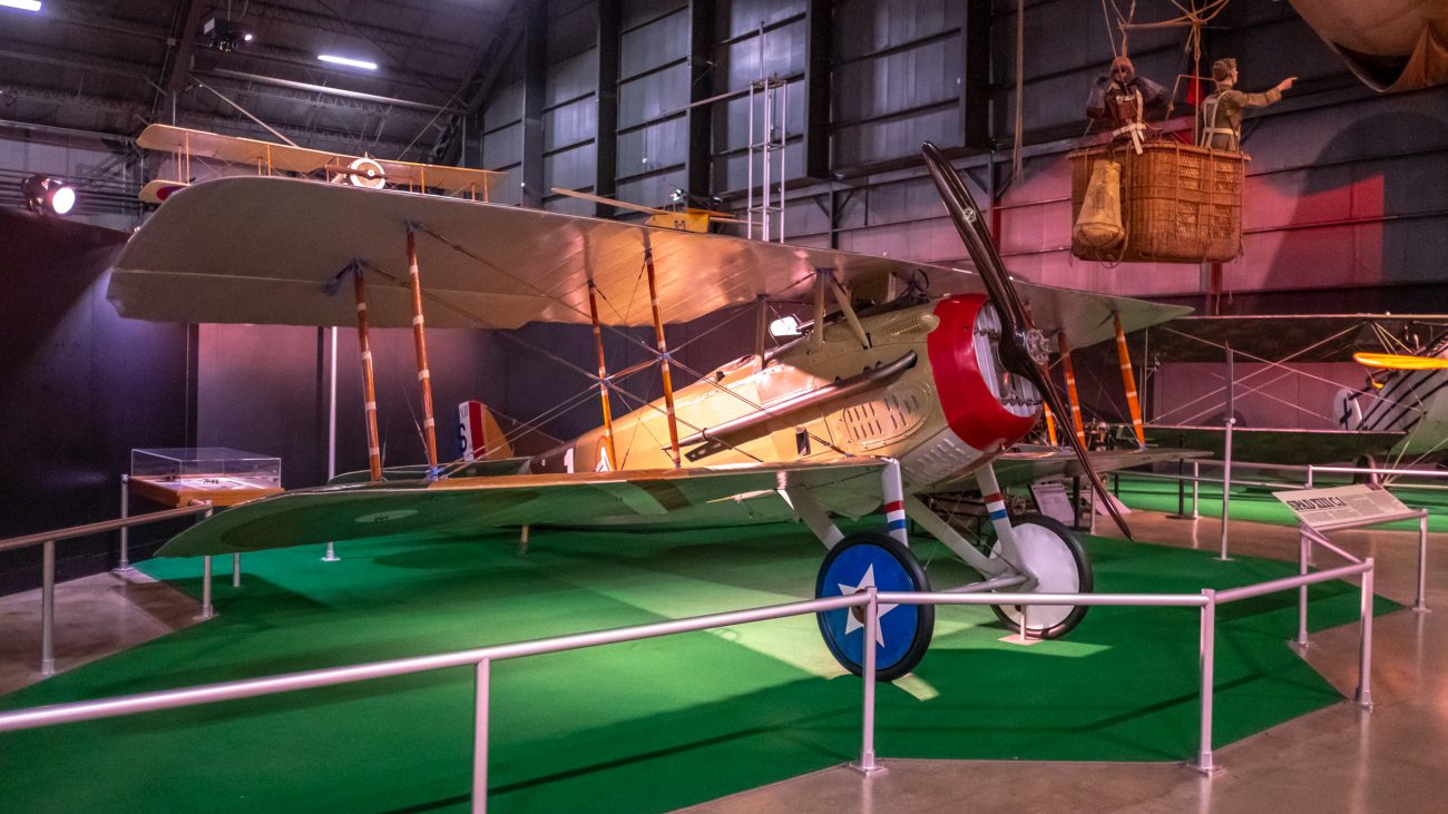
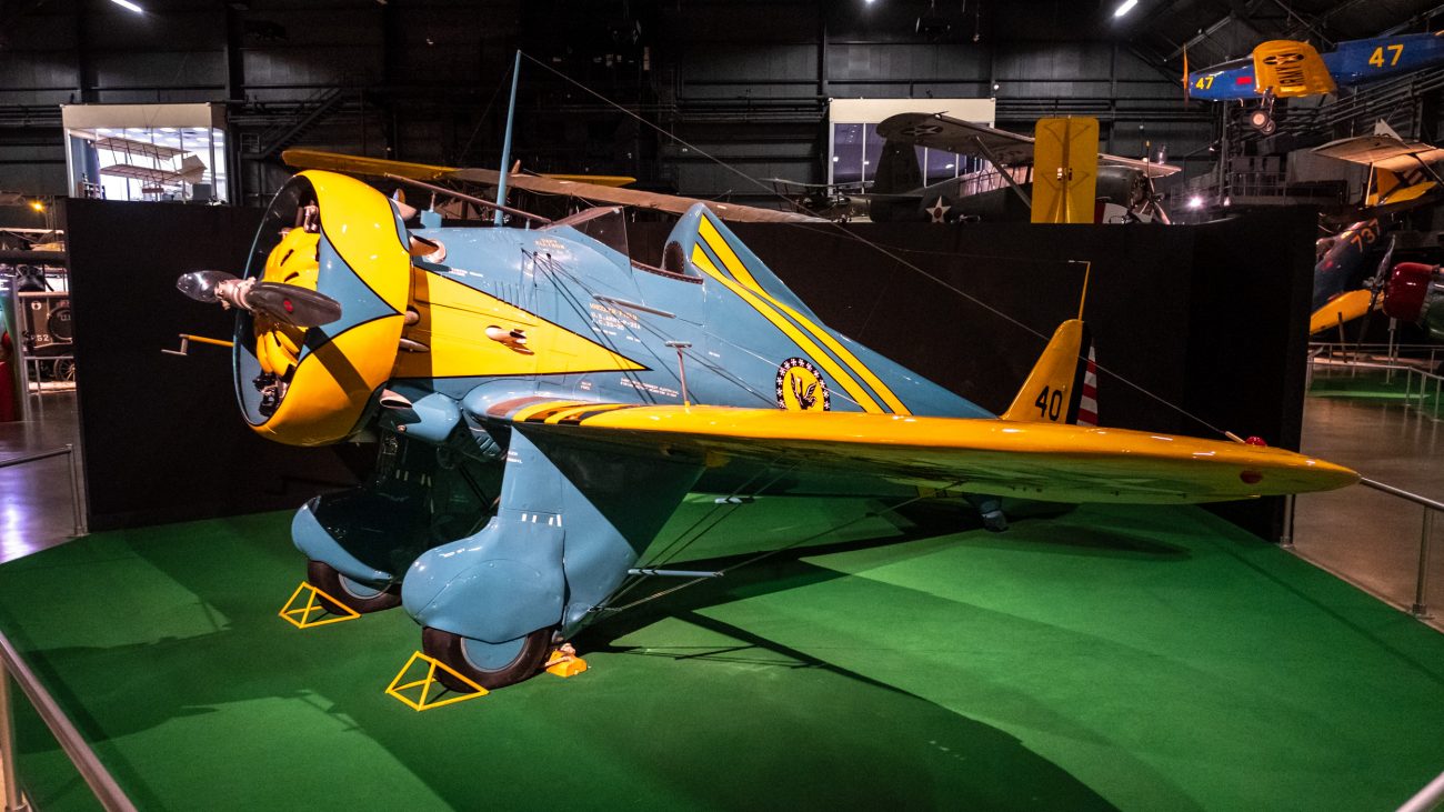
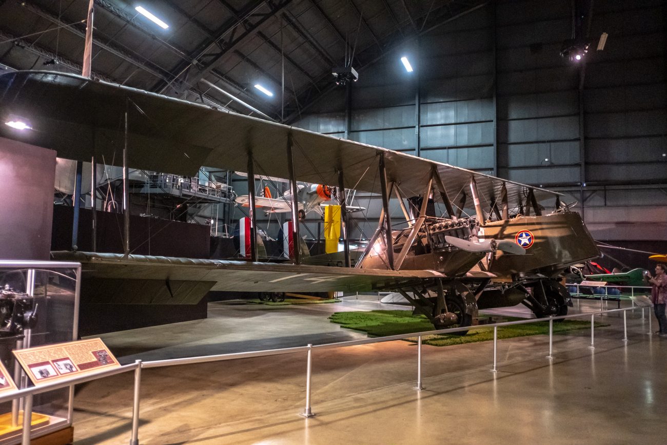
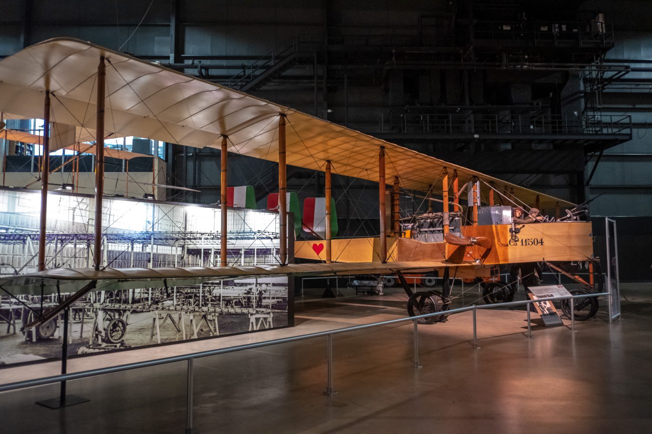
National Museum of the US Air Force, Early Years Gallery

Standard J-1 at the National Museum of the US Air Force. As with all my posts, click on any image to see it full screen and kick off a slideshow of all the images.


-
Tri-Puss

Tri-puss – Tubby and Blue Kitty are touching! Copyright © 2018 Gary Allman, all rights reserved. It’s an uncommon configuration, and for Blue Kitty to let Tubby touch her is almost unheard of. And it’s a cute picture too.
-
Morty – Workshop Cat

‘Morty’ – Workshop Cat. Copyright © 2018 Gary Allman, all rights reserved. For an outdoor cat, Morty looks exceptionally healthy. I suspect that Jim has something to do with that. It’s even more surprising as Morty spends his time in the workshop wandering around ignoring the red-hot metal, banging, sparks, and roaring forge.

‘Morty’ – Workshop Cat. Copyright © 2018 Gary Allman, all rights reserved. -
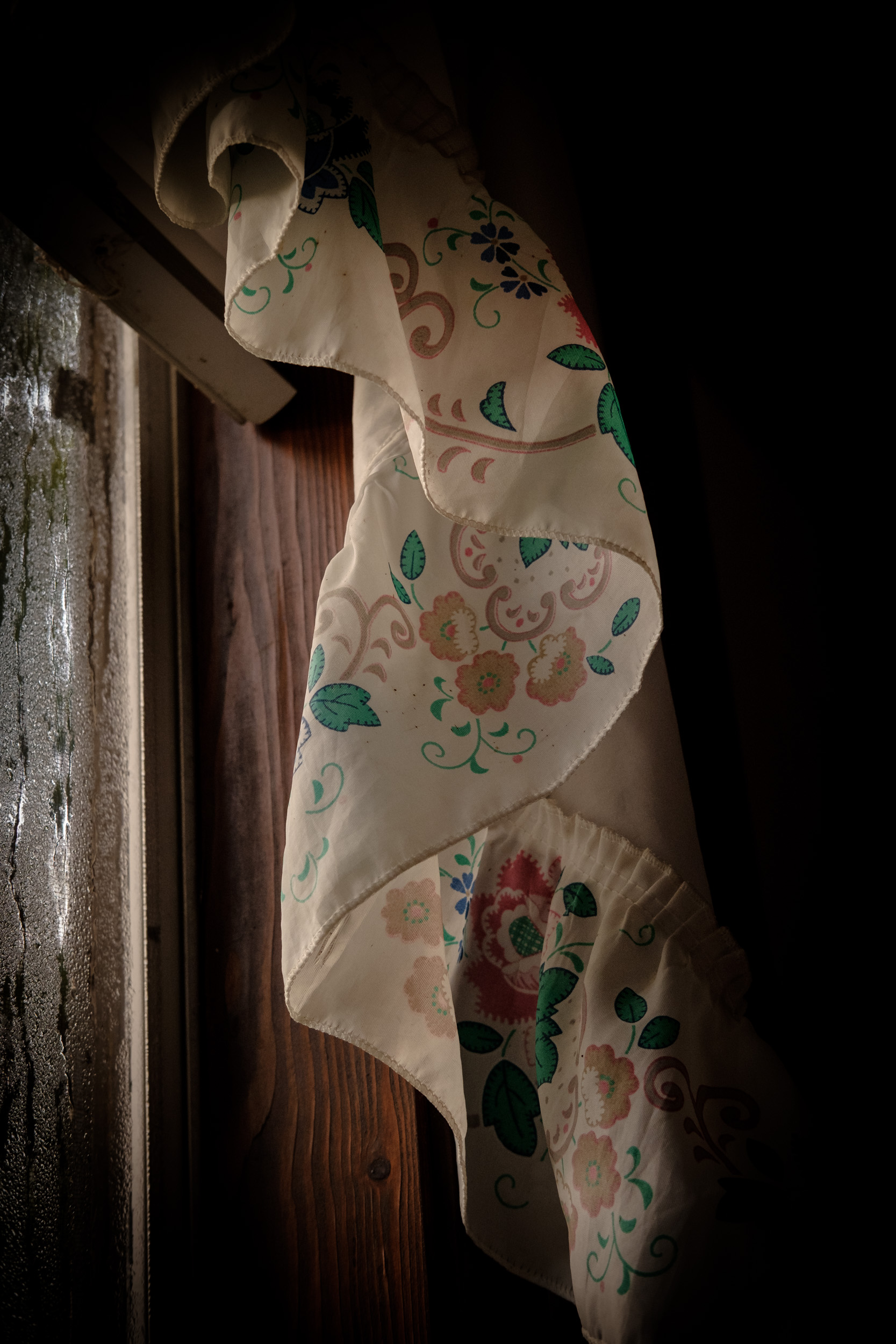
Valance – Three Studies in Light

Valance – One. Copyright © 2018 Gary Allman, all rights reserved. We popped down to Thornfield to spend three days with Ginger’s parents. Our trip was delayed by a couple of days as I came down with a cold. I’ll admit to temporarily misplacing my photo Mojo again. It made a brief reappearance on Monday morning. There is quite a lot to come, as I took some pictures and video of Jim blacksmithing in the workshop.
I think ‘three studies in light’ is a bit of a pretentious title, as actually, nah, I was just trying to capture the essence of what I saw, there was very little adjustment or studying regarding the light.
However, I had been watching the light change for about half an hour as the sun came up through the mist. There was something ‘old world’ about the pattern, fabric, color, and light that held my attention.

Valance – Two. Copyright © 2018 Gary Allman, all rights reserved. 
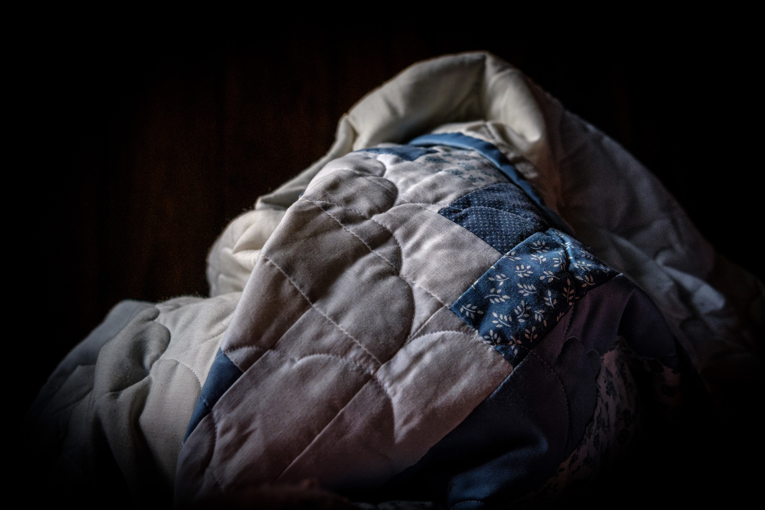
Valance – Three. Copyright © 2018 Gary Allman, all rights reserved. It was very humid over the weekend, as evidenced by the condensation on the window. (By the way. That’s not one of Jim and Carol’s house windows, we stayed in the ‘Little House’).
Bonus picture. I loved the look of the scrunched up comforter on the bed.

Comforter. Copyright © 2018 Gary Allman, all rights reserved. -
Twisted

Twisted – Jim Davis. Copyright © 2018 Gary Allman, all rights reserved. -
Rose

Rose – Jim Davis. Copyright © 2018 Gary Allman, all rights reserved. -
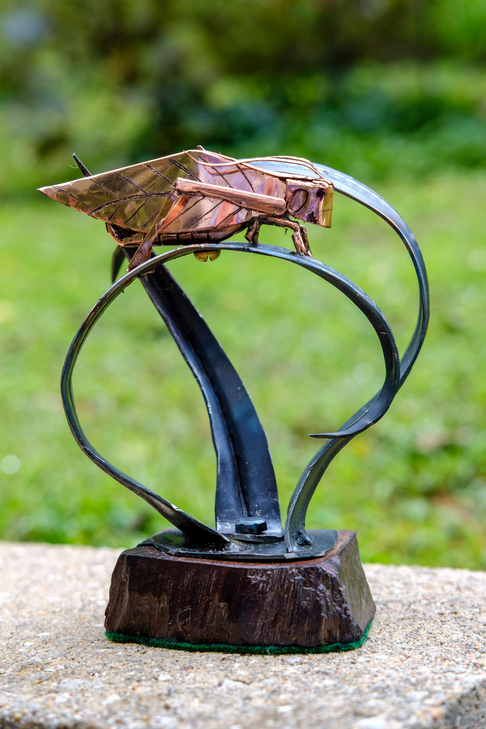
Katydid for Katy O.

Katydid for Katy O – Jim Davis. Copyright © 2018 Gary Allman, all rights reserved. Jim created this for our friend Pastor Katie in Pennsylvania. We’ll be delivering it in a few weeks when we go visit.
-
Ivory

Ivory – Jim Davis. Copyright © 2018 Gary Allman, all rights reserved. -
Anticrepuscular Rays

Anticrepuscular Rays These were quite striking. Unfortunately I only had my cell phone with me at the time.
-
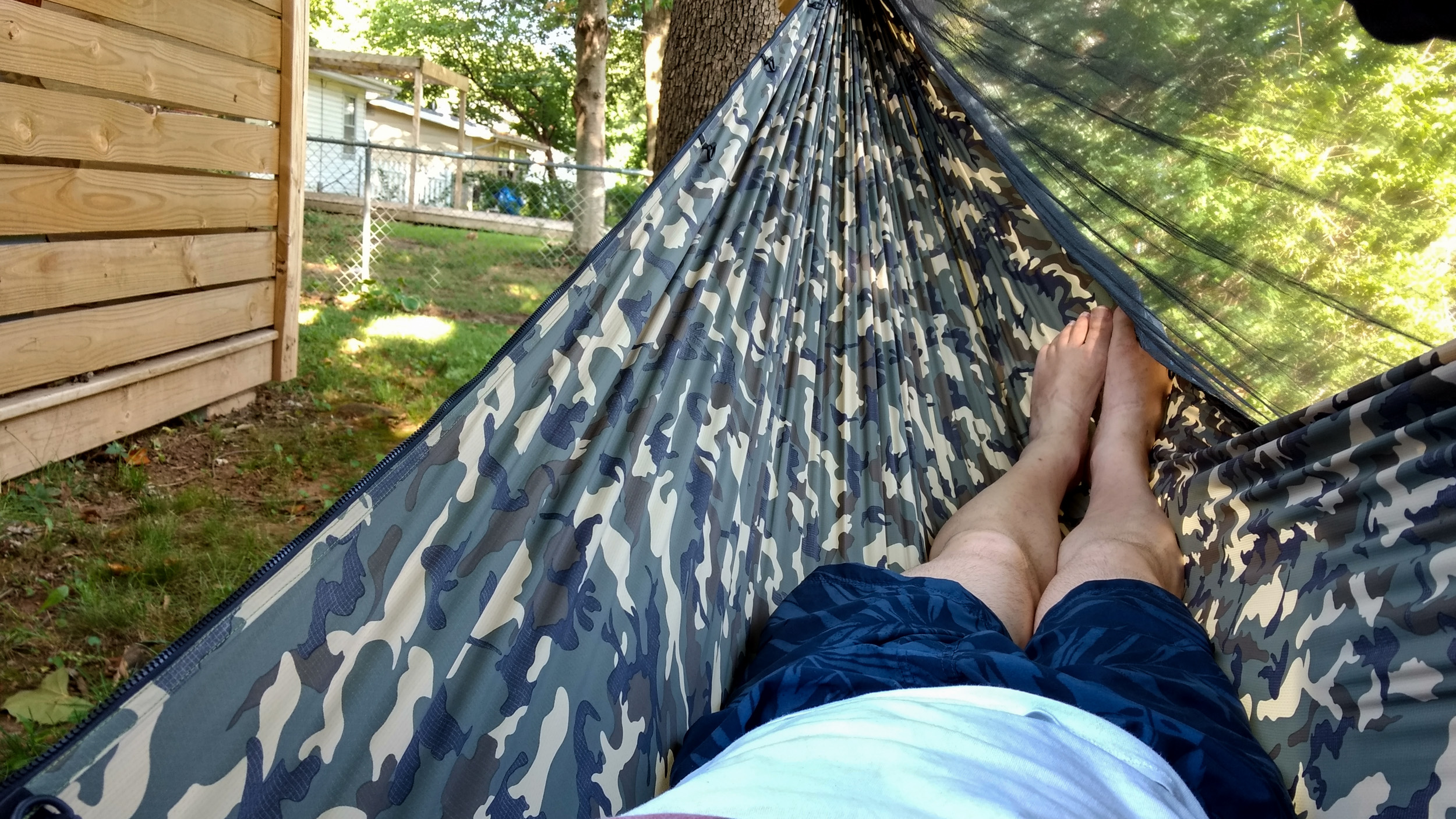
Back Yard Bad Weather Hammock Testing

Back Yard Hammock Bad Weather Testing When I last went backpacking I mentally earmarked three things to fix before my next trip.
- Something to stop the clothes or whatever I am using as a pillow from sliding down under me while I’m sleeping.
- Something to organize all the items I tend to hang from the hammock’s ridgeline.
- Storage of some sort to stop the inside of the hammock becoming a mess of covers, clothes, and gear.
Trawling the forums looking for ideas I came up with the following list of goodies that I bought from the cottage manufacturers, DutchWare and Hammock Gear.
- A down pillow. I’ll admit this is an extravagance, and the jury is definitely out as to whether I need it. The pillow ties to the hammock suspension so it will not slide down.
- A ridgeline organizer. This keeps odds and ends out of the way so I’m not laying on my books, journal, knife, GPS, phone, headlamp, glasses, etc.
- Sidecar. This is a giant pocket that fits on the side of the hammock. It’s great for storing clothes, quilts, and other larger odds and ends. It really helps to keep the inside of the hammock clear of things.
- Tarp Sock. This is a mesh holder for my tarp. You just pull it up over the tarp and it’s put away. The great thing is you can leave the tie-outs attached, so no more time lost coiling them up and stowing them away.
- A thin foam sit pad (this is to replace a heavier item I’m currently using).
The forecast yesterday showed that we were in for a lot of quite heavy rain and some blustery wind so I decided to set up the tarp and hammock in the back yard to see how well it coped. It was also an opportunity to try out my new gear. Just to make it more of a ‘real-trip’ experience, I had to set everything up in the rain, which allowed me to try out my new and as yet unused backpacking rain poncho.
Putting up a hammock In the rain was fairly easy. First I put up the tarp. Once that was staked out I could do a lot of the set up in the shelter it provided. However, setting up the tarp was a bit of a challenge, but only because the trees are a tad too close together at just over 13′. The tarp is 12′ leaving just a little over 6″ at each end to set up the attachments.
Once the tarp was staked out it took less than a minute to set up the hammock, as I already had the chains for our rope lounging hammock adjusted from an afternoon nap a couple of days ago. So no straps to set up.
Taking it slow and easy it probably took around 20 minutes to set up, and it only took that long because of my having to fiddle with the tarp.
That done I spent the afternoon reading in the hammock listening to the often heavy and wind-driven rain on the tarp. Everything worked great, and I went on to spend the night out in the hammock too. And, here’s my initial thoughts on the new gear.
- The down pillow was great. I’m still not sure it’s essential but it was very comfy.
- The ridgeline organizer seems to work really well.
- The sidecar is cavernous! It easily swallowed my top quilt plus some other stuff with room to spare. And it stows in the hammock stuff sack along with the hammock, bug net, and the hammock tie-outs. So, no extra pack space or stuff sacks needed.
- The tarp sock works very well. It and the bag of tent stakes needed to stake out the tarp (and hammock) all fit in the tarp’s stuff sack.
- The sit pad seems fine, though I’ve not had much time to try it out. That will have to wait for my next real trip.
I’m now working on the principle that if I add something to my base pack weight, something of equivalent or higher weight has to go. The only exception I’m making to that is for seasonal items, which is just as well as I’ve ordered a hammock cover and 10° under quilt so I can go out backpacking when it drops below freezing. Hopefully, that will mark the end of my purchases for now and I’m set up for year-round hammock camping.
It worked out that I added a whopping (That’s sarcasm by the way) 8oz for the tarp sock, hanger and sit pad (3oz for the pillow, 3oz for the sidecar, and the rest 2oz). In return, I’ve simplified my packing and saved on a load of Ziploc bags.
In future, I’ve decided to leave behind the heavy cotton shemagh that I mainly used for a sit-pad, and by changing my cooking pot stand and windscreen I’ve managed to reduce my overall weight by a lot more than 8oz, and it all packs smaller. However, I like my shemagh — it was a gift from a friend in Pakistan — and it has a lot of uses, so I might invest in a lighter more packable one to replace it for going out on the trail.
Now I’m just waiting for the temperatures to fall so I can get out on the trail again.
-
Back Yard Hammock Testing. Zzzzzzzz

Back Yard Hammock Testing. Zzzzzzzzz. Some ideal sun lounging weather prompted me to see if my camping hammock would fit between the two big trees in our backyard. It does, though it is going to be very tight if I want to put up the tarp.

View From The Hammock -
Sprinky – Nothing is out of bounds

Sprinky – Nothing is out of bounds When it comes to Sprinky, nothing is out of bounds as a perch. Today she sat on top of one of my office speakers.

Sprinkles, riding high -
Gary Allman, August 26, 2018

Gary Allman, August 26, 2018. Copyright © 2018 Gary Allman, all rights reserved. I saw a tired person peering back at me from the bathroom mirror this morning, and I thought I’d get a picture of what I saw. Unfortunately (or fortunately, depending on your point of view), by the time I got round to taking these pictures I’d downed my coffee and perked up a bit. I could have used a filter to make them look a little more ragged, but I decided against that and went for a ‘straight out of camera’ with no post-processing approach. I must admit I failed with that plan too, as I added a slight vignette in Lightroom.
It should be noted that I couldn’t capture exactly what I saw anyway, because if I did it would have to be blurred and distorted to match my astigmatism and other vision defects! I became very conscious of what I don’t notice when I’m in front of the bathroom mirror when I studied these pictures more closely. Some personal grooming and skin care are in order.
 Gary Allman, August 26, 2018. Copyright © 2018 Gary Allman, all rights reserved.
 Gary Allman, August 26, 2018. Copyright © 2018 Gary Allman, all rights reserved.
 Gary Allman, August 26, 2018. Copyright © 2018 Gary Allman, all rights reserved.
 -
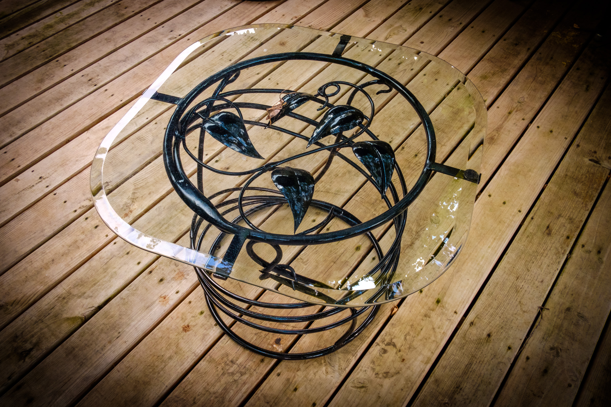
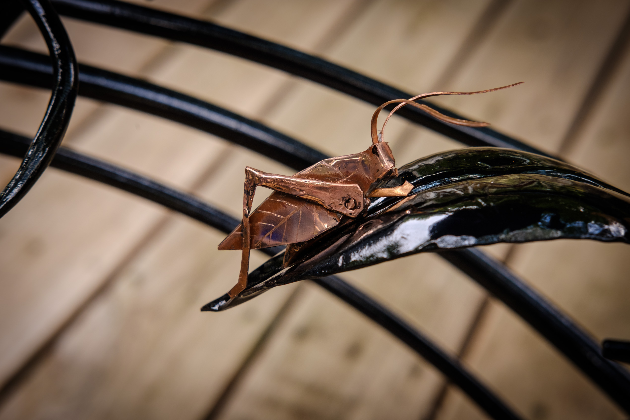
Katie’s Occasional Table

Katie’s Occasional Table
Jim’s latest creation, an occasional table for Katie. This was a surprise arrival, so the picture was a bit rushed and the best I could do in the time. It really needs a plain background, but that would have meant extracting an 4′ x 8′ board from storage and rearranging the deck furniture even more than I did to take this picture. The deck umbrella did a great job of reducing reflections in the glass table top.Note the copper katydid.

Katie’s Occasional Table Detail – Copper Katydid. -
Joy, shunned

Joy, shunned. Copyright © 2018 Gary Allman, all rights reserved. I finished processing this picture a while ago. What’s stopped me posting it (and the associated background images) is that I couldn’t come up with a suitable title for the picture/post. I’ve been mulling it over for days (I’m still not, happy with the title, but I’ve got to move on — updated in 2019 with a marginally better title).
At the beginning of the week, we re-visited Crystal Bridges. We went primarily for the Georgia O’Keeffe exhibition and to see the Bachman-Wilson House (Frank Lloyd Wright). Sadly, I thought the O’Keeffe exhibition was disappointing, but the Bachman-Wilson House was great and has provoked a lot of discussions (and watching a series of Grand Designs Australia et al on Netflix during the week)
However, once again, photographically, ‘Sappho’ and ‘The Bubble’ stole the show. Though unlike my first visit, when I knew I’d got the picture I wanted there and then, this time it wasn’t until I’d worked on the image in post-production that I knew that I had nailed it. The problem was that they’ve rearranged the main galleries, and changed the lighting, in my opinion much to the detriment of the art on display. The ambient lighting has been boosted by uplighters that reflect off the wooden ceiling casting a pale yellow pall over everything. Gone is the dark and spotlights.
The Sappho and Bubble statues have been moved, and it was the juxtaposition of the two that intrigued me. It looked like Sappho was shunning Desha Delteil (The model for ‘The Bubble’). The difference in the emotion exuded (represented?) by the two pieces only adds to the tension.
The picture was a pain to frame because of the surrounding artwork (not to mention people constantly wandering into the shot), the external glass door, and a white sticker on the far wall. I tried using Sappho to hide the door, but visually it brought the two sculptures too close together. So I had to use the wider shot that included the door, resisting the temptation to remove it in post.
The lighting though was a different story. That I changed to match my previous visit, removing the ghastly ambient lighting, leaving just the highlights from the spotlights. The choice of black and white for the image was a given. Though, I was interested to see that in the color version, the color and light on the floor draws your eye away from Sappho and onto ‘The Bubble’ making it the focus of the picture (well, for me anyway).
") Unrequited Joy. Showing the ghastly lighting in this gallery. Copyright © 2018 Gary Allman, all rights reserved.
Unrequited Joy. Showing the ghastly lighting in this gallery. Copyright © 2018 Gary Allman, all rights reserved.") Unrequited Joy (color). For me the color version shifts the main focus onto ‘The Bubble’. Copyright © 2018 Gary Allman, all rights reserved.
Unrequited Joy (color). For me the color version shifts the main focus onto ‘The Bubble’. Copyright © 2018 Gary Allman, all rights reserved.Sappho. Artist: William Wetmore Story (1819 – 1895).
The Bubble. Artist: Harriet Whitney Frishmuth (1880 – 1980).