-
Day 8. Colorado Trail Segment 14: Chalk Creek to US Hwy 50
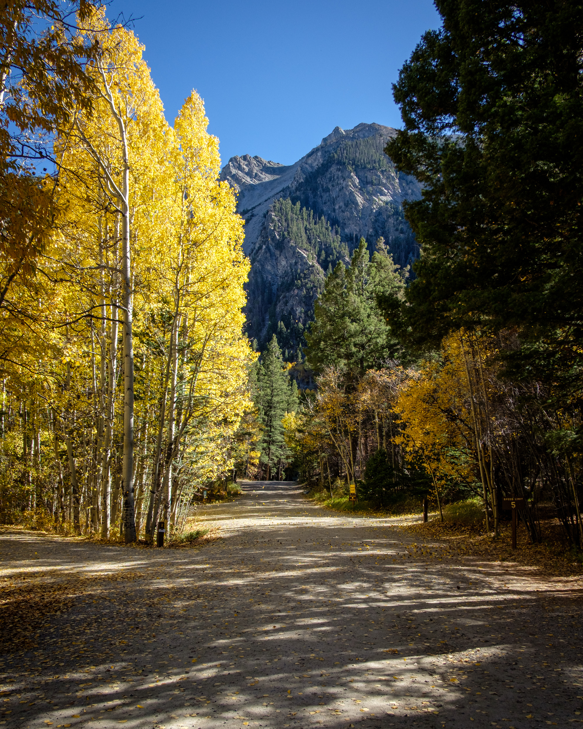
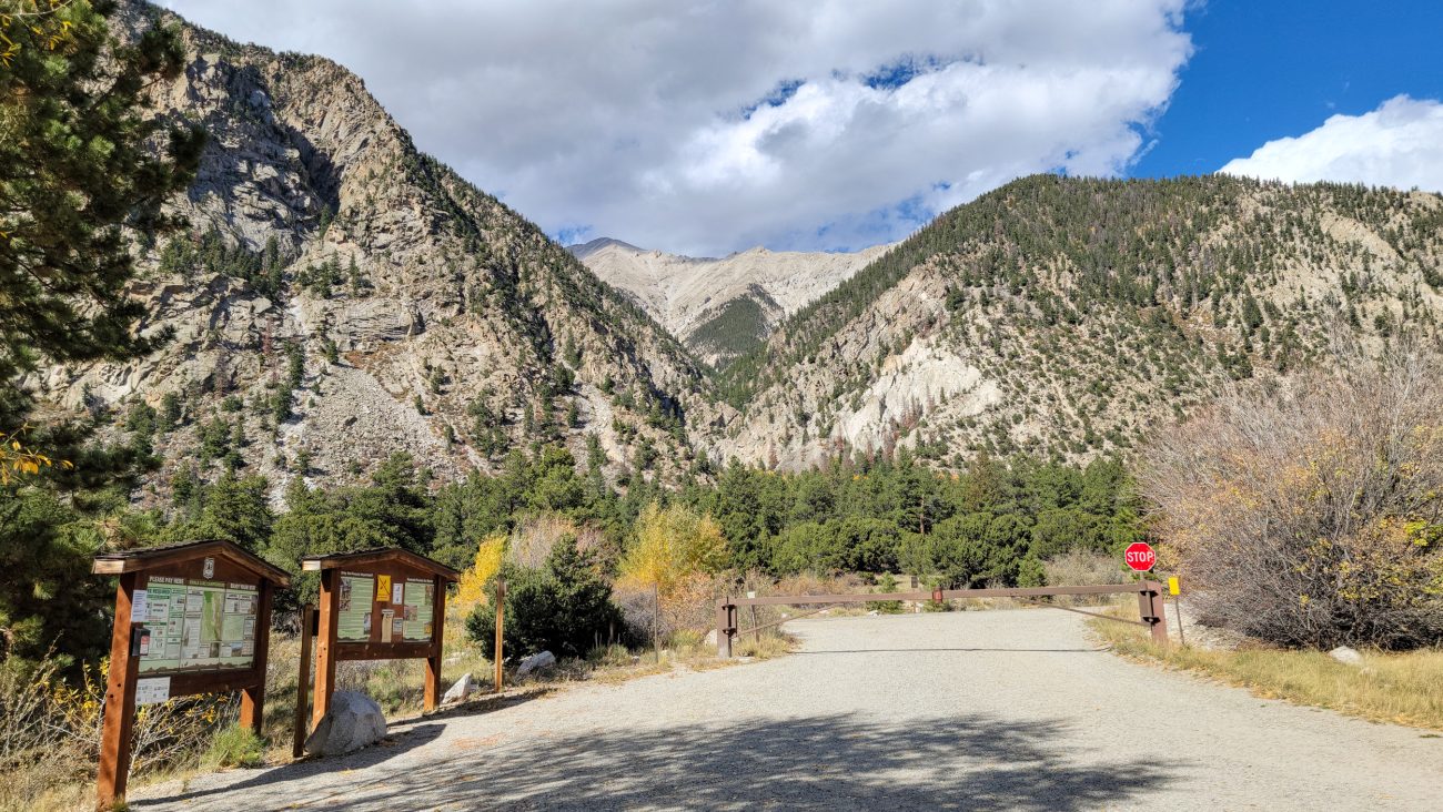
Colorado Trail Segment 14: Chalk Creek to US Hwy 50 — Day 8 – Road Trip, October 2025. Copyright © 2025 Gary Allman, all rights reserved. And, as is appropriate, heading south, the trail starts with a crossing of Chalk Creek. The complete segment is 20 miles. I’m only going three or four miles and then turning around to come back. However, this includes a 900+ foot climb, it’s going to be the most elevation gain I’ve ever done in a single climb and starting out at 8,700 feet or so too. Hopefully my altitude acclimatization and hiking build-up plan will pay off today.
-
Cascade Campground

Cascade Campground. Day 7 – Road Trip October 2025. Copyright © 2025 Gary Allman, all rights reserved. The final leg of my hike back to my campsite. As it was still early, I then drove to St. Elmo, a Ghost town ten or so miles away. The unpaved roads were in the process of being regraded, and they’d been dumping and wetting topsoil on the road, making it sticky, slippery, and muddy.
-
Approaching Cascade Campground
Approaching Cascade Campground. Day 7 – Road Trip October 2025. Copyright © 2025 Gary Allman, all rights reserved. 
Approaching Cascade Campground. Day 7 – Road Trip October 2025. Copyright © 2025 Gary Allman, all rights reserved. -
Trail Sign, the western end of Narrow Gauge Trail #1432

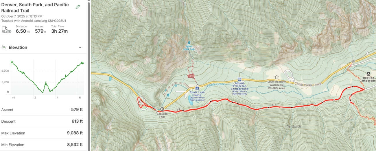
Trail sign, the western end of Narrow Gauge Trail #1432. Denver, South Park, and Pacific Railroad Trail. Day 7 – Road Trip October 2025. Copyright © 2025 Gary Allman, all rights reserved. With my short road hike and excursion up a brief bit of Section 14 of the Colorado Trail, I managed six and a half miles for my second hike.
-
The western end of Narrow Gauge Trail #1432

Denver, South Park, and Pacific Railroad Trail. Day 7 – Road Trip October 2025. Copyright © 2025 Gary Allman, all rights reserved. -
Chalk Creek Cascade

Chalk Creek Cascade. Day 7 – Road Trip October 2025. Copyright © 2025 Gary Allman, all rights reserved. This is just the start. The cascade runs for a tad under half a mile and drops over 250 ft. The Cascade campground is just around the corner on the left.
-
This trail is really easy going
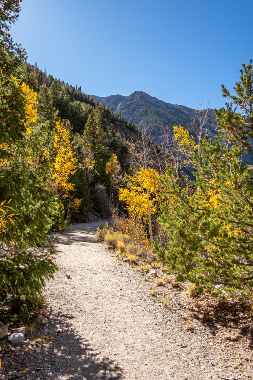
Denver, South Park, and Pacific Railroad Trail — Heading west. Day 7 – Road Trip October 2025. Copyright © 2025 Gary Allman, all rights reserved. -
Mt. Princeton from the Denver, South Park, and Pacific Railroad Trail

Mt. Princeton — from the Denver, South Park, and Pacific Railroad Trail. Day 7 – Road Trip October 2025. Copyright © 2025 Gary Allman, all rights reserved. -
Looking west up Chalk Creek Canyon. Mt. Princeton on the right

Looking west up Chalk Creek Canyon. Mt. Princeton on the right. View from the Denver, South Park, and Pacific Railroad Trail. Day 7 – Road Trip October 2025. Copyright © 2025 Gary Allman, all rights reserved. -
View from the Denver, South Park, and Pacific Railroad Trail — Looking northwest

View from the Denver, South Park, and Pacific Railroad Trail — Looking northwest. Day 7 – Road Trip October 2025. Copyright © 2025 Gary Allman, all rights reserved. -
View from the Denver, South Park, and Pacific Railroad Trail

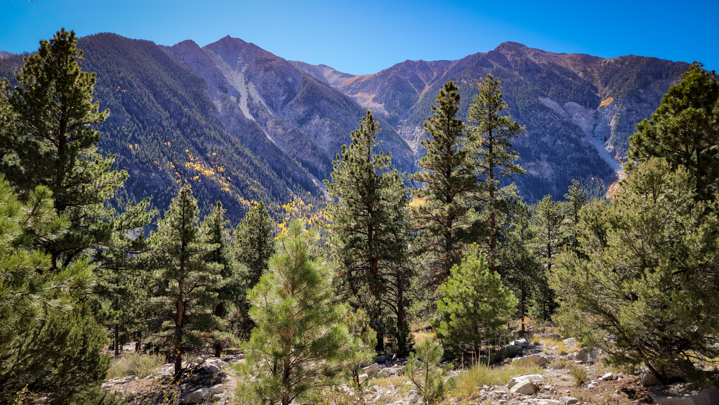
View from the Denver, South Park, and Pacific Railroad Trail. Day 7 – Road Trip October 2025. Copyright © 2025 Gary Allman, all rights reserved. This is looking eastward down the canyon. The colors were breathtaking. And I was right. It was cold in the shade, and I was glad I brought some warm clothes along for the hike. In the distance is Browns Canyon National Monument. It’s around fifteen miles as the crow flies.
-
Rockslide over the trail

View from the Denver, South Park, and Pacific Railroad Trail. Day 7 – Road Trip October 2025. Copyright © 2025 Gary Allman, all rights reserved. There was one point where a rockslide had covered the trail.
I took this picture on the way back. It didn’t take me long to hike the entire trail, and I was surprised to find a fairly big parking lot at the start. I carried on, found where the Colorado Trail crossed the road, and started up the trail a short way before turning back. That’s tomorrow’s hike. I reckoned by the time I hiked back up the Narrow Gauge Trail, and got to the campground, I’d have gone six or more miles. Quite enough for my second hike in three months.
-
View from the Denver, South Park, and Pacific Railroad Trail

View from the Denver, South Park, and Pacific Railroad Trail. Day 7 – Road Trip October 2025. Copyright © 2025 Gary Allman, all rights reserved. -
Chalk Lake — from the Denver, South Park, and Pacific Railroad Trail

Chalk Lake — From the Denver, South Park, and Pacific Railroad Trail. Day 7 – Road Trip October 2025. Copyright © 2025 Gary Allman, all rights reserved. Driving up Chalk Creek Canyon, you don’t realize how quickly you’re gaining altitude. Hiking down and back up the road yesterday, I got a better idea. Even so, I was surprised how quickly the trail gained height — well, actually, how quickly the ground dropped away — from where it started out just above the road.
-
Day 7. Narrow Gauge Trail #1432 — Denver, South Park, and Pacific Railroad

Denver, South Park, and Pacific Railroad Trail. Day 7 – Road Trip October 2025. Copyright © 2025 Gary Allman, all rights reserved. Today’s hike is an out-and-back hike on the Narrow Gauge Trail #1432, which runs along the bed of the Denver, South Park, and Pacific Railroad, Chalk Creek Grade, of the line that linked Buena Vista to St. Elmo. It was a narrow-gauge railway used to provide passenger, mining and logging transport within Chalk Creek Canyon.
The line closed in 1926, and was later converted to a trail, variously known as the Chalk Creek Grade Historic Trail, Narrow Gauge Trail, and officially by the U.S. Forest Service as the Narrow Gauge Trail #1432.
I’ve got warm clothes as the trail hugs the southern — shady side of the Canyon. It should be a nice easy hike of around 5 miles, though I might extend that a little by checking out the start of my planned hike for tomorrow on the Colorado Trail.
-
Chalk Creek

Chalk Creek — There’s no water available at the campground, so I got mine from Chalk Creek. Day 6 – Road Trip October 2025. Copyright © 2025 Gary Allman, all rights reserved. The Cascade Campground was good, but I don’t like the sterile ‘modern’ tent pads and the lack of screening between sites. When I stayed, there was no camp host, and no water.
As there weren’t many people staying, I think there was a maximum of five sites occupied while I was there, the lack of a host wasn’t a problem. Despite the government shutdown, I noticed a ranger drove through at least once a day.
Water might have been a bit of a problem, but I’d packed my water filter and pouches, so I just went and got my supplies from Chalk Creek.
One thing to be aware of, if you consider staying here, is how cold it gets when the sun is lower in the sky. That’s because there’s effectively a 2,000 ft. high cliff immediately to the west, so the campground is in shadow for a good part of the day.
-
Entrance to Chalk Creek Campground
Entrance to Chalk Creek Campground. Mt. Princeton in the distance. Day 6 – Road Trip October 2025. Copyright © 2025 Gary Allman, all rights reserved. 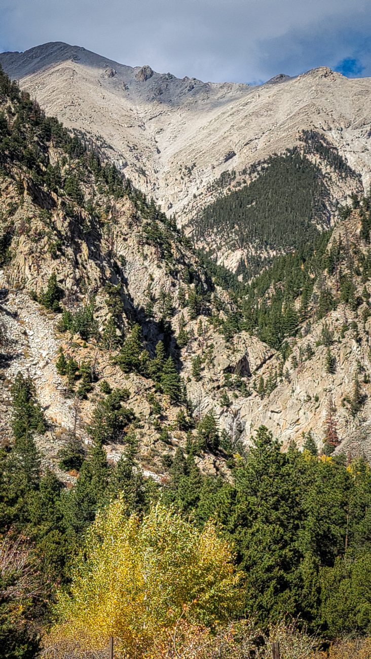
Agnes Vaille falls from Chalk Creek Campground — Mt. Princeton in the background. Good luck spotting the falls! Day 6 – Road Trip October 2025. Copyright © 2025 Gary Allman, all rights reserved. The Cascade Trail is relatively short, so I extended my hike by going further east along the road and then exploring some unmarked trails.
The two other campgrounds here are already closed for the season. I took a stroll around the Chalk Creek Campground to compare it to Cascade Campground.
Taking a picture of the entrance, I realized that the Agnes Vaille Falls could be seen from here.
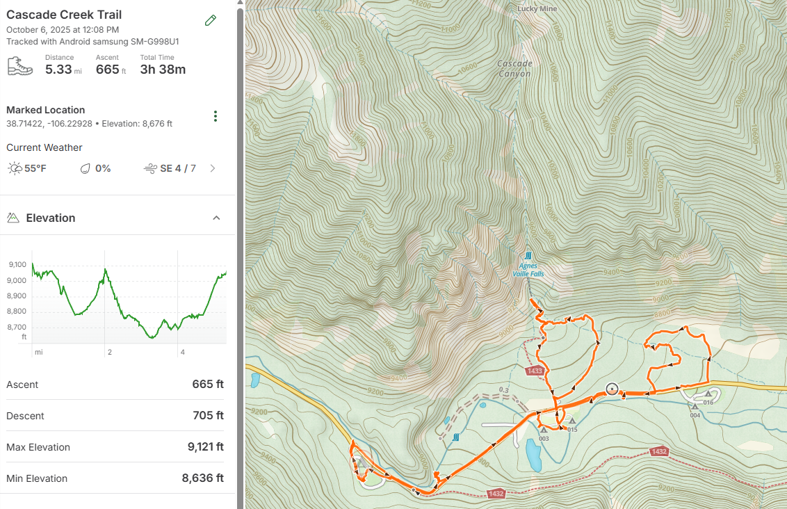
For my first ‘high altitude’ hike I went a modest 5.33 miles with 665 ft. of elevation gain. The actual Cascade Creek Trail is the loop just below Agnes Vaille Falls on the map below.
-
View from the Cascade Creek Trail

Day 6 – Road Trip October 2025. Copyright © 2025 Gary Allman, all rights reserved. -
Gary on the Cascade Creek Trail

Gary on the Cascade Creek Trail — Chalk Creek Canyon, San Isabel National Forest, Colorado. Day 6 – Road Trip October 2025. Copyright © 2025 Gary Allman, all rights reserved. -
View from the Cascade Creek Trail
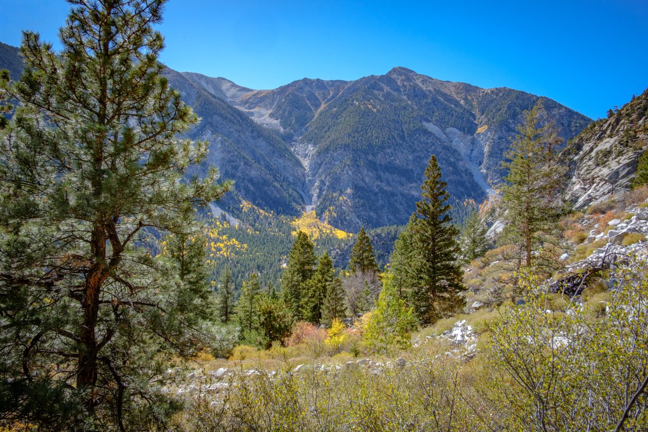
View from the Cascade Creek Trail. Looking across Chalk Creek Canyon towards Mt. Antero (not visible). Day 6 – Road Trip October 2025. Copyright © 2025 Gary Allman, all rights reserved.