-
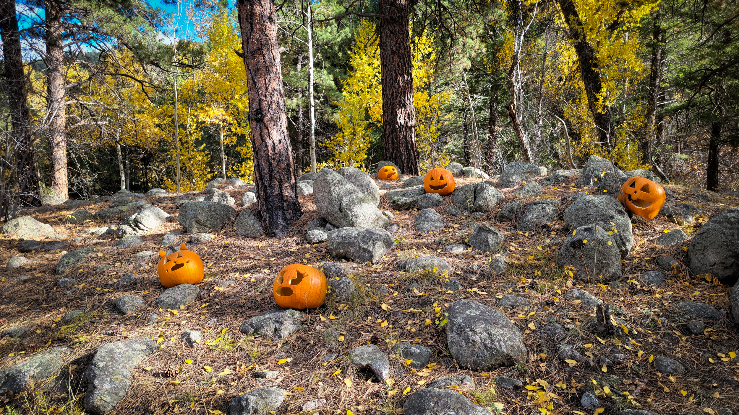
Back to the start and some trailside pumpkins

Back to the start and some trailside pumpkins — I saw these near the start of the trail. Hike totals: 6.5 miles and 1,300 ft. of elevation gain/loss. Day 8 – Road Trip, October 2025. Copyright © 2025 Gary Allman, all rights reserved. -
Nearly down

Nearly down — it took me around fifty minutes to get here from the top of the ridge. Day 8 – Road Trip, October 2025. Copyright © 2025 Gary Allman, all rights reserved. -
Trailside deer
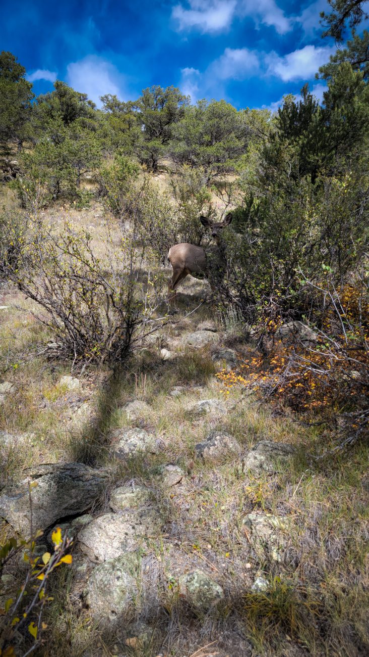
Trailside deer — the deer here are not timid, there were three in this group, but the others were enjoying an afternoon snack behind the cover of some bushes, so I could only get a picture of this one. Day 8 – Road Trip October 2025. Copyright © 2025 Gary Allman, all rights reserved. -
A brief respite

A brief respite — The trail levels out briefly in places. Day 8 – Road Trip, October 2025. Copyright © 2025 Gary Allman, all rights reserved. -
Looking up the trail

Looking up the trail — Going up was much easier than coming down. I have just noticed that I can see my footprints going up the trail in this picture. Day 8 – Road Trip, October 2025. Copyright © 2025 Gary Allman, all rights reserved. -
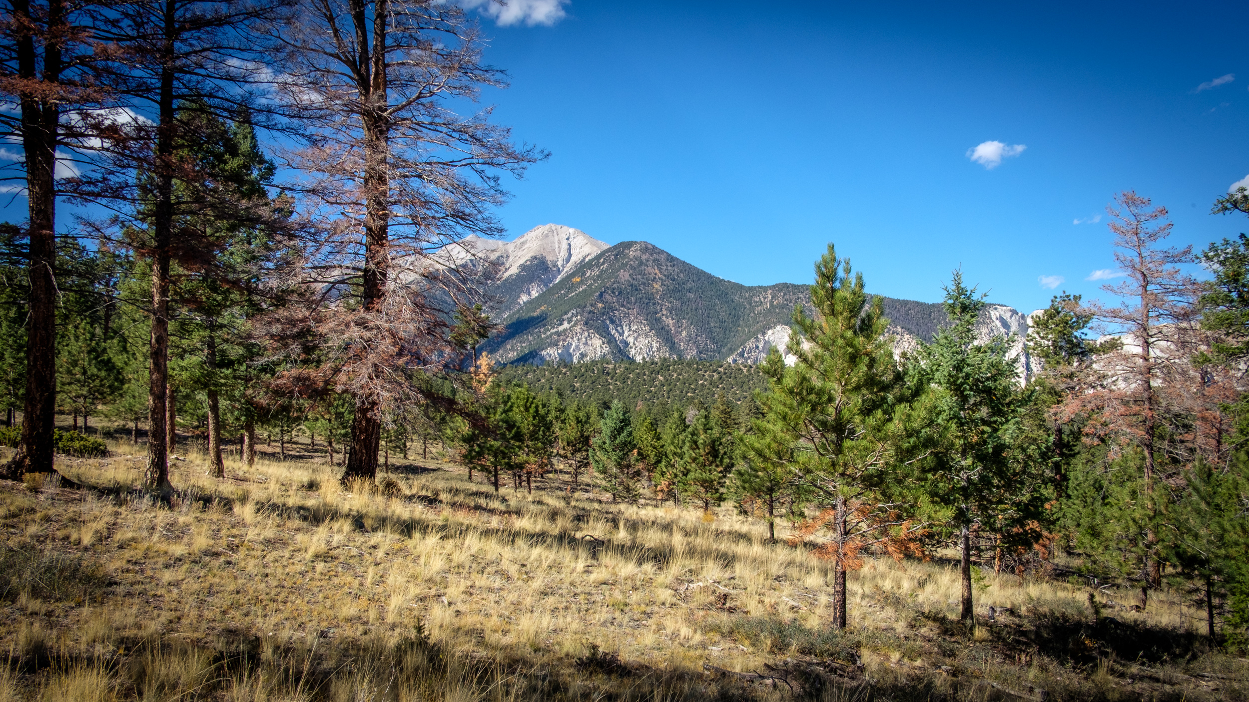
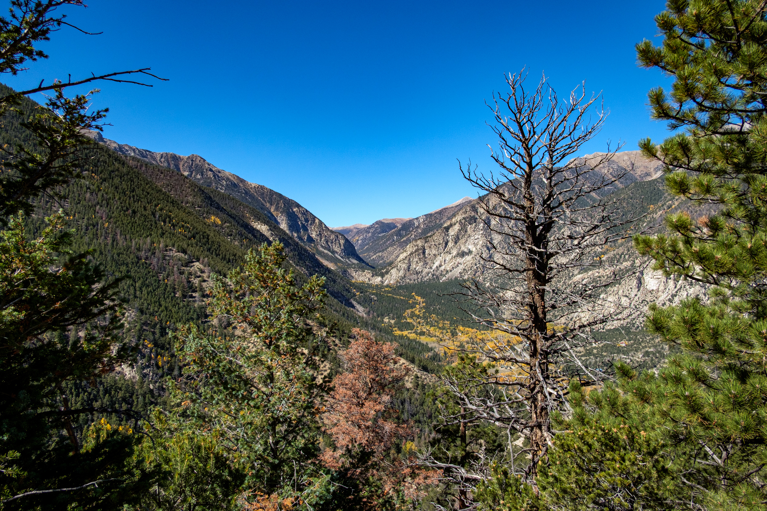
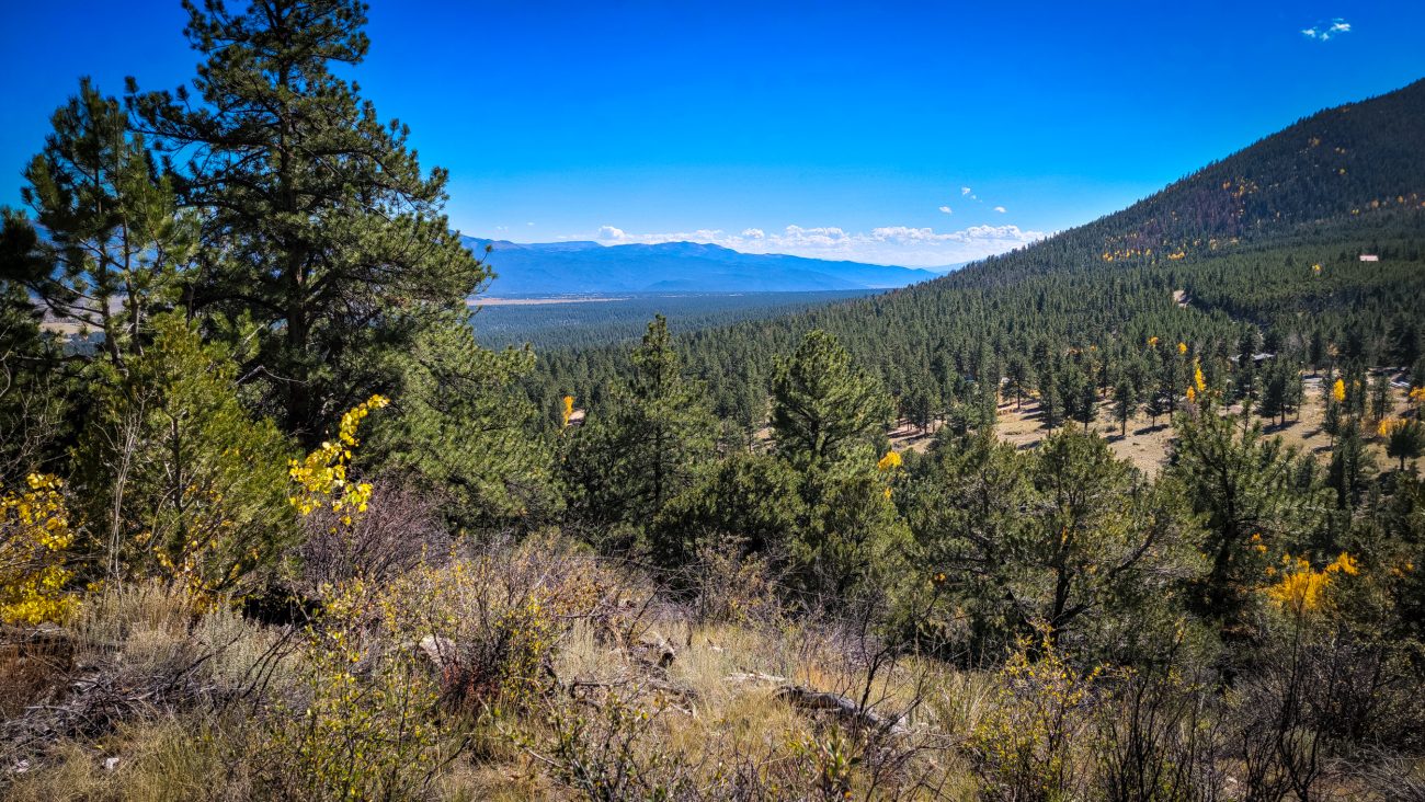
The views continue to impress me
The views continue to impress me. Day 8 – Road Trip, October 2025. Copyright © 2025 Gary Allman, all rights reserved. I didn’t take a compass bearing, so if my interpretation of the map is correct we are looking at (nearest to furthest), first, an unnamed peak with the Mt. Princeton Chalet and Lucky Mine out of view on the top, then Tigger Peak (I misread that name earlier and called it Tiger Peak), and finally Mt. Princeton.
-
Descending

Descending — Day 8 – Road Trip, October 2025. Copyright © 2025 Gary Allman, all rights reserved. The long trudge down the ridge has begun. The trail is steep and sandy at the top, making for a very loose footing. I’m always surprised to find sand in high places. Of course, it makes perfect sense when you consider the entire area was buried under an alluvial plain at one point.
It’s a tad steep in places — Day 8 – Road Trip, October 2025. Copyright © 2025 Gary Allman, all rights reserved. Yes, it really is that steep. This descent is not for sissies, or the wrong footwear! I was fine with my Bedrock Sandals and hiking poles.
-
A last look to the southeast

A last look to the southeast — before dropping back down into Chalk Creek Canyon, I popped over to the other side of the ridge for one last look at the view across the plains to the southeast. Day 8 – Road Trip, October 2025. Copyright © 2025 Gary Allman, all rights reserved -
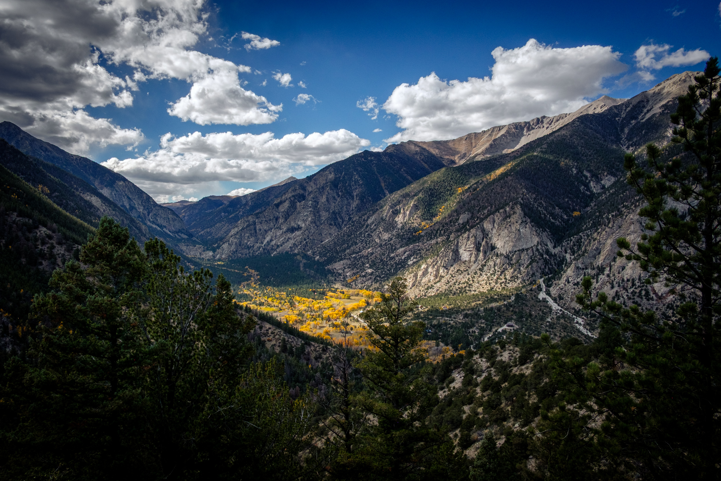
The endless play of light
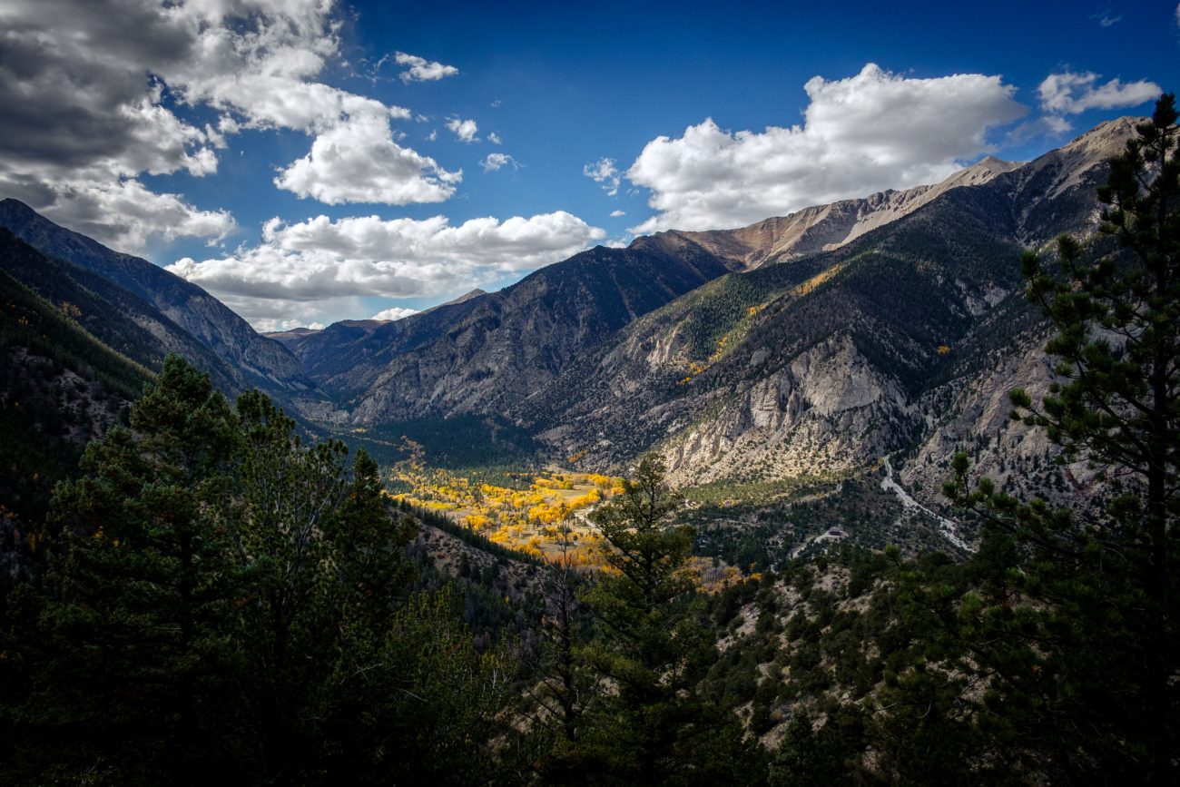
The endless play of light — I stayed here for several minutes watching the ever-changing light move across Chalk Creek Canyon. Day 8 – Road Trip, October, 2025. Copyright © 2025 Gary Allman, all rights reserved 
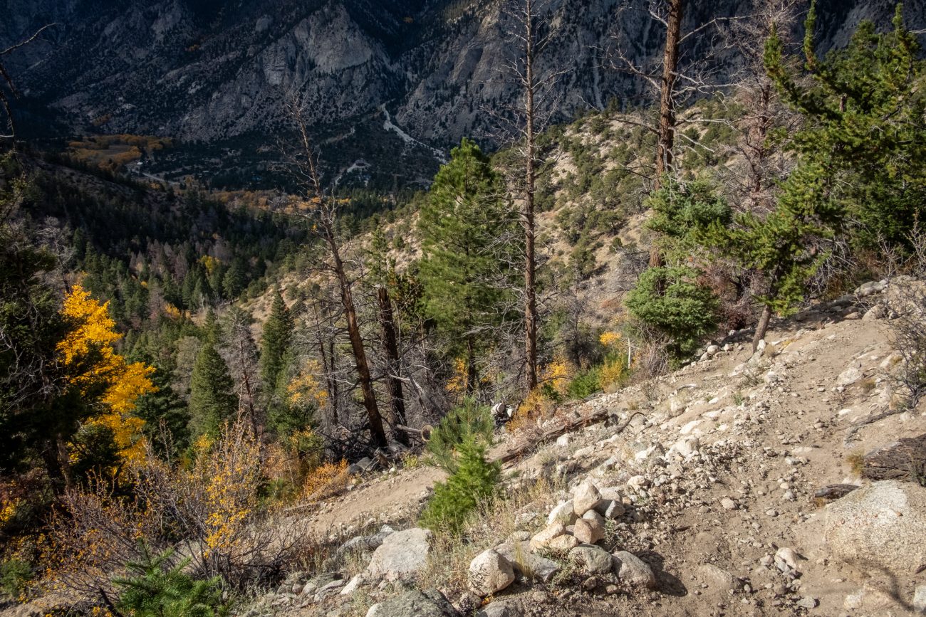
Long way down — about 900 ft. and I’m parked in the bottom of the valley. This viewpoint shows how massive piles of scree have spread out across the canyon’s floor. Day 8 – Road Trip, October 2025. Copyright © 2025 Gary Allman, all rights reserved. -
Chalk Creek Canyon
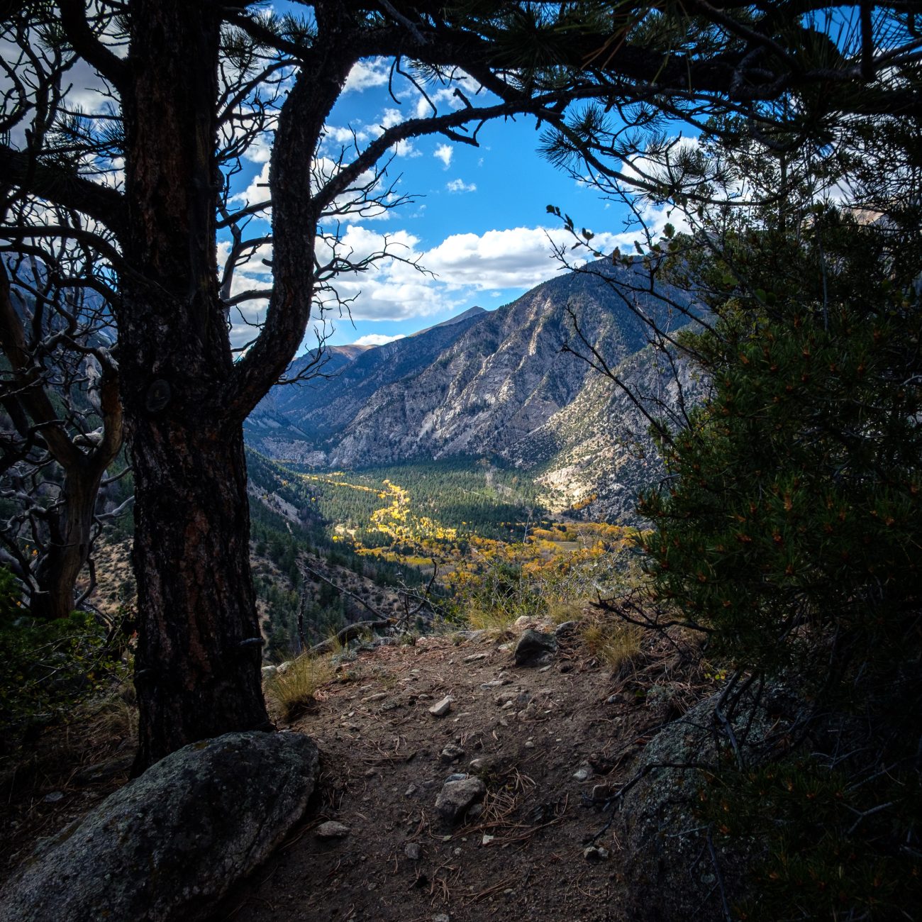
Chalk Creek Canyon — I couldn’t resist taking a picture of Chalk Creek Canyon framed by this tree and bush. It was windy and the light was changing rapidly as the clouds moved across the sky. Day 8 – Road Trip October 2025. Copyright © 2025 Gary Allman, all rights reserved. -
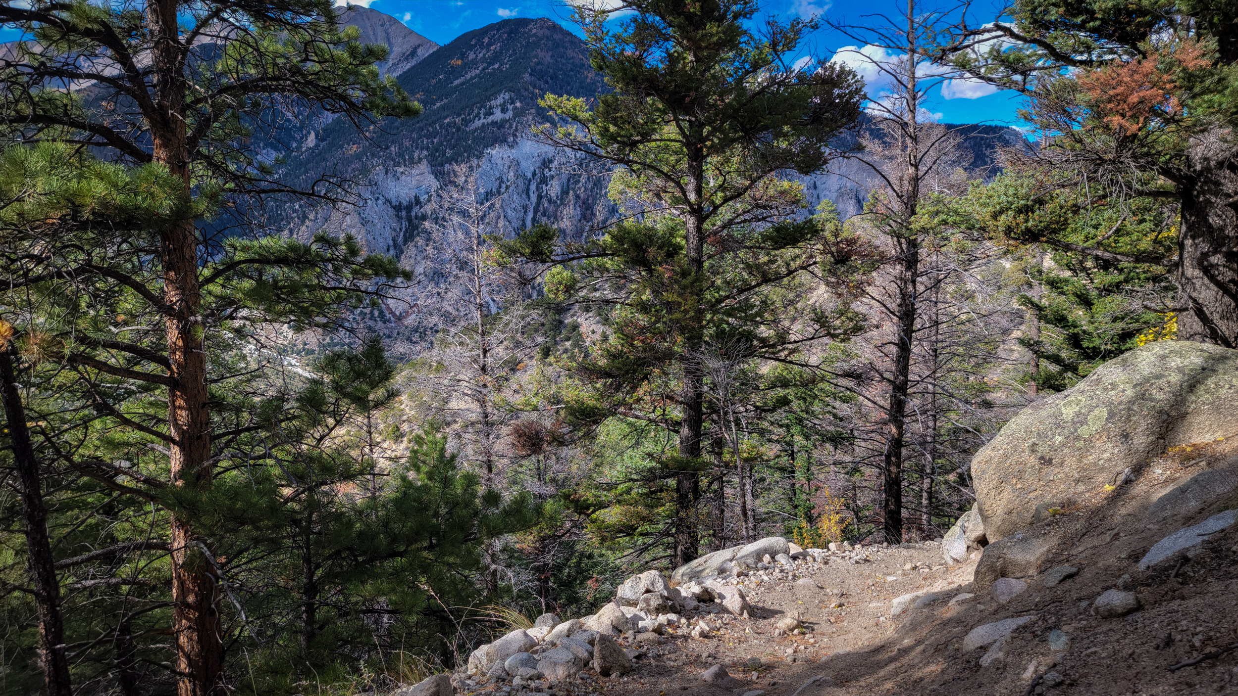
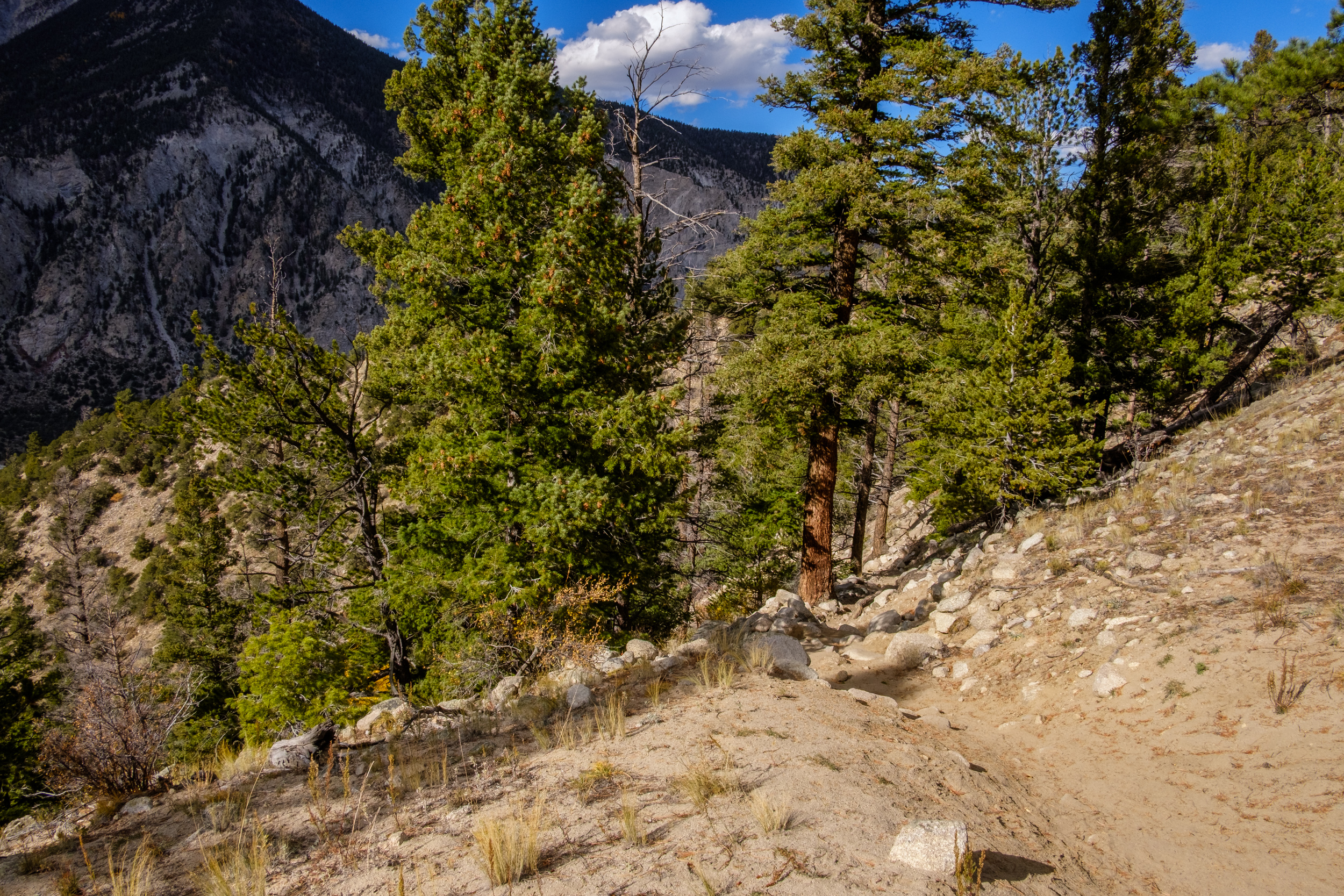
Getting near to the top
Getting near to the top — Day 8 – Road Trip October 2025. Copyright © 2025 Gary Allman, all rights reserved. Looking southwest. A glimpse of the trail is visible at the bottom of the frame. It’s looking quite rugged, and it was. It was somewhere around here I met the woman on her mountain bike again. It looked a tad easier going down, but only slightly easier.
-
Time to head back up the ridge

Time to head back up the ridge — At least it’s only 300 ft. on this side. But I still have 900ft. to descend on the other side. Day 8 – Road Trip, October 2025. Copyright © 2025 Gary Allman, all rights reserved. -
Heading back
Heading back — Look carefully, and in the middle distance, you can see the ridge I’m going to climb. Day 8 – Road Trip, October 2025. Copyright © 2025 Gary Allman, all rights reserved. -
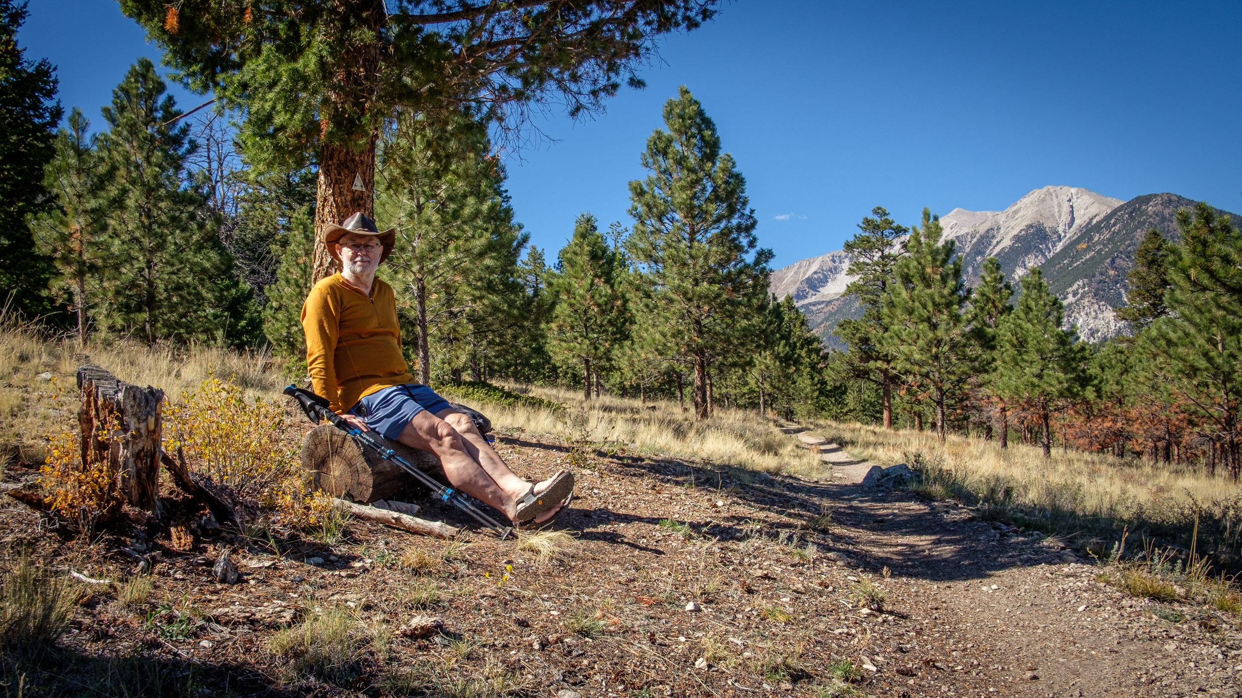
Turnaround Point, and stopped for lunch
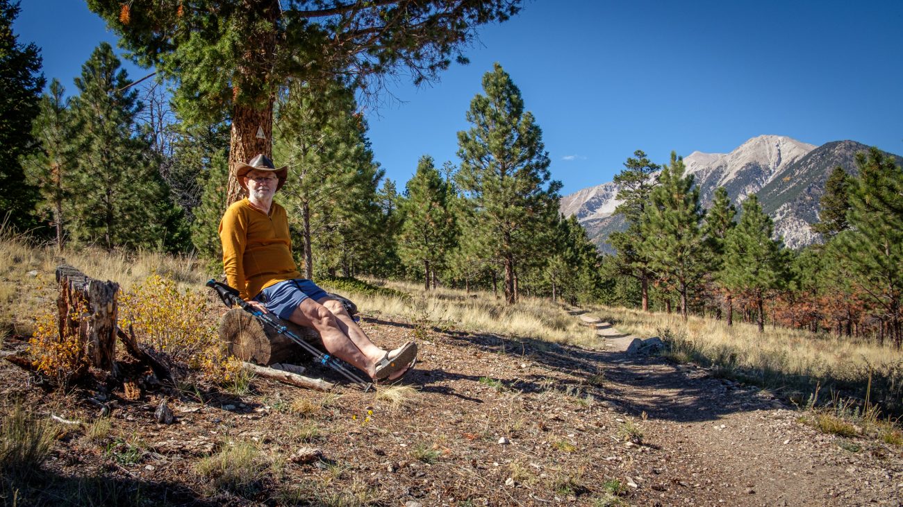
Turnaround Point, and stopped for lunch — Day 8 – Road Trip, October 2025. Copyright © 2025 Gary Allman, all rights reserved. According to my calculations, I was about three-and-a-half miles into my hike, and this log offered a great view and spot to eat lunch. The weather for this entire trip has been fantastic, it’s just as well I brought some shorts along. It’s not been the cold and snowy trip the original forecast was promising when we left Missouri.
My calves are looking the part, even if I say so myself, and a shoutout for my Bedrock sandals too.
-
Descending
Descending — Nearly down the south side of the ridge, and the trail is leveling out. It was quite rugged in places. I met a woman pushing her mountain bike up the trail, it looked like very hard work. Day 8 – Road Trip, October 2025. Copyright © 2025 Gary Allman, all rights reserved. -
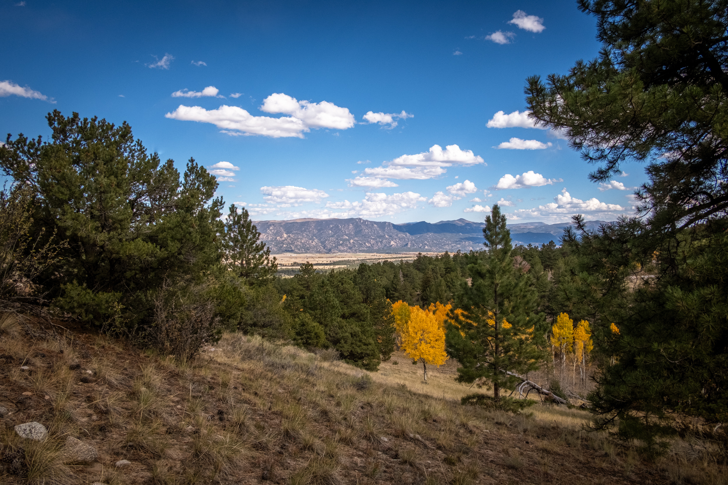
I could almost be in Hercules Glades
I could almost be in Hercules Glades — If the Glades were at around 10,000ft, that is. I’m following the trail as it runs along the northern side of the ridge. Day 8 – Road Trip, October 2025. Copyright © 2025 Gary Allman, all rights reserved. -
Looking over the other side of the ridge
Looking over the other side of the ridge — I’m facing roughly southeast. The drop on this side of the ridge is only 300ft. Hopefully not a very rugged descent, and not too far for me to climb up on my return. Day 8 – Road Trip, October 2025. Copyright © 2025 Gary Allman, all rights reserved. -
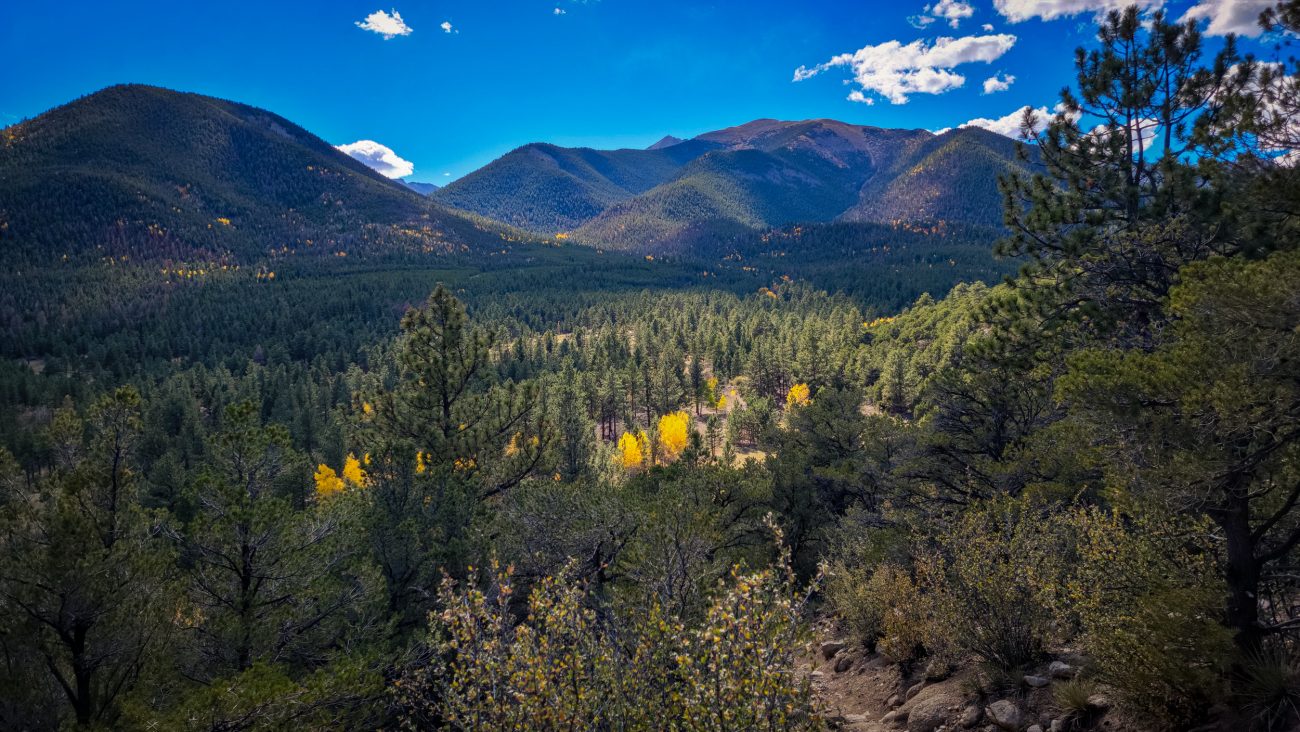
Under an hour later and I’m on the top of the ridge

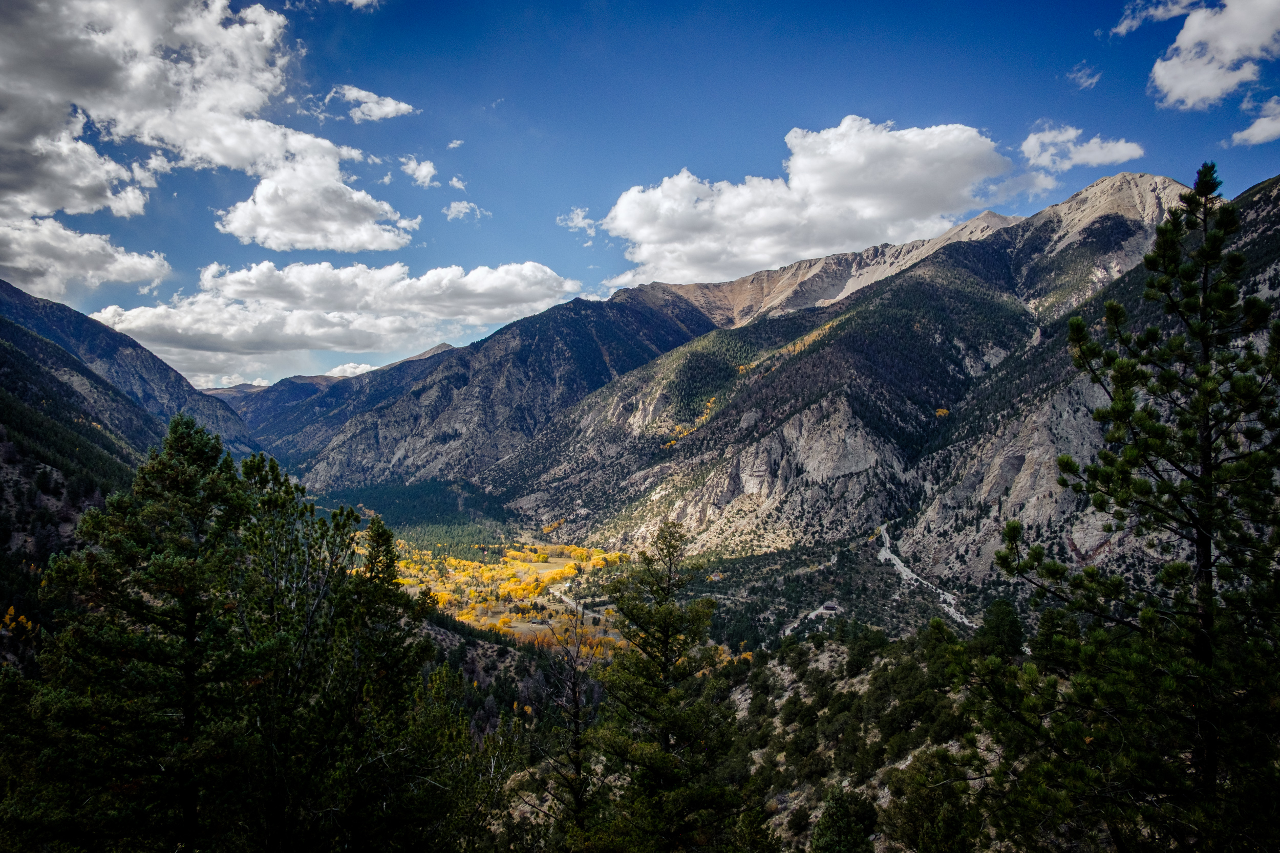
Under an hour later and I’m on the top of the ridge — Day 8 – Road Trip, October 2025. Copyright © 2025 Gary Allman, all rights reserved. And what a view! The fall colors and mountains are spectacular. That was a lot easier than I expected, but it was very steep in places. It was worth it for the views.
-
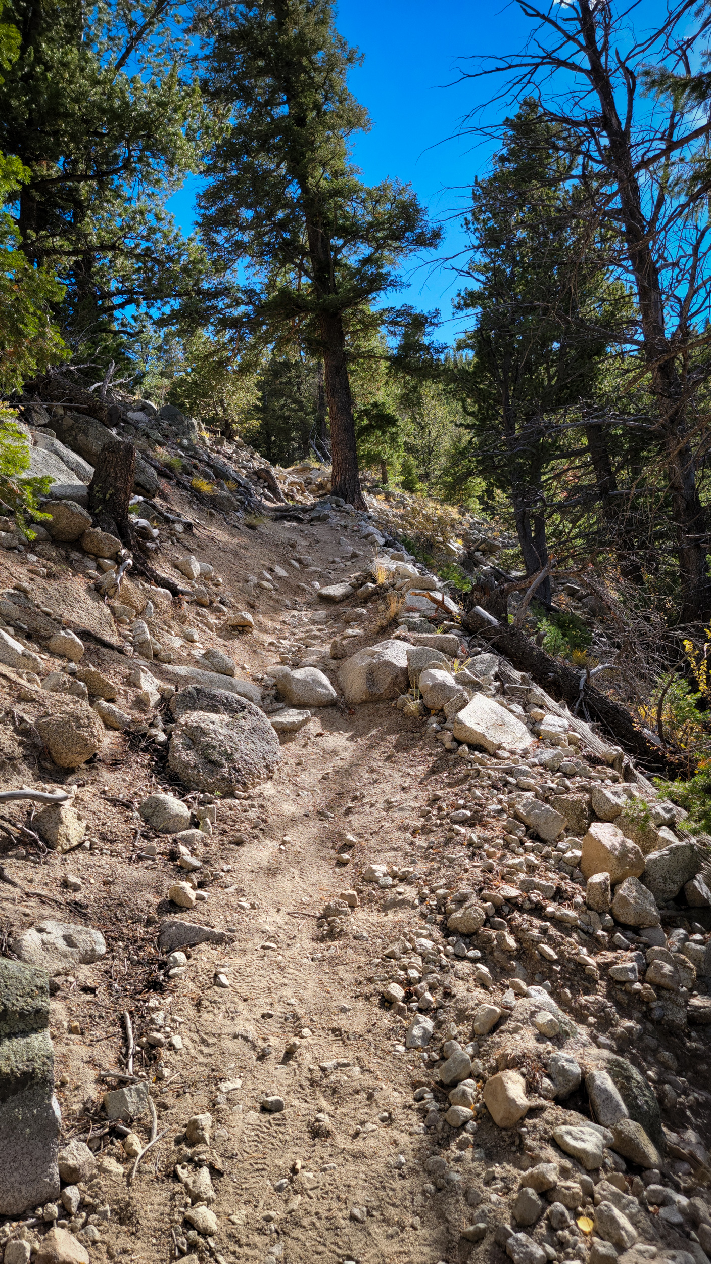
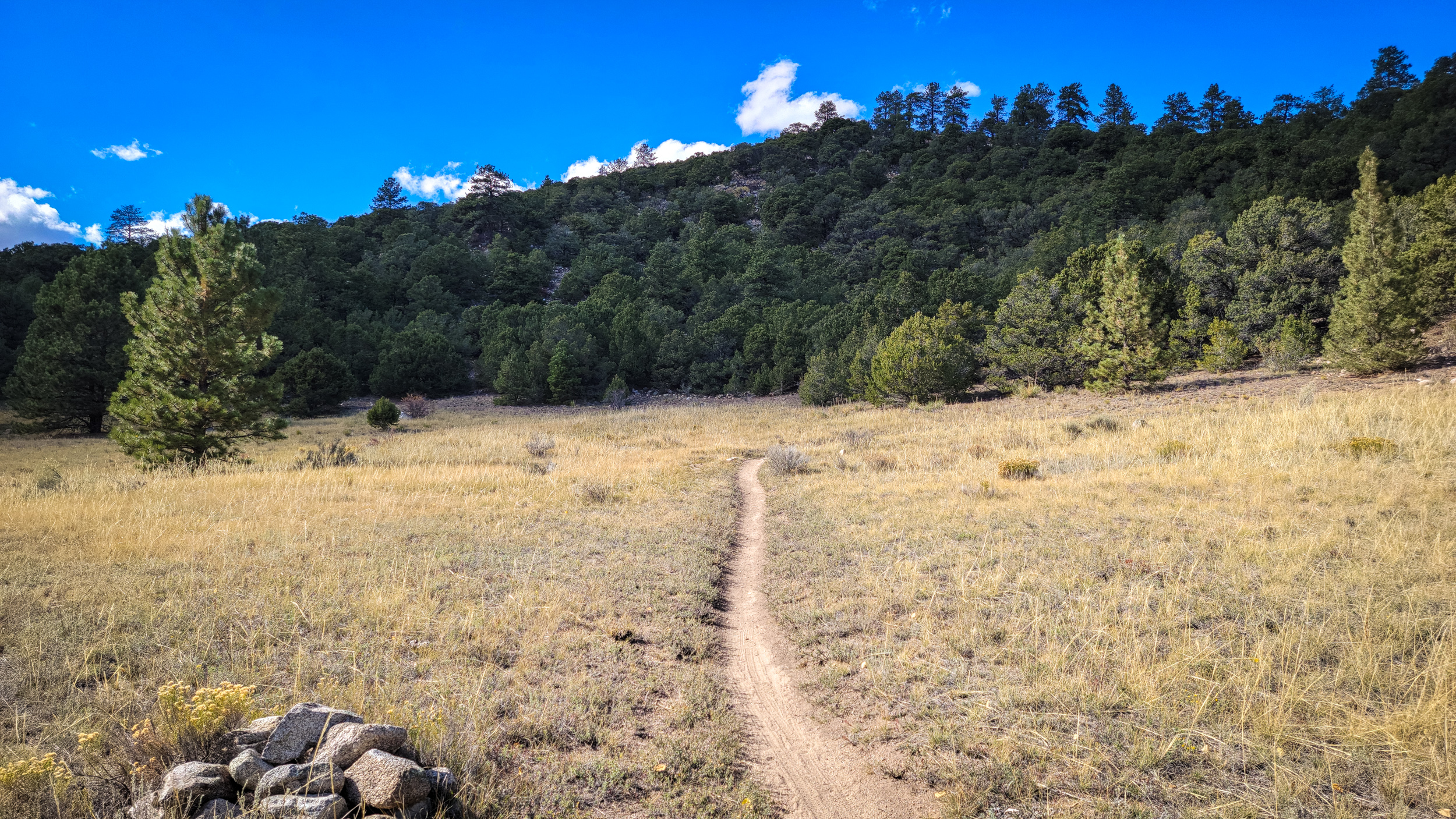
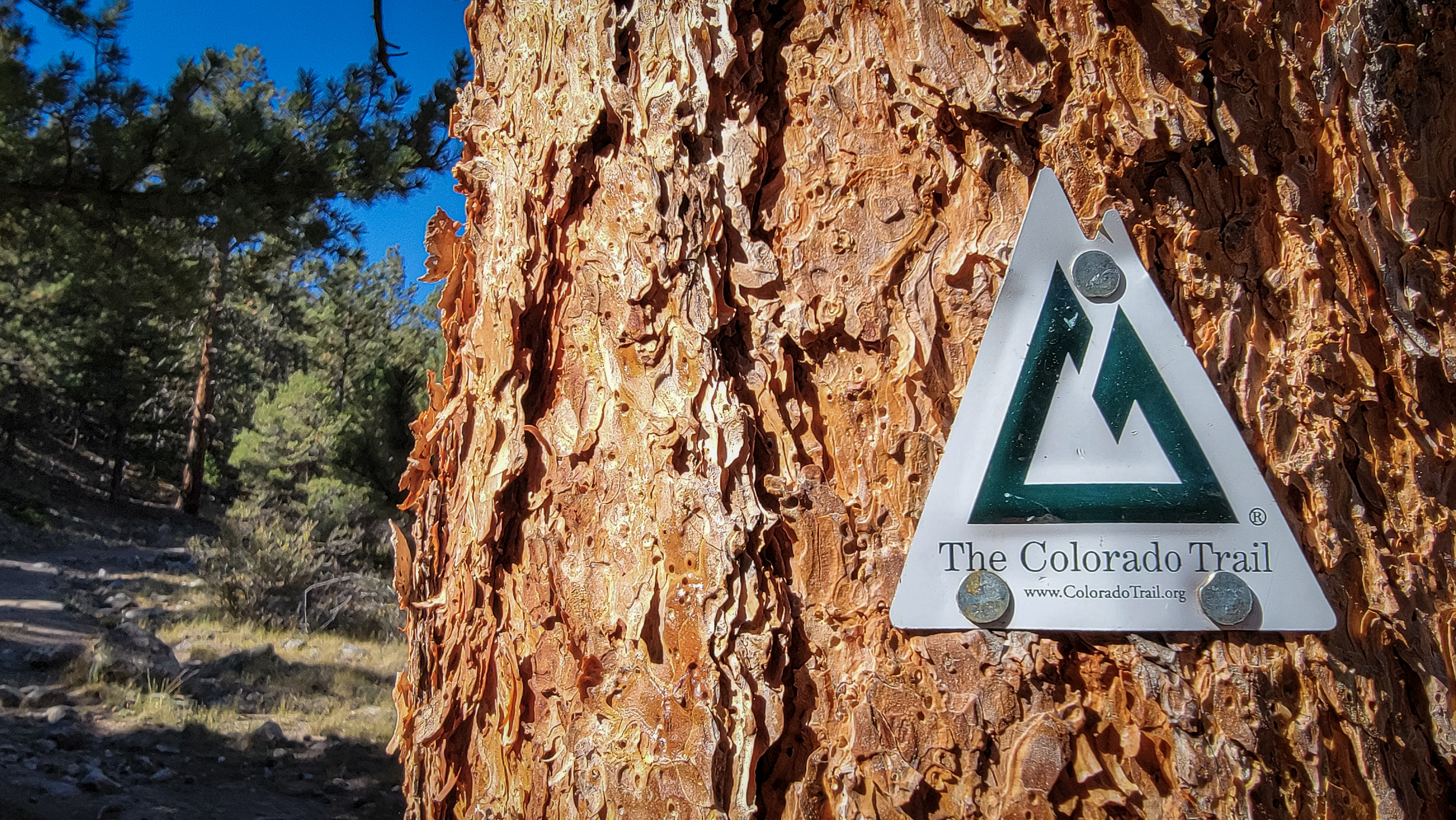
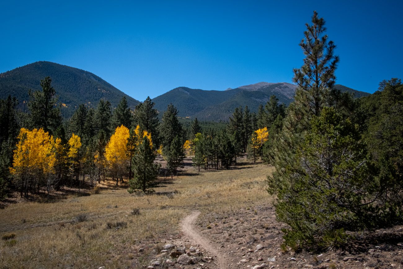
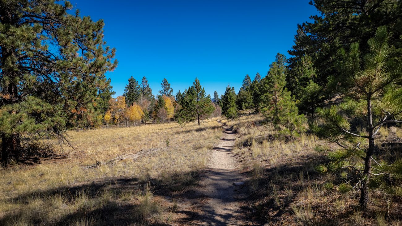
On the Colorado Trail
On the Colorado Trail — Day 8 – Road Trip October 2025. Copyright © 2025 Gary Allman, all rights reserved. Okay, I did a tiny bit of this trail yesterday, but I’m counting this as my first hike on a major through trail. I’ll only be going a total of seven miles or so, but that’s enough for me with all the elevation I’ll be gaining.
-
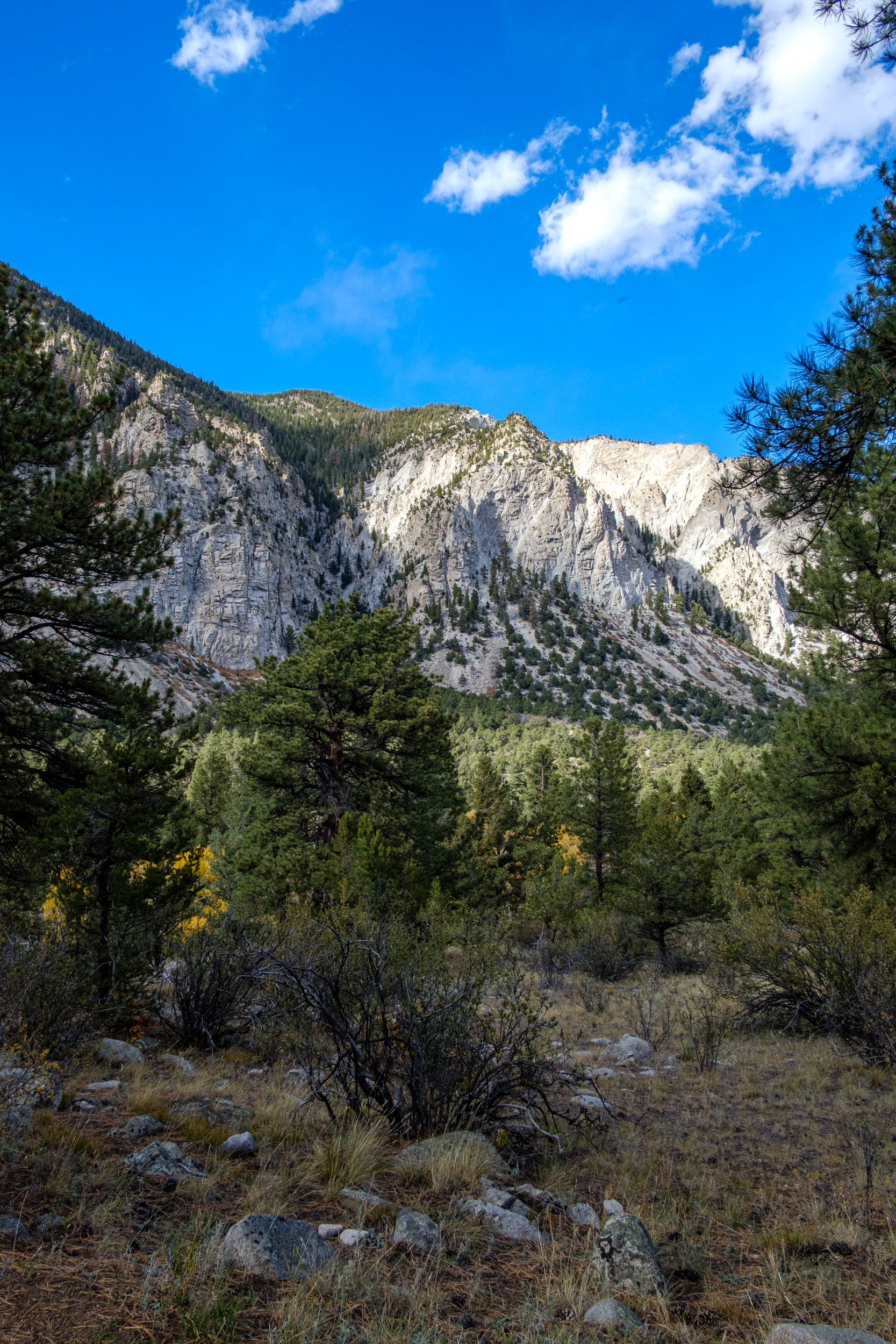
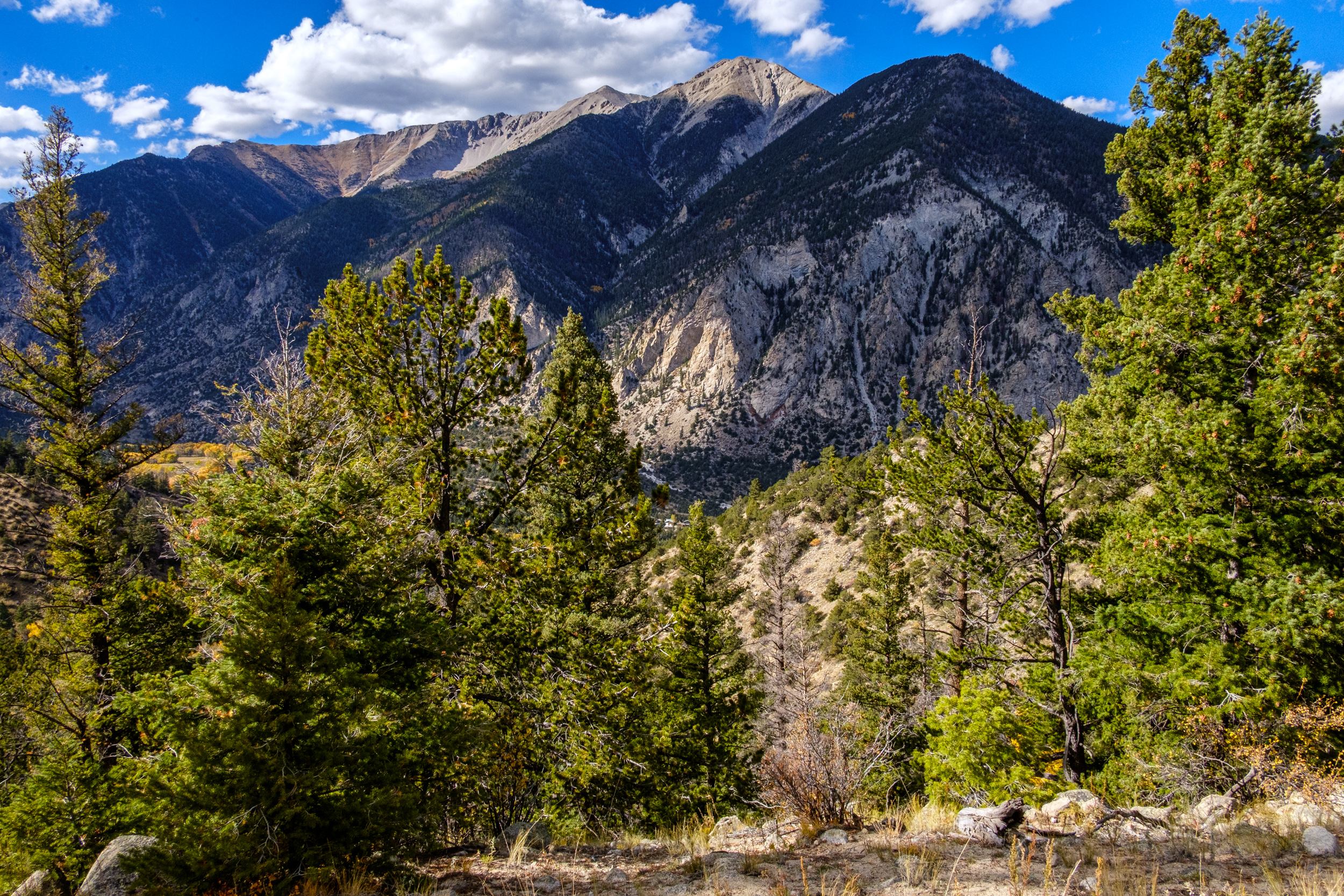
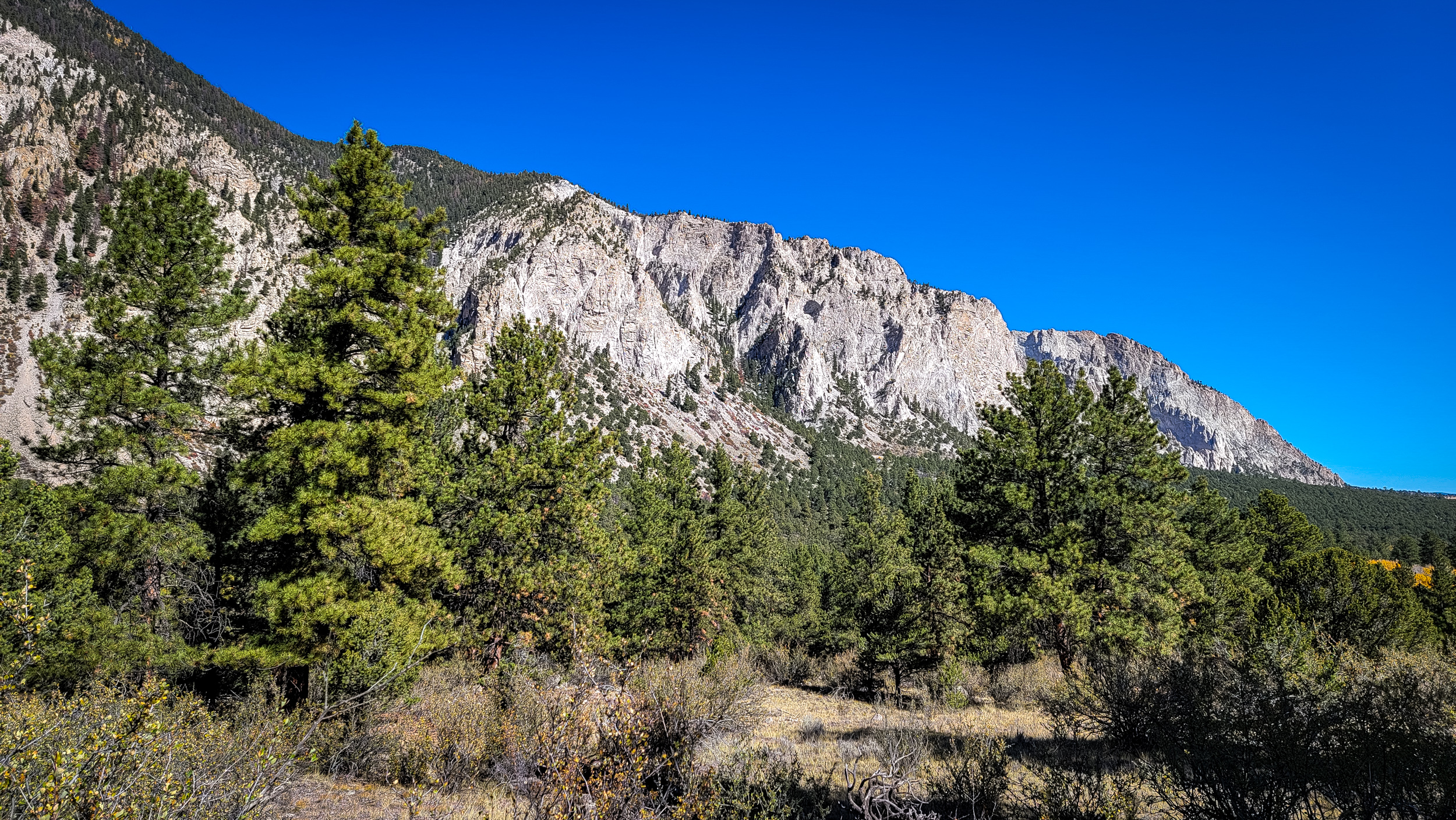
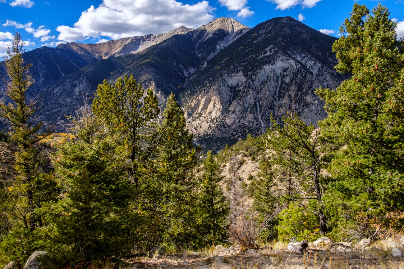
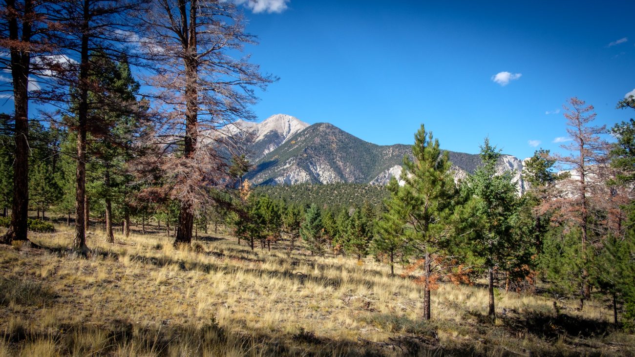
Chalk Cliffs from the Colorado Trail

Chalk Cliffs from the Colorado Trail — Day 8 – Road Trip, October 2025. Copyright © 2025 Gary Allman, all rights reserved. Of course, they are not chalk. They are white quartz left behind after other minerals have been leached from the original rock by hot water (there are hot springs here). The cliffs are very friable, and landslides are common. The Agnes Vaille Trail I was on a couple of days ago had to be rerouted due to a major rockfall.