No time to read?
Click here for all the pictures from this trip
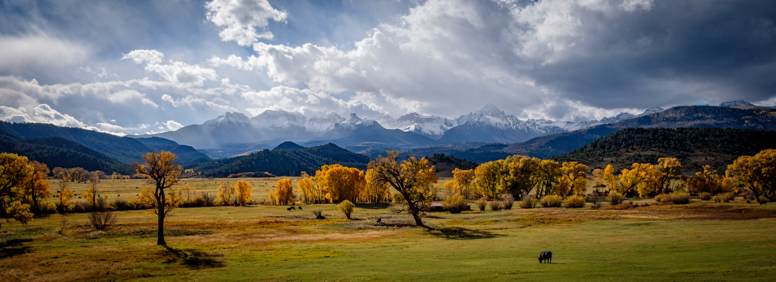
Ginger had a week-long retreat in Colorado Springs at the start of October, and an event scheduled in Denver two weeks later. I planned to go backpacking in the Rockies while she was at her retreat and once the retreat was over, we’d visit the Colorado haunts of Ginger’s childhood for a few days, go to Utah, spend some time in the desert, catch up with Lanie at the Vermejo Ranch in New Mexico, and then head back to Denver for the event and finally a two-day cross-country dash home.
And that’s pretty much what we did … All in all, it took us twenty-seven days and over 2,500 miles to complete the trip.
Days 1 & 2
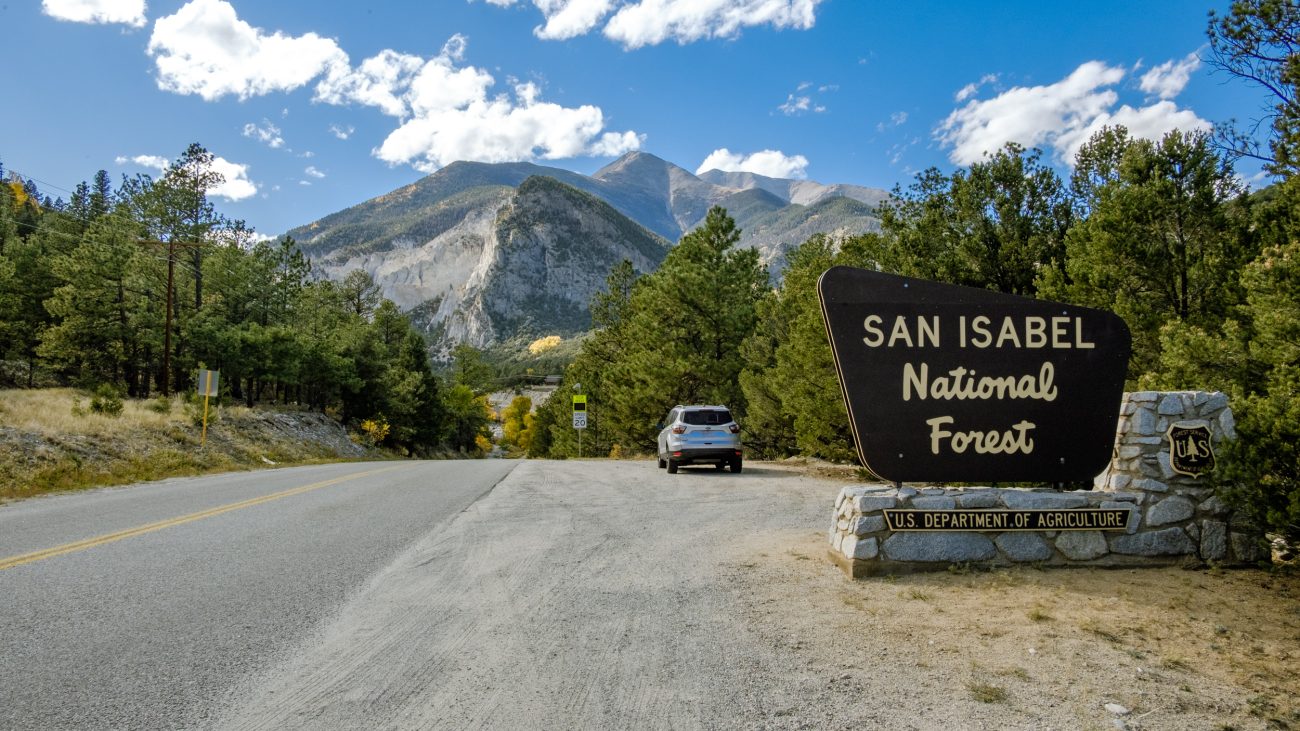
On Day One, we drove from Springfield to Dodge City, and on Day Two, from Dodge City to Colorado Springs. Day Three, I dropped Ginger off at her retreat and headed off to Basalt, Colorado. A worsening weather forecast, with temperatures in the twenties and snow, had prompted me to change my backpacking plans. I decided to car camp for a week. I’d already spent a night at around 7,000 ft in Colorado Springs, now for a couple of days camping in the White River National Forest at 8,000 ft. and then move to another campground in the San Isabel National Forest at over 9,000 ft. I would see if I could get to do some hiking in the mountains! I had no idea what to expect, and how well I’d acclimatize to hiking nearly 1¾ miles up. Apart from flying, I’ve spent pretty much my entire life at below 2,000 ft.
-
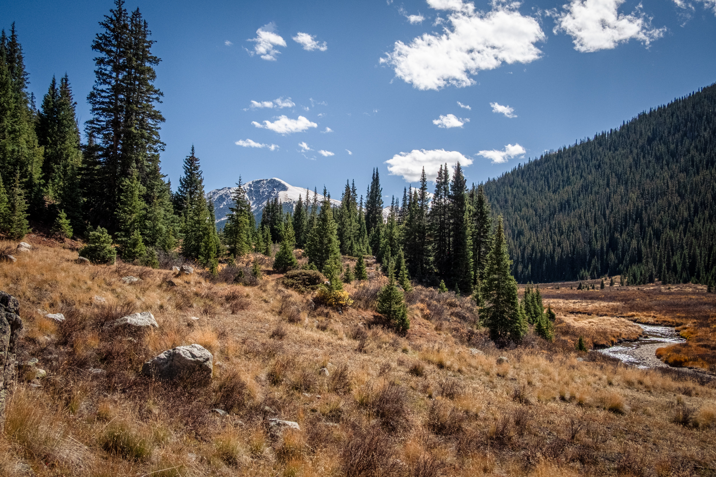
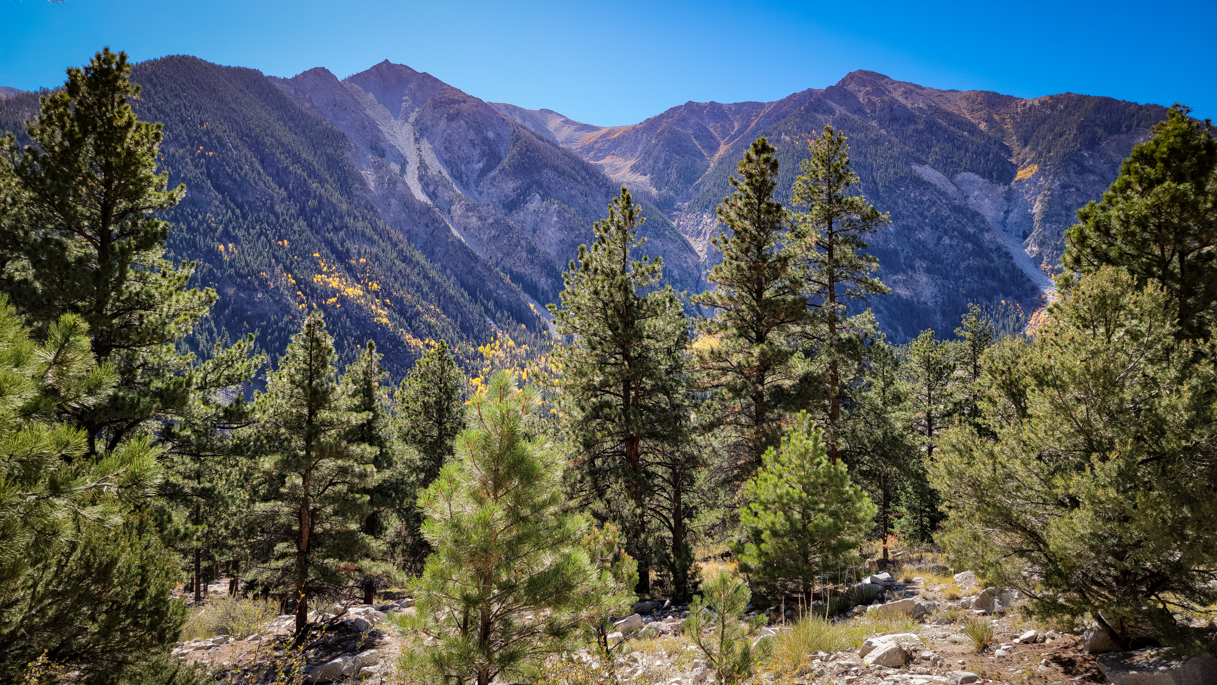
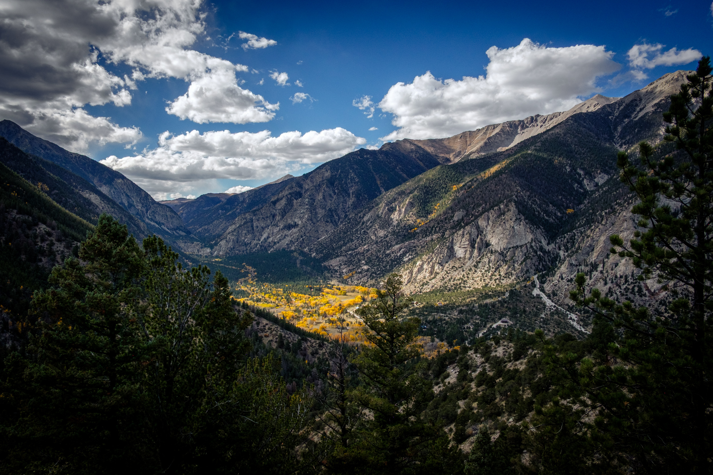
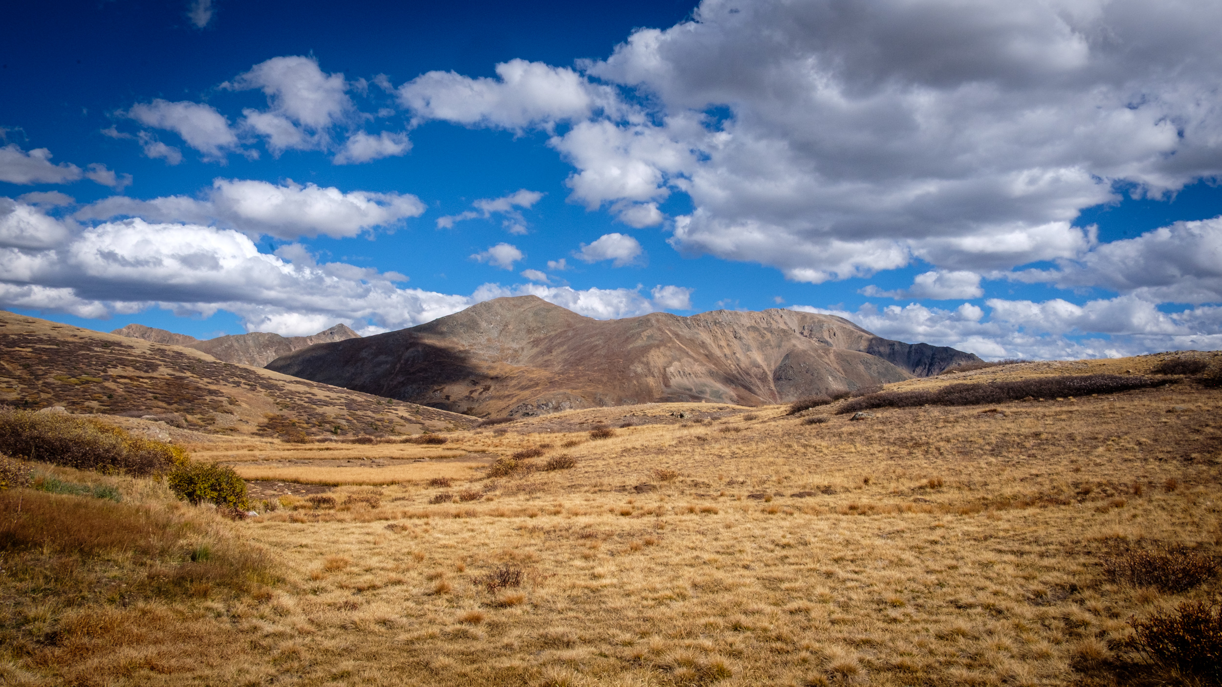
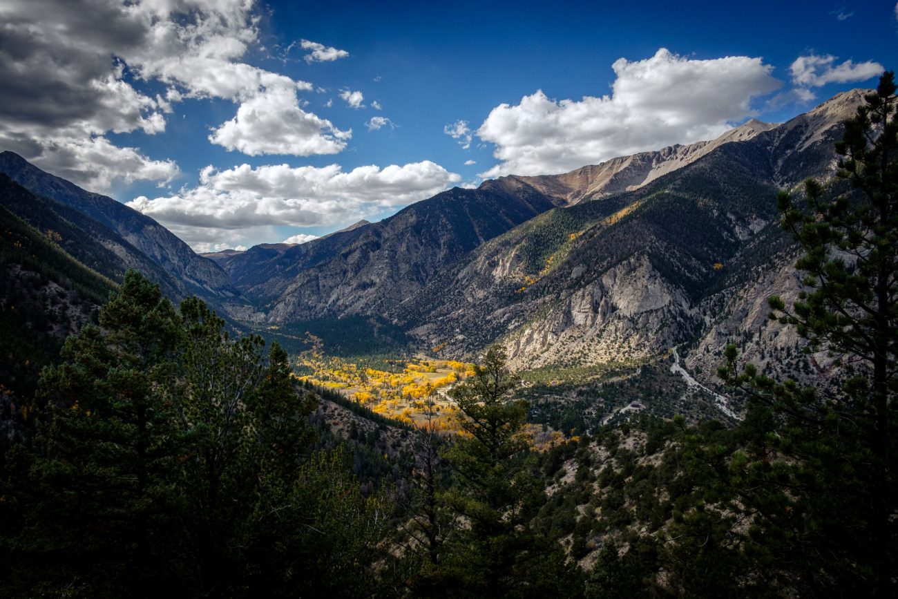
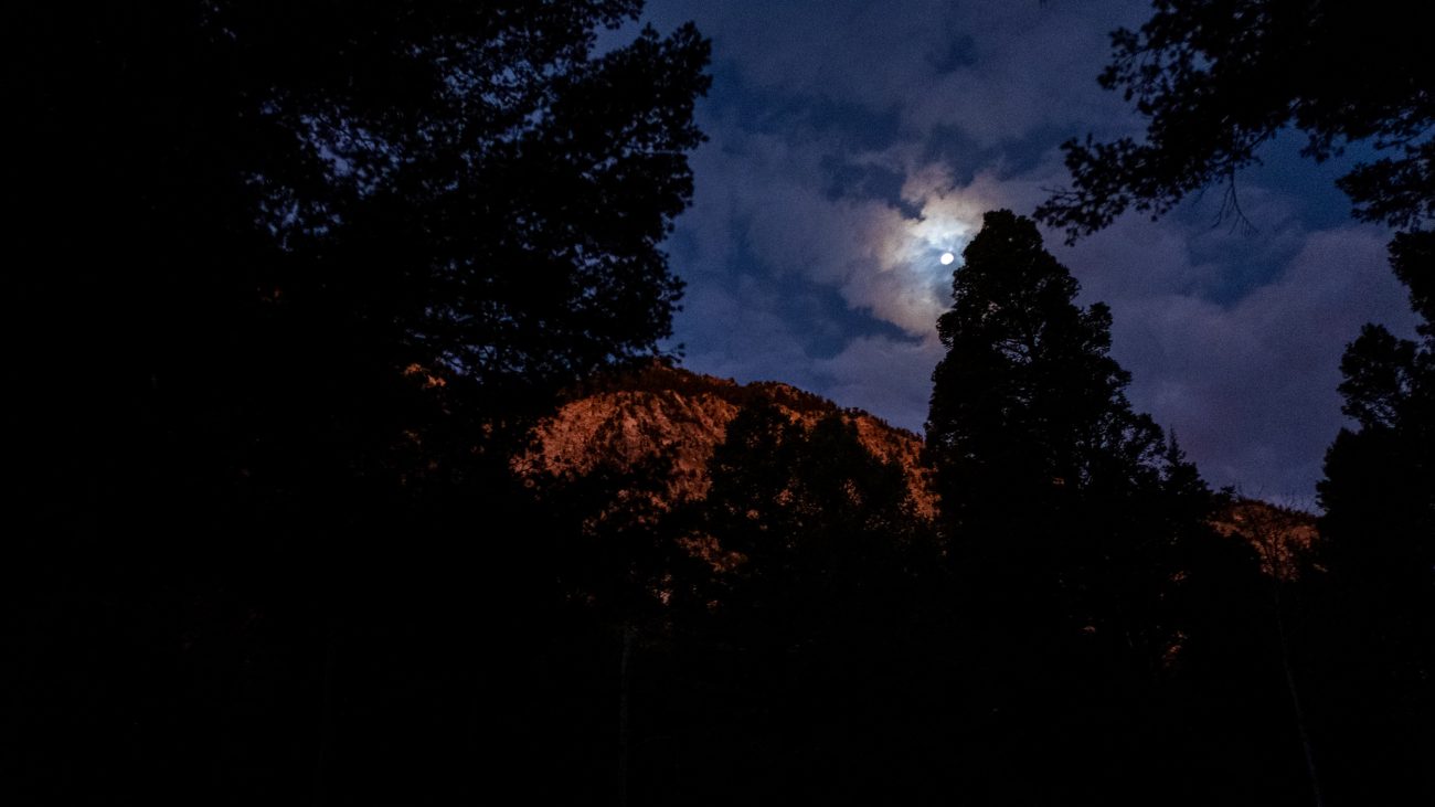
Day 3. Pond and Mountains
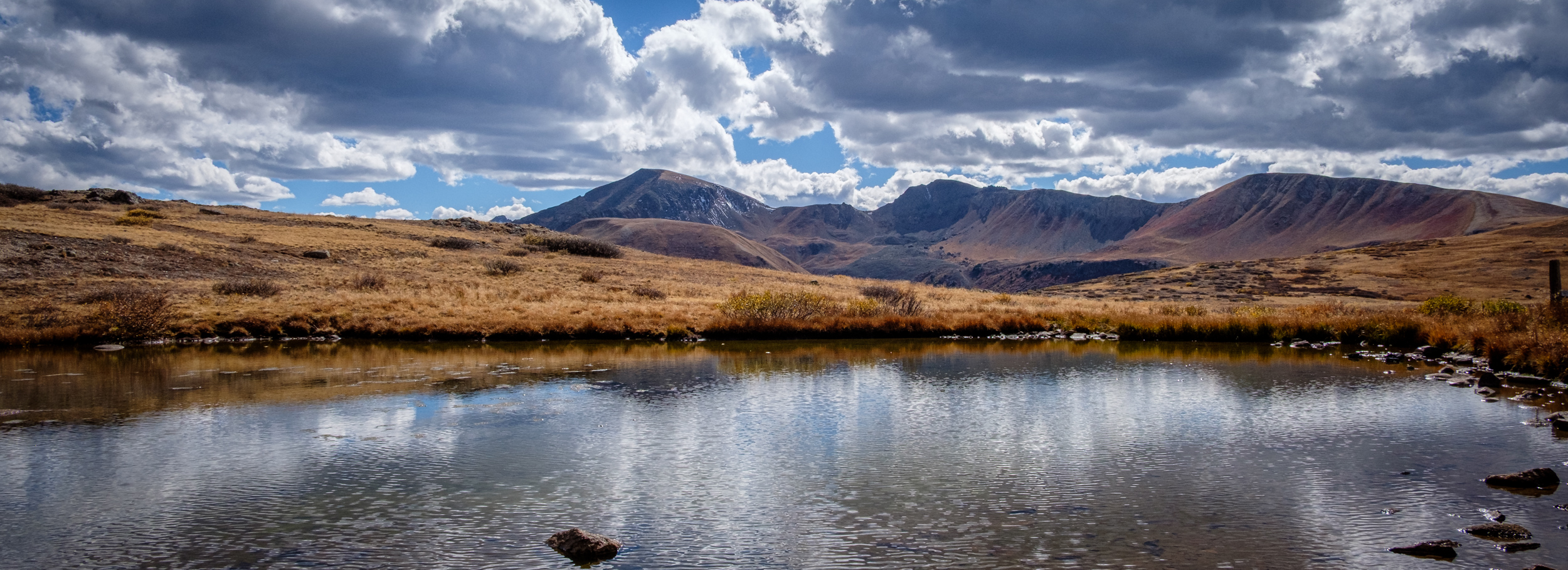
Pond and Mountains — I stopped briefly at the top of Independence Pass to stretch my legs and get a better look at the mountains. Day 3 – Road Trip October 2025. Copyright © 2025 Gary Allman, all rights reserved. -
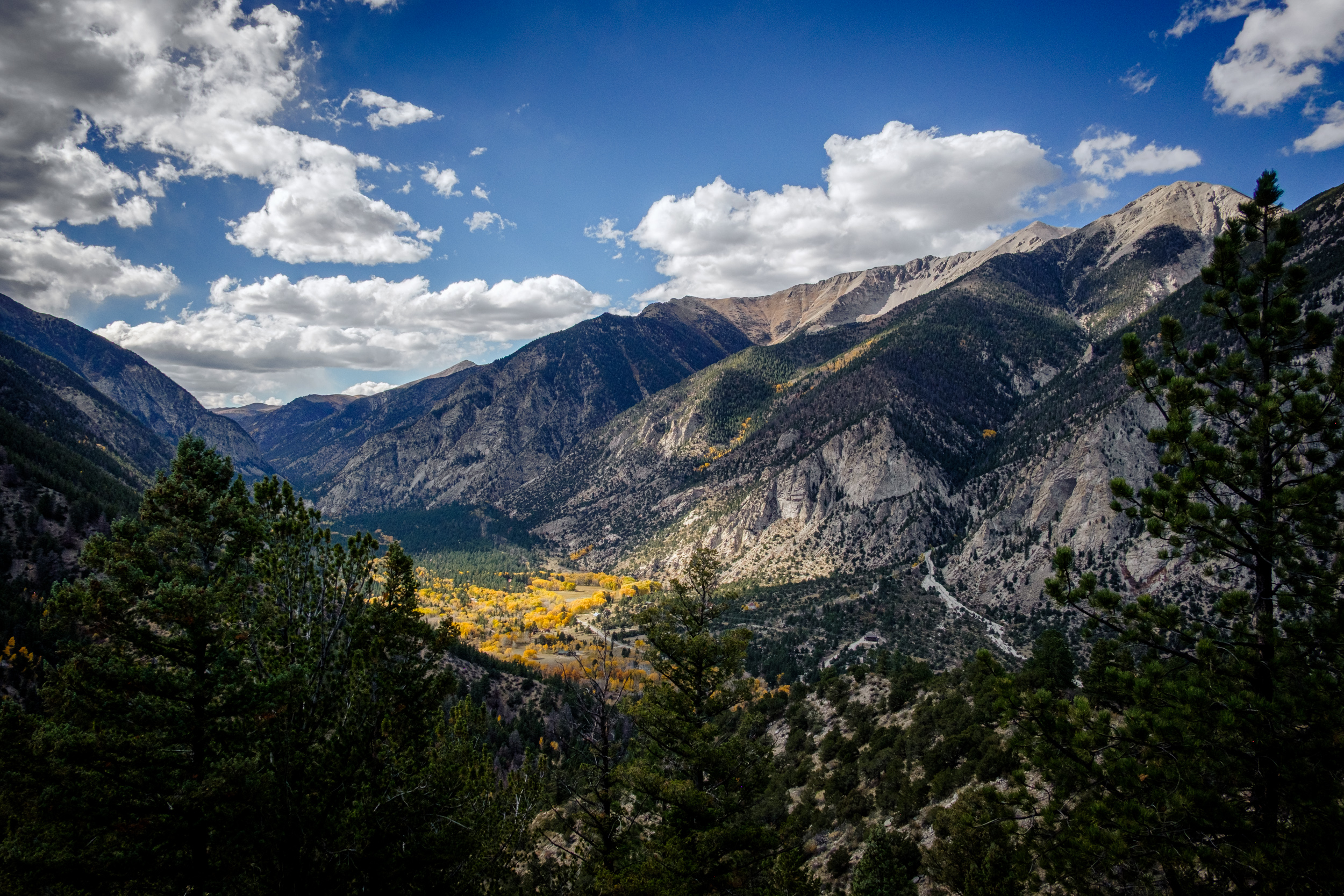
View from the top of Independence Pass

View from the top of Independence Pass — I stopped briefly at the top of Independence Pass to stretch my legs and get a better look at the mountains. Day 3 – Road Trip October 2025. Copyright © 2025 Gary Allman, all rights reserved. -
View from the top of Independence Pass

View from the top of Independence Pass — I stopped briefly at the top of Independence Pass to stretch my legs and get a better look at the mountains. Day 3 – Road Trip October 2025. Copyright © 2025 Gary Allman, all rights reserved. -
Independence Pass and Continental Divide
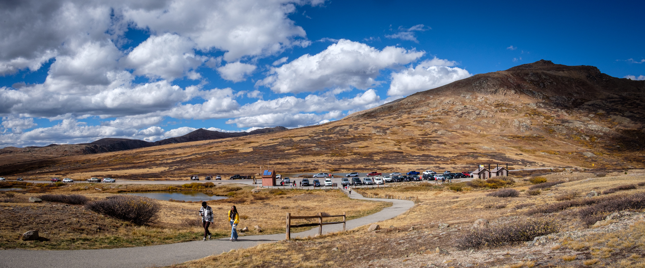
Independence Pass and Continental Divide — It was a lot busier than I expected given the tortuous drive to get here. Day 3 – Road Trip October 2025. Copyright © 2025 Gary Allman, all rights reserved. -
Empty
Empty — I stopped briefly at the top of Independence Pass to stretch my legs and get a better look at the mountains. Day 3 – Road Trip October 2025. Copyright © 2025 Gary Allman, all rights reserved. -
Independence Pass and Continental Divide

Independence Pass and Continental Divide — It was a lot busier than I expected given the tortuous drive to get here. Day 3 – Road Trip October 2025. Copyright © 2025 Gary Allman, all rights reserved. -
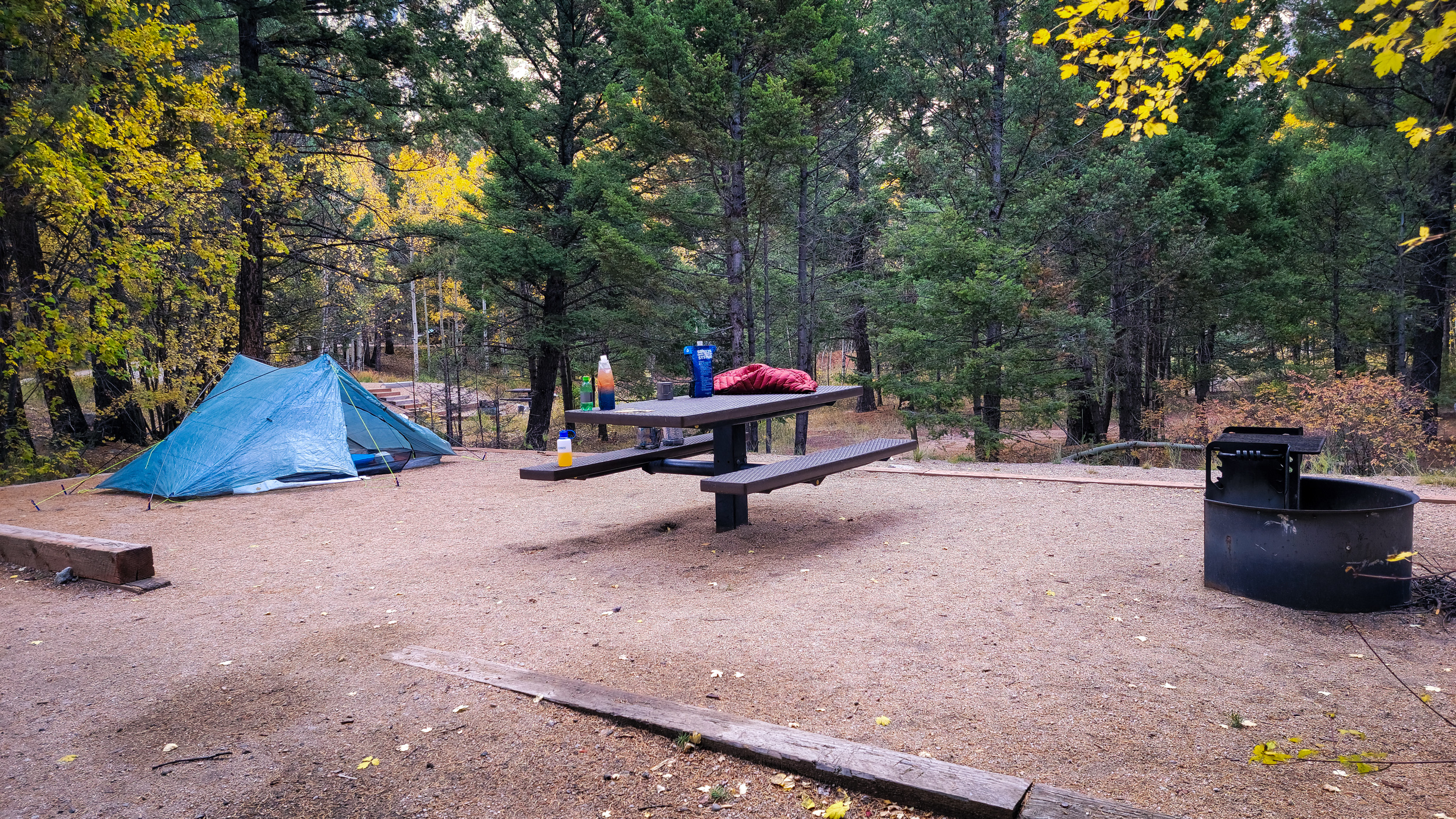
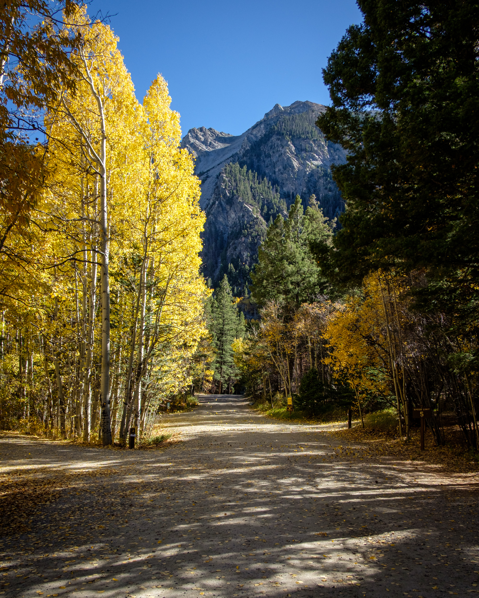
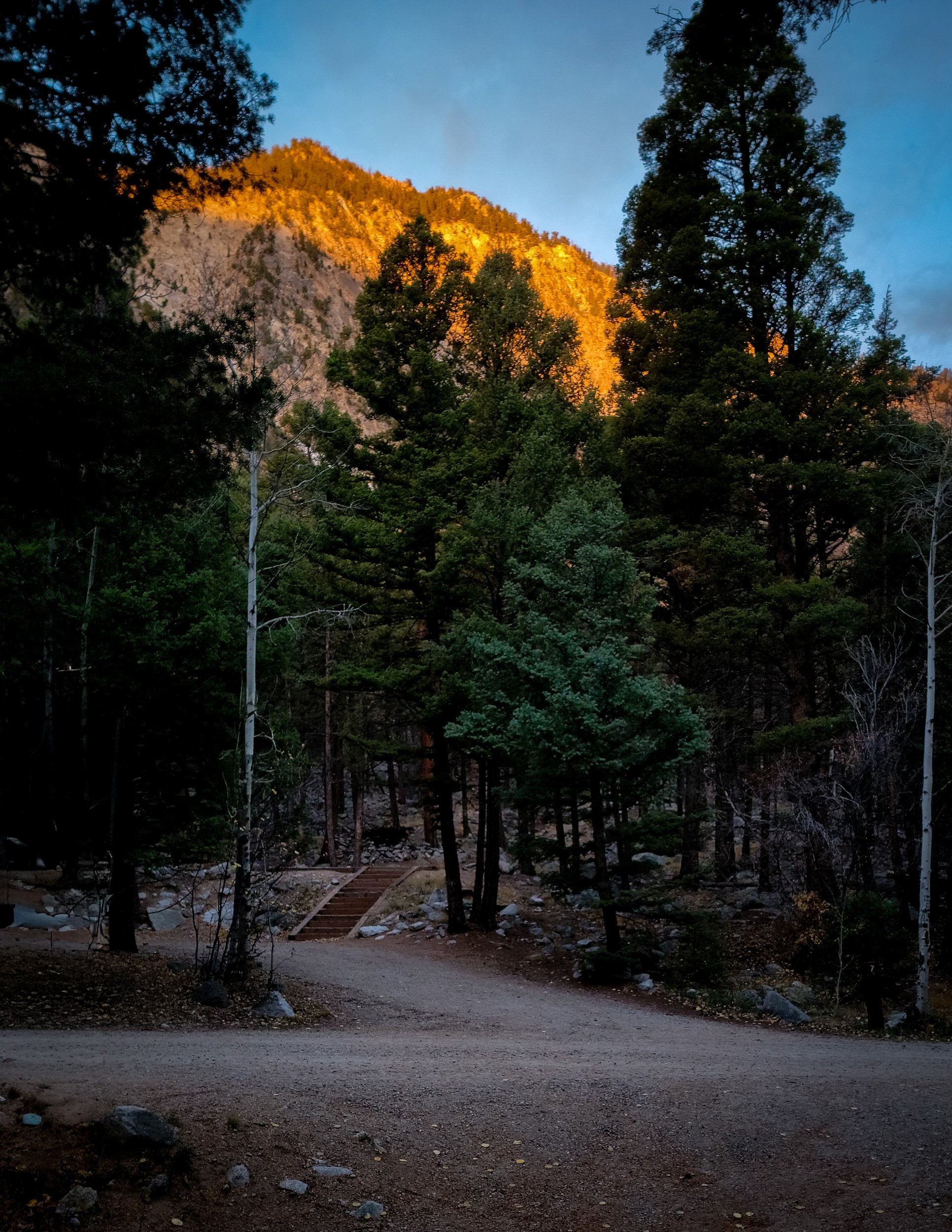
Little Maud Campground, White River National Forest, Basalt, Colorado
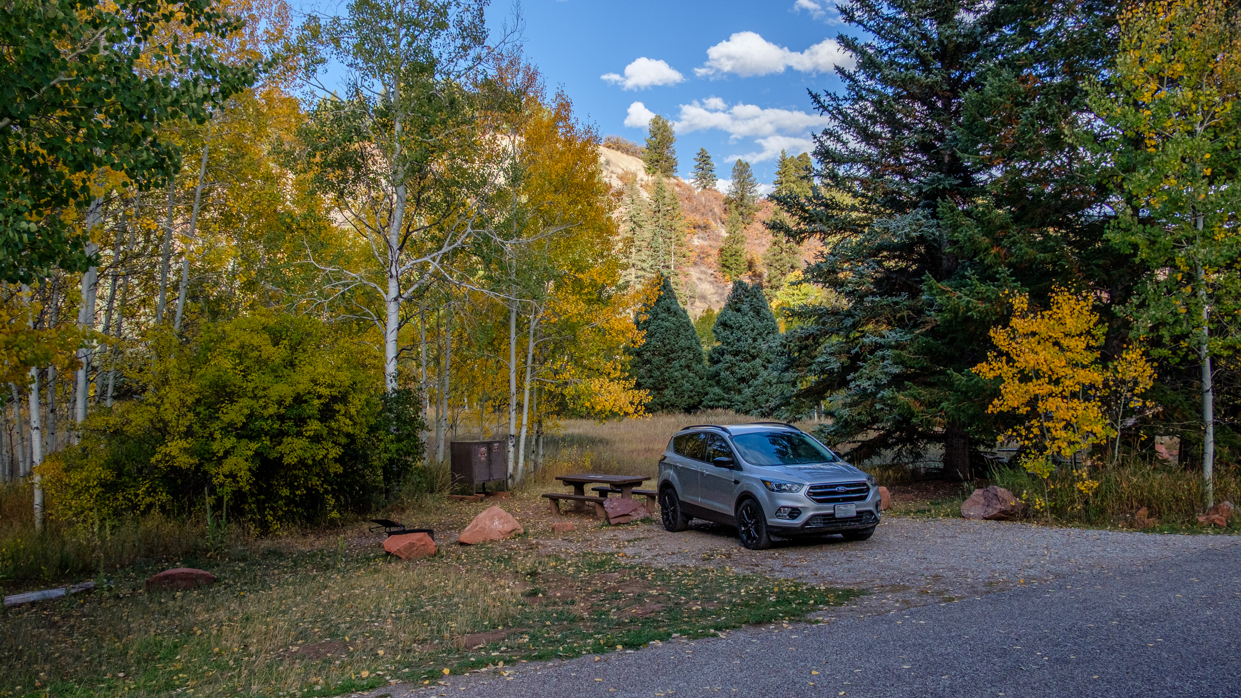
Little Maud Campground, White River National Forest, Basalt, Colorado — Day 3 – Road Trip October 2025. Copyright © 2025 Gary Allman, all rights reserved. -
Camped among the aspens
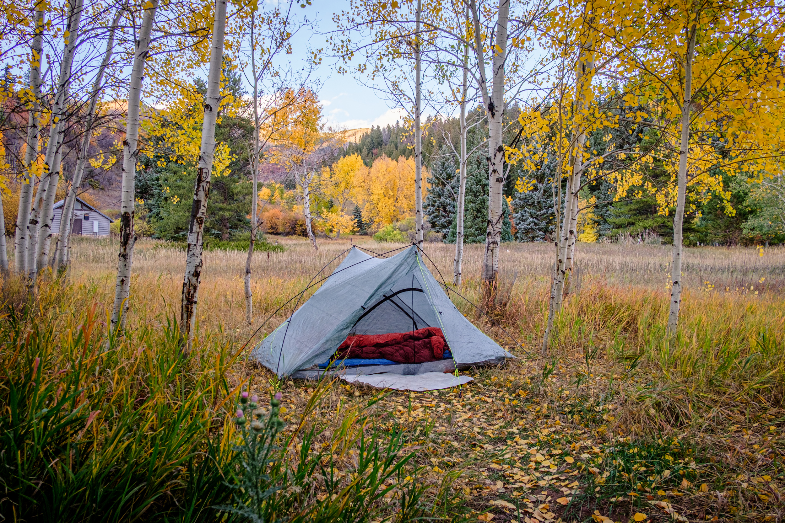
Camped among the aspens. Little Maud Campground, White River National Forest, Basalt, Colorado. Day 3 – Road Trip October 2025. Copyright © 2025 Gary Allman, all rights reserved. -
Glorious colors

Glorious colors — Early morning sunshine on the aspens at Little Maud Campground, White River National Forest, Basalt, Colorado. Day 4 – Road Trip October 2025. Copyright © 2025 Gary Allman, all rights reserved. -
Early morning sunshine

Early morning sunshine — Little Maud Campground, White River National Forest, Basalt, Colorado. Day 4 – Road Trip October 2025. Copyright © 2025 Gary Allman, all rights reserved. -
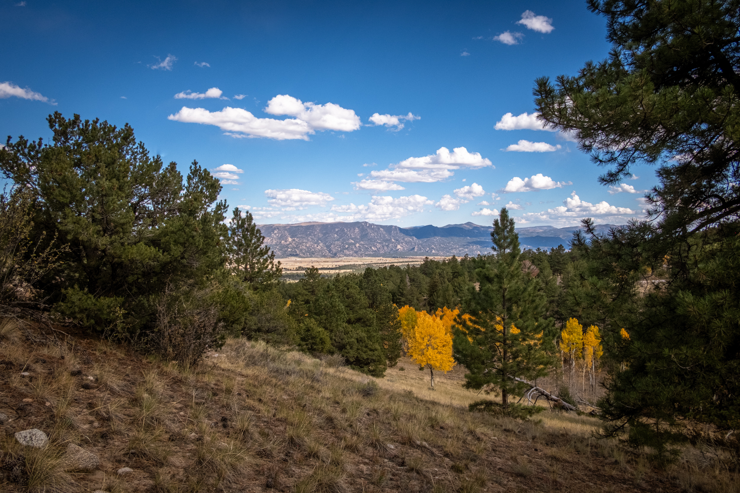
Checking out the view
Checking out the view — Stopped at an overlook of Ruedi Reservoir. Day 5 – Road Trip October 2025. Copyright © 2025 Gary Allman, all rights reserved. -
Ruedi Reservoir

Ruedi Reservoir. Day 5 – Road Trip October 2025. Copyright © 2025 Gary Allman, all rights reserved. 
Ruedi Reservoir Dam. Day 5 – Road Trip October 2025. Copyright © 2025 Gary Allman, all rights reserved. -
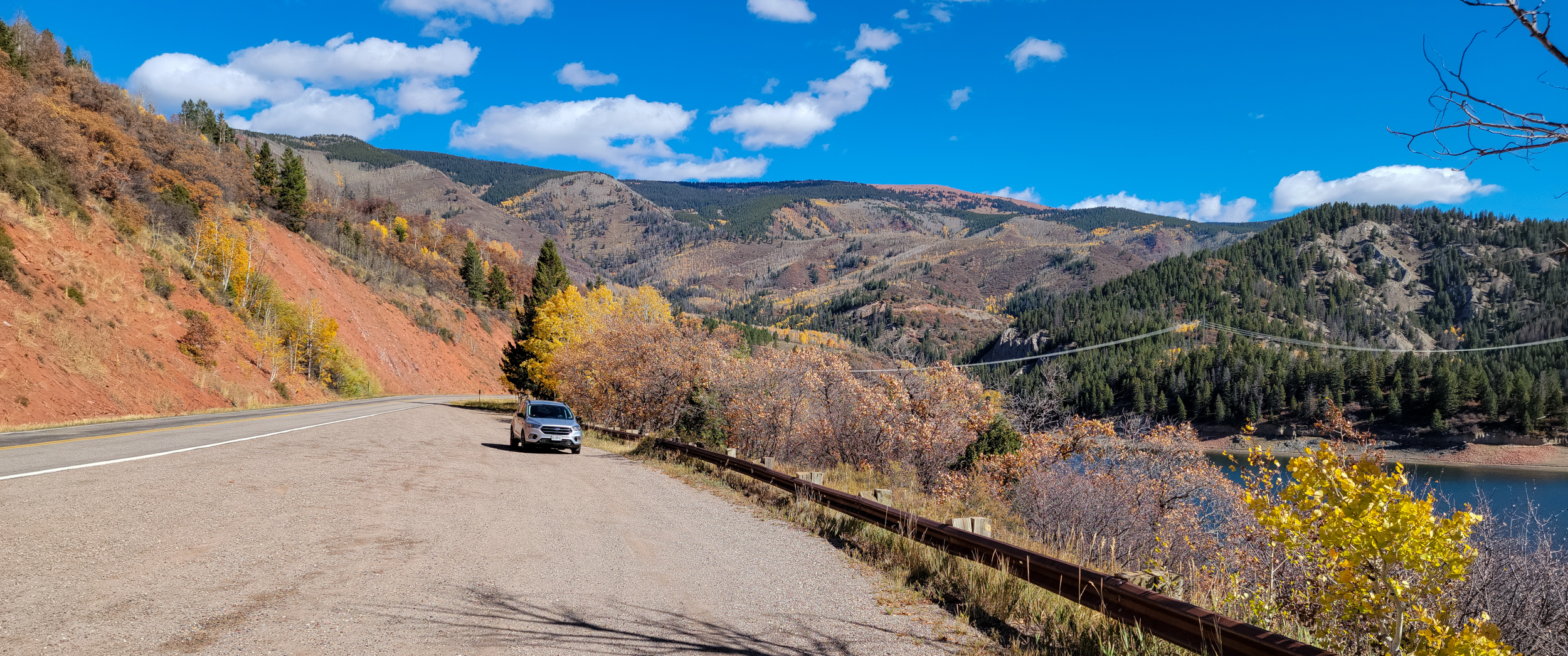
Independence Pass (western side)

Independence Pass (western side). Day 5 – Road Trip October 2025. Copyright © 2025 Gary Allman, all rights reserved. -
Heading east on Independence Pass
Heading east on Independence Pass. Day 5 – Road Trip October 2025. Copyright © 2025 Gary Allman, all rights reserved. -
Heading east on Independence Pass

Heading east on Independence Pass. Day 5 – Road Trip October 2025. Copyright © 2025 Gary Allman, all rights reserved. -
Snow on the mountain tops

Snow on the mountain tops. Day 5 – Road Trip October 2025. Copyright © 2025 Gary Allman, all rights reserved. -
Snow on the mountain tops

Snow on the mountain tops. Day 5 – Road Trip October 2025. Copyright © 2025 Gary Allman, all rights reserved. -
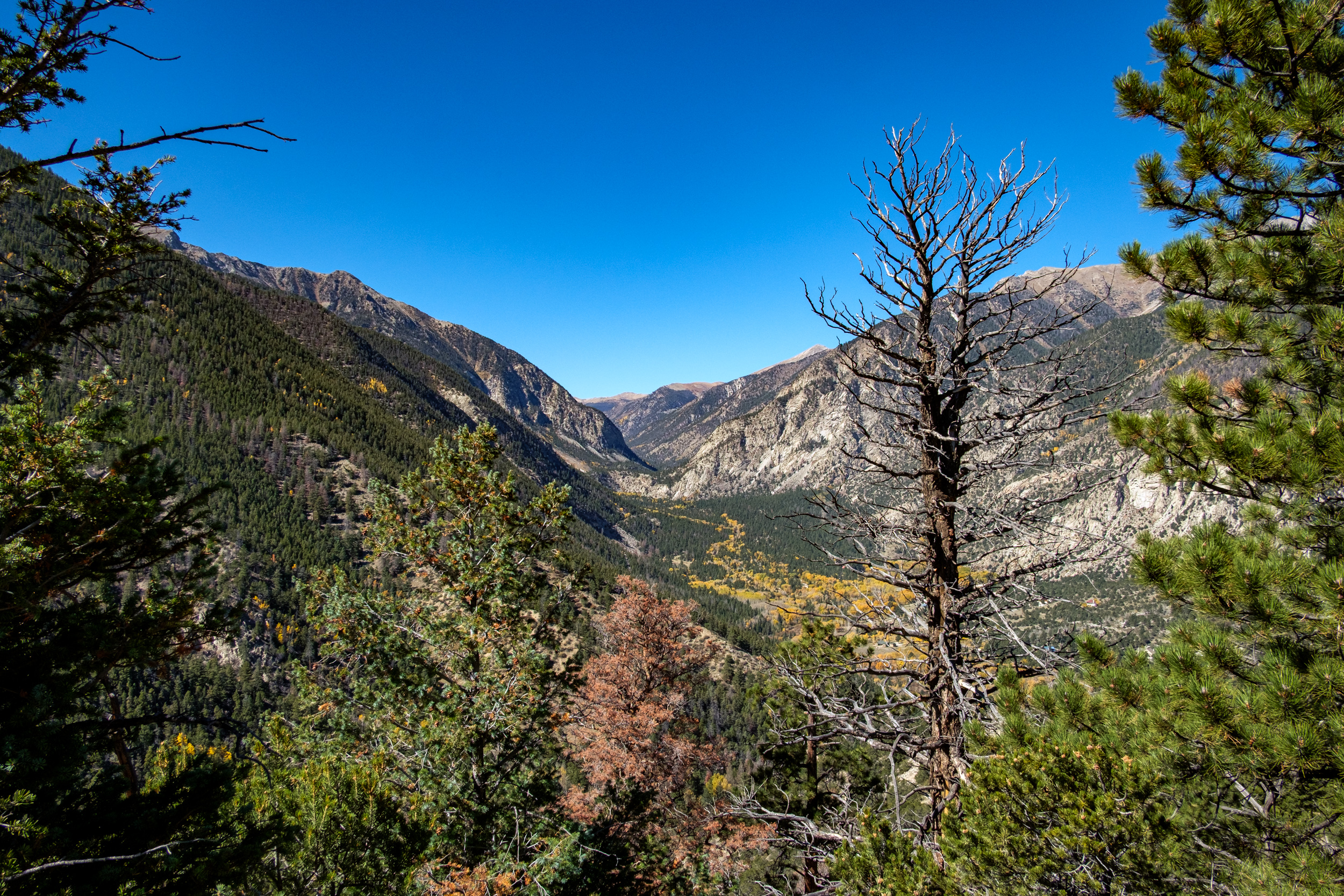
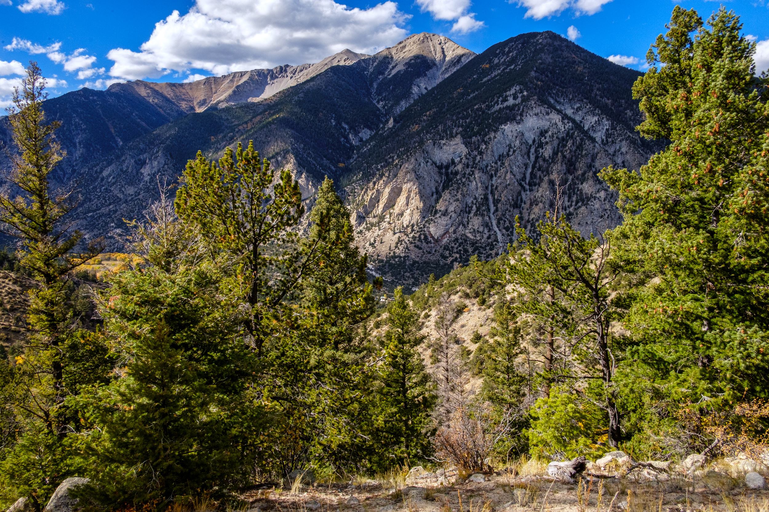
Approaching Chalk Creek Canyon

Approaching Chalk Creek Canyon. Day 5 – Road Trip October 2025. Copyright © 2025 Gary Allman, all rights reserved. They call these the Chalk Cliffs. This area has hot springs, which caused a chemical reaction that created the chalky-looking rocks, resulting in various features being named after their chalky appearance. Chalk Creek runs down through Chalk Creek Canyon, and there’s a Chalk Lake too.
But there is no chalk… The cliffs are made of a soft, white clay mineral called kaolinite, not chalk, which is a limestone (calcium carbonate) deposited in a sea. In the picture, you can see Mount Antero, 14,269 ft. (left) and Mount Princeton, 14, 204 ft. (right, behind Tigger Peak).
-
Chalk Creek Canyon, San Isabel National Forest
Chalk Creek Canyon, San Isabel National Forest. Day 5 – Road Trip October 2025. Copyright © 2025 Gary Allman, all rights reserved. -
Camped at the Cascade Campground
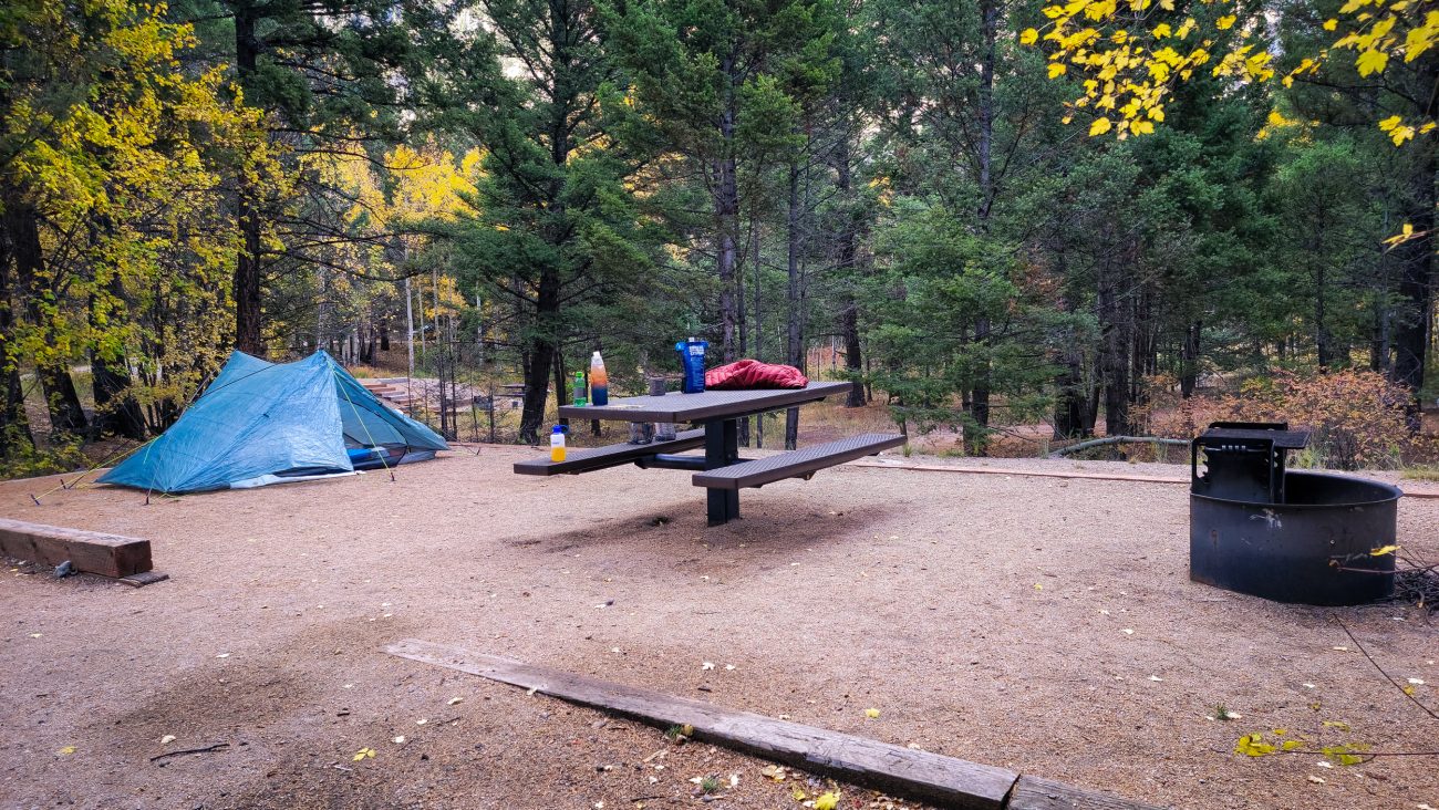
Camped at the Cascade Campground, Chalk Creek Canyon, San Isabel National Forest. Day 5 – Road Trip October 2025. Copyright © 2025 Gary Allman, all rights reserved. -
Camped at the Cascade Campground

Camped at the Cascade Campground, Chalk Creek Canyon, San Isabel National Forest. Day 6 – Road Trip October 2025. Copyright © 2025 Gary Allman, all rights reserved. -
Camped at the Cascade Campground

Camped at the Cascade Campground, Chalk Creek Canyon, San Isabel National Forest. Day 6 – Road Trip October 2025. Copyright © 2025 Gary Allman, all rights reserved. -
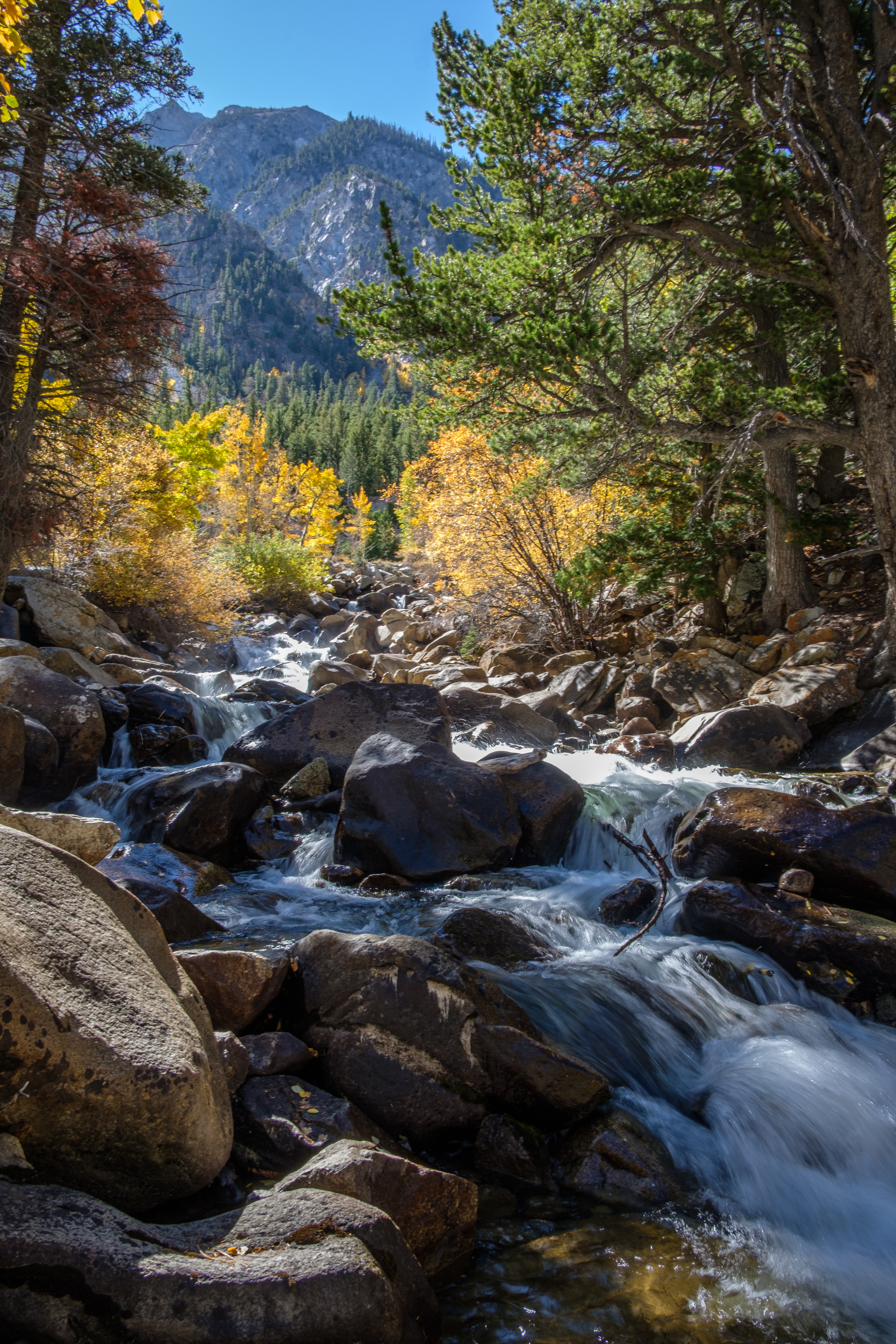
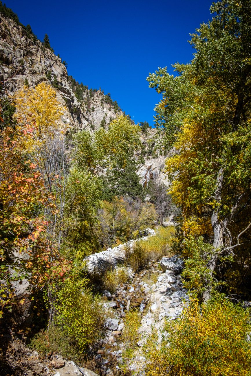
Cascade on Chalk Creek

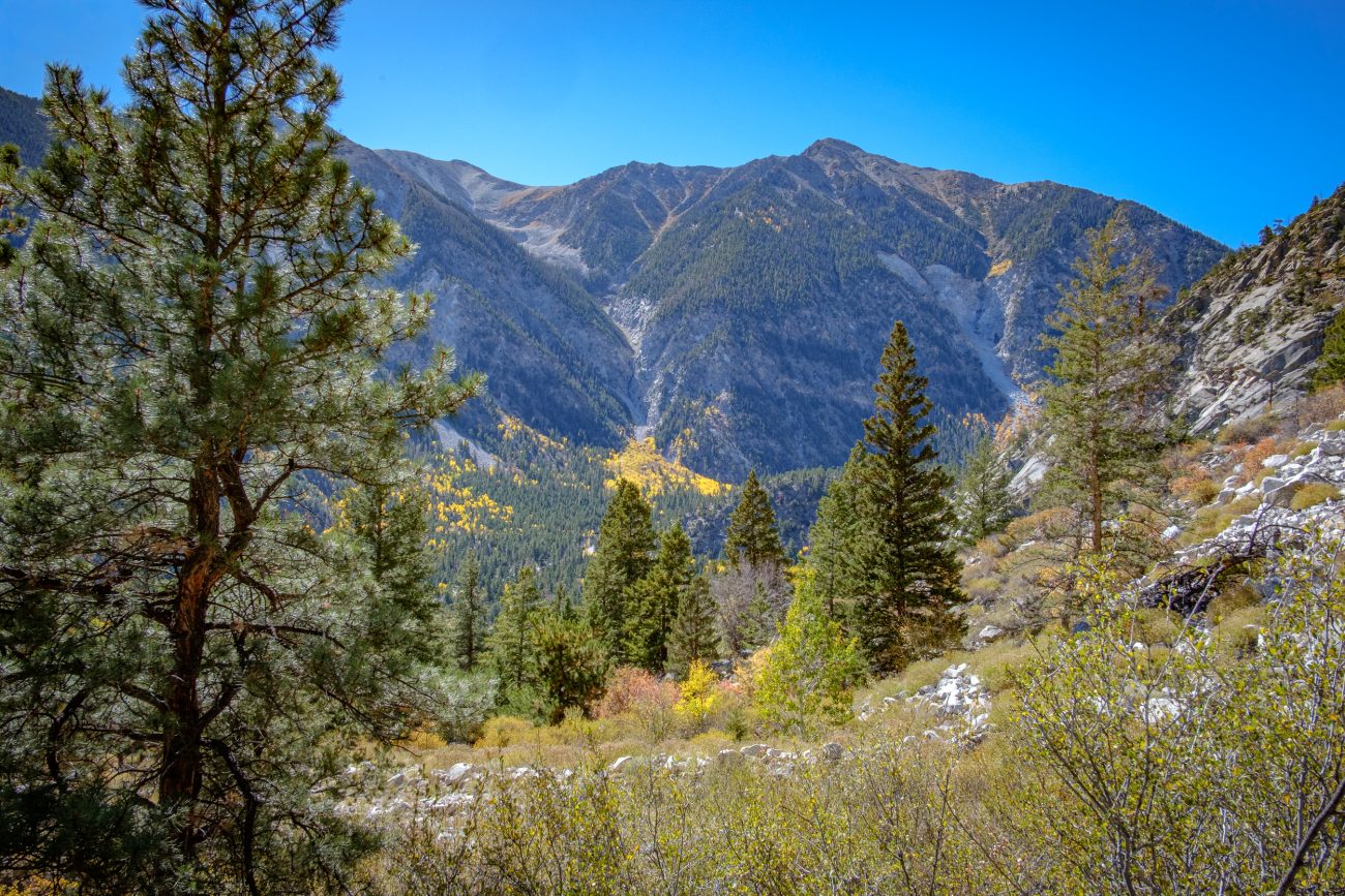
Cascade on Chalk Creek. Day 6 – Road Trip October 2025. Copyright © 2025 Gary Allman, all rights reserved. I’m feeling pretty good after a few days of acclimatizing to the altitude — over 9,000 feet at the Cascade Campground. It’s time for a hike, and to see how it goes. There’s a short hike on the Cascade Creek Trail to see the Agnes Vaille Falls. Too short, so I’m leaving the car at the campsite and walking along the road to the trailhead, and I’ll also do some exploring while I’m out.
On the way to the trailhead, I passed the Cascade Viewpoint and went down for a closer look at Chalk Creek. The picture is slightly blurry because I didn’t bring a tripod, and I used a long exposure — handheld — to soften the flow of the water.
-
Looking down the cascade

Looking down the cascade — Chalk Creek, Chalk Creek Canyon. Day 6 – Road Trip October 2025. Copyright © 2025 Gary Allman, all rights reserved. -
Agnes Vaille Falls

Agnes Vaille Falls — Cascade Creek Trail. Day 6 – Road Trip October 2025. Copyright © 2025 Gary Allman, all rights reserved. The falls were named by a local resident and friend of mountaineer Agnes Vaille. Vaille died in January 1925 during a winter ascent of Longs Peak, located in the Rocky Mountain National Park.
The Cascade Creek Trail is steep in places, and I had to pause and catch my breath a couple of times. The official trail stops well short of the falls themselves, and I didn’t feel like trying to bushwack to get closer. This is a rather nasty cellphone zoom of the falls, which was the closest view I got. And yes, the sky in the mountains really is that blue. It was stunning.
Coincidentally, I met a family from Kansas City at the viewpoint, which, considering how far off the beaten track this trail is, was quite a surprise… That’s foreshadowing. Wait until we get to Canyonlands National Park in Utah 🙂
-
Looking up Cascade Creek towards Agnes Vaille Falls
Agnes Vaille Falls — Cascade Creek Trail. Day 6 – Road Trip October 2025. Copyright © 2025 Gary Allman, all rights reserved. -
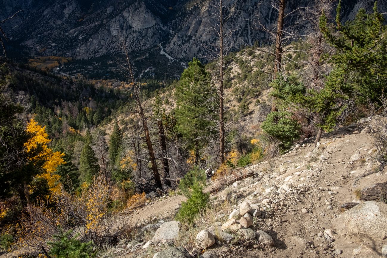
The trail was steep in places

The trail was steep in places — Cascade Creek Trail. Day 6 – Road Trip October 2025. Copyright © 2025 Gary Allman, all rights reserved. -
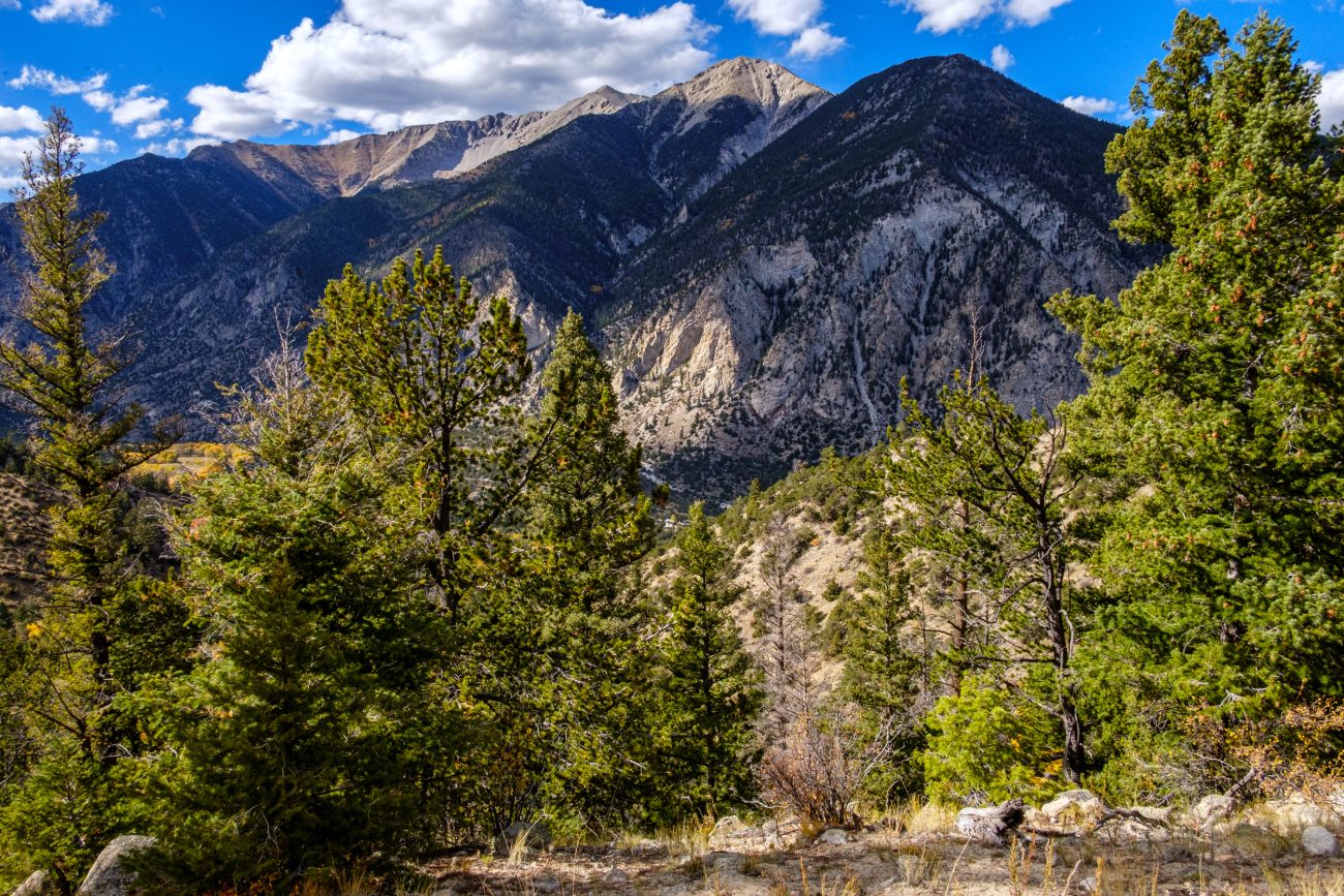
View from the Cascade Creek Trail
View from the Cascade Creek Trail. Looking across Chalk Creek Canyon towards Mt. Antero (not visible). Day 6 – Road Trip October 2025. Copyright © 2025 Gary Allman, all rights reserved. -
Gary on the Cascade Creek Trail

Gary on the Cascade Creek Trail — Chalk Creek Canyon, San Isabel National Forest, Colorado. Day 6 – Road Trip October 2025. Copyright © 2025 Gary Allman, all rights reserved. -
View from the Cascade Creek Trail

Day 6 – Road Trip October 2025. Copyright © 2025 Gary Allman, all rights reserved. -
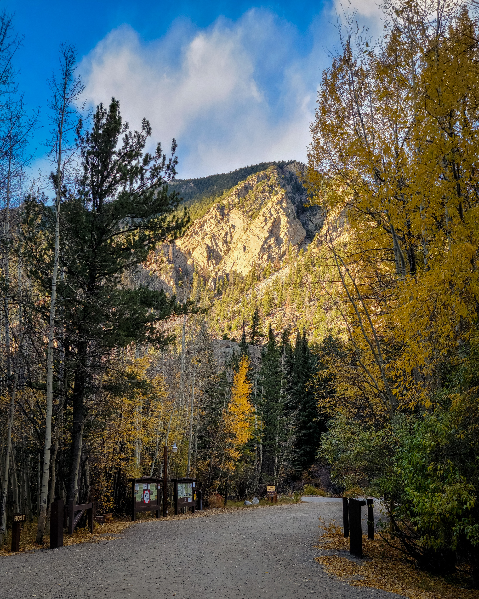
Entrance to Chalk Creek Campground
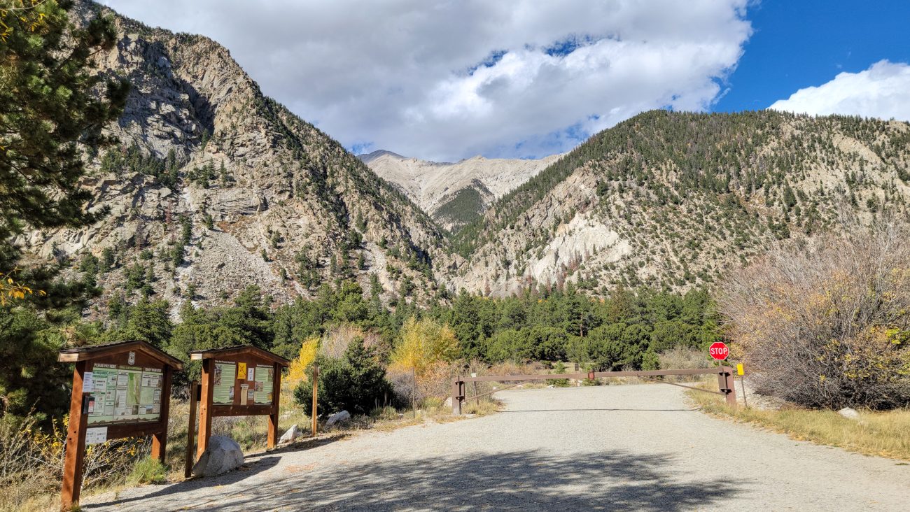
Entrance to Chalk Creek Campground. Mt. Princeton in the distance. Day 6 – Road Trip October 2025. Copyright © 2025 Gary Allman, all rights reserved. 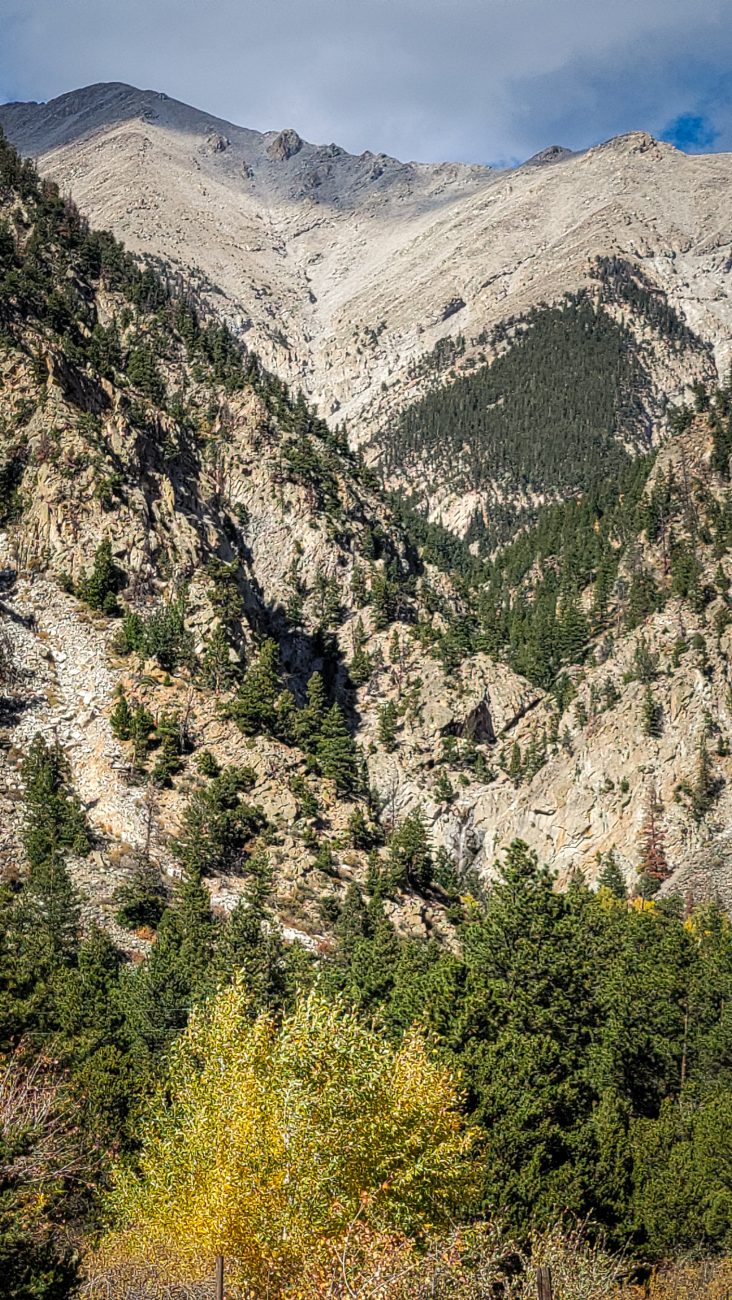
Agnes Vaille falls from Chalk Creek Campground — Mt. Princeton in the background. Good luck spotting the falls! Day 6 – Road Trip October 2025. Copyright © 2025 Gary Allman, all rights reserved. The Cascade Trail is relatively short, so I extended my hike by going further east along the road and then exploring some unmarked trails.
The two other campgrounds here are already closed for the season. I took a stroll around the Chalk Creek Campground to compare it to Cascade Campground.
Taking a picture of the entrance, I realized that the Agnes Vaille Falls could be seen from here.
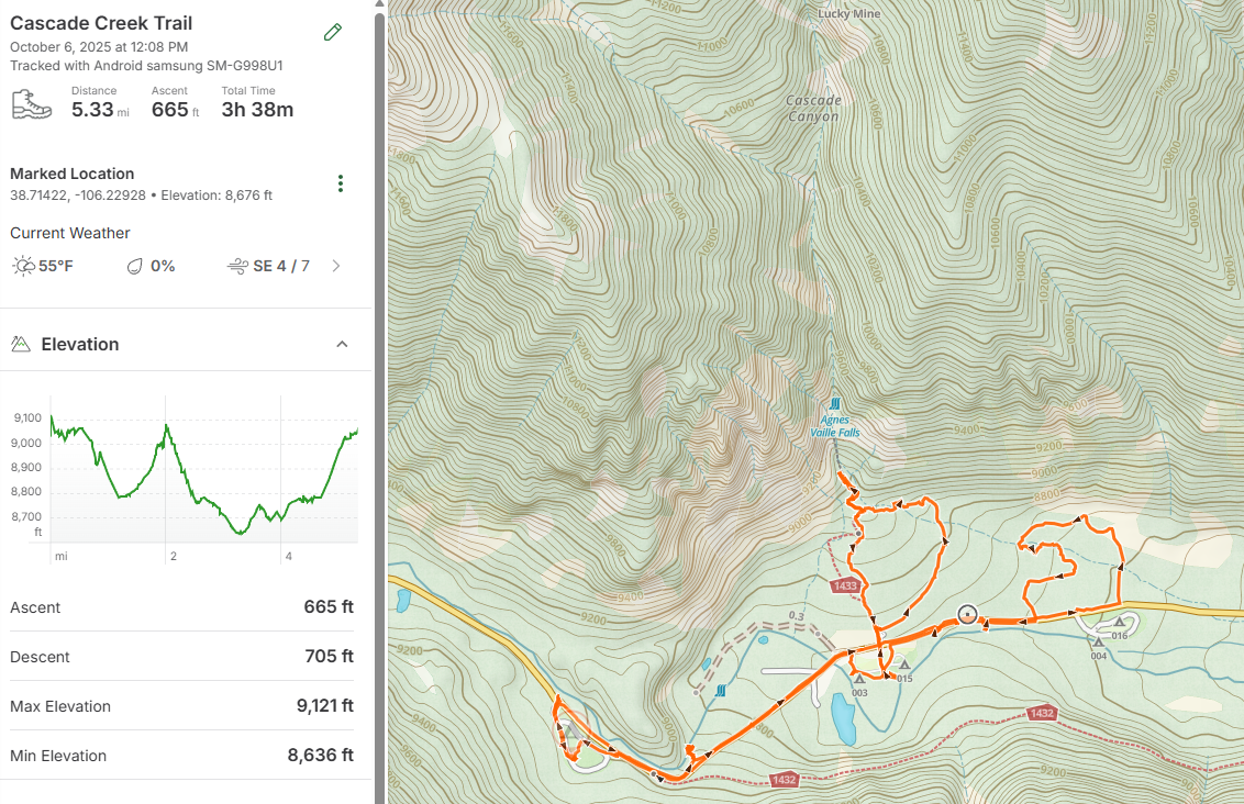
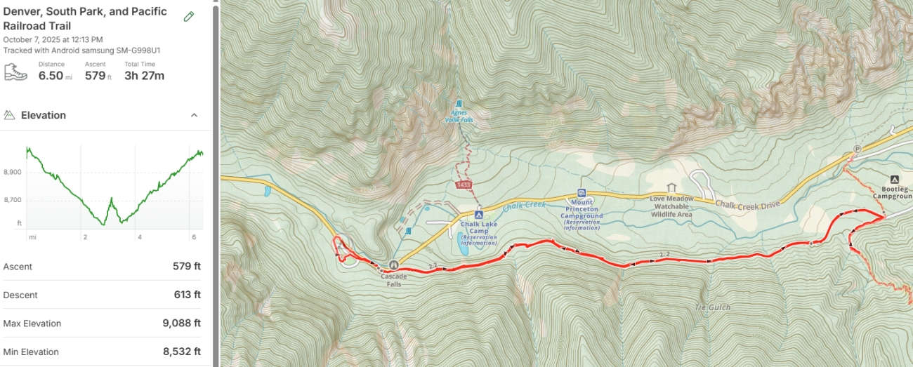
For my first ‘high altitude’ hike I went a modest 5.33 miles with 665 ft. of elevation gain. The actual Cascade Creek Trail is the loop just below Agnes Vaille Falls on the map below.
-
Chalk Creek

Chalk Creek — There’s no water available at the campground, so I got mine from Chalk Creek. Day 6 – Road Trip October 2025. Copyright © 2025 Gary Allman, all rights reserved. The Cascade Campground was good, but I don’t like the sterile ‘modern’ tent pads and the lack of screening between sites. When I stayed, there was no camp host, and no water.
As there weren’t many people staying, I think there was a maximum of five sites occupied while I was there, the lack of a host wasn’t a problem. Despite the government shutdown, I noticed a ranger drove through at least once a day.
Water might have been a bit of a problem, but I’d packed my water filter and pouches, so I just went and got my supplies from Chalk Creek.
One thing to be aware of, if you consider staying here, is how cold it gets when the sun is lower in the sky. That’s because there’s effectively a 2,000 ft. high cliff immediately to the west, so the campground is in shadow for a good part of the day.
-
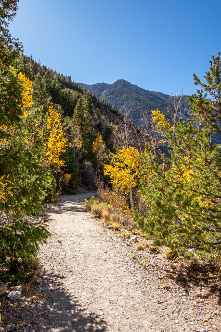
Day 7. Narrow Gauge Trail #1432 — Denver, South Park, and Pacific Railroad

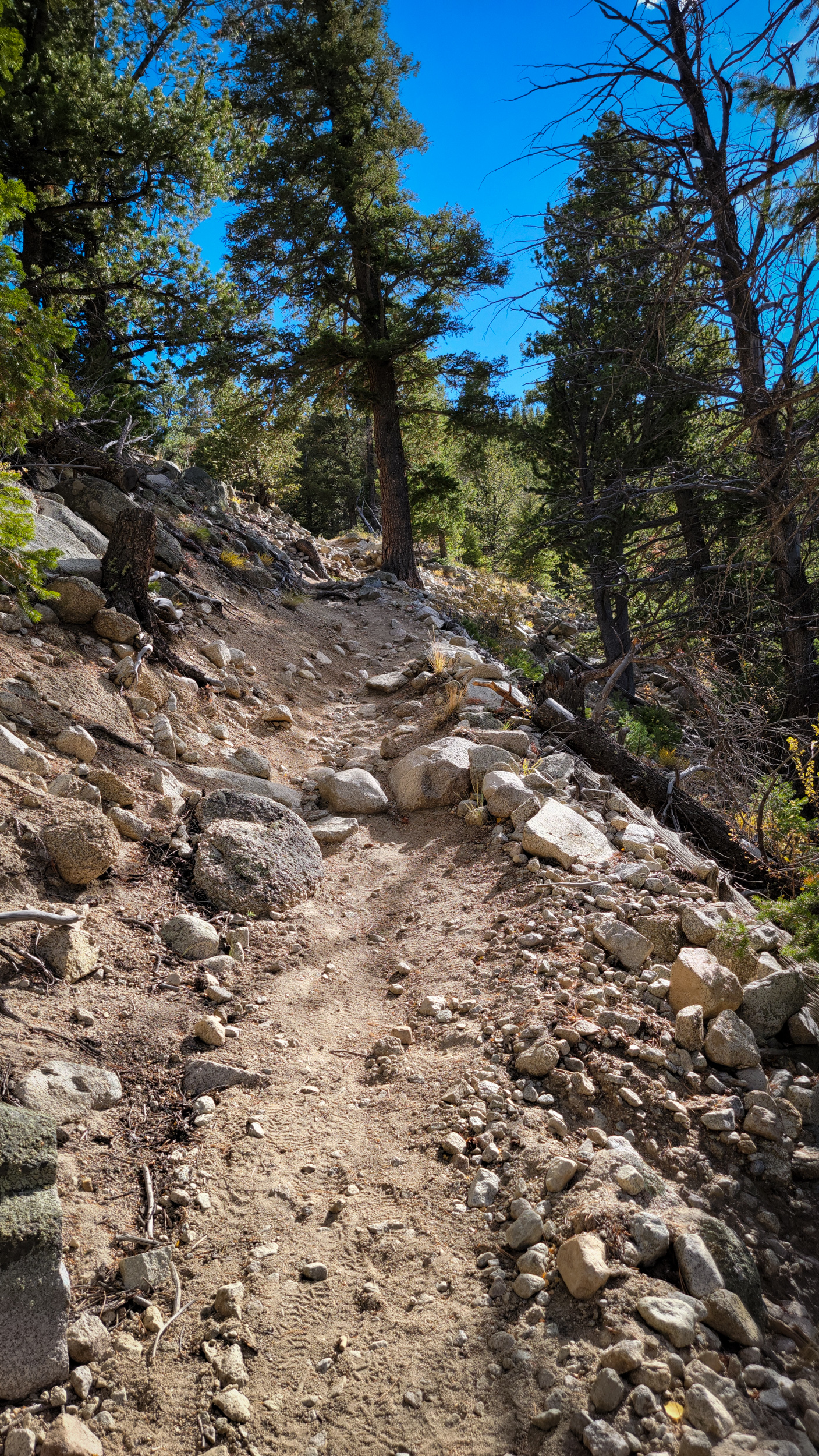
Denver, South Park, and Pacific Railroad Trail. Day 7 – Road Trip October 2025. Copyright © 2025 Gary Allman, all rights reserved. Today’s hike is an out-and-back hike on the Narrow Gauge Trail #1432, which runs along the bed of the Denver, South Park, and Pacific Railroad, Chalk Creek Grade, of the line that linked Buena Vista to St. Elmo. It was a narrow-gauge railway used to provide passenger, mining and logging transport within Chalk Creek Canyon.
The line closed in 1926, and was later converted to a trail, variously known as the Chalk Creek Grade Historic Trail, Narrow Gauge Trail, and officially by the U.S. Forest Service as the Narrow Gauge Trail #1432.
I’ve got warm clothes as the trail hugs the southern — shady side of the Canyon. It should be a nice easy hike of around 5 miles, though I might extend that a little by checking out the start of my planned hike for tomorrow on the Colorado Trail.
-
Chalk Lake — from the Denver, South Park, and Pacific Railroad Trail

Chalk Lake — From the Denver, South Park, and Pacific Railroad Trail. Day 7 – Road Trip October 2025. Copyright © 2025 Gary Allman, all rights reserved. Driving up Chalk Creek Canyon, you don’t realize how quickly you’re gaining altitude. Hiking down and back up the road yesterday, I got a better idea. Even so, I was surprised how quickly the trail gained height — well, actually, how quickly the ground dropped away — from where it started out just above the road.
-
View from the Denver, South Park, and Pacific Railroad Trail

View from the Denver, South Park, and Pacific Railroad Trail. Day 7 – Road Trip October 2025. Copyright © 2025 Gary Allman, all rights reserved. -
Rockslide over the trail

View from the Denver, South Park, and Pacific Railroad Trail. Day 7 – Road Trip October 2025. Copyright © 2025 Gary Allman, all rights reserved. There was one point where a rockslide had covered the trail.
I took this picture on the way back. It didn’t take me long to hike the entire trail, and I was surprised to find a fairly big parking lot at the start. I carried on, found where the Colorado Trail crossed the road, and started up the trail a short way before turning back. That’s tomorrow’s hike. I reckoned by the time I hiked back up the Narrow Gauge Trail, and got to the campground, I’d have gone six or more miles. Quite enough for my second hike in three months.
-
View from the Denver, South Park, and Pacific Railroad Trail

View from the Denver, South Park, and Pacific Railroad Trail. Day 7 – Road Trip October 2025. Copyright © 2025 Gary Allman, all rights reserved. This is looking eastward down the canyon. The colors were breathtaking. And I was right. It was cold in the shade, and I was glad I brought some warm clothes along for the hike. In the distance is Browns Canyon National Monument. It’s around fifteen miles as the crow flies.
-
View from the Denver, South Park, and Pacific Railroad Trail — Looking northwest

View from the Denver, South Park, and Pacific Railroad Trail — Looking northwest. Day 7 – Road Trip October 2025. Copyright © 2025 Gary Allman, all rights reserved. -
Looking west up Chalk Creek Canyon. Mt. Princeton on the right

Looking west up Chalk Creek Canyon. Mt. Princeton on the right. View from the Denver, South Park, and Pacific Railroad Trail. Day 7 – Road Trip October 2025. Copyright © 2025 Gary Allman, all rights reserved. -
Mt. Princeton from the Denver, South Park, and Pacific Railroad Trail

Mt. Princeton — from the Denver, South Park, and Pacific Railroad Trail. Day 7 – Road Trip October 2025. Copyright © 2025 Gary Allman, all rights reserved. -
This trail is really easy going
Denver, South Park, and Pacific Railroad Trail — Heading west. Day 7 – Road Trip October 2025. Copyright © 2025 Gary Allman, all rights reserved. -
Chalk Creek Cascade

Chalk Creek Cascade. Day 7 – Road Trip October 2025. Copyright © 2025 Gary Allman, all rights reserved. This is just the start. The cascade runs for a tad under half a mile and drops over 250 ft. The Cascade campground is just around the corner on the left.
-
The western end of Narrow Gauge Trail #1432

Denver, South Park, and Pacific Railroad Trail. Day 7 – Road Trip October 2025. Copyright © 2025 Gary Allman, all rights reserved. -
Trail Sign, the western end of Narrow Gauge Trail #1432

Trail sign, the western end of Narrow Gauge Trail #1432. Denver, South Park, and Pacific Railroad Trail. Day 7 – Road Trip October 2025. Copyright © 2025 Gary Allman, all rights reserved. With my short road hike and excursion up a brief bit of Section 14 of the Colorado Trail, I managed six and a half miles for my second hike.
-
Approaching Cascade Campground
Approaching Cascade Campground. Day 7 – Road Trip October 2025. Copyright © 2025 Gary Allman, all rights reserved. 
Approaching Cascade Campground. Day 7 – Road Trip October 2025. Copyright © 2025 Gary Allman, all rights reserved. -
Cascade Campground

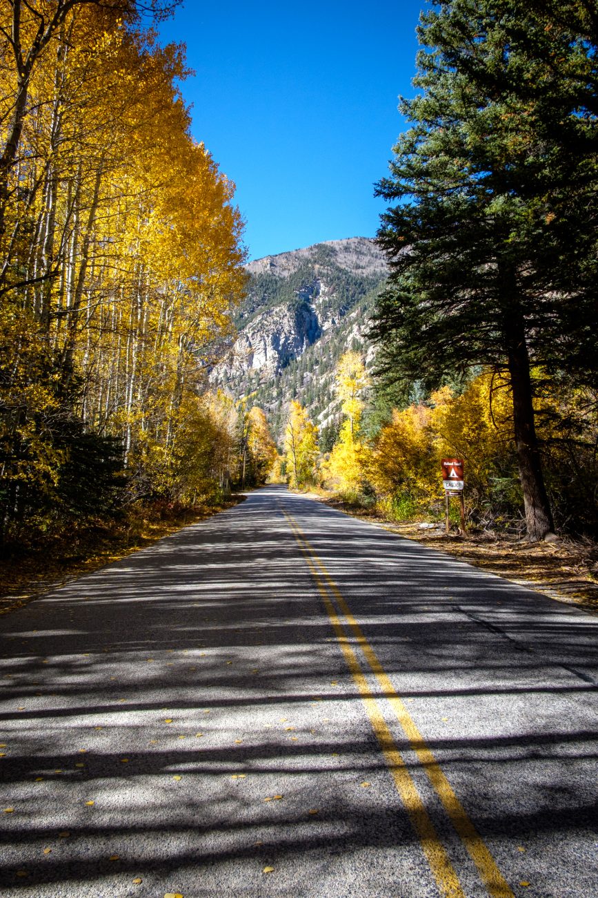
Cascade Campground. Day 7 – Road Trip October 2025. Copyright © 2025 Gary Allman, all rights reserved. The final leg of my hike back to my campsite. As it was still early, I then drove to St. Elmo, a Ghost town ten or so miles away. The unpaved roads were in the process of being regraded, and they’d been dumping and wetting topsoil on the road, making it sticky, slippery, and muddy.
-
Day 8. Colorado Trail Segment 14: Chalk Creek to US Hwy 50
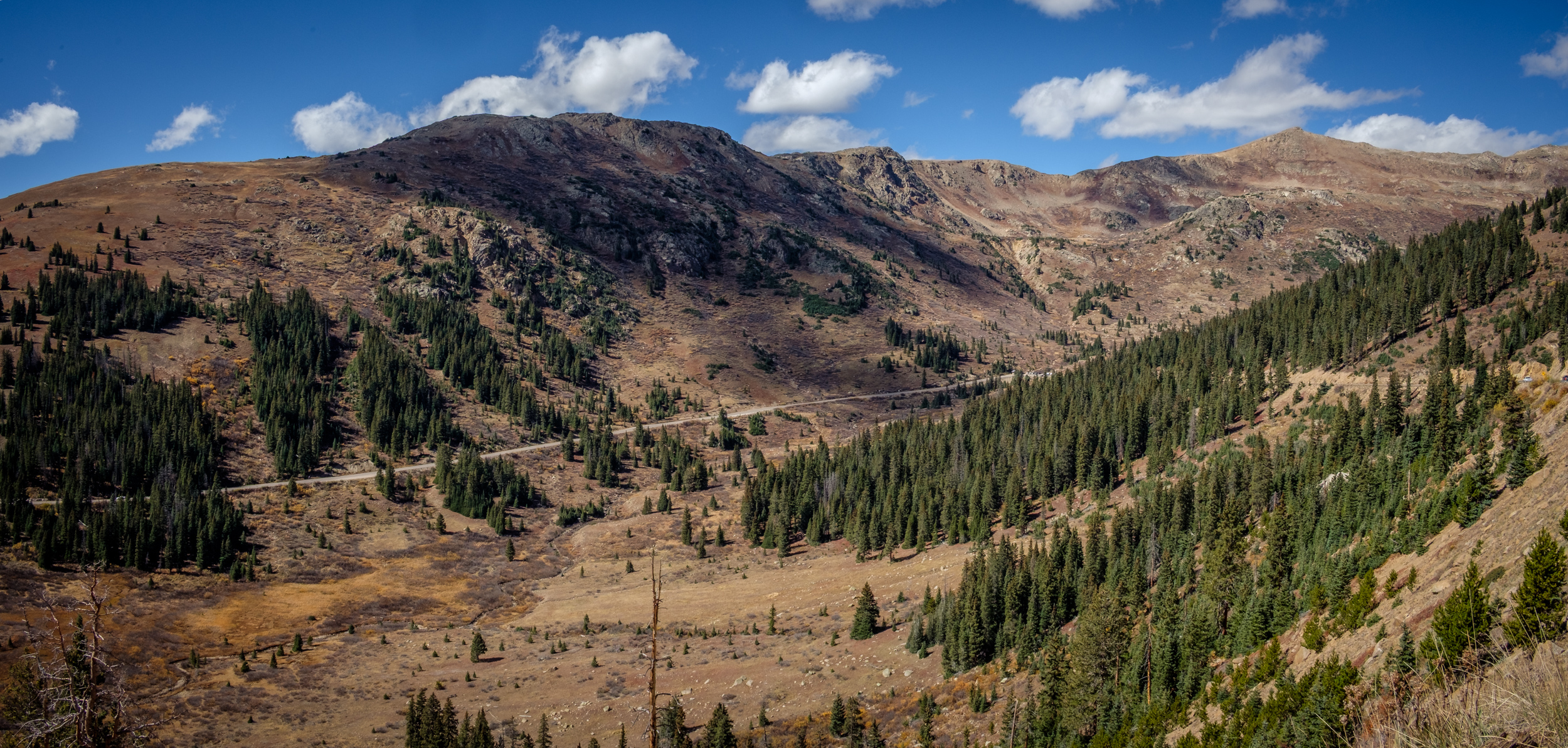
Colorado Trail Segment 14: Chalk Creek to US Hwy 50 — Day 8 – Road Trip, October 2025. Copyright © 2025 Gary Allman, all rights reserved. And, as is appropriate, heading south, the trail starts with a crossing of Chalk Creek. The complete segment is 20 miles. I’m only going three or four miles and then turning around to come back. However, this includes a 900+ foot climb, it’s going to be the most elevation gain I’ve ever done in a single climb and starting out at 8,700 feet or so too. Hopefully my altitude acclimatization and hiking build-up plan will pay off today.
-
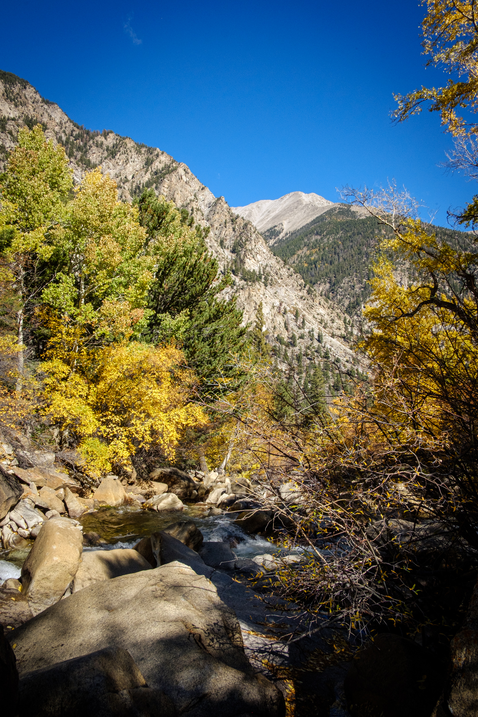
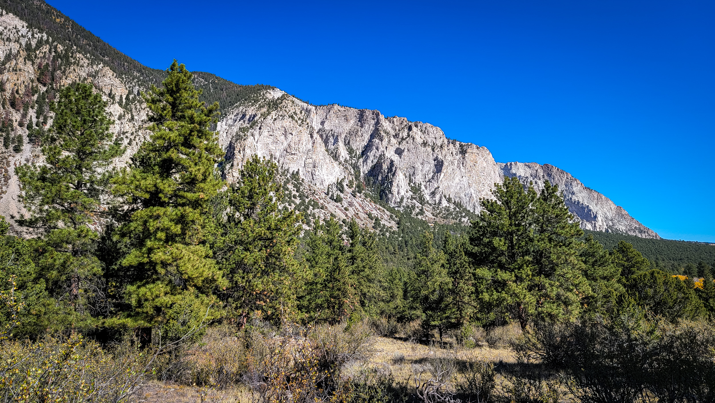
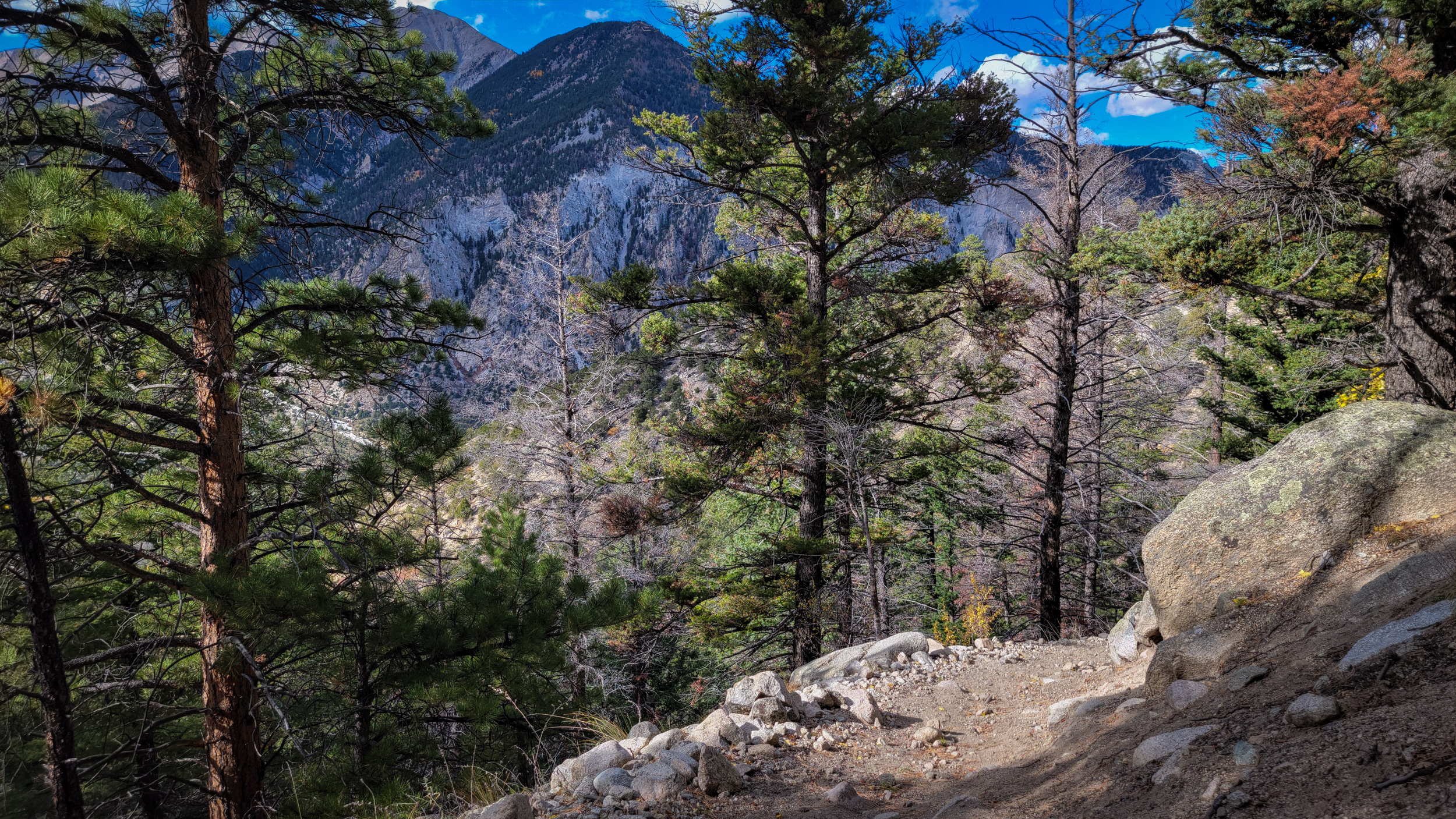
Chalk Cliffs from the Colorado Trail

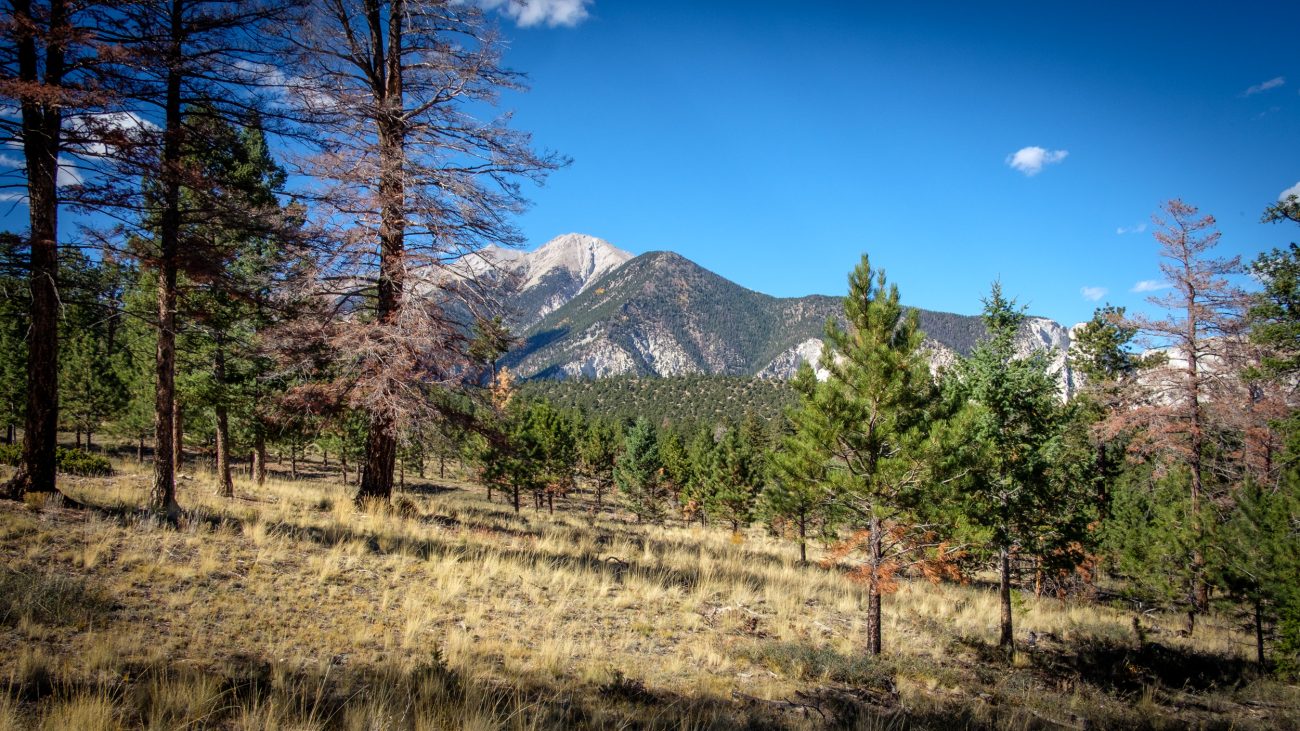
Chalk Cliffs from the Colorado Trail — Day 8 – Road Trip, October 2025. Copyright © 2025 Gary Allman, all rights reserved. Of course, they are not chalk. They are white quartz left behind after other minerals have been leached from the original rock by hot water (there are hot springs here). The cliffs are very friable, and landslides are common. The Agnes Vaille Trail I was on a couple of days ago had to be rerouted due to a major rockfall.
-
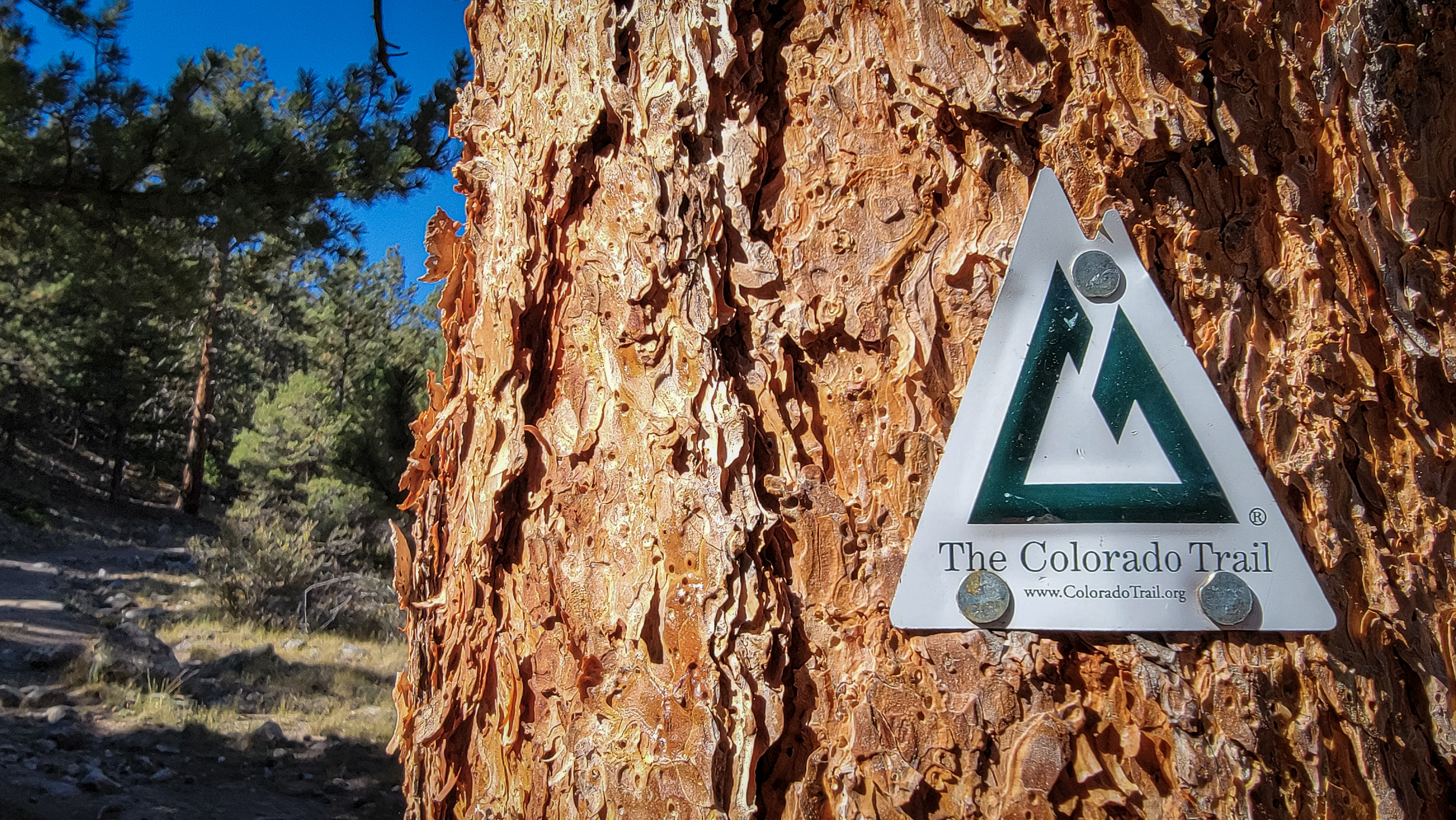
On the Colorado Trail
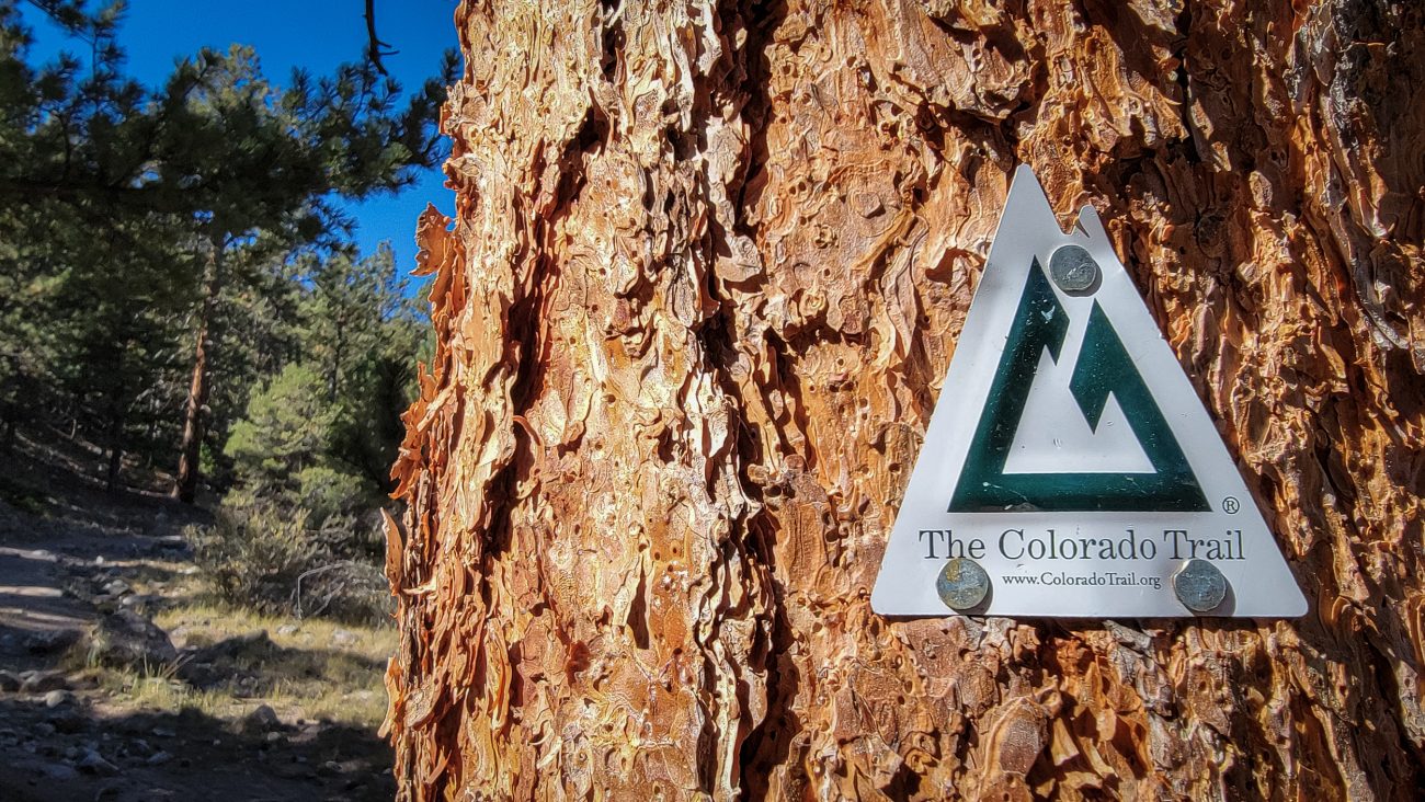
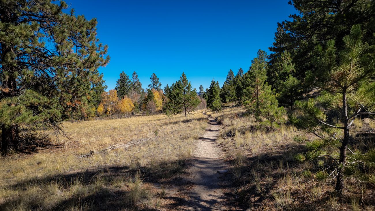
On the Colorado Trail — Day 8 – Road Trip October 2025. Copyright © 2025 Gary Allman, all rights reserved. Okay, I did a tiny bit of this trail yesterday, but I’m counting this as my first hike on a major through trail. I’ll only be going a total of seven miles or so, but that’s enough for me with all the elevation I’ll be gaining.
-
Under an hour later and I’m on the top of the ridge

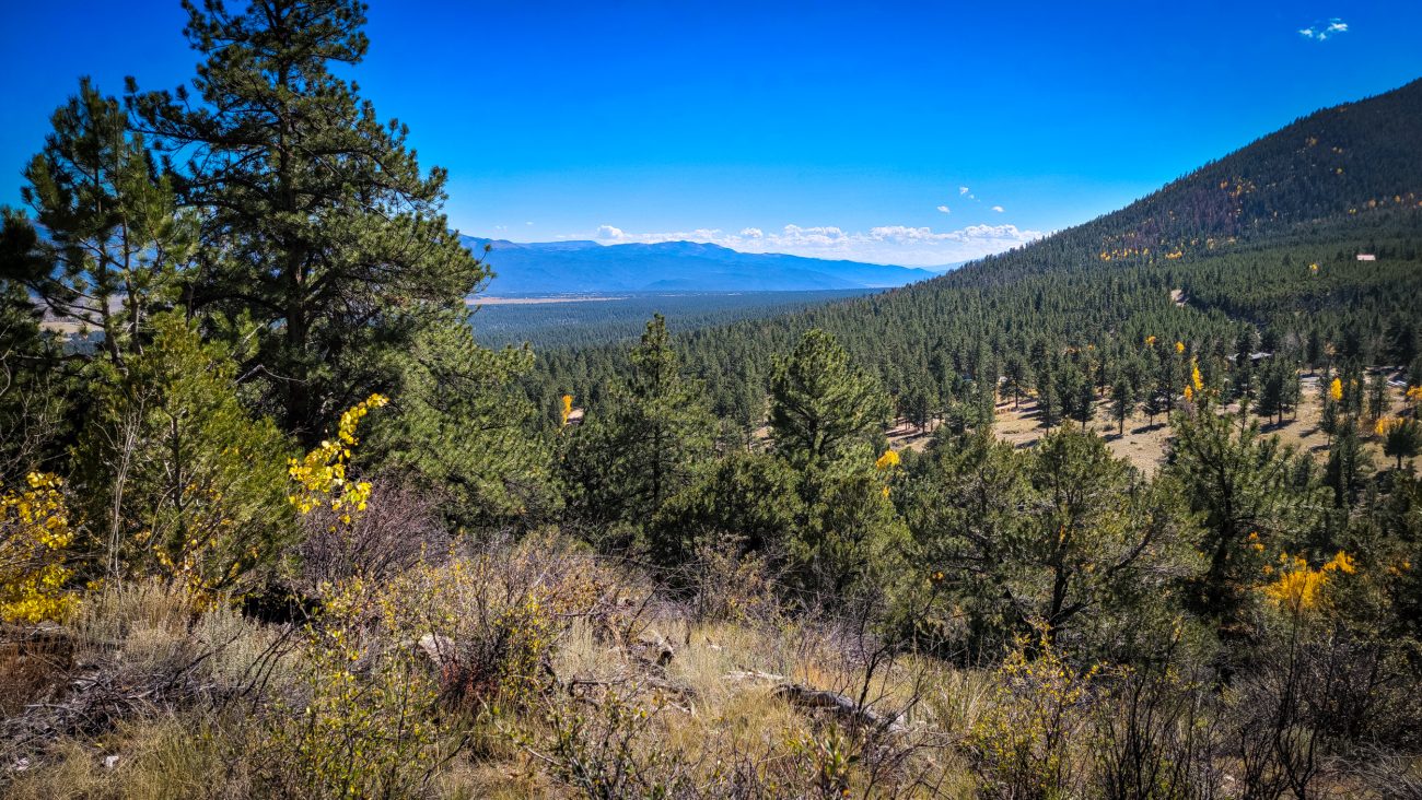
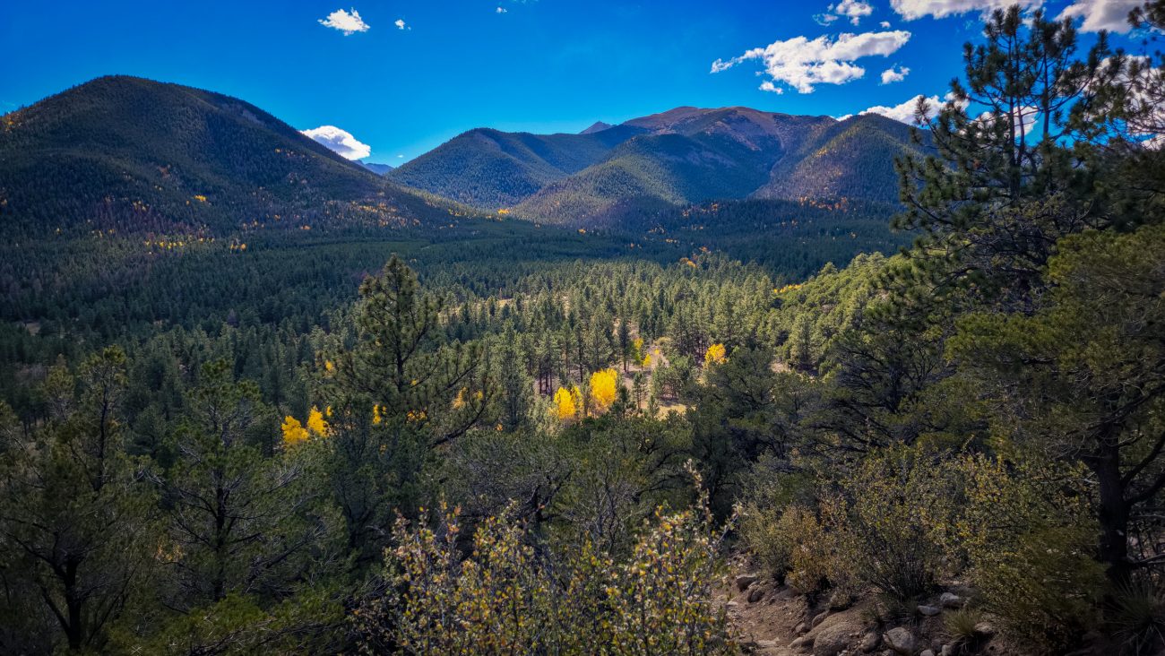
Under an hour later and I’m on the top of the ridge — Day 8 – Road Trip, October 2025. Copyright © 2025 Gary Allman, all rights reserved. And what a view! The fall colors and mountains are spectacular. That was a lot easier than I expected, but it was very steep in places. It was worth it for the views.
-
Looking over the other side of the ridge
Looking over the other side of the ridge — I’m facing roughly southeast. The drop on this side of the ridge is only 300ft. Hopefully not a very rugged descent, and not too far for me to climb up on my return. Day 8 – Road Trip, October 2025. Copyright © 2025 Gary Allman, all rights reserved. -
I could almost be in Hercules Glades
I could almost be in Hercules Glades — If the Glades were at around 10,000ft, that is. I’m following the trail as it runs along the northern side of the ridge. Day 8 – Road Trip, October 2025. Copyright © 2025 Gary Allman, all rights reserved. -
Descending
Descending — Nearly down the south side of the ridge, and the trail is leveling out. It was quite rugged in places. I met a woman pushing her mountain bike up the trail, it looked like very hard work. Day 8 – Road Trip, October 2025. Copyright © 2025 Gary Allman, all rights reserved. -
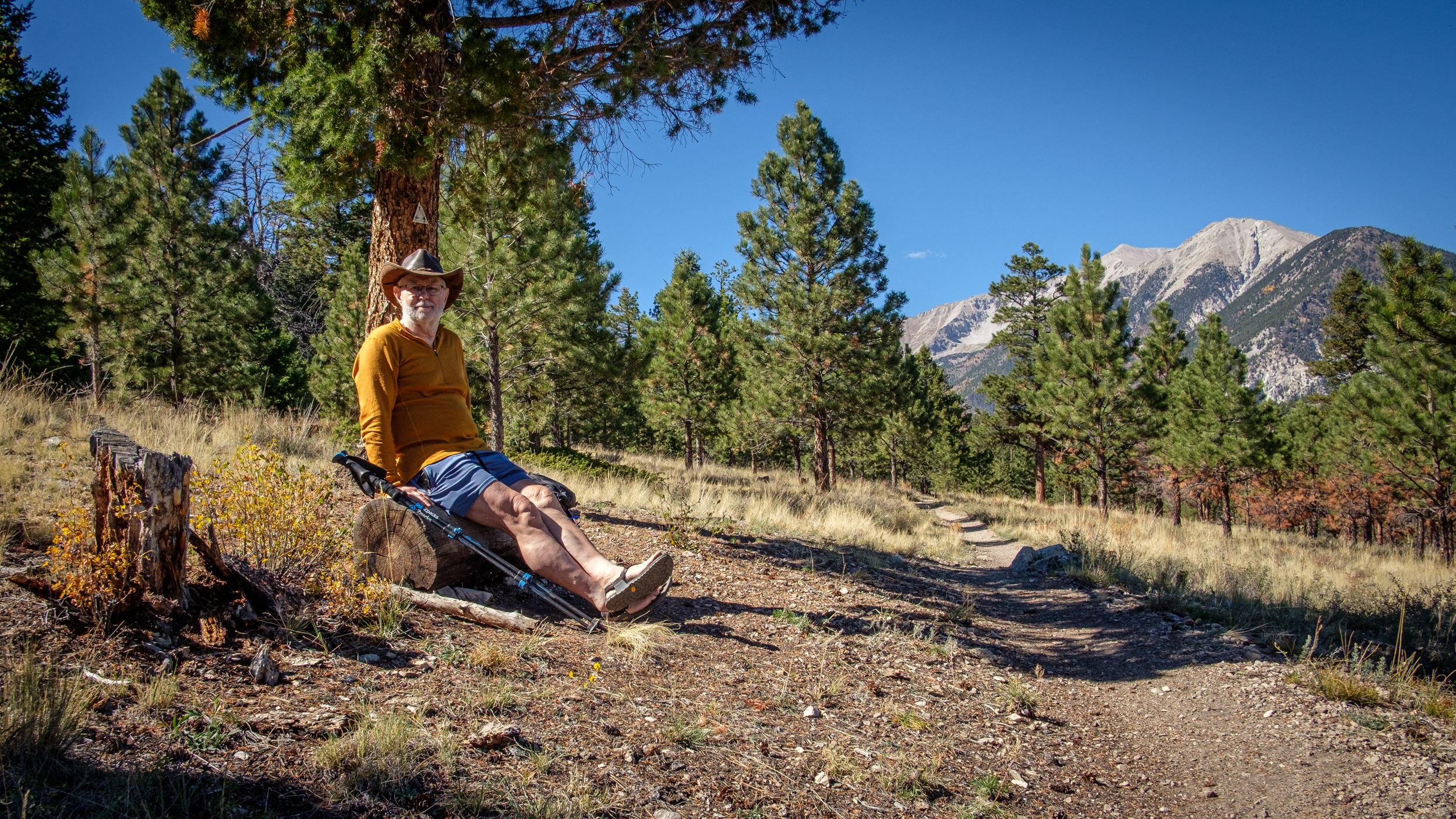
Turnaround Point, and stopped for lunch
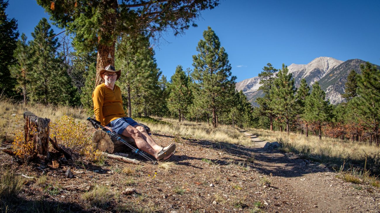
Turnaround Point, and stopped for lunch — Day 8 – Road Trip, October 2025. Copyright © 2025 Gary Allman, all rights reserved. According to my calculations, I was about three-and-a-half miles into my hike, and this log offered a great view and spot to eat lunch. The weather for this entire trip has been fantastic, it’s just as well I brought some shorts along. It’s not been the cold and snowy trip the original forecast was promising when we left Missouri.
My calves are looking the part, even if I say so myself, and a shoutout for my Bedrock sandals too.
-
Heading back
Heading back — Look carefully, and in the middle distance, you can see the ridge I’m going to climb. Day 8 – Road Trip, October 2025. Copyright © 2025 Gary Allman, all rights reserved. -
Time to head back up the ridge

Time to head back up the ridge — At least it’s only 300 ft. on this side. But I still have 900ft. to descend on the other side. Day 8 – Road Trip, October 2025. Copyright © 2025 Gary Allman, all rights reserved. -
Getting near to the top
Getting near to the top — Day 8 – Road Trip October 2025. Copyright © 2025 Gary Allman, all rights reserved. Looking southwest. A glimpse of the trail is visible at the bottom of the frame. It’s looking quite rugged, and it was. It was somewhere around here I met the woman on her mountain bike again. It looked a tad easier going down, but only slightly easier.
-
Chalk Creek Canyon
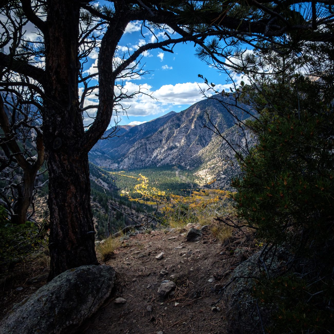
Chalk Creek Canyon — I couldn’t resist taking a picture of Chalk Creek Canyon framed by this tree and bush. It was windy and the light was changing rapidly as the clouds moved across the sky. Day 8 – Road Trip October 2025. Copyright © 2025 Gary Allman, all rights reserved. -
The endless play of light
The endless play of light — I stayed here for several minutes watching the ever-changing light move across Chalk Creek Canyon. Day 8 – Road Trip, October, 2025. Copyright © 2025 Gary Allman, all rights reserved 
Long way down — about 900 ft. and I’m parked in the bottom of the valley. This viewpoint shows how massive piles of scree have spread out across the canyon’s floor. Day 8 – Road Trip, October 2025. Copyright © 2025 Gary Allman, all rights reserved. -
A last look to the southeast

A last look to the southeast — before dropping back down into Chalk Creek Canyon, I popped over to the other side of the ridge for one last look at the view across the plains to the southeast. Day 8 – Road Trip, October 2025. Copyright © 2025 Gary Allman, all rights reserved -
Descending

Descending — Day 8 – Road Trip, October 2025. Copyright © 2025 Gary Allman, all rights reserved. The long trudge down the ridge has begun. The trail is steep and sandy at the top, making for a very loose footing. I’m always surprised to find sand in high places. Of course, it makes perfect sense when you consider the entire area was buried under an alluvial plain at one point.
It’s a tad steep in places — Day 8 – Road Trip, October 2025. Copyright © 2025 Gary Allman, all rights reserved. Yes, it really is that steep. This descent is not for sissies, or the wrong footwear! I was fine with my Bedrock Sandals and hiking poles.
-
The views continue to impress me
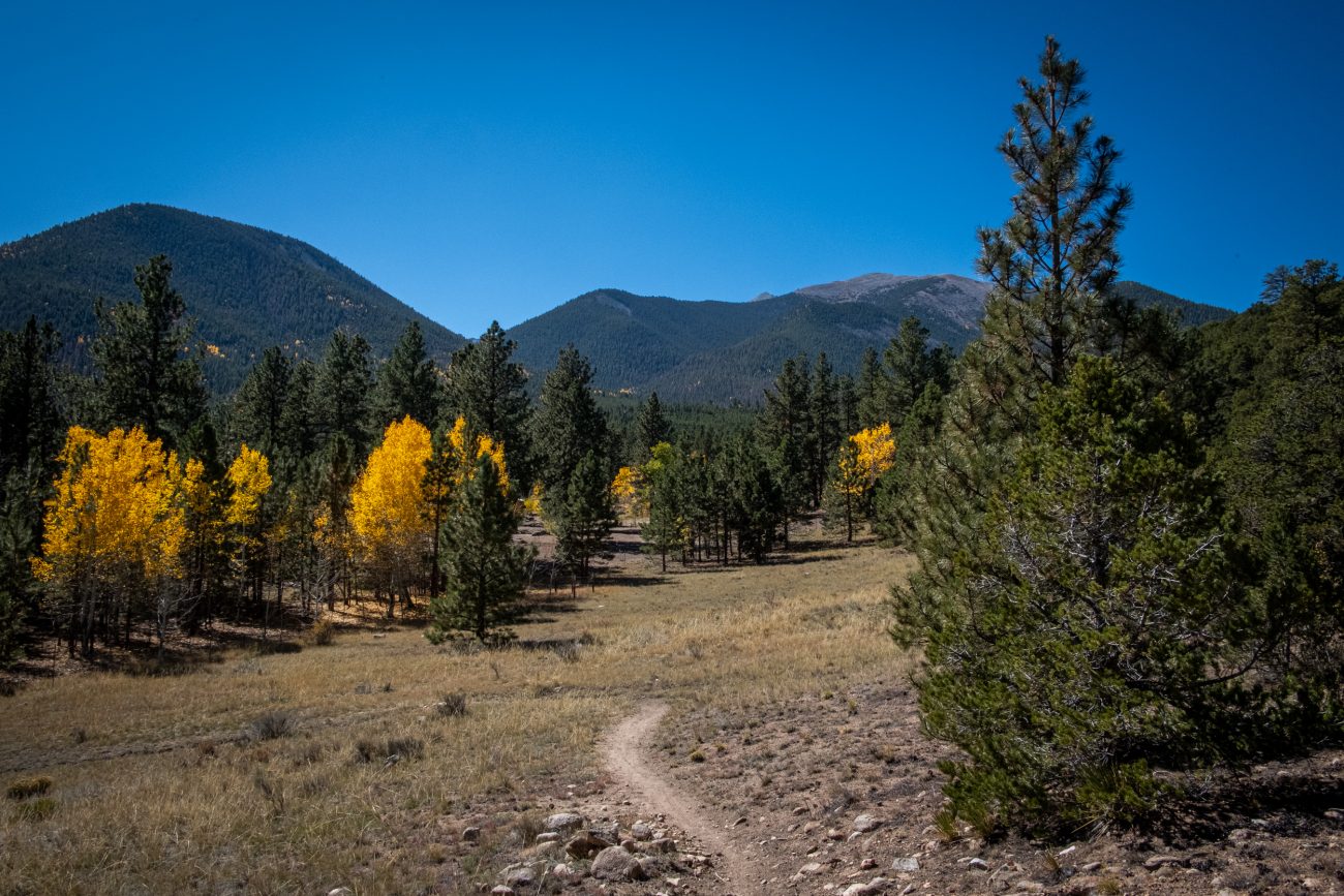
The views continue to impress me. Day 8 – Road Trip, October 2025. Copyright © 2025 Gary Allman, all rights reserved. I didn’t take a compass bearing, so if my interpretation of the map is correct we are looking at (nearest to furthest), first, an unnamed peak with the Mt. Princeton Chalet and Lucky Mine out of view on the top, then Tigger Peak (I misread that name earlier and called it Tiger Peak), and finally Mt. Princeton.
-
Looking up the trail

Looking up the trail — Going up was much easier than coming down. I have just noticed that I can see my footprints going up the trail in this picture. Day 8 – Road Trip, October 2025. Copyright © 2025 Gary Allman, all rights reserved. -
A brief respite

A brief respite — The trail levels out briefly in places. Day 8 – Road Trip, October 2025. Copyright © 2025 Gary Allman, all rights reserved. -
Trailside deer
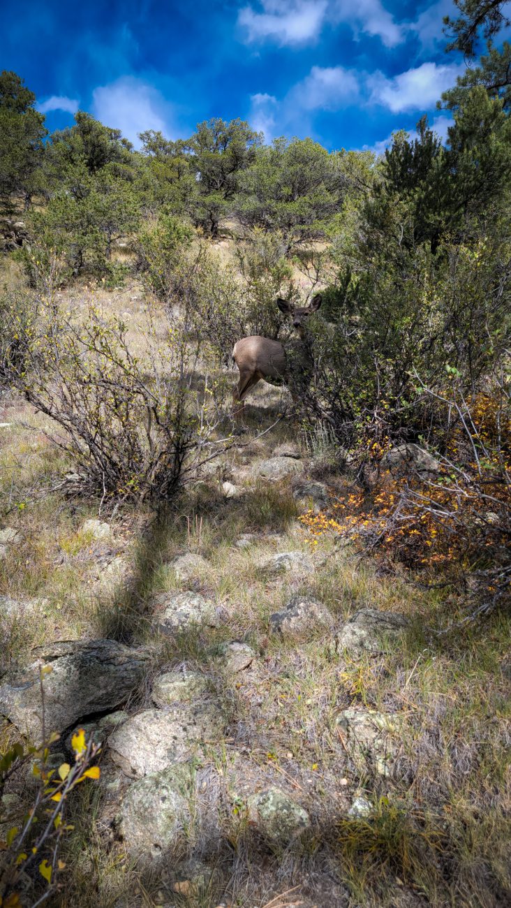
Trailside deer — the deer here are not timid, there were three in this group, but the others were enjoying an afternoon snack behind the cover of some bushes, so I could only get a picture of this one. Day 8 – Road Trip October 2025. Copyright © 2025 Gary Allman, all rights reserved. -
Nearly down

Nearly down — it took me around fifty minutes to get here from the top of the ridge. Day 8 – Road Trip, October 2025. Copyright © 2025 Gary Allman, all rights reserved. -
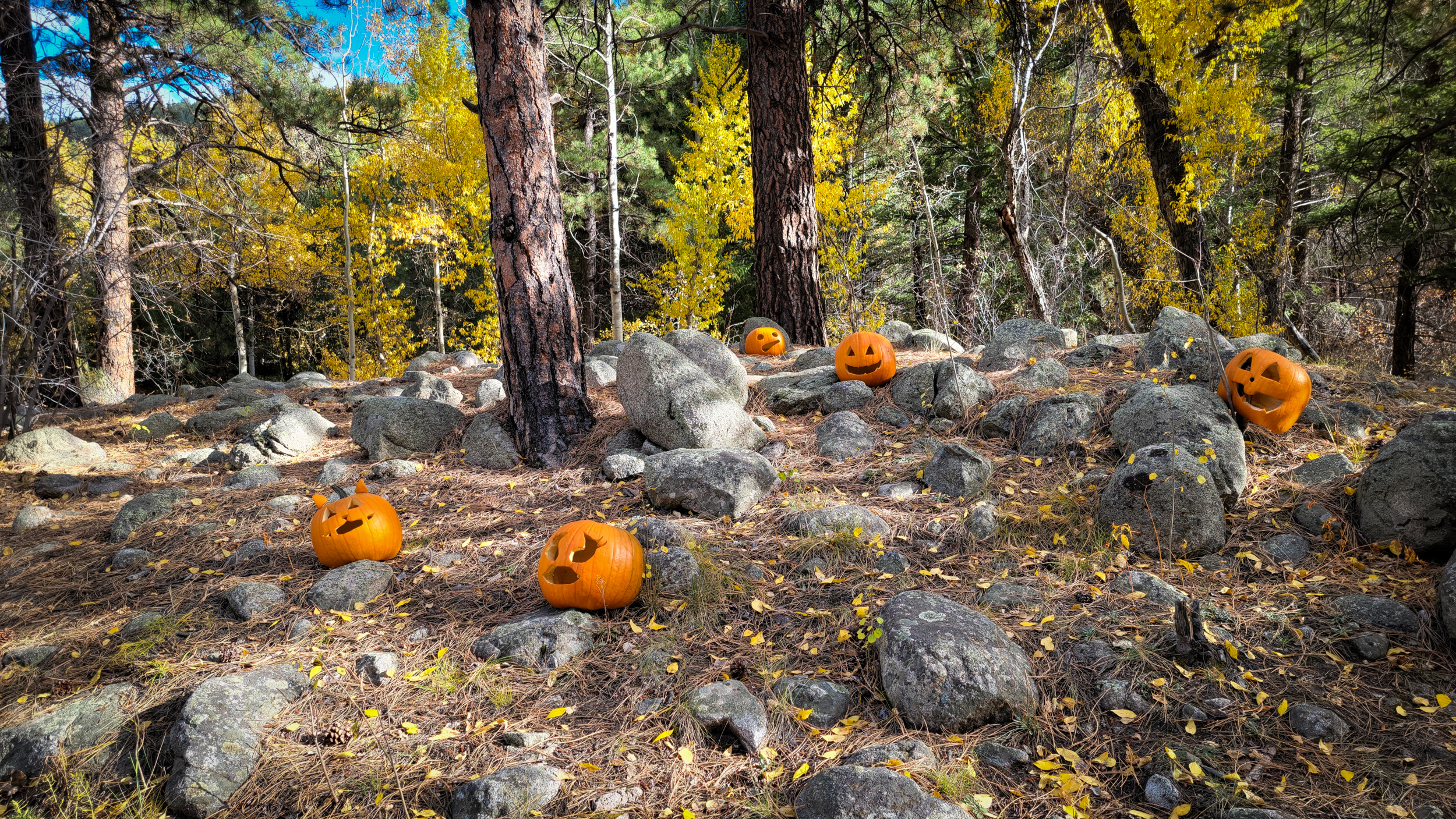
Back to the start and some trailside pumpkins

Back to the start and some trailside pumpkins — I saw these near the start of the trail. Hike totals: 6.5 miles and 1,300 ft. of elevation gain/loss. Day 8 – Road Trip, October 2025. Copyright © 2025 Gary Allman, all rights reserved. -
Entrance to the Cascade Campground

Entrance to the Cascade Campground — Looking out towards the road. Day 8 – Road Trip, October 2025. Copyright © 2025 Gary Allman, all rights reserved. -
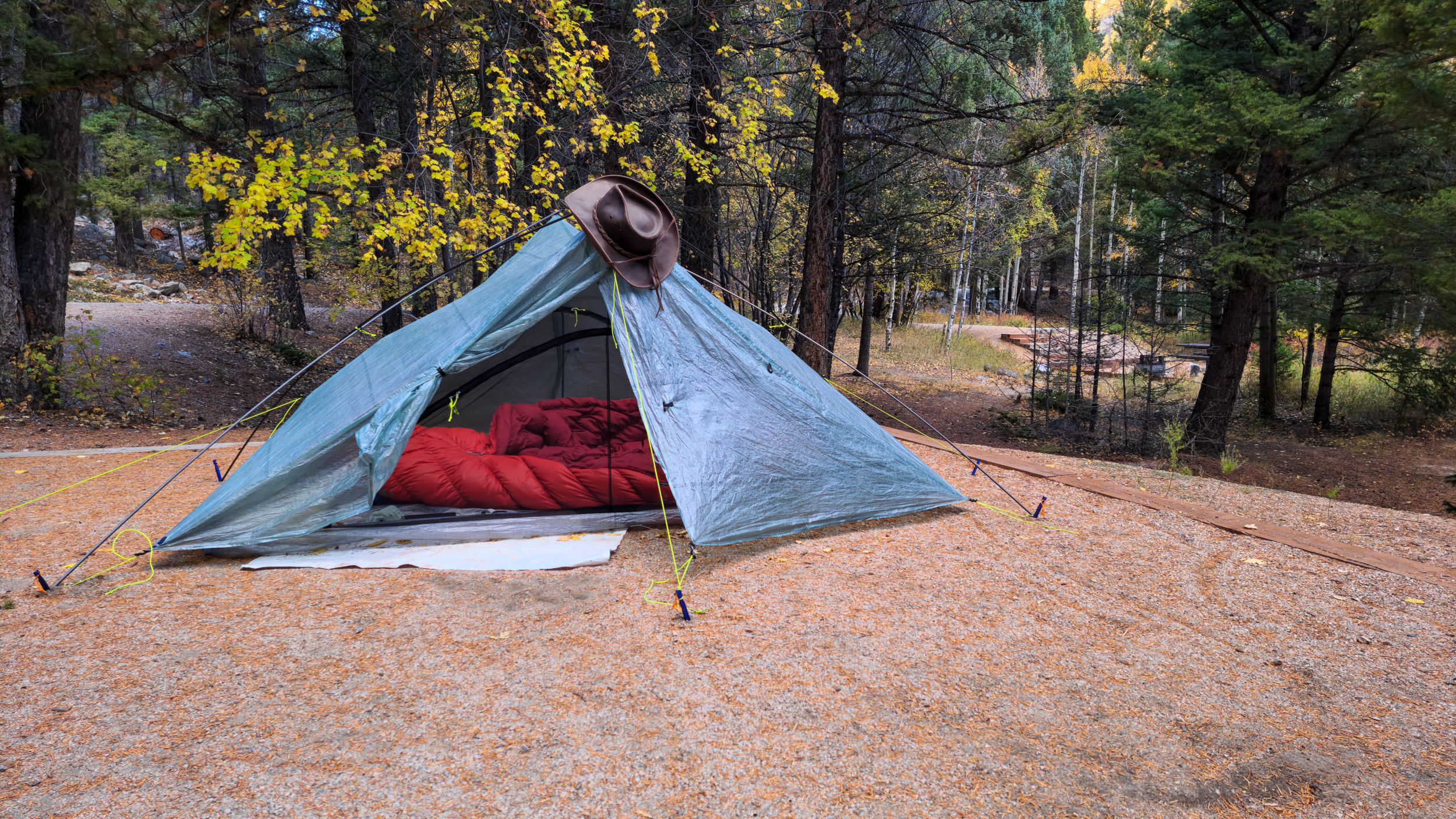
Well staked out

Well staked out. Day 8 – Road Trip October, 2025. Copyright © 2025 Gary Allman, all rights reserved. It’s been very windy, so I used all the tie out points on Ginger’s Zpacks Duplex tent. I also used the freestanding kit so I didn’t have to collapse the tent to use my hiking poles for hiking. Though, had I thought of it, I think Ginger has some carbon fiber tent poles I could have brought along.
I do like this tent, though I’ve never used it for backpacking. It would certainly be lighter than my hammock set up. But sleeping on the ground, even with Ginger’s four-inch thick sleeping pad, is not as comfortable as sleeping in my hammock. As to having to get down on my hands and knees to get in and out… I think it’s the hammock life for me.
-
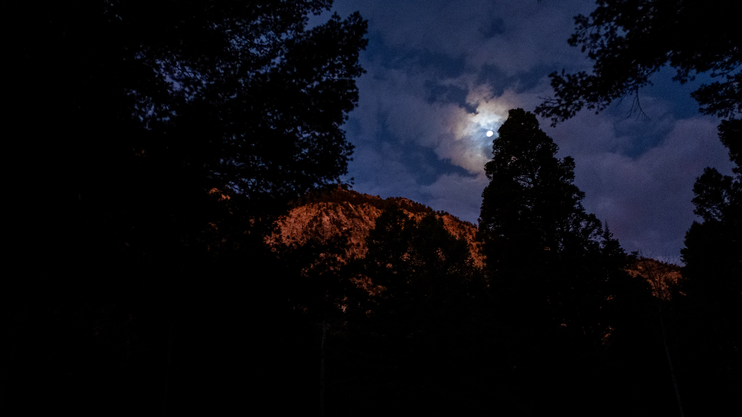
Day 9. Pre-dawn light
Up before dawn. Day 9 – Road Trip, October 2025. Copyright © 2025 Gary Allman, all rights reserved. It’s six-thirty, and I have to be in Colorado Springs shortly after ten. I allowed plenty of time to wake up and get ready to go. I packed away most of my stuff before bed, and set my alarm, and this was the view that greeted me when I got out of the tent.
-
Sunshine on the cliff tops

Sunshine on the cliff tops — Just after seven the sunlight caught the tops of the cliff behind the campground. Time for a quick picture, finish packing everything away in the car, and get on my way. Day 9 – Road Trip, October 2025. Copyright © 2025 Gary Allman, all rights reserved. -
Leaving Chalk Creek Canyon
Leaving Chalk Creek Canyon — I hadn’t gone far before the scenery in the rearview mirror begged me to stop and take a picture. Day 9 – Road Trip, October 2025. Copyright © 2025 Gary Allman, all rights reserved. -
Plains and mountains
Plains and mountains — Seen from Hwy 24, Colorado. The Rocky Mountains are striking, but the unexpected plains between them took my breath away. Driving across the plains for miles and miles was humbling. Day 9 – Road Trip, October 2025. Copyright © 2025 Gary Allman, all rights reserved. -
The sudden shock of being confronted with the expanse of the plains
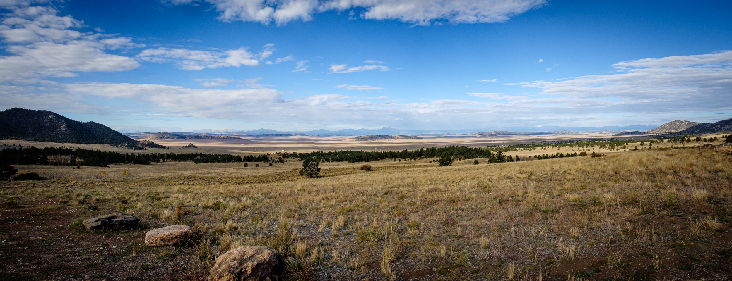
The sudden shock of being confronted with the expanse of the plains. Day 9 – Road Trip, October 2025. Copyright © 2025 Gary Allman, all rights reserved. I saw this picture — well, one like it — while driving north on Day 3 and made a note to take a picture on the return trip, except I couldn’t find the exact viewpoint I’d found, which is a shame because it was a much better composition. Oh well, this photograph will have to do.
-
The Garden of the Gods, Colorado Springs
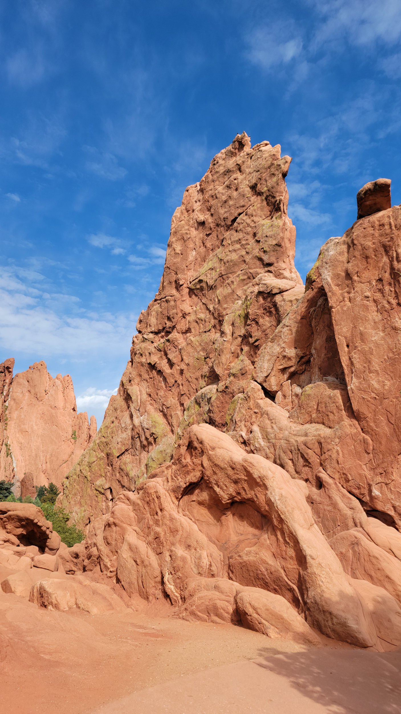
The Garden of the Gods, Colorado Springs. Day 9 – Road Trip October 2025. Copyright © 2025 Gary Allman, all rights reserved. I arrived in Colorado Springs on time, and we packed Ginger’s stuff into the car. Now what? We’d booked a hotel in Colorado Springs so that Ginger could take a rest, and I could get cleaned up ready for the next part of our trip, a visit to Ginger’s childhood town and haunts. Our hotel room wasn’t ready, so we went for a drive around, and quick a walk around some of the more popular parts of the Garden of the Gods. For a Friday afternoon in October the place was packed, so I gave up trying to get pictures there were just too many people getting in the way. This picture originally had four people in it.