-
Long Creek

Long Creek – Hercules Glades – Looking upstream. Copyright © 2019 Gary Allman, all rights reserved. In the picture above we’re looking East — upstream — this is the large pool I had to skirt around to get to my overnight campsite. The pool was deep enough for me to float in, take a very welcome bath, and wash off some of the trail dust. I didn’t stay in the water long though as it was a little chilly.

Long Creek – Hercules Glades Wilderness, looking downstream. Copyright © 2019 Gary Allman, all rights reserved. Looking west — downstream. I didn’t venture any further downstream. That’ll have to wait for another trip. Below are a couple of views of the surroundings, including my hammock set up for the night.
 Long Creek – Hercules Glades Wilderness. Copyright © 2019 Gary Allman, all rights reserved.
 Copyright © 2019 Gary Allman, all rights reserved.
 -
Another Overhang Campsite and my Home for the Night

Overhange Campsite – Exploring further along Long Creek I found another, much less used (and more to my liking), campsite under a large overhang. Copyright © 2019 Gary Allman, all rights reserved. The trail leading west from the campsite under the overhang came to an abrupt end at a very rocky ravine. I decided that if the trail continued on the other side of the ravine, it would do so a fair way up it. I hiked up over the very large boulders. It was difficult going and I quickly decided that it was an unlikely route for the trail.
Getting back to Long Creek, I concluded that the only logical route was straight down the creek; a bit of water hiking was in order.
I was surprised that I’d not seen or heard a single person so far and this was Memorial Day, which I was expecting to be busy as the area near The Falls draws quite a crowd. The creek didn’t look to be too deep, but I figured with no one around if it got too deep I could always strip off to keep my clothes dry.
It was just as well the creek wasn’t too deep and I didn’t strip off, as five minutes later I bumped into John — the only person I was to see on this trip — hiking up the creek. We exchanged pleasantries, and he told me he had a hammock set up a short distance downstream.
We were probably the only people in the entire wilderness, and we’d both turned up at the same spot.
I carried on hiking down the creek past where he said he’d set up his hammock. I had just worked my way around the edge of a big deep pool when I spotted what looked like another overhang behind the trees. And so it was. This was a much more primitive spot. Tucked under the overhang there was a fire ring and a small stone stool, nothing fancy. Scouting around I found what looked like a trail coming in from the west, so that might be another way to get to this spot. I’ll have to check that out another time.

Camped for the night. Copyright © 2019 Gary Allman, all rights reserved. 
Hidden overhang – it could be easy to miss this spot if you are not paying attention. Copyright © 2019 Gary Allman, all rights reserved.  Camped just outside the overhang. Copyright © 2019 Gary Allman, all rights reserved.
 Ready for the evening – Hammock’s hung, the fire’s ready to be lit, and my sit-pad is in place. Copyright © 2019 Gary Allman, all rights reserved.
 Hammock set up just outside of an overhang. Copyright © 2019 Gary Allman, all rights reserved.
 Overhange Campsite – Exploring further along Long Creek I found another, much less used (and more to my liking), campsite under a large overhang. Copyright © 2019 Gary Allman, all rights reserved.
 -
Campsite Under an Overhang

Overhang Campsite – I found this well-tended campsite while exploring along Long Creek. Copyright © 2019 Gary Allman, all rights reserved. My plan was to follow the unmarked trail leading west away from The Falls. I already knew what to expect as a few weeks previously I’d received an email telling me about this spot and asking if I had any idea where the trail came out. Unfortunately, I’ve never hiked this trail, so I couldn’t give an answer, but I thought I’d go along and check it out the first chance I had.
The trail is steep and narrow, with an 80-100 ft. drop off to the creek in places, so not a place to suffer vertigo, or to hike along with young children. On one of the climbs, I realized I’d not been checking my heart rate, so I stopped to do so and found it was at 150 bpm — which is about maxing things out for my age, especially with the temperatures up in the high eighties — so I took a short rest before carrying on.
Pretty soon I was dropping back down to the creek and arrived at the campsite under an overhang (pictured). This charming spot has ready access to the creek, and I could have easily hung my hammock between a couple of the trees. However, I was keen to see where the trail led, so I spent a few minutes scouting around and took a couple of pictures before carrying on.

Overhang Campsite – I found this well tended campsite while exploring along Long Creek. Copyright © 2019 Gary Allman, all rights reserved. 
Overhang Campsite – I found this well tended campsite while exploring along Long Creek. Copyright © 2019 Gary Allman, all rights reserved. -
Day Two – and another six-mile hike

Trail Erosion. That’s a bit of an understatement. Copyright © 2019 Gary Allman, all rights reserved. I was all packed up and underway shortly before eleven. The first quarter/half mile was pure bushwhacking as there is no trail to the bluffs. It’ll come as no surprise to hear that I crossed the trail without seeing it. I bumped into the very rough hunting camp, which immediately made me think I must have overshot the trail. A quick check on the GPS showed that to be the case. I know that’s cheating, but I wasn’t about to start faffing about looking for it. It was hot — mid-eighties — and I wanted to get on.
I decided I’d take the Devil’s Den East (Middle) Trail, down to Rock Spring (Long Creek) Trail, rather than the first trail junction I’d meet. Doing so would save me the 300 ft. climb out of Devil’s Den. By the time I was on the Devil’s Den East Trail, I was down to my last few sips of water, so I decided I’d get some more with a short diversion to Rock Spring. Which I did. I drank my fill and filled my water bottle at the spring box. From there it was mainly downhill — but a couple of miles — to The Falls on Long Creek. When I got there, I was surprised to find water running in Long Creek. When I got to The Falls, I could hear some water running, but I didn’t stop. My plan was to go exploring.
 Hunting camp – it’s a tad tidier than many I’ve come across. Copyright © 2019 Gary Allman, all rights reserved.
 View to the north from the glades. Copyright © 2019 Gary Allman, all rights reserved.
 Trail Junction – Junction of the Pilots (Tower) Trail and the Devil’s Den West (Lower Pilot) Trail. Copyright © 2019 Gary Allman, all rights reserved.
 Upper Pilots – yet another view of the pilots from the glades. Copyright © 2019 Gary Allman, all rights reserved.
 -
Prickly Pear

Prickly Pear Cactus – I love the new growth on these plants. Copyright © 2019 Gary Allman, all rights reserved. I found a whole bunch of these. The new shoots almost match the color of my rain poncho!

Prickly Pear Cactus – I love the new growth on these plants. Copyright © 2019 Gary Allman, all rights reserved. -
View from the bluffs overlooking Beaver Creek at Hercules Glades

View from the bluffs overlooking Beaver Creek at Hercules Glades. Copyright © 2019 Gary Allman, all rights reserved. Video
View from the bluffs overlooking Beaver Creek at Hercules Glades. Copyright © 2019 Gary Allman, all rights reserved. What the view from the bluffs really looks like…

What the view from the bluffs really looks like – There are only a couple of places where you can get a clear view from the edge of the bluff. Copyright © 2019 Gary Allman, all rights reserved. -
Camped behind the Bluff at Hercules Glades

Camped behind the bluffs at Hercules Glades – The edge of the bluff shows clearly in the distance. Copyright © 2019 Gary Allman, all rights reserved. Here I am all cozy, fifty yards or so back from the bluff. The foliage on the edge of the bluff was so thick I didn’t bother to try and set up my hammock with a view out over the edge.
I made one mistake — I drank a cup of coffee. I gave up coffee nine months ago, and just one cup left me feeling all jittery for several hours. Hot chocolate or decaff it will have to be in future.
 Camped at the top of the bluffs at Hercules Glades. Copyright © 2019 Gary Allman, all rights reserved.
 Camped at the top of the bluffs at Hercules Glades. Copyright © 2019 Gary Allman, all rights reserved.
 Good Morning! Time to get up. Copyright © 2019 Gary Allman, all rights reserved.
 Morning Coffee in my hammock – which was a mistake as I gave up drinking coffee nine-months ago. I felt very jittery for most of the morning. Copyright © 2019 Gary Allman, all rights reserved.
 -
Sunset from the bluffs overlooking Beaver Creek

Sunset from the bluffs overlooking Beaver Creek – massively processed to make a ‘meh’ sunset look average. Copyright © 2019 Gary Allman, all rights reserved. I’ll admit that this is an attempt to make a silk purse out of a sow’s ear. But after hiking all the way to the bluffs I was determined to get a sunset picture, even if I had to excessively process the picture to do so.
-
Sitting on the top of the bluff

Sitting on the top of the bluff – I was hoping for a decent sunset. It wasn’t to be. Copyright © 2019 Gary Allman, all rights reserved. 
Sitting on the top of the bluff – the bluff is around 200 ft high here. Copyright © 2019 Gary Allman, all rights reserved. It’s a six-and-a-half mile hike from the trailhead to the bluffs overlooking Beaver Creek on the western edge of Hercules Glades. I’ve been wanting to get a nice sunset picture from here for ages. It wasn’t going to happen today though, everything was very wishy-washy. I also hadn’t reckoned on how dense the foliage would be at the top of the bluff. There was only a couple of places where it was possible to get any sort of a view and they both involved getting a lot closer to the edge of the (200 ft.) bluff than I’m particularly comfortable with.
For some odd reason in the picture below I’m looking a bit cheeky. I have no idea why. I blame the altitude.

Looking a bit cheeky. Copyright © 2019 Gary Allman, all rights reserved. -
The Hunchback of Hercules

Caught in a Thunderstorm – A sudden thunderstorm meant I got a chance to try out my rain poncho. It worked fine, but it was hot and humid in there! Copyright © 2019 Gary Allman, all rights reserved. Despite my best intentions, I’ve been too busy to get out on the trails since my last trip in March. This weekend I decided to fix that with three days hiking at Hercules Glades. My plan was to catch a sunset from the bluffs and do some exploring down Long Creek.
About an hour into my hike west along the Pilot (Tower) Trail to the bluffs I was caught by a thunderstorm. Finally, a real chance to try out my rain poncho! It worked fine, but with the temperatures up in the mid-eighties it was hot and humid with it on. I put my main camera in my pack when it started to rain, so the picture above was taken with my phone. I must learn to look at the lens and not the screen when taking pictures with my phone.
The picture below was taken half-an-hour earlier when I arrived at the cairn marking the first trail junction.

Cairn marking the Pole (Pete) Hollow Trail. Copyright © 2019 Gary Allman, all rights reserved. -
Hercules Glades – Visiting the Bluffs, Exploring Long Creek, and a Visit to ER
Caught in a Thunderstorm – A sudden thunderstorm meant I got a chance to try out my rain poncho. It worked fine, but it was hot and humid in there! Copyright © 2019 Gary Allman, all rights reserved. Despite my best intentions, I’ve been too busy to get out on the trails since my last trip in March. This weekend I decided to fix that with three days hiking at Hercules Glades. My plan was to catch a sunset from the bluffs and do some exploring down Long Creek. Things didn’t quite end up how I’d planned though.
Day One
About an hour into my hike west along the Pilots (Tower) Trail to the bluffs I was caught by a thunderstorm. Finally, a real chance to try out my rain poncho! It worked fine, but with the temperatures up in the mid-eighties it was hot and humid with it on. I put my main camera in my pack when it started to rain, so the picture above was taken with my phone. I must learn to look at the lens and not the screen when taking pictures with my phone.
The picture below was taken half-an-hour earlier when I arrived at the cairn marking the first trail junction.
Cairn marking the Pole (Pete) Hollow Trail. Copyright © 2019 Gary Allman, all rights reserved. Sitting on the top of the bluff – the bluff is around 200 ft high here. Copyright © 2019 Gary Allman, all rights reserved. It’s a six-and-a-half mile hike from the trailhead to the bluffs overlooking Beaver Creek on the western edge of Hercules Glades. I’ve been wanting to get a nice sunset picture from here for ages. It wasn’t going to happen today though, everything was very wishy-washy. I also hadn’t reckoned on how dense the foliage would be at the top of the bluff. There was only a couple of places where it was possible to get any sort of a view and they both involved getting a lot closer to the edge of the (200 ft.) bluff than I’m particularly comfortable with.
Sunset from the bluffs overlooking Beaver Creek – massively processed to make a ‘meh’ sunset look average. Copyright © 2019 Gary Allman, all rights reserved. I’ll admit that this is an attempt to make a silk purse out of a sow’s ear. But after hiking all the way to the bluffs I was determined to get a sunset picture, even if I had to excessively process the picture to do so.
Day Two
Camped behind the bluffs at Hercules Glades – The edge of the bluff shows clearly in the distance. Copyright © 2019 Gary Allman, all rights reserved. Here I am all cozy, fifty yards or so back from the bluff. The foliage on the edge of the bluff was so thick I didn’t bother to try and set up my hammock with a view out over the bluff.
I made one mistake — I drank a cup of coffee. I gave up coffee nine months ago, and just one cup left me feeling all jittery for several hours. Hot chocolate or decaff it will have to be in future.
View from the bluffs overlooking Beaver Creek at Hercules Glades. Copyright © 2019 Gary Allman, all rights reserved. Video
View from the bluffs overlooking Beaver Creek at Hercules Glades. Copyright © 2019 Gary Allman, all rights reserved. What the view from the bluffs really looks like…
What the view from the bluffs really looks like – There are only a couple of places where you can get a clear view from the edge of the bluff. Copyright © 2019 Gary Allman, all rights reserved. Prickly Pear Cactus – I love the new growth on these plants. Copyright © 2019 Gary Allman, all rights reserved. I found a whole bunch of these prickly pears. The new shoots almost match the color of my rain poncho!
Prickly Pear Cactus – I love the new growth on these plants. Copyright © 2019 Gary Allman, all rights reserved. Back on the Trail
I was all packed up and underway shortly before eleven. The first quarter/half mile was pure bushwhacking as there is no trail to the bluffs. It’ll come as no surprise to hear that I crossed the trail without seeing it. I bumped into the very rough hunting camp, which immediately made me think I must have overshot the trail. A quick check on the GPS showed that to be the case. I know that’s cheating, but I wasn’t about to start faffing about looking for it. It was hot — mid-eighties — and I wanted to get on.
Trail Erosion. That’s a bit of an understatement. Copyright © 2019 Gary Allman, all rights reserved. I decided I’d take the Devil’s Den East (Middle) Trail, down to Rock Spring (Long Creek) Trail, rather than the first trail junction I’d meet. Doing so would save me the 300 ft. climb out of Devil’s Den. By the time I was on the Devil’s Den East Trail, I was down to my last few sips of water, so I decided I’d get some more with a short diversion to Rock Spring. Which I did. I drank my fill and filled my water bottle at the spring box. From there it was mainly downhill — but a couple of miles — to The Falls on Long Creek. When I got there, I was surprised to find water running in Long Creek. When I got to The Falls, I could hear some water running, but I didn’t stop. My plan was to go exploring and follow the unmarked trail leading west away from The Falls. I already knew what to expect as a few weeks previously I’d received an email telling me about this spot and asking if I had any idea where the trail came out. Unfortunately, I’ve never hiked this trail, so I couldn’t give an answer, but I thought I’d go along and check it out the first chance I had.
The trail is steep and narrow, with an 80-100 ft. drop off to the creek in places, so not a place to suffer vertigo, or to hike along with young children. On one of the climbs, I realized I’d not been checking my heart rate, so I stopped to do so and found it was at 150 bpm — which is about maxing things out for my age, especially with the temperatures up in the high eighties — so I took a short rest before carrying on.
Pretty soon I was dropping back down to the creek and arrived at the campsite under an overhang (pictured). This charming spot has ready access to the creek, and I could have easily hung my hammock between a couple of the trees. However, I was keen to see where the trail led, so I spent a few minutes scouting around and took a couple of pictures before carrying on.
Overhang Campsite – I found this well-tended campsite while exploring along Long Creek. Copyright © 2019 Gary Allman, all rights reserved. Overhang Campsite – I found this well-tended campsite while exploring along Long Creek. Copyright © 2019 Gary Allman, all rights reserved. Overhang Campsite – I found this well-tended campsite while exploring along Long Creek. Copyright © 2019 Gary Allman, all rights reserved. The trail leading west from the campsite under the overhang came to an abrupt end at a very rocky ravine. I decided that if the trail continued on the other side of the ravine, it would do so a fair way up it. I hiked up over the very large boulders. It was difficult going and I quickly decided that it was an unlikely route for the trail.
Getting back to Long Creek, I concluded that the only logical route was straight down the creek; a bit of water hiking was in order.
I was surprised that I’d not seen or heard a single person so far and this was Memorial Day, which I was expecting to be busy as the area near The Falls draws quite a crowd. The creek didn’t look to be too deep, but I figured with no one around if it got too deep I could always strip off to keep my clothes dry.
It was just as well the creek wasn’t too deep and I didn’t strip off, as five minutes later I bumped into John — the only person I was to see on this trip — hiking up the creek. We exchanged pleasantries, and he told me he had a hammock set up a short distance downstream.
We were probably the only people in the entire wilderness, and we’d both turned up at the same spot.
I carried on hiking down the creek past where he said he’d set up his hammock. I had just worked my way around the edge of a big deep pool when I spotted what looked like another overhang behind the trees. And so it was. This was a much more primitive spot. Tucked under the overhang there was a fire ring and a small stone stool, nothing fancy. Scouting around I found what looked like a trail coming in from the west, so that might be another way to get to this spot. I’ll have to check that out another time.
Hidden overhang – it could be easy to miss this spot if you are not paying attention. Copyright © 2019 Gary Allman, all rights reserved. Long Creek – Hercules Glades – Looking upstream. Copyright © 2019 Gary Allman, all rights reserved. In the picture above we’re looking East — upstream — this is the large pool I had to skirt around to get to my overnight campsite. The pool was deep enough for me to float in, take a very welcome bath, and wash off some of the trail dust. I didn’t stay in the water long though as it was a little chilly.
Long Creek – Hercules Glades Wilderness, looking downstream. Copyright © 2019 Gary Allman, all rights reserved. Looking west — downstream. I didn’t venture any further downstream. That’ll have to wait for another trip. Below are a couple of views of the surroundings, including my hammock set up for the night.
Overhange Campsite – Exploring further along Long Creek I found another, much less used (and more to my liking), campsite under a large overhang. Copyright © 2019 Gary Allman, all rights reserved. Camped for the night. Copyright © 2019 Gary Allman, all rights reserved. I was glad I had my sit-pad to soften and warm up the rock seat by the fire. It was a huge fire ring, but I only set a small fire.

Campfire. Copyright © 2019 Gary Allman, all rights reserved. 
Campfire. Copyright © 2019 Gary Allman, all rights reserved. Day Three, and out…

Uphill – It seems that most trips finish at the top of a climb. Copyright © 2019 Gary Allman, all rights reserved. It’s funny how a lot of the hikes start (and end) at a high point. There are no low-lying trailheads at Hercules, between Long Creek and the Tower Trailhead the height difference is only 500 ft. but the actual amount of climbing you do ends up being a fair bit more as the trail undulates over bluffs and up and down the sides of hollows.
For the route out, I decided against the most direct trails as I wanted to get nearer to my monthly 20-miles backpacking target. That decided me on taking the less direct Cedars Trail. It worked out at around five miles bringing my trip total to 18 miles. Not bad for my first hike in two months. (That’s the impact on my schedule of Lent, and the Great 50 Days of Easter for you, plus trips to Denver and Louisville). But I knew that my target was overly ambitious when I set it (read on to find out how overly ambitious that was).
The scenery and the temperatures had changed a lot since my last trip, so had the insect population. The entire trip I was constantly removing ticks. It didn’t help that I ran out of Deet on day one. Despite removing dozens, I still ended up with twenty or more attached when I did a thorough check at home. Some I knew I had and I just couldn’t reach them, others had just slipped by my radar.
All in all, it was a good trip, but I did not settle into a ‘relaxing’ groove. I’m still learning how to switch off and relax.
However spending three days out over the Memorial Weekend, and I only seeing one other person, that’s pretty hard to beat.

Back at the Pole (Pete) Hollow Cairn. Copyright © 2019 Gary Allman, all rights reserved. 
Missouri Primrose. Copyright © 2019 Gary Allman, all rights reserved. 
And the visit to ER?
You can read about that here.
-
Blue Bowl (Black and White)

Blue Bowl (Black and White). Copyright © 2019 Gary Allman, all rights reserved. This is the picture that I wanted to get, and the image is ‘straight out of camera’ — I resisted any temptation to edit it beyond adding metadata — the high contrast and deep shadows were part of my plan.
I had a point to prove to myself. A website like this needs a bit of tending, it has over one thousand posts spanning many years. In that time screen resolutions and camera resolutions have changed, so there’s a constant round of maintenance, updating, correcting, and tidying up. Just recently I’ve been looking at how everything is organized, and in the process of reviewing the content I was surprised to discover how many of my favorite pictures came from my little FujiFilm Finepix F30 point and shoot camera. I realized — not for the first time — that I’ve grown lazy over time, and that I tend to rush my pictures, knowing full well that apart from some major disaster — and those do happen — I can re-frame and fix things in post production. So I decided to challenge myself to take this picture with zero editing.
I used the camera’s settings to get what I wanted. for the color version of this image I could have re-processed it in-camera as there is some handy software that lets me do that, but being lazy (or wanting to save time), I just added my film simulation of choice (Astia Soft), and sharpened the raw image in Lightroom.
So I can do it. Maybe I need to drag out the Finepix F30 and see what results I can get with that.
-
Blue Bowl

Blue Bowl. Copyright © 2019 Gary Allman, all rights reserved. The color version of this image. This is as near to straight out of camera as I can get without re-processing the image in the camera. All I’ve done is applied the film simulation I use when shooting color, and sharpened the image a tad (because raw images aren’t sharpened by default). Both pictures have their merits.
I’ll have to see which one appeals to me more over time.
-
It’s been a busy week

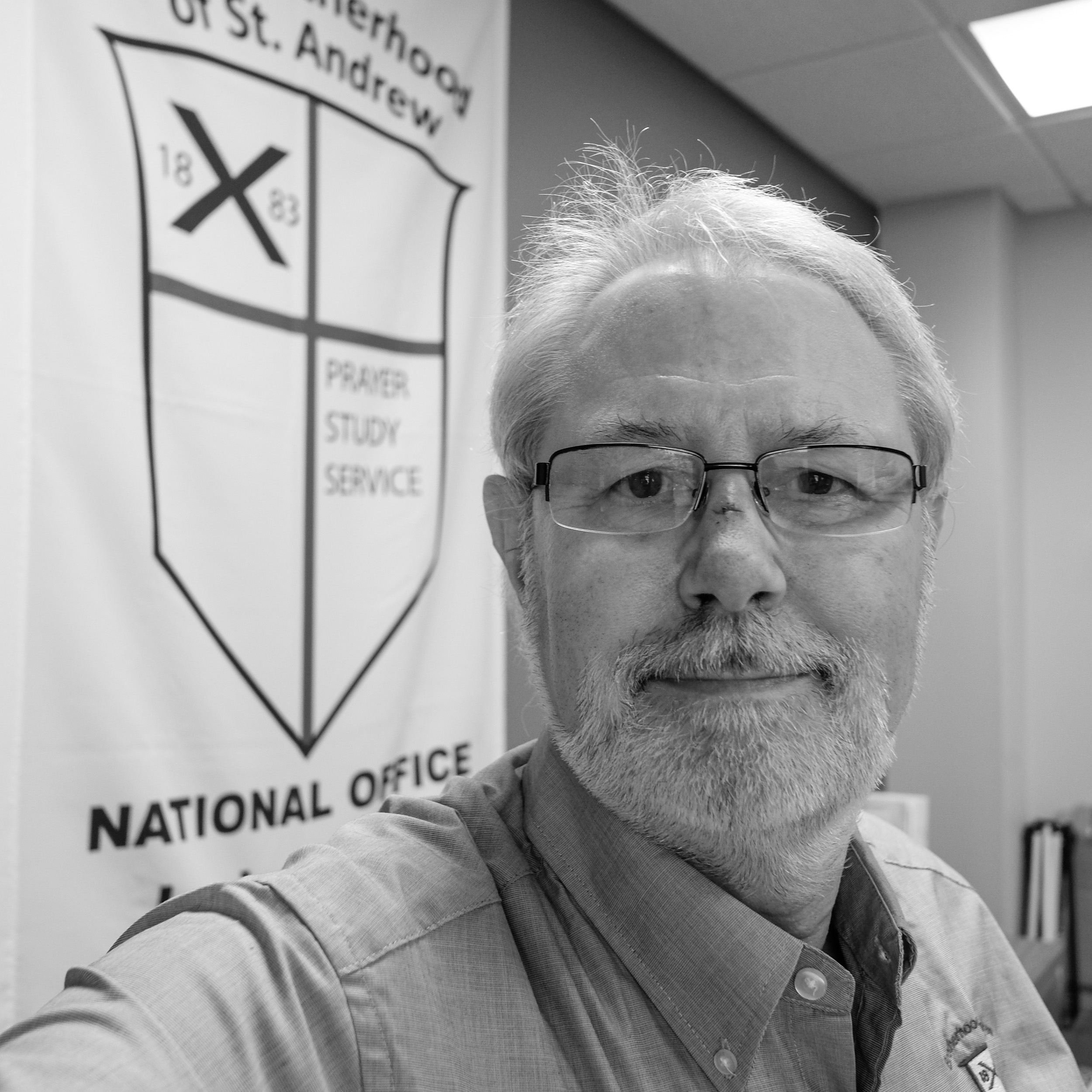
Oops, Friday I walked into a plate glass window. Copyright © 2019 Gary Allman, all rights reserved. Wednesday — I was up at four-thirty for an early morning flight to Louisville Kentucky (via Chicago). I was staying for a couple of days of meetings of the board of The Brotherhood of St. Andrew. I have volunteered to help the brotherhood with their communications efforts, and ended up with the very grandiose sounding honorary title of 1st VP Communications and Public Relations. I arrived at Louisville, where the brotherhood is headquartered, just after two, and had just enough time to get to the accommodation and unpack before the week’s events kicked off with some social time in the evening.

Morning Prayer – The Brotherhood of St. Andrew. Copyright © 2019 Gary Allman, all rights reserved. Thursday — all day meeting, starting just after eight. With the day’s business done, We headed straight to the restaurant for our evening meal and some more social time.

Bishop Terry White, Eighth Bishop of Kentucky, blessed the new National Office of The Brotherhood of St. Andrew May 17, 2019. Copyright © 2019 Gary Allman, all rights reserved. 
Christ Church Cathedral, Louisville, Kentucky. Copyright © 2019 Gary Allman, all rights reserved. Friday — started badly, we had a seven-thirty start, but I wanted to get some pictures of the cathedral before we got going, so I was packed and heading out before seven. In my hurry I manged to walk full speed into a plate glass window that blocked a corridor where I was staying. There was blood, and subsequently some swelling and a couple of minor black eyes.
Undaunted but staggering slightly I got my pictures and arrived at the meeting pretty much on time. After finishing up our business, we walked to the new offices, and on the way one of my colleagues tripped and fell. He ended up in urgent care. My accident was a minor inconvenience in comparison. Bishop Terry White, Eighth Bishop of Kentucky, visited to bless the offices, and that closed our meeting. I flew from Louisville to Charlotte and hence back to Springfield arriving after eight pm.
 Area Confirmations at St. James, Springfield. Copyright © 2019 Gary Allman, all rights reserved.
 L-R. The Rev. Bradley Heuett, Bishop Marty, and the Rev. Chandler Jackson. Copyright © 2019 Gary Allman, all rights reserved.
Saturday — I attended an area confirmation service at St. James, Springfield. There were five churches represented with around 20 confirmands — an excellent turn out. Several of those present (myself included) couldn’t stop to enjoy the after service hospitality as it was on to Christ Church in Springfield for the ordination of two priests. It’s great getting to document these events, but two in a day makes things a bit hectic! I arrived home around seven-thirty.
Sunday — Unlike the bishop and clergy, I took a day off. Though I now have a lot of pictures from the meeting, office blessing, confirmations and ordinations to process and publish.
I think that concludes all my churchy activities for Lent and the great 50 days of Easter. The bishop’s wife will take pictures at the final set of confirmations, saving me seven hours driving and freeing me up to attend my monthly brotherhood meeting. I’ve not been out hiking or backpacking since March 25. Maybe if I can get the yard mowed again soon, I can manage some wilderness time.
-
Oops!

Oops. I walked into a plate glass window. Copyright © 2019 Gary Allman, all rights reserved. I walked into a plate glass window. No real damage done, and luckily there was no one around to witness me doing it. I just have some minor bruising and slight black eyes to show for my clumsiness.
You can read about my busy (for me) week here.
-
Christ Church Cathedral, Louisville, Kentucky

Christ Church Cathedral, Louisville, Kentucky. Copyright © 2019 Gary Allman, all rights reserved. I found someone to show me where the light switch is!

Christ Church Cathedral, Louisville, Kentucky. Copyright © 2019 Gary Allman, all rights reserved. 
Christ Church Cathedral, Louisville, Kentucky. Copyright © 2019 Gary Allman, all rights reserved. -
Christ Church Cathedral, Louisville, Kentucky

Christ Church Cathedral, Louisville, Kentucky. Copyright © 2019 Gary Allman, all rights reserved. -
High altar (Silhouette) and stained glass windows

High altar and stained glass windows – Christ Church Cathedral, Louisville, Kentucky. Copyright © 2019 Gary Allman, all rights reserved. It was very dark in the cathedral, so I decided to try and use that to my advantage. I went back again later and sought help to locate the light switches.
-
Final Descent

Final Descent. Copyright © 2019 Gary Allman, all rights reserved. Louisville Airport is very close to the center of the city — just a 15 minute drive away. That puts the downtown area right on the flight path for the final descent to the airport.
-
Fifth Third Bank – Louisville, Kentucky

Fifth Third Bank – Louisville, Kentucky. Copyright © 2019 Gary Allman, all rights reserved. And again only this time in color.

Fifth Third Bank – Louisville, Kentucky. Copyright © 2019 Gary Allman, all rights reserved.