-
Mid-hike posing (and my new hat)

What the well-dressed English hiker wears abroad – I’m not going to win any fashion awards. It’s just as well I didn’t meet any people on the trail. Day Two, Hercules Glades, Pees Hollow Trail. Copyright © 2020 Gary Allman, all rights reserved. What the well-dressed English hiker wears abroad, along with my new hat, which has worked great so far in the rain and sun.
I’m not going to win any fashion awards. It’s just as well I didn’t meet any people on the trail.
The color treatment for this picture was prompted by a comment from a friend who saw the original color version. He said, “…only the token hi-tech gadget on your left shoulder strap shows that it’s not something out of the Boer War,” that got me thinking. I see exactly what he is alluding to, but I suspect that someone from that period would be stunned at the high-tech light-weight materials and the number of creature comforts I’m packing. The (empty) pack weighs about a pound-and-a-half, there is all the titanium cookware, the down quilts, my hammock, the LED lights, camera, my camp chair (using aircraft-grade aluminum), water filter, cell phone/GPS, and of course on my left shoulder, the tiny InReach personal locator/SOS beacon and texting handset with its worldwide coverage via the Iridium satellite network.
Finally, given that six-shot revolvers were the thing back then, I think they would really covet the semi-automatic handgun with 15 rounds.
Back to the hike
By this point, the skies had darkened to the south and there was a lot of thunder in the distance. If I was lucky the storm would pass to the south-east, if I wasn’t it was going to be a race back to the trailhead. I was thinking I ought to keep hiking rather than stop for a few vanity pictures, but what the heck? The worst that could happen was I’d get wet … or struck by lightning.
-
Flowering meadow – Day Two, Hercules Glades, Pees Hollow Trail.

Flowering meadow – Day Two, Hercules Glades, Pees Hollow Trail. Copyright © 2020 Gary Allman, all rights reserved. -
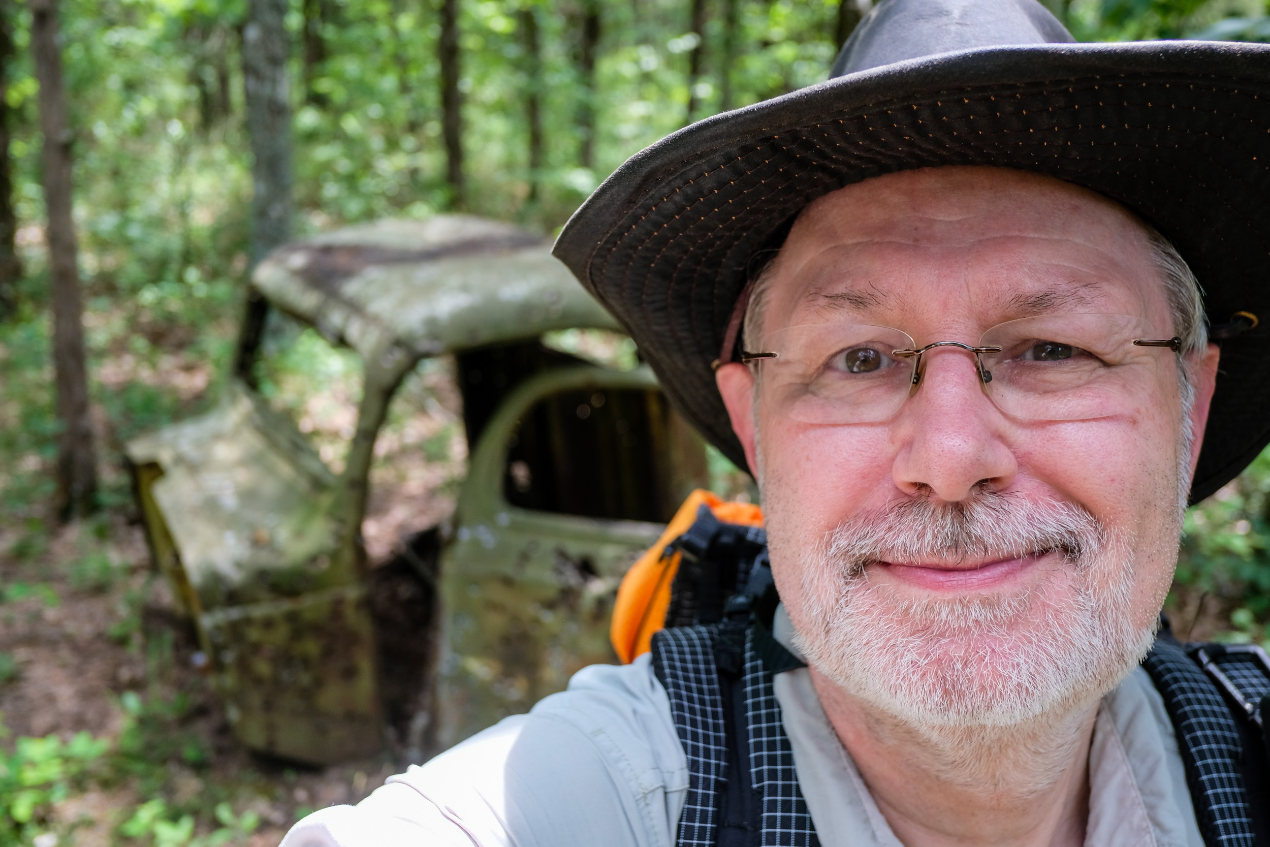
Selfie with the Cab

Selfie with the Cab – It looked like someone had been doing some close-range target practice. Day Two, Hercules Glades, Pees Hollow Trail. Copyright © 2020 Gary Allman, all rights reserved. Apparently, someone has been doing some close-range target practice on the cab. Even though the cab’s out of focus in the background the fresh bullet holes are fairly obvious. As a selfie here is another of my photographic traditions, I’ve created a tag for them.
I’m not quite sure why I have such a funny expression. Odd looks (from me) seem to be all the rage in my pictures at the moment.
-
Another good thing about my chair…

Another good thing about my chair – I can keep all my gear on it as I break camp. Day Two, Hercules Glades, Pees Hollow Trail. Copyright © 2020 Gary Allman, all rights reserved. Having spent the morning lounging around, it was finally time to break camp. I didn’t want to be too late home. Packing up I discovered that my chair comes in useful to keep all my gear on as I break camp. In the picture, it has my two quilts, tree straps, hammock, and phone sitting on it. Most likely my tarp is hiding under there too. It’s also ideal for keeping things up off of the ground away from spiders and slimy things overnight too.
I’m finding that the chair is one of the first things unpacked and last things packed. It’s getting a lot more use than I expected.
-
‘Cab Creek,’ Hercules Glades Wilderness

‘Cab Creek’ – Day Two, Hercules Glades, Pees Hollow Trail. Copyright © 2020 Gary Allman, all rights reserved.  Camped by ‘Cab Creek’ – Day Two, Hercules Glades, Pees Hollow Trail. Copyright © 2020 Gary Allman, all rights reserved.
 Breakfast by ‘Cab Creek’ – Day Two, Hercules Glades, Pees Hollow Trail. Copyright © 2020 Gary Allman, all rights reserved.
 -
Drying my clothes and enjoying the sun

Breakfast, sunbathing, and drying out my hiking clothes – Day Two, Hercules Glades, Pees Hollow Trail. Copyright © 2020 Gary Allman, all rights reserved. No, I wasn’t really wearing camo undies, but your eyes are not deceiving you, for the sake of modesty, in this picture I am. I carry spare undies with me just in case I get run over by a bus while hiking (that’s a joke and an obscure reference to my mother’s insistence on always wearing clean underwear in case one has an unexpected trip to a hospital. It’s probably just an English thing). If you are going ‘regimental’ — that’s the kilt equivalent of going ‘commando’ — and I do, such things are superfluous.
Who said this blog wasn’t educational?
-
Camped by ‘Cab Creek’

Camped by ‘Cab Creek’ – Day Two, Hercules Glades, Pees Hollow Trail. Copyright © 2020 Gary Allman, all rights reserved. -
Camped by ‘Cab Creek’

Camped by ‘Cab Creek’ – Day Two, Hercules Glades, Pees Hollow Trail. Copyright © 2020 Gary Allman, all rights reserved. After all the rain we’ve had it was very green. There was just something about the light that was just right when I took this. Looking at the stack of firewood by the fire ring, I wouldn’t be surprised if it’s not the same pile of firewood that we left when we stayed here back in May 2018.
-
All lit up

All lit up – Day One, Hercules Glades, Pees Hollow Trail. Copyright © 2020 Gary Allman, all rights reserved. There were some problems with the tarp. First, the trees were a little bendy, but that’s normally not a major issue. What was a major issue was that despite my correctly setting up the tarp pull-outs, when the ridgeline got wet they slipped. As it was late, I wasn’t going to mess about and I rigged up temporary lashings to hold the tarp. Reviewing things in the morning, I realized that anticipating a line coming through, I’d tightened down the tarp in case it got windy, and that may have contributed to the problem. However, it’s not the first time the tarp pull-outs have slipped, so I am now considering swapping the continuous ridgeline for two separate lines.

Late night adjustments – Day Two, Hercules Glades, Pees Hollow Trail. Copyright © 2020 Gary Allman, all rights reserved. -
Sunset after the rain

Sunset after the rain – Camped on ‘Cab Creek’. Day One, Hercules Glades, Pees Hollow Trail. Copyright © 2020 Gary Allman, all rights reserved. My camp was all set up, the hammock set, and everything sorted out before the rain arrived. I enjoyed sitting in my chair watching the rain fall before preparing dinner. It rained for an hour or two, clearing up in time for me to take my chair and go and sit by the creek and watch the sunset.
Although it may not look like it, the creek was running … Just. It was enough for me to be able to filter water, and that’s all I needed.

Sunset after the rain – Camped on ‘Cab Creek’. Day One, Hercules Glades, Pees Hollow Trail. Copyright © 2020 Gary Allman, all rights reserved. 
Watching the sunset – I was glad I had a change of clothes. My hiking clothes were soaked in sweat. Day One, Hercules Glades, Pees Hollow Trail. Copyright © 2020 Gary Allman, all rights reserved. -
Trail-side shelf fungi

Trail-side shelf fungi – Day One, Hercules Glades, Pees Hollow Trail. Copyright © 2020 Gary Allman, all rights reserved. -
New Hat & and the hike continued

At the trail junction – Time to explore the unofficial trail that tees off from here – Day One, Hercules Glades, Pees Hollow Trail. Copyright © 2020 Gary Allman, all rights reserved. Here’s a selfie featuring my new hat. Which deliberately looks well-worn and abused. Finding a good hat is remarkably hard. I didn’t want to end up looking pretentious (heaven forbid), or potentially worse, like I was some wannabe weekend warrior:
- Cowboy
- Indiana Jones
- Crocodile Dundee
I’m not sure my selection succeeded. But it’s comfy, keeps the sun off, and doesn’t look too stupid on me.
Continuing with the hike…
Setting off down the unofficial trail I could see from the tracks that there had been some fairly recent horse and foot traffic, but it was still quite overgrown in places. It didn’t take too long to get down to the creek, and once there I could see that the trail crossed the creek and headed, who knows where? I say that because my plan was to go down the creek and find a spot to stop. There was a problem though. I was expecting there to be water in the creek. There was none. The creek was full of rocks and brush, but no water. When the creek was running the water had obviously pushed all the brush over so it was bent downstream. I immediately realized that going downstream was going to be a lot easier than heading back upstream, but that’s fine. I wanted to head downstream to the wilderness boundary anyway. It was tough going, the brush was dense and my progress slow, especially as I was trying to keep an eye out for snakes and other nasties. Checking where I was, the topography, and the state of the brush, I began to think that the chances of finding somewhere to camp for the night in this area were pretty limited. One thing I have learned about the creeks here, however, is that even if you acn’t see the water, it is probably still there, just underground. So I kept on going hoping to find a usable pool when the water eventually re-emerged.
After a while, I did find a pool, so I went up the bank to scout for a campsite, and work out if I wanted to carry on towards the wilderness boundary. That was when I spotted the bunker. It was concrete, appeared to have a slab stone roof, and a pair of buttresses bracketing the doorway. The doorway was big, so I approached it carefully, as who knows who might live in a place like this? And I didn’t want to accidentally corner some critter inside. I was mulling getting my headlamp out of my pack when I obviously disturbed something that sounded particularly pissed with me. Actually it sounded hissed with me. It was like a long release of compressed air or steam. My first guess was that it was a possum. I peered around but couldn’t see the source of the sound which seemed to be coming from the bunker. Well, if the bunker was occupied I didn’t want to upset the occupant any more than necessary, so I slowly backed off. I wasn’t going to turn my back on whatever it was, because it really wasn’t sounding like the possums I’ve heard. Of more concern was that I wasn’t quite sure where exactly whatever I annoyed was. Backing away wasn’t easy in the dense brush which was full of cat briars. I stopped a few yards away and shot some video to hopefully capture the noise so I could get a second opinion as to what it was. Unfortunately, you can’t hear the hissing in the video over the birdsong.
So, what next? The brush was getting denser, and the chances of finding a good place to make camp seemed to be diminishing, so I decided to hike back up the creek. I was sure there was water in the creek, so the chances were good I’d find in on the surface above where I’d joined it. Bushwhacking back against the lie of the brush was hard, but I got there and was eventually rewarded by some big pools of moving water. Scouting around for a campsite I found a nearby trail that had some fairly fresh bootprints too. Scouting further afield I realized I was close to the confluence of ‘Cab Creek’ and Brushy Creek. Time to stop and regroup. It was four p.m. I was expecting rain sometime around five p.m. I decided that rather than waste time looking for a campsite, I might just as well return to the main Pees Hollow Trail, and camp at one of my preferred spots by Cab Creek. And that’s what I ended up doing.
-
Hog Trap and going off trail

Hog Trap – Day One, Hercules Glades, Pees Hollow Trail. Copyright © 2020 Gary Allman, all rights reserved. Not that the fact that my hike didn’t go to plan had anything to do with this hog trap I found. I noticed a fairly well-worn spur trail and decided to check it out. It appears it must have been a feral hog trail, as this contraption was set up across it. I presume it’s sitting here so the hogs can get used to it before they bait it. I couldn’t see any obvious trigger mechanism, and I didn’t want to hang around in case my scent put the hogs off of using the trail. Hogs do a lot of damage, and anything that can be done to get rid of them is fine in my book. It used to be that you were free to shoot them on sight. Now they prefer that you report sightings so they can set traps to catch and kill an entire herd.
Back to my hike. About 90 minutes in I got to the trail junction where Ginger and Katie took a wrong turn a few years ago. My plan was to take the wrong turn and see where it headed. I wanted to get down to the edge of the wilderness. To do that, I needed to ignore the arrow which someone thoughtfully added to the trail blaze to make the trail obvious (that would be me — vandal that I am), and go right.

At the trail junction – Official trail to the left and unexplored territory to the right – Day One, Hercules Glades, Pees Hollow Trail. Copyright © 2020 Gary Allman, all rights reserved. -
About to head down the Pees Hollow Trail

About to head down the Pees Hollow Trail (Counter-Clockwise) – Day One, Hercules Glades, Pees Hollow Trail. Copyright © 2020 Gary Allman, all rights reserved. Another weekend, another quick backpacking trip. I couldn’t get away Friday night because I had a meeting Saturday morning. So here I am One O’clock Saturday afternoon, and I’m just about to set off down the trail you can see behind me. What appeared to be a church youth group had just come up the Pilot (Tower) Trail, talking loudly about their inability to find the falls having hiked three miles out and back. I pointed out the Long Creek Trail trailhead across the parking lot, which leads directly to the falls. Someone else in their party said they should have started at the Coy Bald trailhead. I told them it is currently inaccessible. The lake is so high the ford is under 10-20 feet of water. I know this because Katie was there earlier in the week, and sent us a picture. The good news was that they were the only people I saw during my two-day stay, and they were quickly on their way.
It’s surprising, though it really shouldn’t be, how much everything has ‘grown in’ since my last visit a few weeks ago. It’s all very green. My plan for this hike was simple. Go around the Pees Hollow Trail counter-clockwise, exploring off-trail, and stopping near the wilderness’s northern Brushy Creek border. Then back to the trailhead Sunday, by completing the loop. According to the forecast I could expect rain at around five and eleven p.m. today and again in the morning Sunday. That’s okay. I’ve got a new hat to try out in the rain.

Pees Hollow Trail (Counter-Clockwise) looking very different in the summer – Day One, Hercules Glades, Pees Hollow Trail. Copyright © 2020 Gary Allman, all rights reserved. -
Journal: Two nights at Hercules Glades Wilderness, May 2020

Getting ready to go – one last look out from the bluffs before heading back to the trailhead, six miles away. Copyright © 2020 Gary Allman, all rights reserved. A two-night break at Hercules Glades Wilderness with a visit to ‘Twin Falls’ hollow and the bluffs.
-
Small falls on ‘Twin Falls Creek’

Small falls on ‘Twin Falls Creek’ – According to the GPS these are only 260 yards from the trail. It seems a lot more when you are bushwhacking. Copyright © 2020 Gary Allman, all rights reserved. According to the GPS these are only 260 yards from the trail. It seems like a lot further when you bushwhack your way here. The pool looked very inviting and I did try it out, but it wasn’t as big or deep as it looked. I should have stopped at the Twin Falls if I wanted a good bath, but the sides of the hollow there are so steep so it gets little sun. I think it was a lot prettier (and quieter) here.
-
Lunch stop

Gotta love this chair – yup I’m have another chairgasm. What a great spot to stop and have lunch. Copyright © 2020 Gary Allman, all rights reserved. Once again I made reasonable time on the trail (for me), arriving at my selected lunch spot shortly before two pm. There’s a nice set of low falls here, and from the top of them it looked like the pool would be large enough to bathe in. It wasn’t really, but it was nice and refreshing, and worth the tortuous route I had to take to get down to the pool. But I jump ahead of myself. Before I tried out the pool I heated up some water for my noodles and filtered a load to drink. I’d run out of water not long after leaving the bluffs, so I was ready for a drink.
All in all I spent around an hour lounging around and soaking up the views of the creek.

Gotta love this chair – yup I’m have another chairgasm. What a great spot to stop and have lunch. Copyright © 2020 Gary Allman, all rights reserved.  Small falls on ‘Twin Falls’ creek. According to the GPS these are only 260 yards from the trail. Seems a lot more while you are bushwhacking. Copyright © 2020 Gary Allman, all rights reserved.
 Small falls on ‘Twin Falls’ creek. According to the GPS these are only 260 yards from the trail. Seems a lot more while you are bushwhacking. Copyright © 2020 Gary Allman, all rights reserved.
 Looking down ‘Twin Falls’ Creek. Copyright © 2020 Gary Allman, all rights reserved.
 -
The brush is growing and views are limited

The brush is growing and views are limited – ten years ago when we first hiked this trail the views were a lot better. Copyright © 2020 Gary Allman, all rights reserved. Ten years ago, when we first hiked this trail, the views were a lot better.
-
You’d think…

You’d think… Copyright © 2020 Gary Allman, all rights reserved. You’d think… that the trail went left here. Nope. It disappears into the bushes on the right (this picture is looking west), I’d just emerged from said bushes.
-
Ready to go
Getting ready to go – one last look out from the bluffs before heading back to the trailhead, six miles away. Copyright © 2020 Gary Allman, all rights reserved. I was planning on a nice leisurely lunch break down at ‘Twin Falls Creek’ near where I’d camped on Friday night, so I wanted to be on the trail before midday. If I made the same time as I did getting here, I’d be stopping for lunch around two pm.
As it happened I was ready to be on my way by 11:30. I made a short diversion for a final look out over the bluffs before getting out the compass and bushwhacking due east to the trail. I was going to be a bit more observant this time and try not to cross the trail without seeing it!

Getting ready to go – one last look out from the bluffs before heading back to the trailhead, six miles away. Copyright © 2020 Gary Allman, all rights reserved. 
View from the top of the bluffs. Copyright © 2020 Gary Allman, all rights reserved.