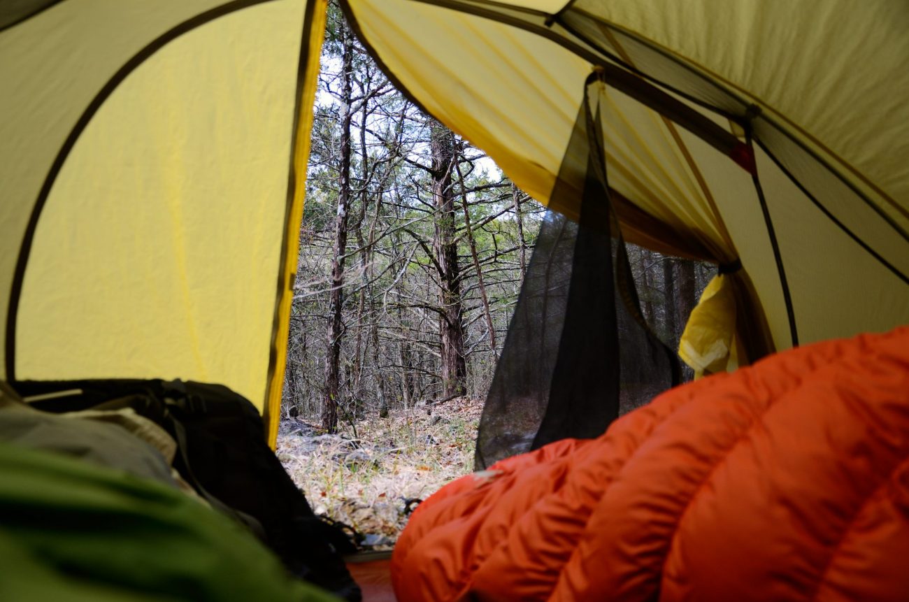
The schools in Springfield were closed on Friday, so we took advantage of the long weekend to go on our first backpacking trip since last September.
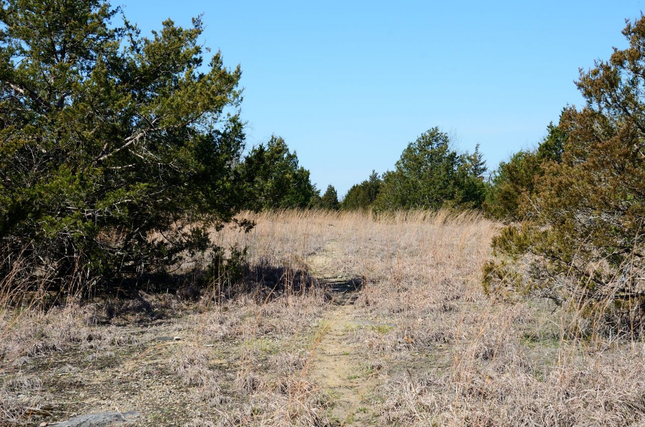
A couple of things influenced our choice of where to go. First Lanie was staying with the Grandparents. Second we are both very out of condition. We wanted to be able to take things easy, but also see some new sights. There’s a set of bluffs on the western side of Hercules Glades that we’d found on the maps and explored a little on Google Earth. This was a great opportunity to go and have a look.
We left home on time to meet up with Ginger’s parents at Ava at 11:30am. Jim treated us to lunch at the Subway at Ava, and then off we went. Shortly after 2pm. we were on the trail.
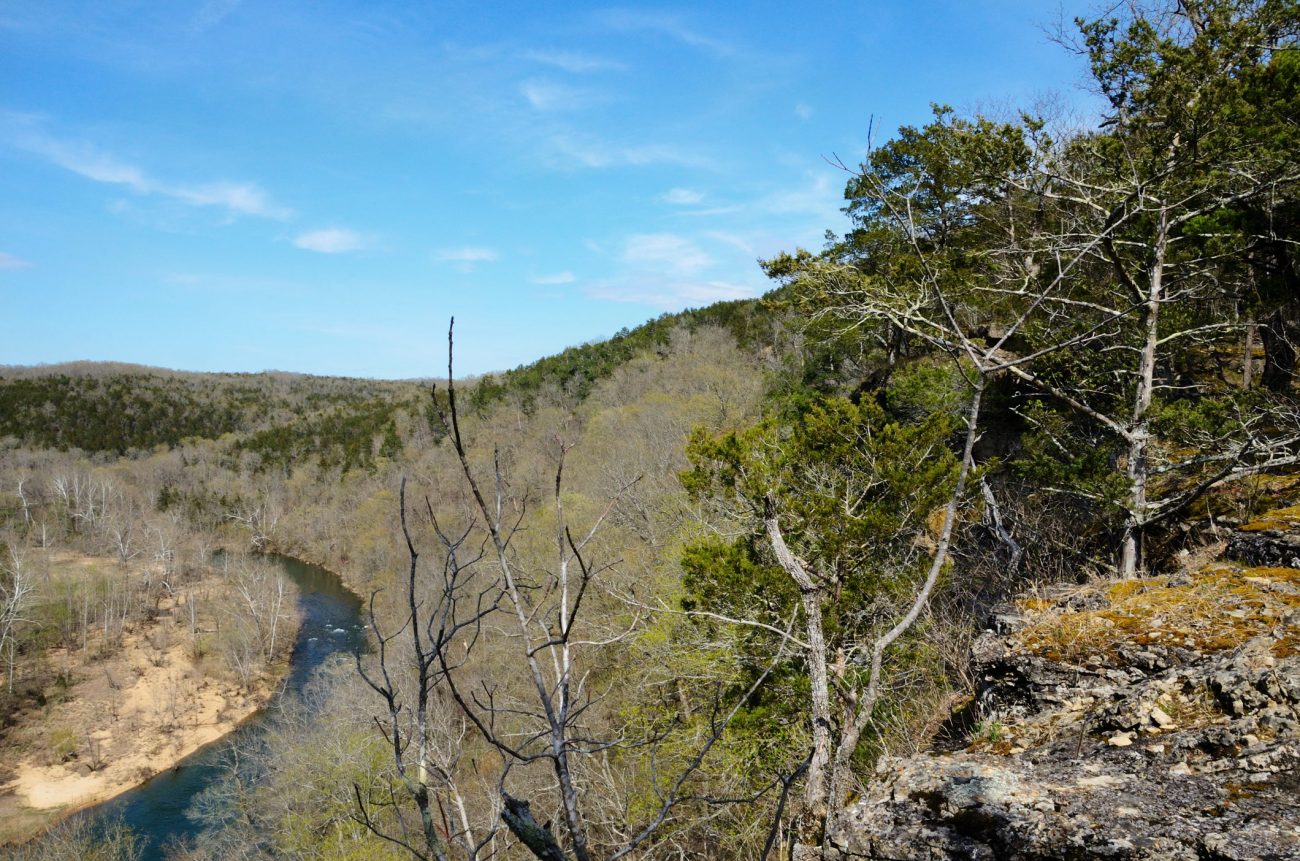
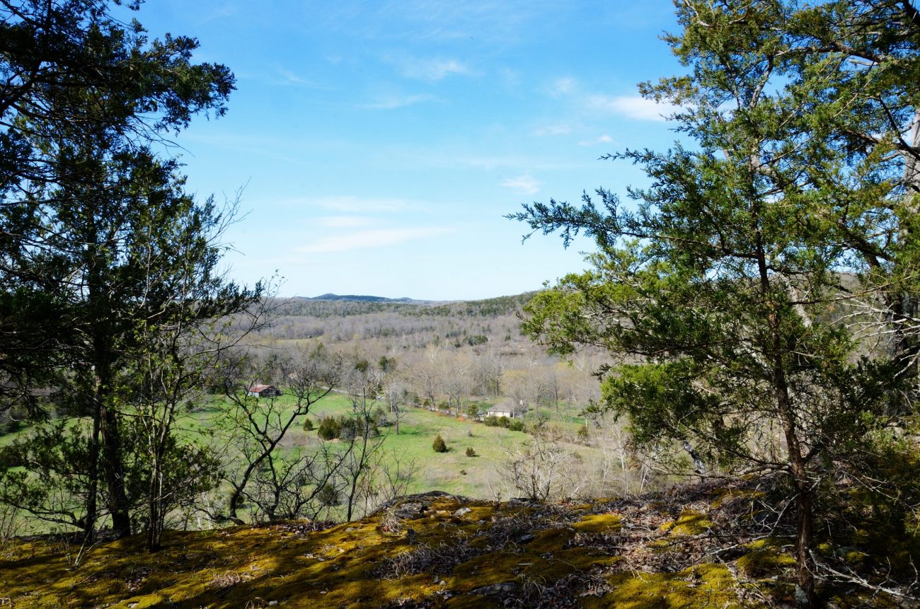
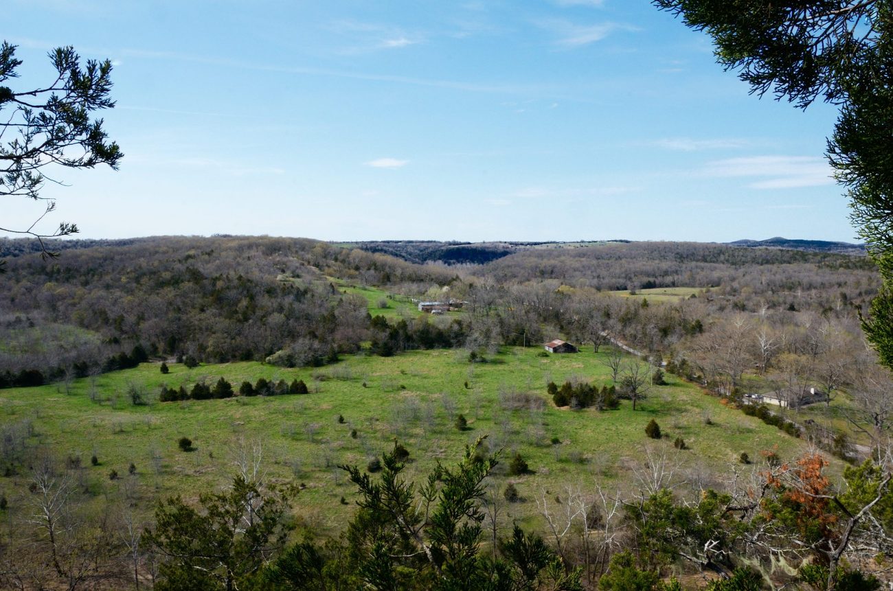
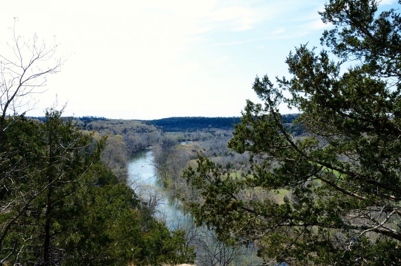
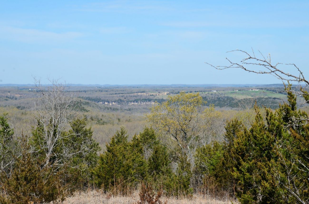
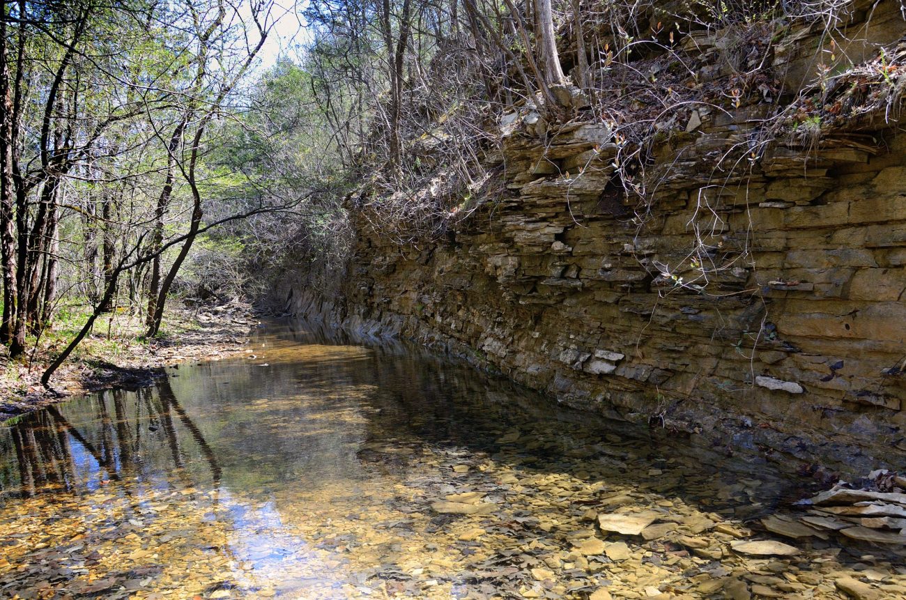
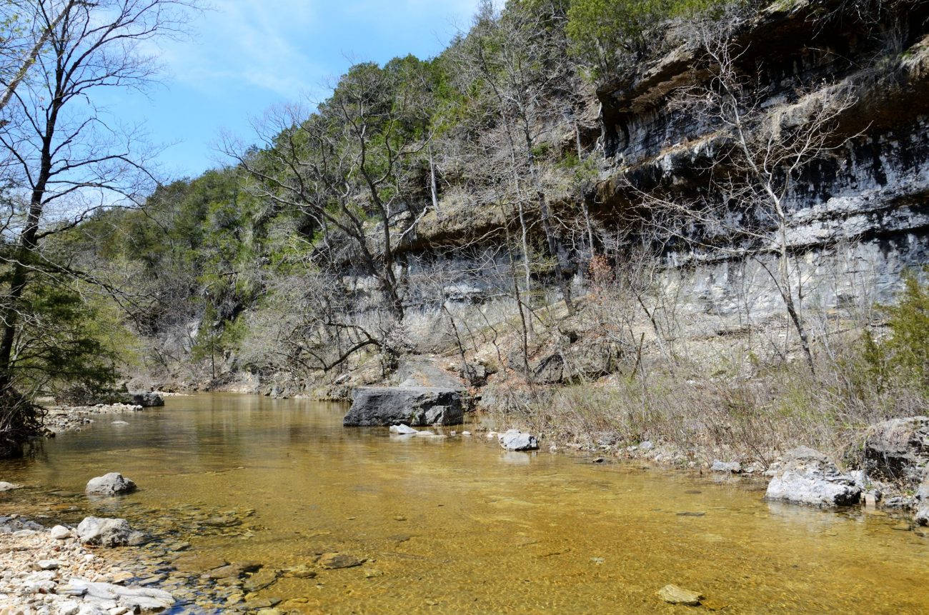
You can read my write up of our trip on Ozarks Walkabout. The highlight of the trip was spending Saturday afternoon resting and enjoying the spring sunshine on top of a 260 ft. bluff overlooking Beaver Creek. In total over the three days we only hiked 10 miles and climbed 1500 feet.
We got back to the trailhead around 1:30pm on Sunday and then went to Ginger’s parents for a family afternoon and dinner.
Bluff on Beaver Creek – Hercules Glades Wilderness
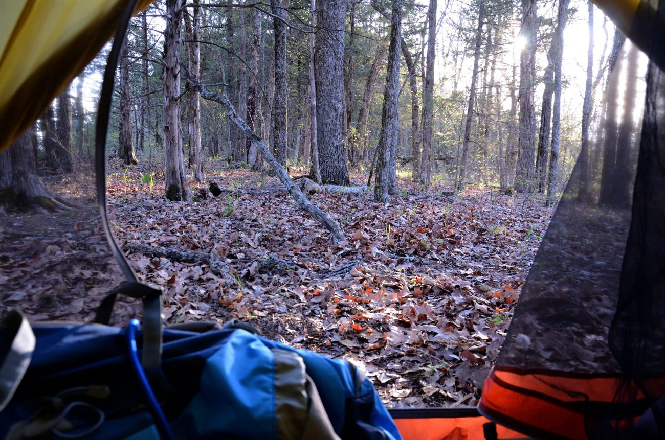
I’ll be writing more in a few days. For now, we camped at the top of this 260ft. bluff last night. It took a bit of bush-whacking to get there but it was worth it.
I know the weather in the Ozarks can be variable, but…
There’s a cold front on it’s way and according to the OEM Extended outlook:
“
There is a 50 degree difference between the warm and cold sides of the front. The slow moving front is projected to make it to US 65 by sunrise Wednesday (04-10-13) morning.
Of course as Ginger points out, that’s the temps up in the clouds. It’s still a big difference though!
I caught myself using the dreadful American pronunciation of the word herb tonight – ‘erb. It’s terrible, it’s herb with an aitch. I need to go and wash my mouth out. On the upside does this mean sometime soon I’ll stop getting into the passenger side of the van when I’m driving?
The second Sunday in Easter, and Ms. Charlotte’s Birthday
Today, for the first time in a while I wasn’t scheduled to be an usher at church.
So, I was able to sit back and enjoy the service which included the vestry (and myself) being ‘commissioned’. Lanie, for her part, did an excellent job in the fairly sparsely populated Junior Choir.
After the service we celebrated a parishioner’s birthday and I took a few pictures including some cute shots of the couple of the kids. It’s just as well that I’ve now gotten into the habit of taking the camera bag with me whenever I head out to church.
Ginger hates how frustrated I get with software. However, the above message is typical of the sort of experiences I have every day.
At least this error message made me smile. There was a bonus too. On re-pressing the button it, WordPress this time, did what it was supposed to do. That’s a much better record than most of the software I use.
I have two key requirements of software.
Any self-respecting software designer/engineer who doesn’t know what I want the software to do is obviously a total twit
When I press a button, it should do what I (or any reasonable user) might expect it to do — not necessarily what it was designed to do 🙂 Any self-respecting software designer/engineer who doesn’t know what I want the software to do is obviously a total twit (that’s remarkably temperate language for me when referring to software designers). If they actually used the software they developed, they’d know that what I expect it to do is the right thing. Which leads me to point two.
I expect the software designer/engineer to have actually tried to use their software before they release it. Oh, hold on, if they actually did that, we’d probably not have any software. For example, what was the developer of the Facebook album editor thinking of? Try using the scroll bar on the edge of an image’s description field without accidentally dragging the image across the screen. Go on, try it. It’s next to downright impossible. As to actually editing text that’s at the bottom of the edit window. It’s almost impossible ‘cos most of the time when you put your cursor there, the stupid ‘where was this taken?’ dialogue pops up.
I could go on and on, but I’d probably burst a blood vessel and have a stroke
I could go on and on, but I’d probably burst a blood vessel and have a stroke. Instead I’ll go off and search the Internets for soothing images of sunsets and kittehs.
Blowing out the candlesIt’s that time of year again, it seems Lanie gets older every year! What happened to the seven year old who was here when I first visited the US? …
This time last year we were backpacking with Lanie at Piney Creek Wilderness, encountering a rather fat Copperhead on the Sac River trail, and I listened to a complete reading of Matthew (Note to self: take cushions if I ever plan on spending over two hours sitting in the pews).
Today I had a long day at Church. Not as long as the Adult Choir though. They were at church rehearsing at 6:30 am sang at the seven o’clock service and were back for the eleven o’clock service!
Luckily for me, unlike the choir, my day didn’t start until 8:30 am, checking the church was ready and handing out a few bulletins before taking pictures of the children Flowering the Cross. Overnight rain and an uncertain weather outlook meant the flowering was done inside this year – the unbalanced mix of fluorescent lights is always a challenge for taking pictures, so I threw in a couple of flash shots – especially when I needed a deeper depth of field. To steal from my post on Facebook about trying to get pictures of the kids, “While Pandemonium didn’t rule, it seemed to have a pretty good working majority”. Mary and Sherrie deserve medals!
With kids running everywhere, it was a bit of a ‘spray and pray’ session. That is, take a load of pictures and pray that enough kids are standing still and no one is running into, or, out of the shot.
Next year I’ll make sure I’m not scheduled to be an usher while I’m trying to take pictures. I totally missed the children’s Easter egg hunt while I was tidying up the church after the 9:00 am service. I popped back into church to get a few more pictures before the 11:00 am service started and discovered we were an usher short, so I stayed and helped out.
This afternoon Jim and Carol popped in on one of their regular trips into Springfield. Jim brought his latest sculpture in for me to photograph. It was cold and I didn’t want to try and heat the studio/garage up for a shoot, so I did a quick tabletop shoot. Quick being a relative term as it took a while to get the backdrop in place, and then some playing with a reflector until I was happy enough with the results.
I liked this piece the moment I first saw the pictures Carol sent to us last week. Ginger wasn’t so sure. It’s Jim’s first big move into more abstract art. Up to now his work has been quite representational. This afternoon we chatted about what we liked, and didn’t. Well, they chatted while I set up and took pictures. I processed the pictures straight away so that Jim could see the final images. I have a couple still in the camera that I took outside. Now I just need to get the prints to Jim and that’s the job done.
Following the introduction of a new YouTube cover image I created a template to help people layout their cover artwork. You can read all about the new YouTube cover image and download photoshop and png template files from The Barefoot Businessman.
Lancia Stratos HF Zero. Update May 2019. I’m not convinced I have the correct provenance of this image as it has been removed from the Flickr account I’ve been crediting with being the originator. Reverse image searches have not located the originator, so for now I’ll keep the original credit. Image: used under the terms of ‘fair use for review purposes’ Accredited to Bramari, on Flickr.
I was a school kid when I discovered this jaw-droppingly awesome car. It caught my imagination and made such an impression that forty years on, I still think it is one of the most stunning vehicles ever built.
A few weeks ago I decided to try to find some pictures and a bit more about the car I lusted over as a teenager. I’d only ever seen it in a Sunday magazine which I drooled over and kept for years. The things I could remember about it now were its unique appearance and that it was styled by Bertone. That proved to be enough.
I’ve since learned a lot about the Stratos Zero and I was devastated to discover it’s been on display for the past year in Los Angeles. The exhibition closed in February (2013) 🙁 I would have loved to have seen it.
New (2018) Lancia Stratos Zero Photographs and Article
Lancia Stratos Zero. Image: Automobile Magazine, used under the terms of ‘fair use for review purposes’.
The good news is that the Stratos Zero has been out on the road for a fantastic photo-shoot, which you can see on the Automobile website, in an article published in June 2018.
The pictures are really good, and the article is well worth reading. It’s also good to see that it’s being well looked after — it even has it’s own room in (presumably) the owner’s house — complete with a bookcase, pictures, a disco ball and lava lamp to set the period feel.
Video: Have a look around (posted October 2009)
Wonderful.
Video: Lancia Stratos Zero On the streets in 2018
I have to say that the engine doesn’t sound as good as its superb looks warrants. To avoid disappointment I suggest you consider watching the following video with the sound off.
2018 Concorso d’Eleganza of Villa D’Este in Cernobbio on YouTube
In another video from the same event, you’ll see the Stratos Zero ignominiously pushed along before being given a jump-start. From what I’ve seen the Stratos Zero doesn’t appear to have a reverse gear — or maybe people just don’t want to stick it in reverse with almost zero rearward visibility.
Lancia Stratos Zero 2011 Auction Listing
In my searching, I found a copy of the auction paperwork for when it was sold in May 2011. I’ve reproduced the text below to ensure the information is kept for prosperity. The original text can be found on RM Auctions website.
[june 2019: I’ve updated the link above, as it was moved without a 301 redirect. Which is exactly why I have this text here. After a year of on-off searching, I’ve managed to find its new location to update the link to the original.]
Villa d’Este Saturday, May 21, 2011 Bertone S.p.A.1970 Lancia Stratos HF Zero LOT: 113 Estimate:€1.000.000-€1.800.000 Chassis No. C/1160 AUCTION RESULTS: Lot was Sold at a price of €761.600
115 bhp, 1,584 cc narrow angle V-4 engine, two twin-choke Solex C42 DDHF carburettors, five-speed gearbox, independent front suspension with coil springs and vertical McPherson telescopic dampers, independent rear suspension with double-wishbones and telescopic dampers, four-wheel disc brakes. Wheelbase: 2,220 mm (87.4″)
From the Collection of Bertone S.p.A.
Unveiled at Turin Motor Show (28 October, 1970)
Fully functioning prototype of a landmark and trendsetting Marcello Gandini design
First prototype of the Stratos production car and successful rally car
Fully and professionally restored in 2000
At the turn of the 1970s, the great design rivalry between Bertone and Pininfarina reached an all-time high, with both companies seemingly determined to pull out all the stops to outdo one another. Bertone had perhaps opened the hostilities with the Marzal and with the first “wedge-shaped” supercar concept, the mighty Alfa Romeo Carabo. Italdesign had joined the fray with the Bizzarrini Manta and the Alfa Romeo Iguana. Pininfarina had replied using all its Ferrari firepower with the striking P5, the 512S berlinetta and the Modulo. The latter had caused quite a stir at the Geneva Motor Show in March 1970, yet nothing, not even the outlandish Modulo, could really have prepared visitors of the 1970 Turin Motor Show just a few months later to what they were about to see on the Bertone stand. The car was officially labelled “Stratos HF.” Nuccio Bertone had initially wanted to call it “Stratolimite,” as in “limit of the stratosphere,” clearly inspired by its space-age design. But after some time, it came to be known simply by its internal nickname: Zero.
With the Stratos Zero, Bertone transcended the limits of automotive styling and chiselled a shape that appeared as though it were made of a solid block of metal, evoking speed and the sensation of travel. More remarkable still was the fact that the Zero was not only a design statement but a fully functioning prototype. There was a clear continuity of style and intent between the 1968 Carabo, 1970 Stratos and 1971 Countach prototype. The three projects showed a linear progression in formal research, to the extent that, randomly looking at the preliminary sketches done for each car and omitting the dates, it is difficult to tell which of those three projects they were for. If the Carabo was the radical dream car that broke new ground and the Countach the final step before production, the Stratos was a sculpture on four wheels if ever there was one, a true dream car that married concepts of architecture and pure artistic expression and applied them to the automotive object.
Everything about the Stratos looked futuristic. Its full-width row of ultrathin headlights made for a dramatic front view, echoed at the rear by the minimalist but highly effective combination of mesh grille, ribbon taillights, fat tyres and dual exhaust offset to the side of the protruding gearbox case. The front headlight strip was backlit by ten 55W bulbs at the front, the rear strip by no less than 84 tiny bulbs spread all around the perimeter of the truncated tail. As for turn signals, the same lights simply lit up in succession from the centre to the edges!
According to Eugenio Pagliano, who had joined Bertone’s styling studio a couple years earlier and would become its longstanding Interior Chief Designer, the initial concept behind the Stratos Zero for Bertone’s creative task force was simply to see how low a car they could build! Besides the tongue-in-cheek, slightly provocative aspect of this stated target, it made sense with regard to aerodynamics, where a minimal frontal section is always a prerequisite. It was possibly also a response to Pininfarina’s Modulo. Indeed, where the Modulo had been only 93.5 cm tall, the Stratos peaked at a mere 84 cm (33 inches) from the ground!
According to Pagliano, the Zero was assembled by sourcing from existing Lancia parts. The efficient, no-nonsense mid-ship mechanical layout followed almost effortlessly from that height target, and the diminutive yet spritely 1.6-litre Lancia V-4 engine of the Fulvia HF was chosen for its minimal size as part of that quest for a sleek profile. The chassis was crafted onsite, and the engine was sourced, complete with its own sub-chassis and suspension, from a Fulvia coupé that had been involved in an accident, unbeknownst to Lancia. The double-wishbone with transverse leaf spring arrangement at the rear was simply the Fulvia’s front axle. At the front, the wheel fairings which dominated the narrow cabin were just wide enough to accommodate short McPherson struts. Disc brakes were fitted on all four wheels. A 45-litre fuel tank found space in the right side of the engine bay, and twin fans assisted radiator cooling. The spectacular triangular engine cover incorporated slats shaped to direct air towards the radiator, which was set all the way to the rear.
The cabin was so far up front that access was by way of a flip-up windscreen, and a sourced hydraulic linkage was devised so that, as the steering column was pushed forward to enable access to the driver’s seat, the windscreen would lift. The black rectangle at the bottom of the windscreen was in fact a small rubber mat intended to make climbing in easier by first stepping onto the bodywork.
The Lancia badge at the centre of the mat cleverly concealed a pivoting handle that popped the windscreen open.
Certainly the seating position was as horizontal and as close to the ground as it could possibly get. With the two occupants sitting between the front wheels, the car could have hardly been any narrower as well. Once seated, the driver had nothing but the road in front of him and the sky above him, with a futuristic instrument panel offset to the side behind the front wheel-arch. Its graphics, hand-etched in the green Perspex, were certainly futuristic looking but probably difficult to concentrate on at any speed! Headroom was adequate for the average-sized driver, but one felt slightly “compressed” with the fully enveloping windscreen closed.
The steering wheel was made by Italian manufacturer Gallino-Hellebore. Rear-view mirrors sunk inside the side scallops allowed for somewhat limited rear vision. A small overhead mirror was occasionally installed for road tests atop the windscreen! In this extremely tight package, room for a spare wheel and luggage was found right behind the driver. The “chocolate bar” pattern of the seats themselves was carried through to the Lamborghini Countach LP500. The top side-windows slid backwards into the bodywork, while a “pop-up” wiper was concealed underneath a trap door at the base of the windscreen. Overall, the cost of building the Stratos Zero in 1970 was reportedly 40M Lire (equivalent then to $65,000 or roughly $450,000 in 2010 dollars), when a brand new Lancia Fulvia Rally 1.6 HF coupé cost 2.25M Lire.
Despite being a very abstract vision of the automobile, Italian magazine Quattroruote actually took the Stratos prototype on the road back in 1971, driving it from Milan’s beltway to the historic town centre in front of the Duomo, where it caused, as one could only imagine, quite a sensation. The driver must have felt a certain degree of insecurity looking up at scooters as well as all other forms of traffic, dwarfed by trucks and buses passing by…
Nuccio Bertone had personally already driven the car on public roads when he went to meet Lancia’s top brass a few months earlier to discuss a more realistic sports car project which eventually became the Stratos Stradale. On that occasion, it is reported that the car passed underneath the closed entrance barriers at Lancia’s racing team headquarters, which earned it a most positive reception!
It would be a wild exaggeration to say that the Stratos that eventually made it to showrooms bore much resemblance to the original prototype, but without the Zero, the car that would become one of rally racing’s most memorable icons would likely never have been.
Marcello Gandini himself never commented much about the Stratos he had penned. In an interview granted to Giancarlo Perini in 1977, he simply remarked: “The very first Stratos was designed as freely as the [Autobianchi] Runabout and reached the aim for which it was intended: to establish a bridge between Lancia and Bertone. Having established the bridge, Lancia asked us to come up with an idea for a new sports car that would go rallying in the world championships.”
The Stratos Zero was subjected to a full restoration in 2000, conducted entirely in-house at Stile Bertone in Caprie. In the process it regained its original bronze livery, which had made way for a more traditional silver soon after its initial presentation. It is now presented in its full glory, just as it was on 28th October, 1970, the day it was launched upon unsuspecting show-goers.
Current chief designer Michael Robinson cites the Stratos Zero as the car that made him decide to become a car designer whilst he was studying to become an architect. Without doubt, he isn’t the sole top designer in the industry today to have embraced the profession spurred on by a Bertone show piece. In 1987, Renault Design executive Serge Van Hove, who worked with Marcello Gandini for many years, wrote the following in Italian magazine Auto & Design: “What Gandini cares about more than anything else, what makes him unique, is the dreaming.” Match that to Nuccio Bertone’s ability to transform dreams into reality, and you have the unrepeatable Stratos Zero.
Don’t I wish it was a balmy day. It was 36°F and raining at 7:30am. Forty minutes later when I left for church it was 32°F and snowing. It didn’t stop until early afternoon.
It was a busy morning at church, both ushering and taking pictures.
Christ Episcopal Church
Thurible
9:00am Palm Sunday service
Deacon Anne giving the sermon
Altar dressed for Palm Sunday
Altar dressed for Palm Sunday
Jim’s Trumpet
Jim’s Trumpet
Thurible and supplies
Inside the thurible
John swinging the thurible at the 11:00am service
The afternoon was spent processing the morning’s pictures and tending my various personal and business Internet gardens.
The evening started out with some most delicious roast tatties. After doing the dishes I finished the day working on setting up this website, which turned out to prove a little frustrating. However, my evening’s frustrations were instantly dispelled by two unprompted compliments I received. One in an email from a former colleague that said: “Gary. I can honestly say you were an inspiration and a supreme educator”. Then on the Christ Church Facebook page: “Gary, these photos are great. Thanks for this awesome ministry.” It reminded me of the value of praise and recognition.


 View from the bluff
 View from the bluff above Beaver Creek
 View from the bluff
 View from the bluff above Beaver Creek
 View from the bluff above Beaver Creek
 Camped near the top of the bluff


 Christ Episcopal Church
 Thurible
 9:00am Palm Sunday service
 Deacon Anne giving the sermon
 Altar dressed for Palm Sunday
 Altar dressed for Palm Sunday
 Jim’s Trumpet
 Jim’s Trumpet
 Thurible and supplies
 Inside the thurible
 John swinging the thurible at the 11:00am service