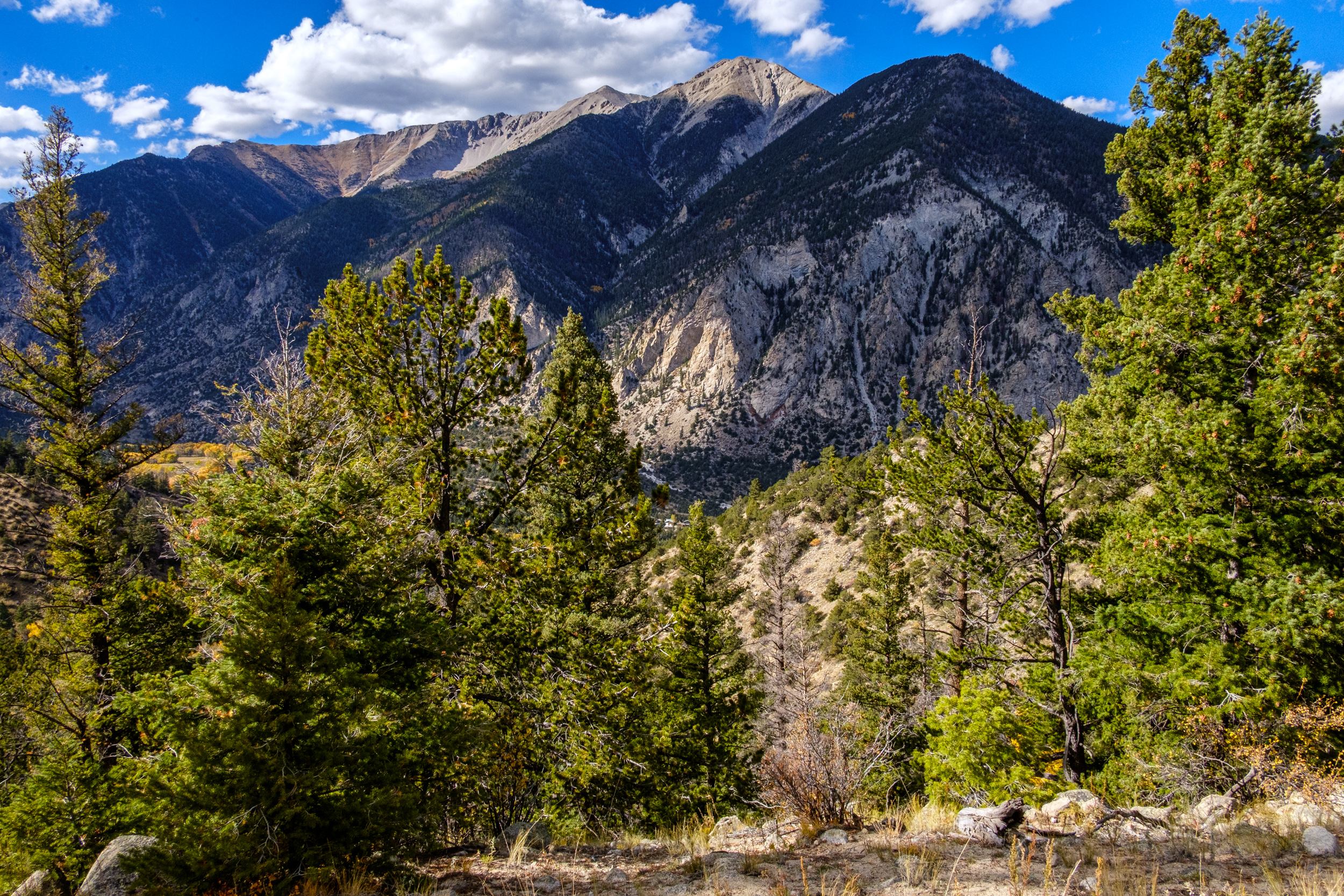
I didn’t take a compass bearing, so if my interpretation of the map is correct we are looking at (nearest to furthest), first, an unnamed peak with the Mt. Princeton Chalet and Lucky Mine out of view on the top, then Tigger Peak (I misread that name earlier and called it Tiger Peak), and finally Mt. Princeton.
Copyright © 2025 Gary Allman, all rights reserved.