-
Whites Creek — close to its confluence with the Eleven Point River

Whites Creek, this is fairly close to its confluence with the Eleven Point River. I stopped here to have lunch and enjoy the view. Copyright © 2023 Gary Allman, all rights reserved. I stopped here to have lunch, enjoy the view and gird my loins for the climb up the ridge past Whites Creek Cave. Sitting eating my lunch I could hear people in the distance, and much to my surprise, I watched as three guys hiked down the very steep sides of the ridge — they’d missed the trail by a quarter mile or so. I’m guessing they were drawn off trail by the siren call of the side trail that had caught me out earlier, but they had failed to find their way back to the main trail.
I never heard or saw anything more of them. Guessing again, but I assume it was the group I met at the Camp 5 Pond parking lot on Friday. ¯\(ツ)/¯
-
Later today I’ll be hiking along that ridge line

Later today I’ll be hiking along that ridge line. Copyright © 2023 Gary Allman, all rights reserved. It is a rubbish picture, but it does give a slight impression of what is in store. I’ve got to go all the way down and then back up again.
The South Loop of the Whites Creek Trail is a lot less traveled, and a lot harder to follow. I’d already spent a fair bit of time bushwhacking when after I lost the trail, and I was about to take a side trail that led me astray. Side trails and game trails can cause a lot of confusion. GPS (and compass) to the rescue both times. Navigating in dense woodland with no major landmarks is difficult (well I find it difficult). I always know roughly where I am — Missouri 🙂 — but opportunities to get a precise fix on the map are rare — you cannot rely on the trail being where it is marked on the map either. The only reliable guides are the few fixed and identifiable topographic features.
So while I don’t get ‘lost’ I often miss the trail. If my GPS failed I have a back up — the Garmin InReach includes a GPS (and so does my watch come to that), but the most reliable backup I carry is a paper map and my compass. All I need to do is go in a straigh-ish line (that the topography will allow) for the nearest accessible road or edge of the wilderness.
losing the trail is more frustrating than anything because bushwhacking your way through the underbrush is a lot slower than walking on a trail.
-
Drying out

Drying out — That will teach me. I didn’t set the tarp and the dew point must have been just perfect for everything to get soaked, including my hammock and my down top and under quilts. I decided to delay the start of my day’s hike (any excuse) and get everything dry before packing it away. Copyright © 2023 Gary Allman, all rights reserved. -
Charging — Giving my InReach Mini and my GPS (phone) a boost

Charging — Giving my InReach Mini and my GPS (phone) a boost. My power brick will keep all my electronics going for about a week. I’m impressed. Copyright © 2023 Gary Allman, all rights reserved. -
Morning messages

Morning messages — Copyright © 2023 Gary Allman, all rights reserved. My InReach Mini, with a morning message from Ginger. All the condensation on the Sig and the holster shows just how wet everything got. I dried off the InReach Mini before I took the picture.
You can send and receive texts from the InReach Mini too, which is cool. I used it yesterday to wish my brother in the UK a happy birthday. I meant to send him a message before I left on Friday and forgot in the rush to get on the road 🙁
The InReach Mini is water resistant. It is rated for 30 minutes immersion in one metre of water (if my memory of the specs. is correct).
-
Time to get up

Time to get up — Yes, I sleep in my clothes, not all the time, but it is part of my layering plan when it gets cooler, and as I only had a 40F top quilt, this was one of those times. Copyright © 2023 Gary Allman, all rights reserved. -
It got a bit damp overnight

It got a bit damp overnight — This is my down puffy jacket, my quilts faired slighlty better as my body heat was drying them as they got wet. Copyright © 2023 Gary Allman, all rights reserved. -
Day Three — Morning view from my hammock

Morning view from my hammock — look closely and you’ll see all the water drops on everything. Not setting my tarp was a big mistake. all my gear got wet. Copyright © 2023 Gary Allman, all rights reserved. -
Camped at the end of Day Two

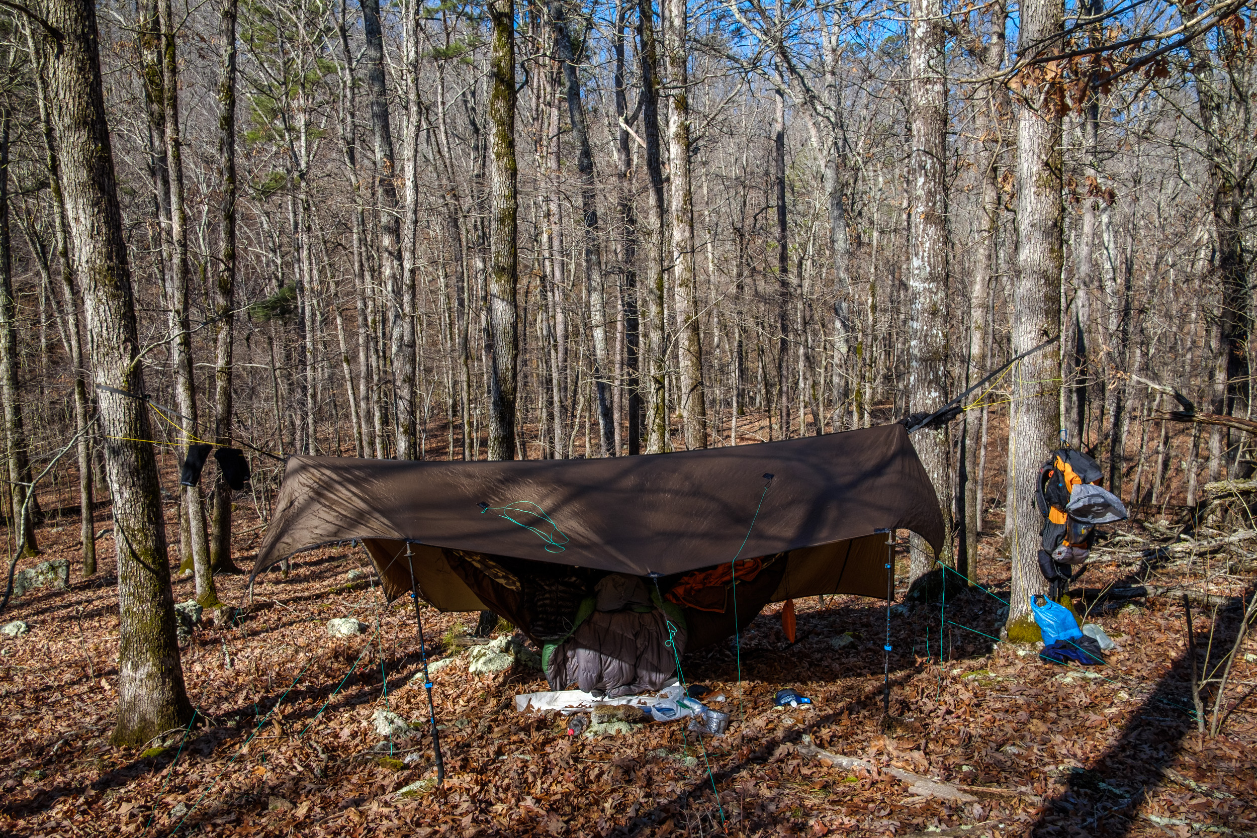
Camped at the end of Day Two. Copyright © 2023 Gary Allman, all rights reserved. I prefer camping on ridges to being down in the hollows. The downside is having to carry a lot of extra water up the ridge. Note my big mistake of the night. I didn’t set my tarp.
-
The only scenic view on the Whites Creek Trail, Irish Wilderness

The only scenic view on the Whites Creek Trail, Irish Wilderness — The Eleven Point River was very high, muddy and noisy after all the recent rain. At least I got a reasonable view of it on this trip. Last time it was hidden by all the leaves on the trees. Copyright © 2023 Gary Allman, all rights reserved. -
Bliss Spring (& a late lunch!)

Bliss Spring — just a quick snapshot. I took pictures and some video the last time I was here. Copyright © 2023 Gary Allman, all rights reserved. I arrived at Bliss Spring at two-fifteen, and set about making some lunch. I planned to stop for the night on one of the two ridges I was about to hike along where there is no water, so I stocked up with water too.
I didn’t bother to take pictures, as I took a load when I spent the night here on my previous visit. Here’s a link to the pictures (and video) I took last time.
-
Old blaze

Old blaze — I’ve no idea where it leads, I’m not going in that direction. Copyright © 2023 Gary Allman, all rights reserved. -
Bliss Spring (and lunch) 3.9 miles

Bliss Spring (and lunch) 3.9 miles. On my first visit to Irish Wilderness I made it to Bliss Spring in the first afternoon. Just as well I have an extra day for this trip. Copyright © 2023 Gary Allman, all rights reserved. -
Sinkhole

Sinkhole — It was impressive because of how wide it was. I’ve seen a lot bigger and deeper, but it was impressive none-the-less. Copyright © 2023 Gary Allman, all rights reserved. -
Whites Creek crossing point, Whites Creek Trail North Loop (Stereo)

Whites Creek Crossing. Apparently, this is where I should have crossed. Copyright © 2023 Gary Allman, all rights reserved. This is looking back across the creek (NE-ish). I wouldn’t have been able to safely cross here either yesterday.

Whites Creek Crossing (Stereo). Apparently, this is where I should have crossed. Copyright © 2023 Gary Allman, all rights reserved. -
Creek? What creek?

The water level in the creek dropped overnight — which was my plan. But the drop exceeded my expectations. I was able to cross without getting my feet wet. Copyright © 2023 Gary Allman, all rights reserved. 
Same spot yesterday afternoon. Copyright © 2023 Gary Allman, all rights reserved. -
Spring water, Whites Creek (stereo image)

Spring water, Whites Creek. And in a few minutes I’ll be climbing the hill on the other side of the creek. Copyright © 2023 Gary Allman, all rights reserved. The fast-moving, noisy, and turbid brown-colored water of Whites Creek yesterday is now running clear, and the color of the water here screams “Spring.” Good to know, this should be a trustworthy water source.
The only thing I don’t like about this picture is that it makes the hill look pretty small. It’s not.
Stereo Image

Spring water, Whites Creek. And in a few minutes I’ll be climbing the hill on the other side of the creek. Copyright © 2023 Gary Allman, all rights reserved. -
Camped near Whites Creek, Irish Wilderness

Camped near Whites Creek, Irish Wilderness, waiting for the creek to drop down. And drop it did! Copyright © 2023 Gary Allman, all rights reserved. -
Camped near Whites Creek, Irish Wilderness

Camped near Whites Creek, Irish Wilderness, waiting for the creek to drop down. And drop it did! Copyright © 2023 Gary Allman, all rights reserved. -
Morning view from my hammock as the Sun breaks through

Morning view from my hammock as the sun breaks through. Not bad last night, it dipped to just below freezing. I was nice and warm. Copyright © 2023 Gary Allman, all rights reserved. Day Two
The temperature dropped to freezing overnight, and despite only having my 40°F top quilt I was too hot. Sometime after midnight, I noticed that the roar of the creek had faded away. I was up at six-thirty and the first thing I did was take a stroll down to the creek and was quite stunned to discover that it was just a small trickle. I’d be able to cross without even getting my feet wet!