All my posts about Hercules Glades Wilderness presented in chronological order. Click here to see all the pictures of Hercules Glades Wilderness without the accompanying text.
-
Dodge Truck Hood

Dodge truck hood. Copyright © 2018 Gary Allman, all rights reserved. We find some odd things in the wilderness, this old truck hood, the truck cab, then a Busiek there’s an old panel van, and two old nitrogen railroad trucks (imported for use as culverts). It’s not that surprising really as it wasn’t that long ago that the current wildernesses were farmland. The number of stock ponds and rock mounds (rocks are possibly one of the most abundant crops of the Ozarks) are testimony to the hard-working people who used to live here.
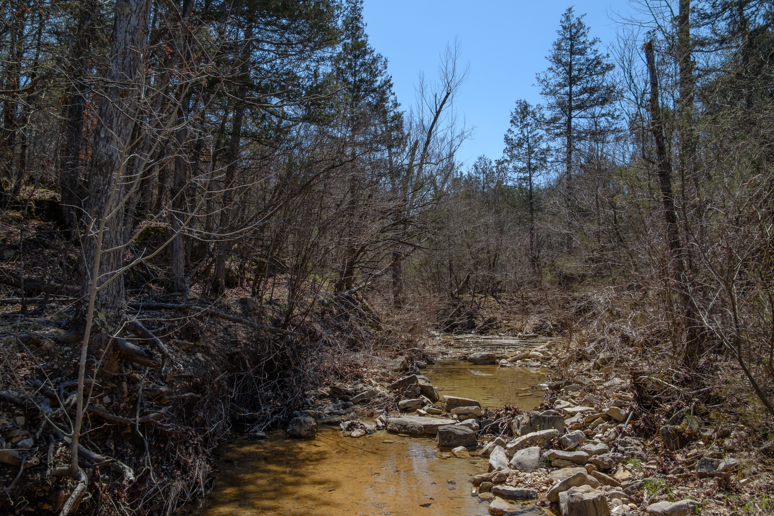
Pees Hollow Trail, Hercules Glades Wilderness. Read about the hike and see more pictures.
-
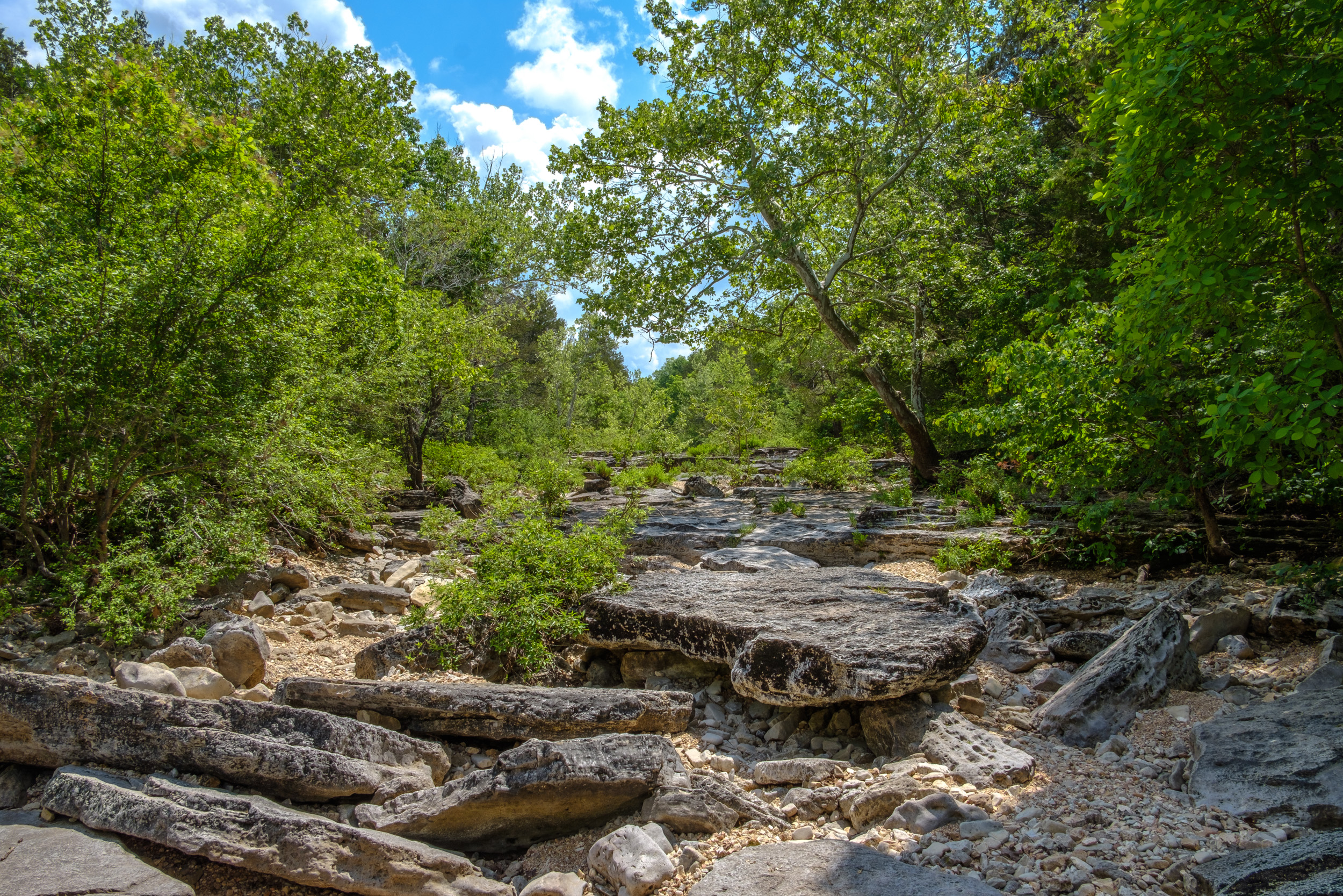
Glades and Knobs

Glades and Knobs. Copyright © 2018 Gary Allman, all rights reserved. You cannot be a Brit (well this Brit anyway) and not occasionally snigger at the local term for a pointy hill — ‘knob’. The word instantly translates into a derogatory anatomical term in my mind. A derogatory term that to this day remains popular with both my sons. With nomenclature like this it’s not surprising Benny Hill was (is?) popular in the Ozarks.
Hercules Glades and the surrounding area is well endowed with knobs, including to the east of the State, the even more hilariously named Knob Lick. No, I did not make that up — I’ll see if I can find a picture (I did, see below). I’m pretty sure I’ve driven past a ‘Knob View’ at some point.
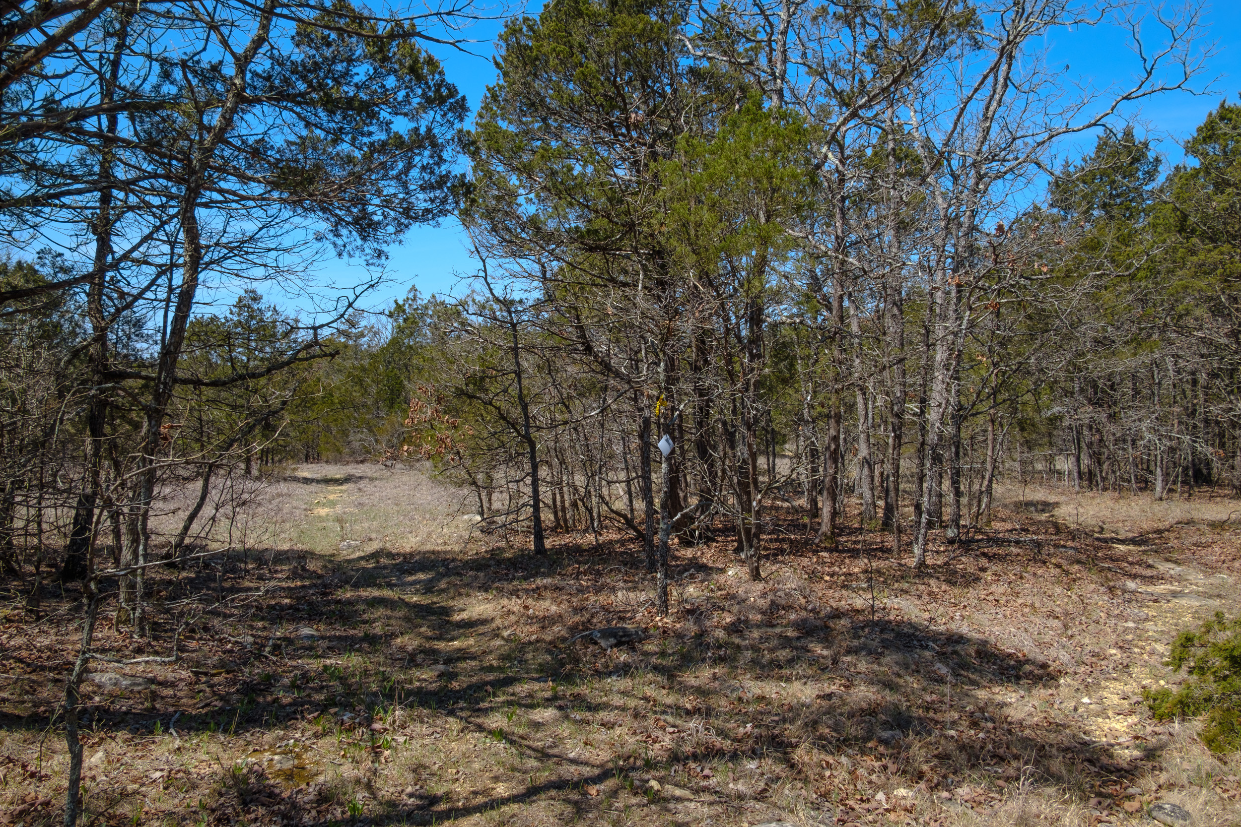
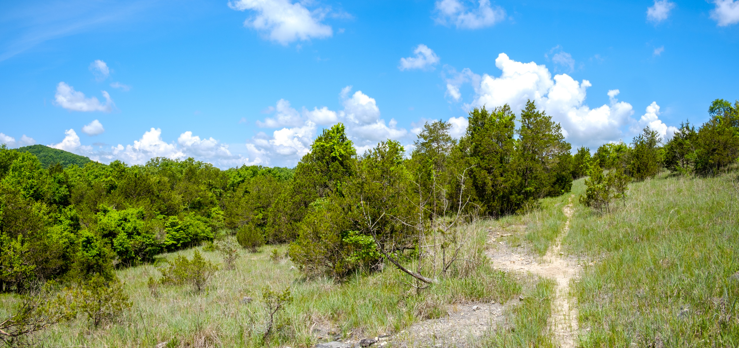
Anyway, after that unplanned digression — sometimes my posts develop a life of their own — the area abounds with knobs, ridges, and glades. Here are few more pictures from my trip.
 Brushy Creek is on the other side of that ridge. Copyright © 2018 Gary Allman, all rights reserved.
 Looking west across the hollow where Brushy Creek runs. Copyright © 2018 Gary Allman, all rights reserved.
 The end of the hike (the fire tower) is in sight.Copyright © 2018 Gary Allman, all rights reserved.
 Looking north east out of Hercules Glades.Copyright © 2018 Gary Allman, all rights reserved.
And just when you thought you were safe from British schoolboy humor…
Knob Lick
 The schoolboy in me couldn’t resist a picture at Knob Lick — March 23, 2012. Copyright © 2012 Gary Allman, all rights reserved.
 Knob Lick Lookout Tower, St Francois County, Missouri — March 23, 2012. Copyright © 2012 Gary Allman, all rights reserved.
 -
Pees Hollow Backpacking Trip

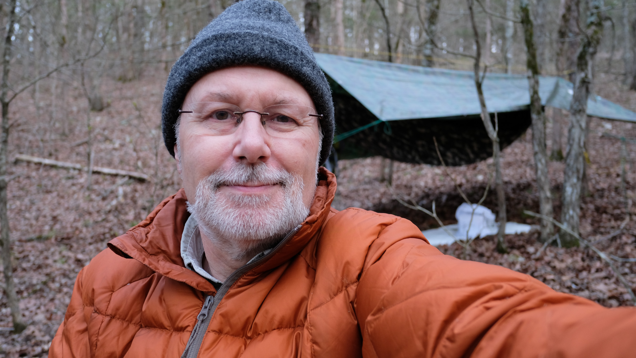
The temperature dropped very quickly so I put on my down jacket to keep warm. My new Hammock arrived last week and I couldn’t wait any longer to try it out. My week was looking pretty full, as I’m at a conference next week and Friday was booked with a customer, plus I had a meeting first thing Monday. I wasn’t sure I could justify squeezing something in, but the alternative was to let my nice new hammock sit in a gear-bin untested for at least a couple of weeks. I checked the weather and decided I could fit in a quick hike with one night in the wilderness if I left straight after the meeting on Monday.

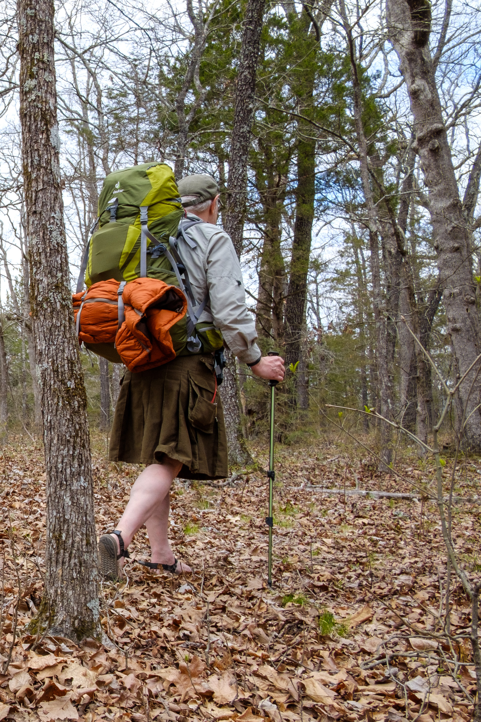
Gary, on his way along the Pees Hollow Trail. Besides spending a night in my new hammock, I thought it would be a chance to change the gear I’d been using. The forecast was for a colder night (35°F) than my last trip, and I wanted to try and lighten my pack.
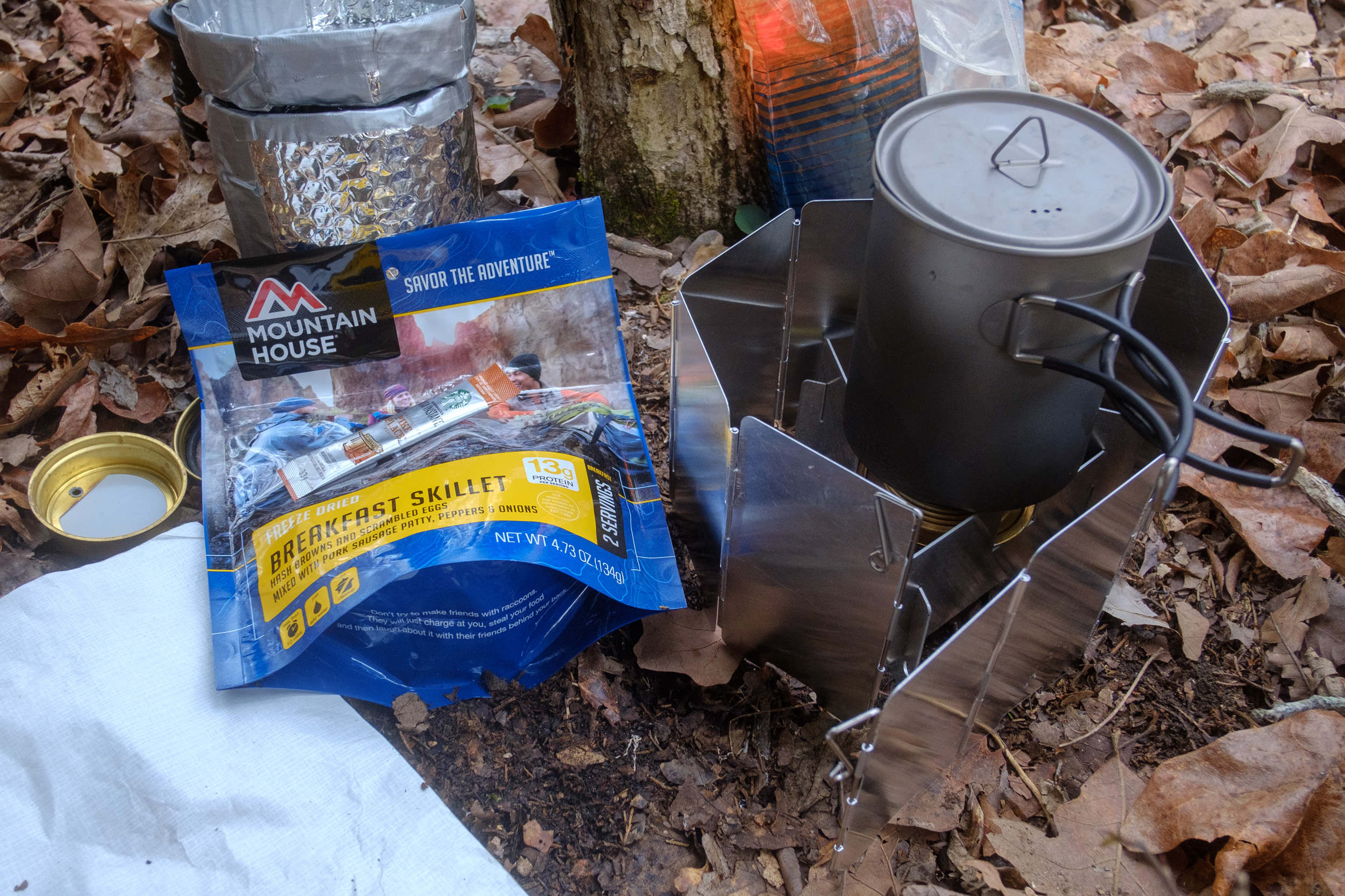
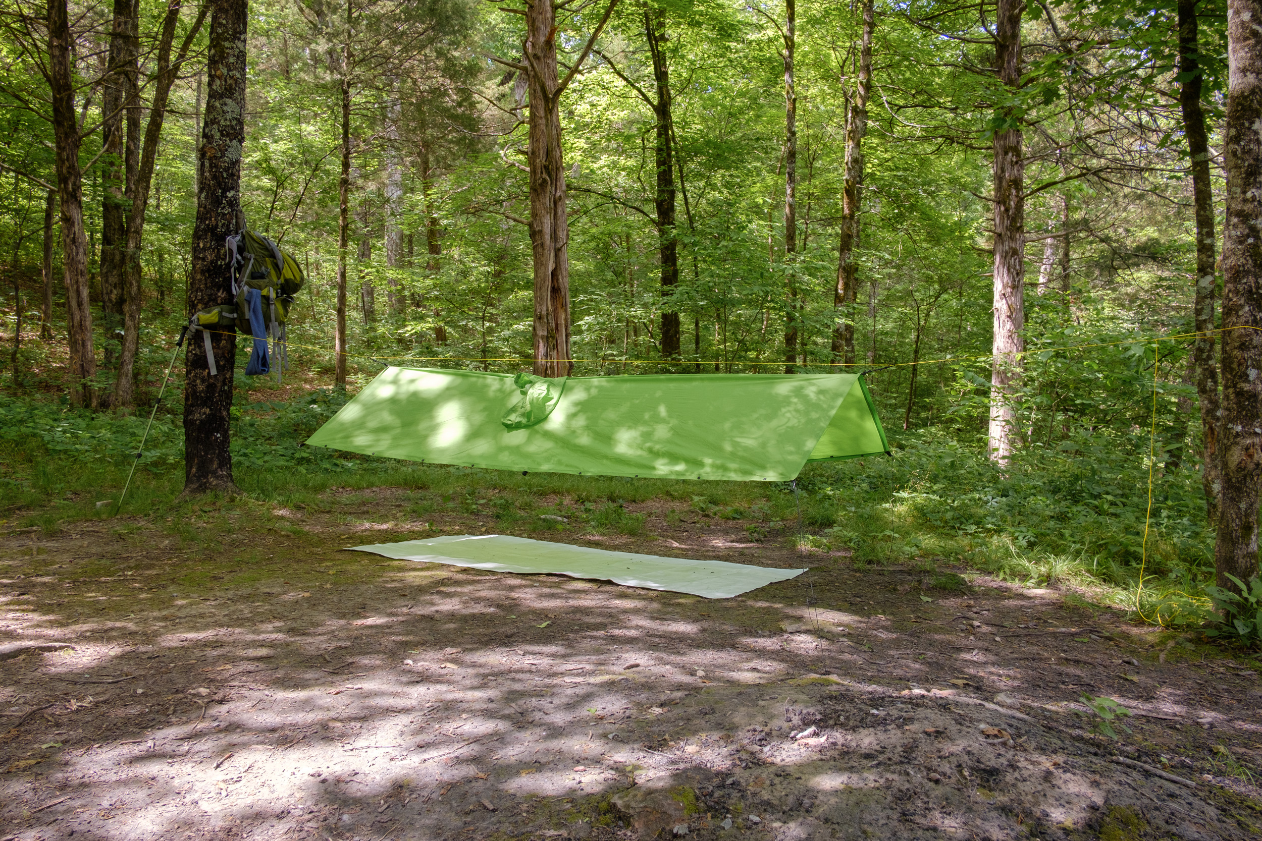
I took my 0° sleeping bag and the huge (77″x24″) but warm and comfy Neoair pad (Contrary to what I said when writing up my last trip, while bigger when in use, the Neoair packs smaller and is lighter than my Thermarest pad). Instead of my huaraches, I wanted to try out my hiking sandals (also from Xero Shoes), and with no rain in the forecast, I decided to give another, heavier, Utility Kilt, and my down jacket a try-out. I had two new Mountain House meals to try out; Beef Stroganoff and Breakfast Skillet. I fixed the ripped out grommet in the tarp (damaged on my last trip) by gluing in its place a plastic washer made out of an old page divider. I wanted to try out a larger groundsheet, but I couldn’t find the spare Tyvek. Oh well.
My Plan
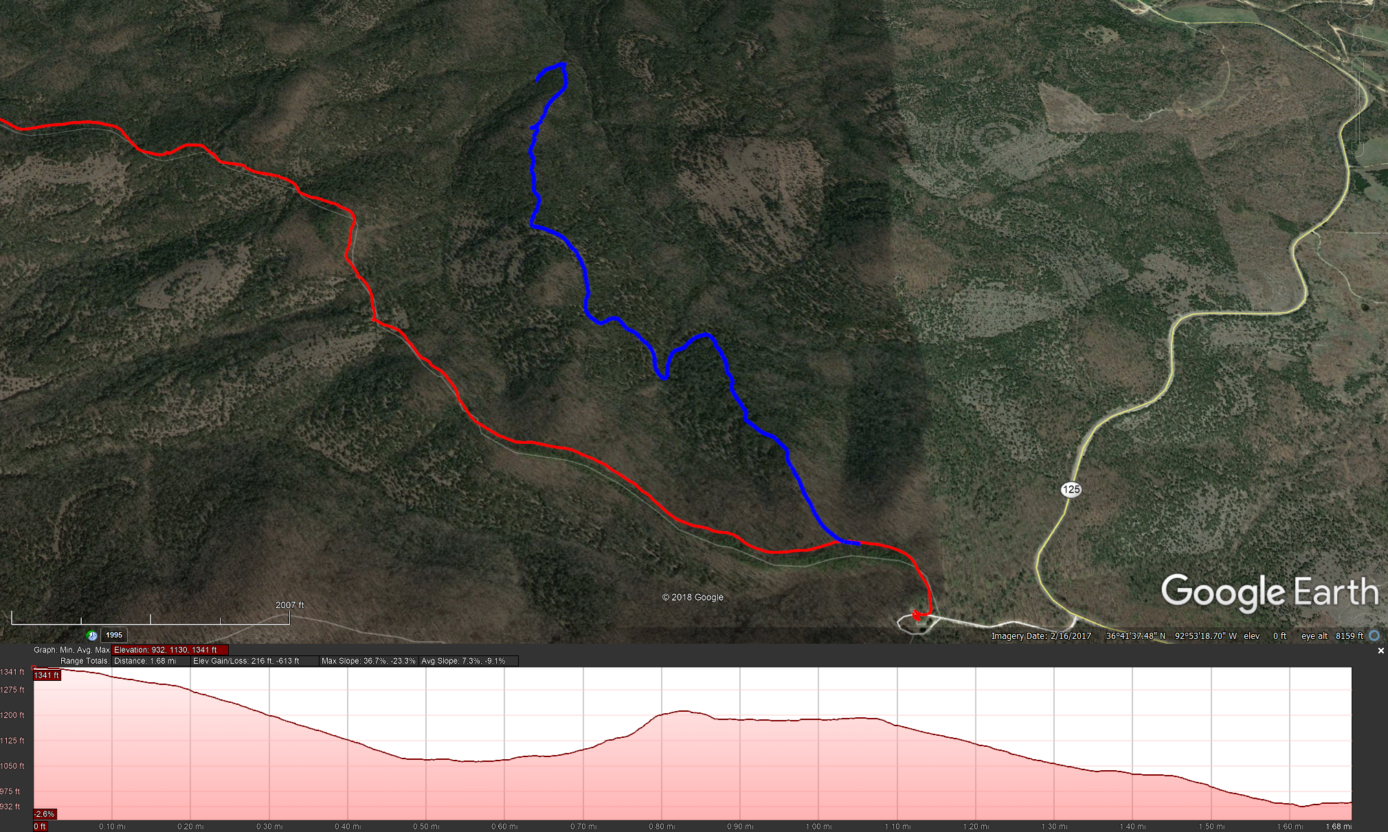
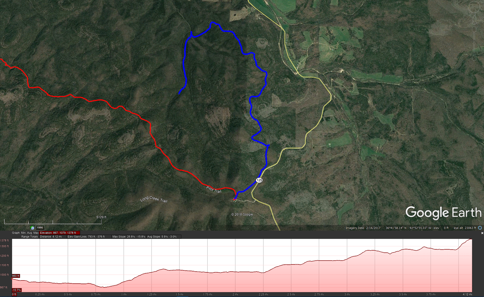
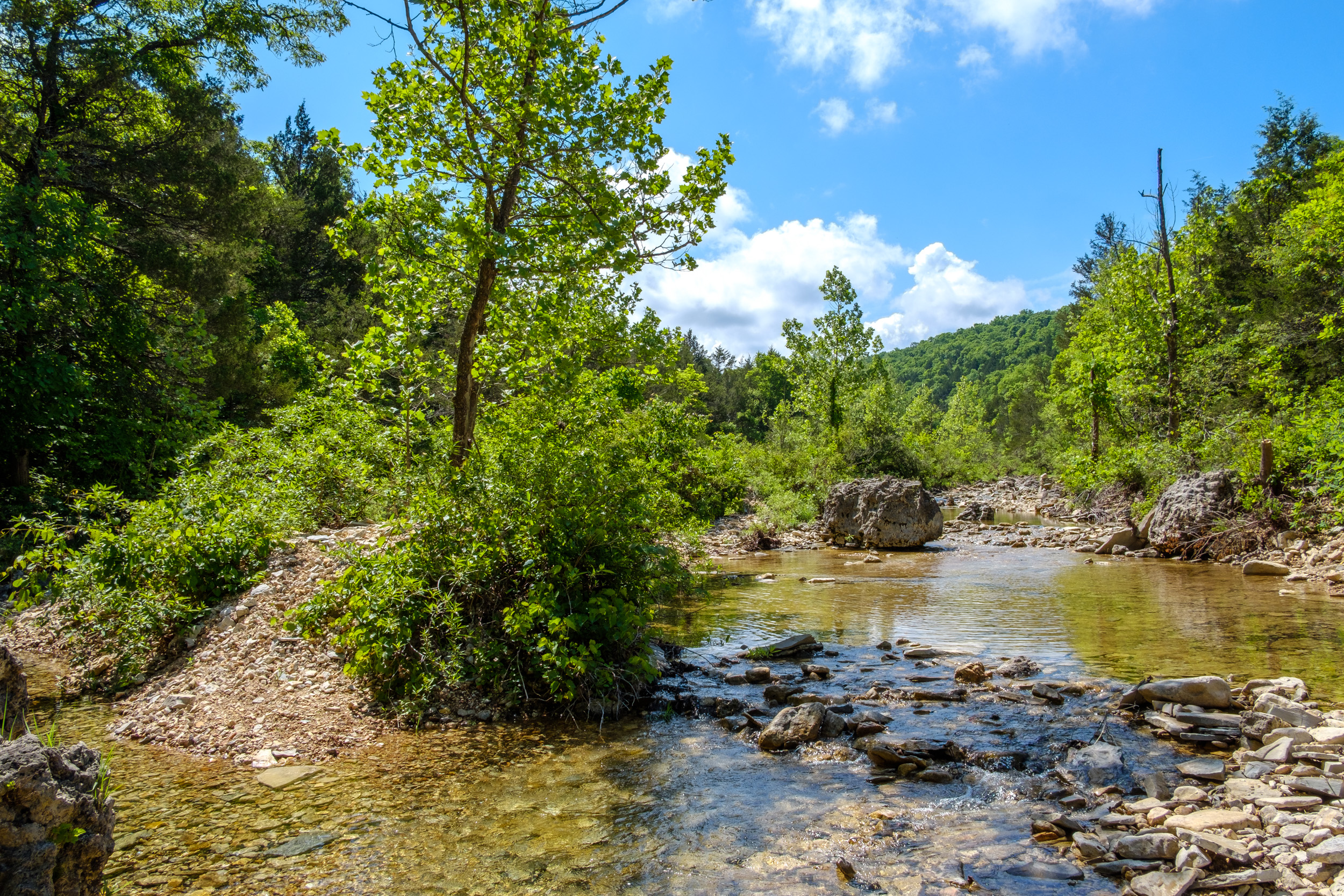
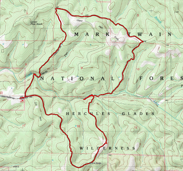
I decided to hike the Pees Hollow trail at Hercules Glades. It’s a six miles loop, which you can do in a day — if you don’t get lost. As I was starting later in the day, I thought I’d hike the trail clockwise, starting at the western (furthest ) end, and hike the mile and a half down to ‘The Cab’ — an old truck cab abandoned in the wilderness. There’s a fire ring by the cab, and I could spend the night there, or do some exploring and find a spot to camp along what we call ‘Cab Creek’. The next day, it would be a fairly easy, but, uphill hike for the remaining four or so miles of the trail to complete the loop.
Day One

Trail Marker at the western end of the Pees Hollow Trail. It was around eleven-thirty by the time I got back from my meeting, and while I’d gathered everything up ready, it all needed to be packed away. I didn’t weigh my fully packed rucksack, but it was 21lbs without water and my 4lb sleeping bag, so probably somewhere around 30lbs. I managed to get out the house and on the road by one p.m. (with one false start where I set off and then realized I’d forgotten to pack coffee).
By two O’clock I was on my way heading towards the Western end of the Pees Hollow Trail. The hike down the ridge to the glades was nice and easy.
I stopped and took lots of pictures all along the way, so, it took me a nice leisurely hour and a half to get to the cab.
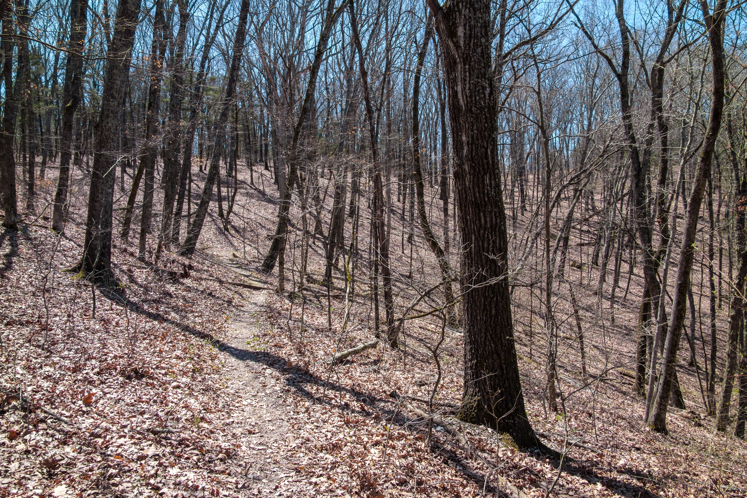
 At the top of the ridge at the begining of the Pees Hollow Trail. Copyright © 2018 Gary Allman, all rights reserved.
 Looking south(ish) along the trail after crossing the small creek. Copyright © 2018 Gary Allman, all rights reserved.
 Brushy Creek is on the other side of that ridge. Copyright © 2018 Gary Allman, all rights reserved.
 The trail was very clear here. Copyright © 2018 Gary Allman, all rights reserved.
 Stock pond set a short way back from the trail. Copyright © 2018 Gary Allman, all rights reserved.
 A tree down across the trail makes a good tripod for a selfie. Copyright © 2018 Gary Allman, all rights reserved.
Someone had left a good supply of firewood at the fire ring there, but I don’t like to camp right on the trail, so I decided to take a look along Cab Creek. After a short walk on what is a little-used side-trail, I found a nice little fire ring next to the creek, which was running and making watery noises as it dropped down a series of low stepped falls. I could have hung my hammock across the trail near the fire ring, but I decided to go a bit further on and then set up camp well back from the trail.

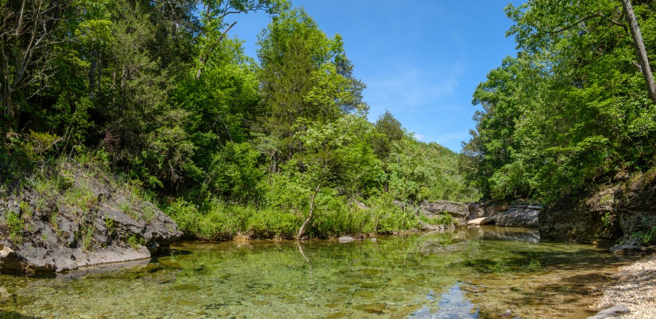
The truck cab, and the near-by fire ring.  Fire ring by ‘Cab Creek’ all set up ready for lighting. Copyright © 2018 Gary Allman, all rights reserved.
 ‘Cab Creek’.Copyright © 2018 Gary Allman, all rights reserved.
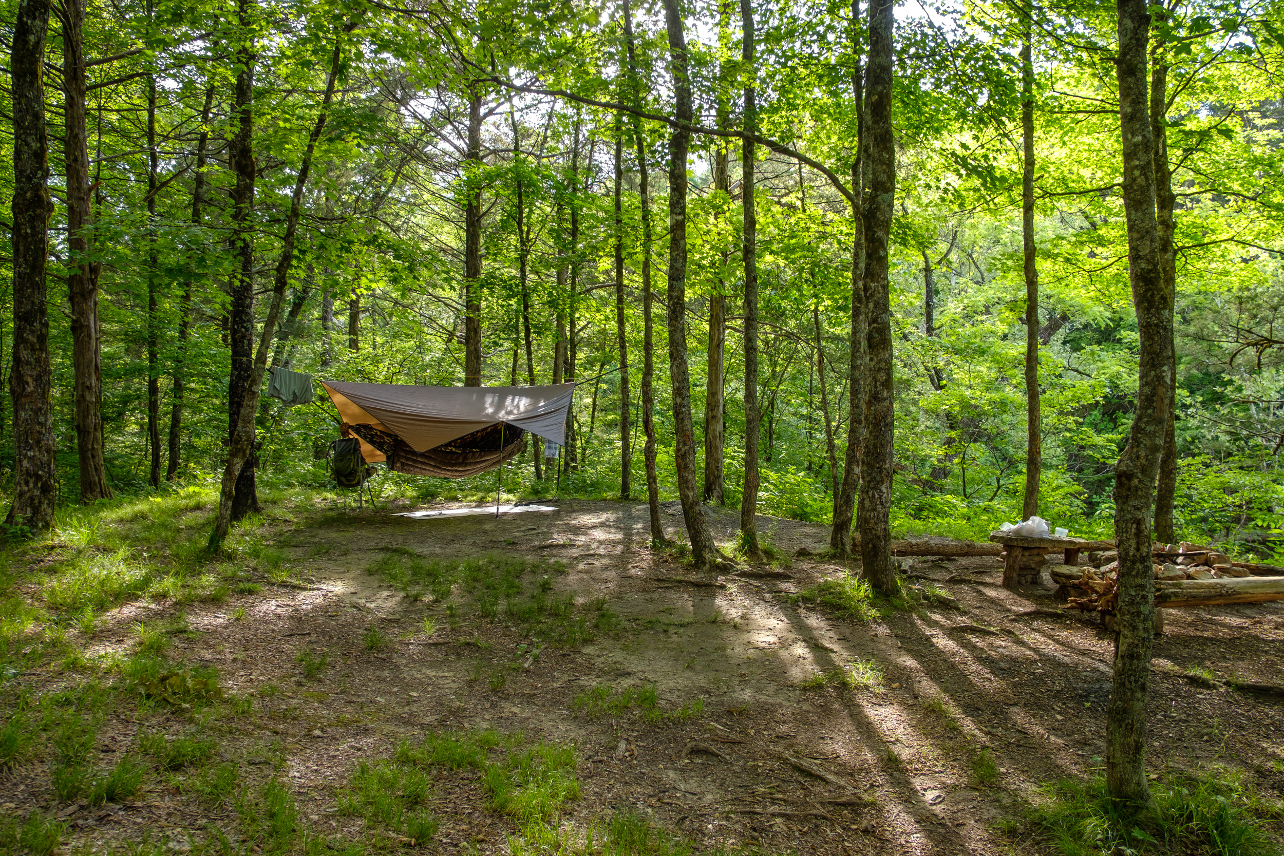
I took my time setting up the hammock — though it was very simple. The new (‘Beetle’) buckles are quick and easy to set up and the hammock set really well. The Neoair pad fitted the hammock okay — I thought it might be a bit of a tight fit.
Just like last time out, later in the afternoon the temperature dropped rapidly, and the last forecast I had seen was for 29°F overnight, a lot cooler than I was expecting. With that in mind, I decided I’d light a fire to pass the evening hours, and keep warm. With plenty of daylight in hand, I collected wood and prepared the fire, and left a nice big pile of prepared wood by the fire ring, enough for the next visitor to start a fire too.
 My new Chameleon hammock all ready for the night. Nice camo! Copyright © 2018 Gary Allman, all rights reserved.
 My new Chameleon hammock all ready for the night. Nice camo! Copyright © 2018 Gary Allman, all rights reserved.
 My new Chameleon hammock all ready for the night. Nice camo! Copyright © 2018 Gary Allman, all rights reserved.
 My new Chameleon hammock all ready for the night. Nice camo! Copyright © 2018 Gary Allman, all rights reserved.
 Relaxing while making dinner (if you can call heating some water ‘making dinner’). Copyright © 2018 Gary Allman, all rights reserved.
 Getting breakfast ready. Copyright © 2018 Gary Allman, all rights reserved.
 Relaxing while making dinner (if you can call heating some water ‘making dinner’). Copyright © 2018 Gary Allman, all rights reserved.
I had dinner sitting under the tarp. The Mountain House Beef Stroganoff was tasty enough. When I’d cleared up I set off to go and sit by the fire. The fire was fun, and the down jacket did an excellent job of keeping my back warm, I was nice and cozy. I also discovered a great advantage of a kilt over shorts. Sitting down, you can drape the kilt over your legs to keep them warm.

It didn’t take long to get a decent fire going. 
Day One (You’ll note I forgot to turn on the GPS until I’d already gone about 1/4 mile). Day Two
 Morning view from my hammock. Copyright © 2018 Gary Allman, all rights reserved.
 Morning view from my hammock. Copyright © 2018 Gary Allman, all rights reserved.
My new hammock is great. I fitted the bug net, which helped keep a bit of warmth in. I’d wrapped my pad in my sleeping bag liner so it was more comfortable to sleep on and used the sleeping bag as a quilt. My nose got chilly, but that was about it. I was very comfortable and warm. Too warm, as at one point and I got rid of my base layer. I’m looking forward to trying out the hammock with an underquilt. While sitting around I had an idea, that, if I can get it to work, might extend the temperature range of the underquilt. I want to try lining it with my 40° quilt.
There was one problem though, I woke up feeling a bit cool underneath. I later realized I’d made a rookie mistake. I inflated the pad when it was warm, and forgot to top it up when it got cold, so the pad was a bit deflated and a lot less effective than it should have been by morning.
Making coffee got delayed when I couldn’t find the coffee. I knew I had it, and I thought I’d put it on one side for the morning. After turning everything out, I went and retrieved the bear bag, and sure enough, I’d packed it away up a tree. Oh well, I needed my breakfast from the bag anyway.
Breakfast, the Mountain House Breakfast Skillet was very good, It is an instant favorite of the dehydrated Mountain House meals I’ve had so far.

Getting breakfast ready. I spent a leisurely morning taking pictures and packing away. I loved how easily the hammock can be pushed into its stuff sack. It took seconds. Disconnecting the hammock from the suspension I discovered another careless/rookie mistake. At the foot end, I’d got the beetle buckle upside down, which meant the buckle wasn’t being held closed. I was lucky I didn’t get dumped on the floor in the middle of the night!
 Moss on a tree. Copyright © 2018 Gary Allman, all rights reserved.
 Morning Sunlight. Copyright © 2018 Gary Allman, all rights reserved.
 DutchWare Gear Chameleon hammock. When I first saw this picture I thought I’d set the hammock up wrong. Then I realized it’s just the weight of the backpack pulling the near end down. Copyright © 2018 Gary Allman, all rights reserved.
 Beetle Buckles the correct way up … Copyright © 2018 Gary Allman, all rights reserved.
 Cab and fire ring. Copyright © 2018 Gary Allman, all rights reserved.
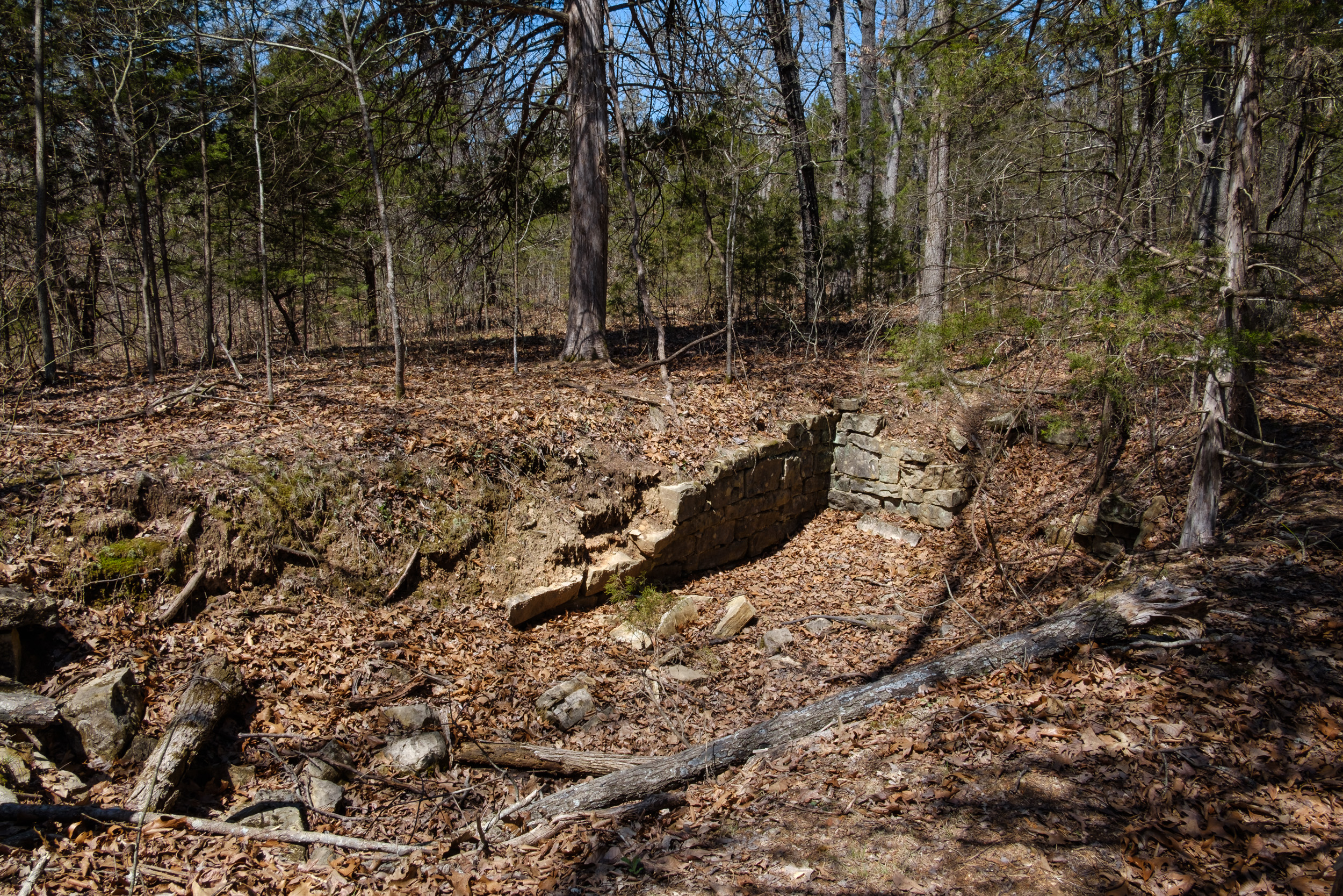
On the way back I planned to try and find the remains of an old Ozarks log cabin we’d discovered on a previous trip. I wanted to take some better pictures and geotag it. It was somewhere just before Brushy Creek (a very apt name by the way, it is very brushy!) Half an hour after setting out in the morning, I was wandering off trail looking for the cabin. I was lucky and found it almost immediately. The cabin must have had a great view of Brushy Creek when all the intervening brush was cleared.
 Remains of an old log cabin. Copyright © 2018 Gary Allman, all rights reserved.
 Remains of an old log cabin.
 Remains of an old log cabin. Copyright © 2018 Gary Allman, all rights reserved.
 Remains of an old log cabin. Copyright © 2018 Gary Allman, all rights reserved.
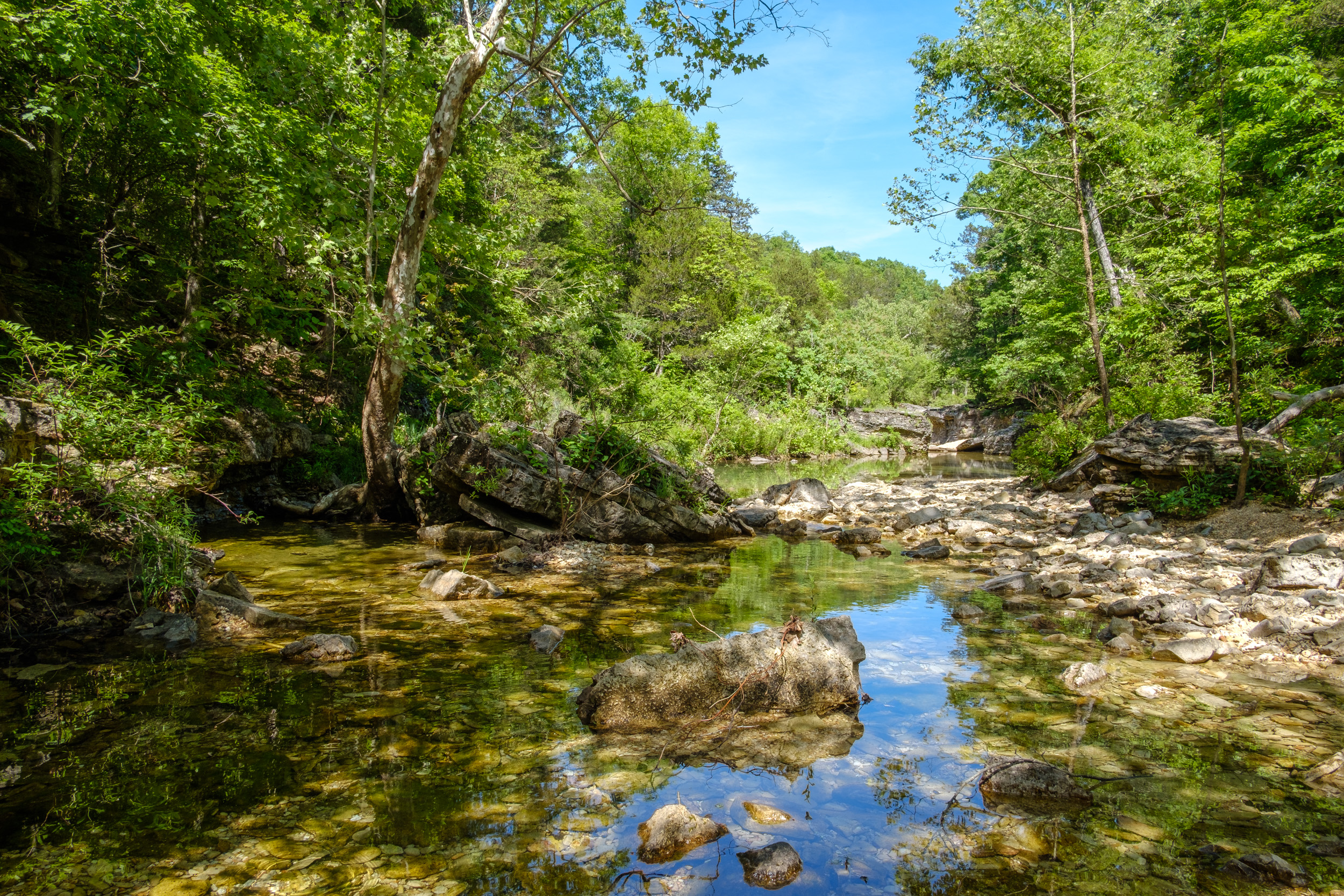
Pictures taken, I hiked the short distance to Brushy Creek.

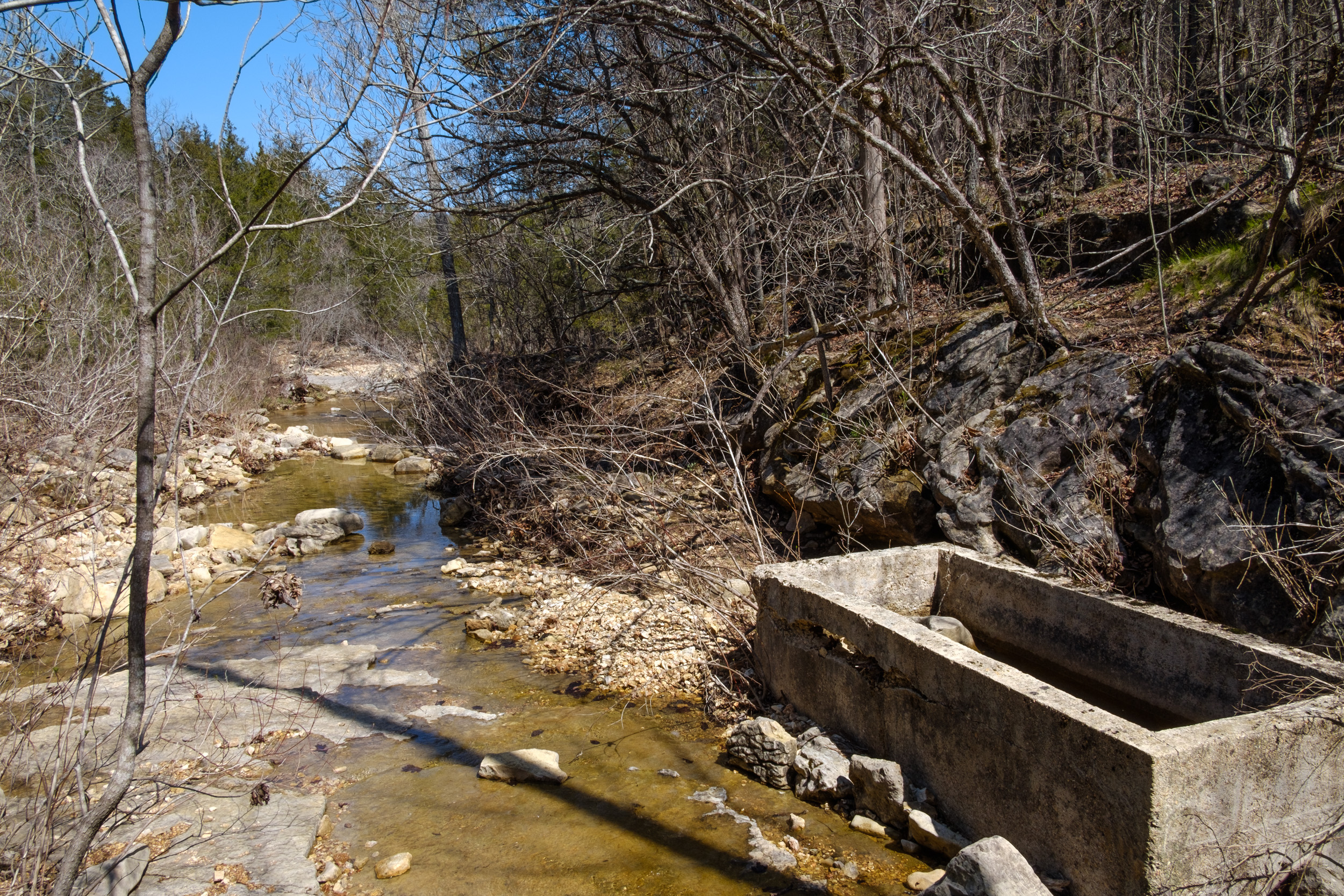
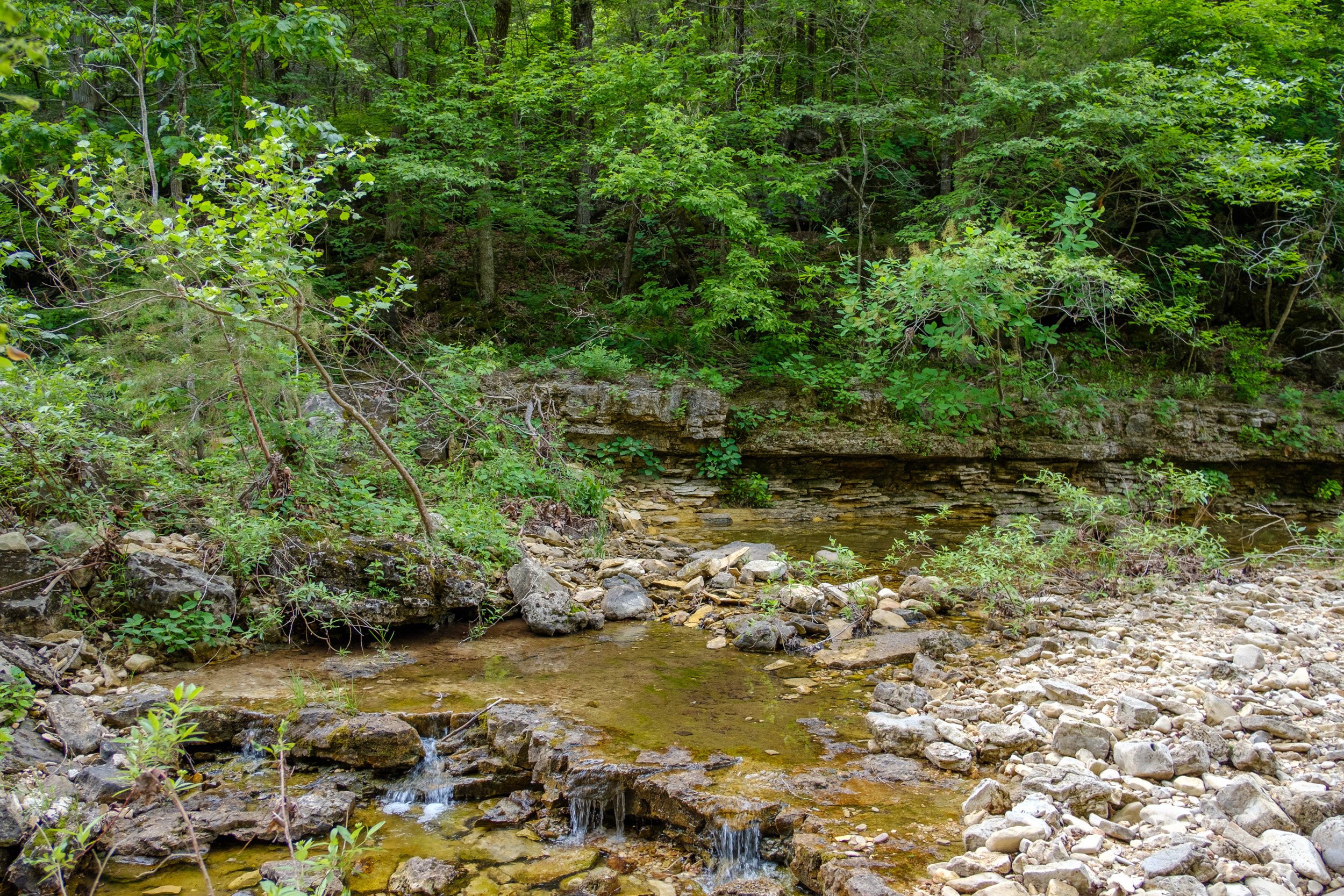
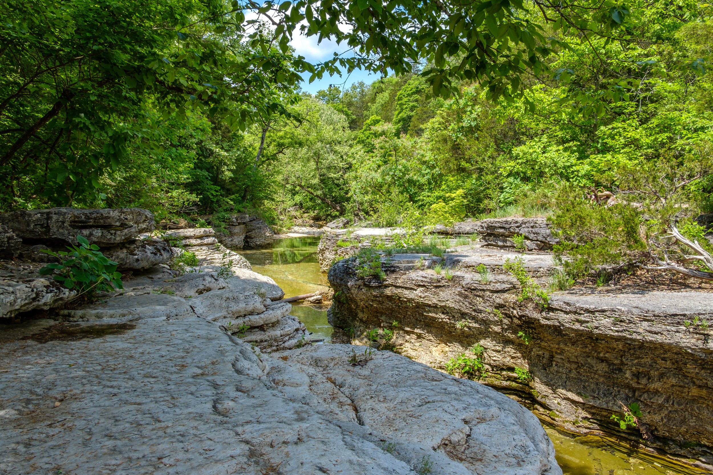
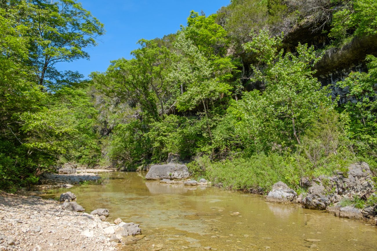
Looking up Brushy Creek. Looking down the creek I spotted a spring box, and went off to explore. Once there, I noticed a second spring box. It looked set up to catch drips from a seep in the creek’s bank. I explored further down the creek and there were some excellent-looking rock steps where Brushy Creek and ‘Cab Creek’ meet. I spent a while taking pictures and looking around. This would be another nice spot for wild camping.

Spring box in Brushy Creek. 
The confluence of Brushy Creek (left) and ‘Cab Creek’ (right).  Spring box in Brushy Creek. Copyright © 2018 Gary Allman, all rights reserved.
 Brushy Creek (Looking south). Copyright © 2018 Gary Allman, all rights reserved.
 Looking East down Brushy Creek. Copyright © 2018 Gary Allman, all rights reserved.
 Rocky steps at the confluence of Bushy Creek (left) and ‘Cab Creek’ (right). Copyright © 2018 Gary Allman, all rights reserved.
 Looking upstream towards Brushy Creek and ‘Cab Creek’. Copyright © 2018 Gary Allman, all rights reserved.
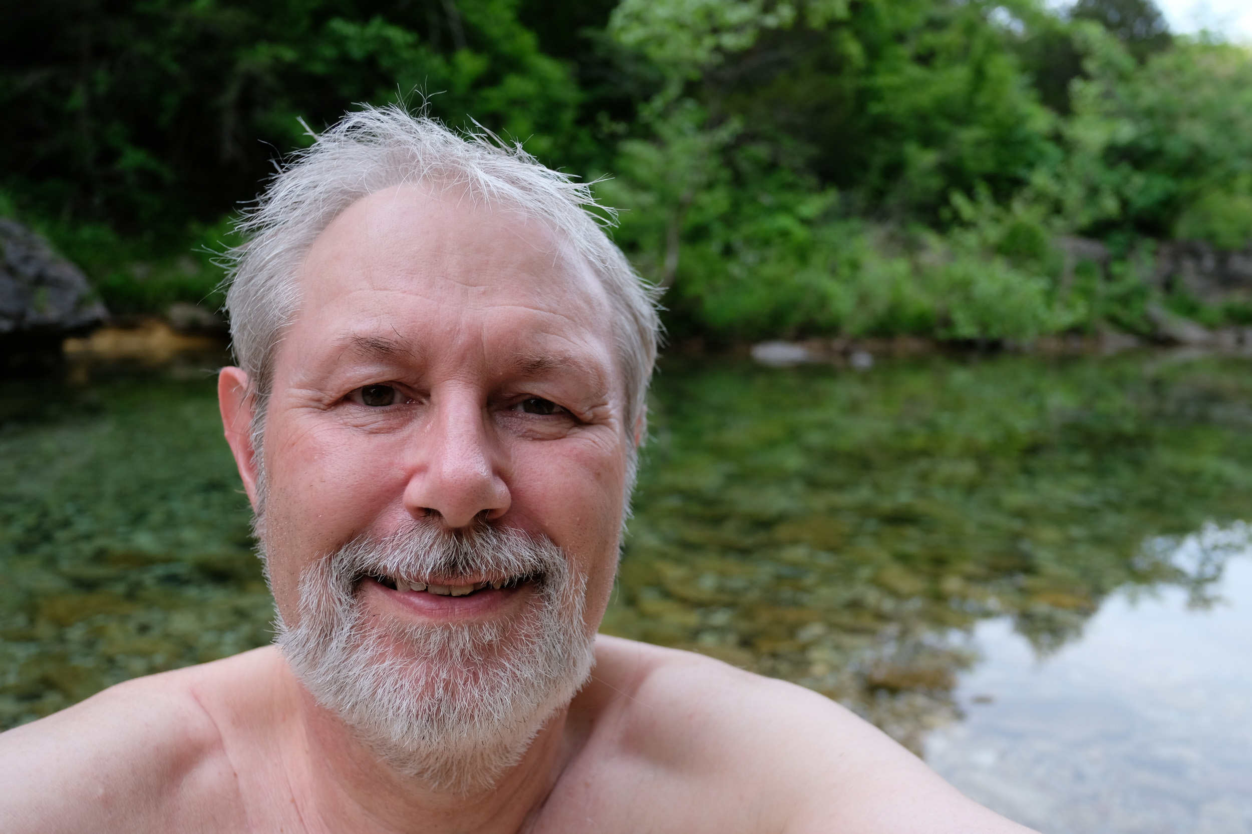
 Gary modestly posing at the confluence of Brushy Creek and ‘Cab Creek’. Copyright © 2018 Gary Allman, all rights reserved.
 Gary modestly posing at the confluence of Brushy Creek and ‘Cab Creek’. Copyright © 2018 Gary Allman, all rights reserved.
Pictures taken and exploring complete, I hiked straight up the creek bed back to the trail (an advantage of wearing sandals or huaraches). Where the trail crosses the creek is well marked, they were the first trail markers I’d seen on my hike so far. Now all I had to do was complete the long climb from the Brushy Creek crossing back to the trailhead at the fire tower. En route I hoped to check on a few old landmarks we have previously geotagged.
The climb up from Brushy Creek along the old farm track got my heart and sweat going! Once out of the trees, I came to a spot where another ‘unofficial’ side trail joined from the north. I realized this was most likely where Ginger got lured off the trail when she tried to hike the Pees Hollow Trail counterclockwise a while back. I stopped to take a picture to show Ginger and I saw one of the most badly placed trail markers I’ve seen so far. Instead of being to the left of the Pees Hollow Trail, it was slap-bang in the middle of the two trails. Nothing indicates that you should follow the trail to the left. I wish I’d had a sharpie with me to draw an arrow on the trail marker.

Very ambiguous trail marker — Take the left trail. As I hoped, I found the landmarks I was looking for; the farm track gate posts, the Dodge truck hood, and the remains of an old building.

Old gateposts, on the old farm trail. 
Old cellar, store, or what? Dodge truck hood.  Looking west across the hollow where Brushy Creek runs. Copyright © 2018 Gary Allman, all rights reserved.
 Trail junction. Make sure you follow the trails that have a marker, or you’ll end up on the glades that run between ‘Cab Creek’ and Brushy Creek. Copyright © 2018 Gary Allman, all rights reserved.
 Trail junction. Make sure you follow the trails that have a marker, or you’ll end up on the glades that run between ‘Cab Creek’ and Brushy Creek.
 Glades and Knobs. Copyright © 2018 Gary Allman, all rights reserved. Looking north east out of Hercules Glades.Copyright © 2018 Gary Allman, all rights reserved. The end of the hike (the fire tower) is in sight.Copyright © 2018 Gary Allman, all rights reserved.
Very near the end of the trail. Hwy 125 is at the top of the slope to the left. I made one new discovery very near the end of the hike. I saw a spring and spring box, at what has to be one of the sources of the creek that Joins ‘Cab Creek’. It must produce quite a lot of water, as It was a couple of hundred yards off of the trail, and the sound of running water was very clear. I didn’t bushwhack over for a closer look, because I didn’t want to give away any of my hard earned elevation gains. I’ll have to explore it another day.
I’d started hiking at around 10:15 a.m. and I arrived back at the van at 1:30 p.m.

Day Two Final Thoughts
What worked:
- My new DutchWare Gear Chameleon Hammock. It is very well made and the bug net kept in a surprising amount of warmth. Having the ridgeline inside the bug net is very convenient for hanging gear on, making things much more organized.
- The Deuter backpack was again comfortable and took everything easily with plenty of room to spare. And that included the huge 0° sleeping bag.
- Utility Kilt. I don’t know if it was the thicker material that made wearing a kilt comfortable in the lower temperatures or not, but it was fine. I was comfortable in it from 34°F to 60°F. I think this might well become my regular hiking attire. I’ll just have to get used to meeting people on the trail while wearing one.
- Buff. I’ve carried one of these for ages, but not used it. I was surprised by how good it was. I turned it into a beanie and wore it instead of my thick Thinsulate hat while I sat around the fire. It was warm and comfortable. I shall be experimenting with it some more. It has the advantage of being very light and compressing very small.
- Hiking Sandals. These were great and I appreciated the extra depth of sole making some of the more stony and sharp parts of the trail easier to hike.
- Once again the Trangia stove and the rest of my cooking system worked great. Right now I see no reason to change anything.
It all went very well for a quick first test of a new hammock. I’m pleased with the hammock and looking forward to getting the underquilt so that I don’t have to carry and deal with an inflatable pad. Lugging around the 12′ x 10′ polypropylene tarp is a bit of a chore, so I cannot wait for the delivery of my lightweight tarp.
This time I remembered to take powdered milk (not whey powder), and I mixed it into a nice hot cup of cocoa which I drank while sitting by the campfire.
I hiked a tad short of six miles with a total elevation gain (and loss) of 1,000′. Now to plan another trip for after next week’s conference.
-
That’s One Way to Get Ginger to Laugh

This is the reaction you get when you crouch down to take a picture while wearing a kilt. -
‘Cab Creek’

Looking west, ‘Cab Creek’ has become a tangled jungle.
-
Gary and the Truck Cab on the Pees Hollow Trail

Gary and the Truck Cab on the Pees Hollow Trail. Copyright © 2018 Ginger Allman, all rights reserved. 
Gary on the Hercules Glades, Tower Trail (March 2018). Copyright © 2018 Gary Allman, all rights reserved. I wanted a better picture of me by the cab to replace the one we took here on February 17, 2016.
Am I mistaken or do I look a little bit less chubby than I was back in March?
2016

Gary on the Pees Hollow Trail (February 2016). Copyright © 2016 Ginger Allman, all rights reserved. -
Looking Across the Glades – Pees Hollow Trail

Looking Across the Glades – Pees Hollow Trail -
Pees Hollow, Counter-Clockwise For a Change

Near the end of the hike. Setting up the camera, I didn’t notice that I’d be standing in full sun while Ginger was in the shade. The last time Ginger and I went backpacking together was in August 2017. Family events, work, and lethargy have gotten in the way. Ginger’s only other recent backpacking trip was backpacking with our eldest daughter (Piney Creek) in 2016. This year I’ve made an effort to go solo backpacking; but thus far we’ve not got out together. Last Sunday/Monday (May 6 & 7) we remedied that.
For this trip, Ginger chose the trail — Hercules Glades Wilderness, Pees Hollow trail, and I chose the route — Counter-clockwise. I’ve never hiked this trail in that direction, and it is arguably the most difficult route to follow. Ginger attempted the trail counter-clockwise last year but got lured off course by a heavily used unofficial trail.
As I’ve only just hiked Pees Hollow, I didn’t take a lot of pictures, though you do get a different view of things ‘going backwards’. For example, the road is much more visible when you are heading north along the trail, I hadn’t noticed that going south. When I was here four weeks ago there were no leaves on the trees. This time I was surprised by the rich green of the forest canopy.

I wanted a picture to show the greening of the trees. It’s a huge change since I was here four weeks ago. 
Looking north-west, the trees were spectacular. When we got to the misplaced trail marker I found on my last trip, I realized I’d forgotten to bring a sharpie with me, so I scratched an arrow into it, hopefully that will be visible enough to help people to take the correct trail.

One glade was carpeted with these tiny white flowers. The storm clouds to the north were real. We had rain, thunder and lightning within the hour. Rain and thunder were predicted for 2:00 p.m. onwards, and right on time the sky darkened, and we had a thunderstorm. We decided to hike through the rain, only pausing to put on pack covers. With rain in the forecast, I had decided to wear a lightweight utility kilt which dries very quickly — unlike the heavy cotton denim kilts. It stopped raining by the time we had arrived at the Cab, and we went off-trail along ‘Cab Creek’ and set up camp at the fire ring I’d found and used four weeks earlier. The small supply of wood I’d left was still stacked to one side. By the time the tent and hammock were up we’d both dried off.

We camped at a spot I’d found on my last visit (April 9&10). This was Ginger’s first time out with my small solo tent. It’s cozy but functional. The fire ring is quite close to the creek, and we camped closer than the 100′ restriction on camping near to water sources. However, the hollow isn’t very wide here, the hill starts to climb up immediately behind where we camped. Where we set up camp was clear of brush, and a lot less damaging place to camp than up the hill in the brush.

Standard feet in front of the fire shot, only this time with added headlamp lighting. The night was surprisingly cold and quite damp. We were both warm enough in our respective abodes. Ginger in our Sierra Designs Lighting XT 1, one person tent, and me in my hammock. I woke at 6:00 a.m. (as I do every day — sigh), fortunately, I went back to sleep until 8:00 a.m. We had coffee, breakfast, took some pictures, and packed up camp. The hike back from here is uphill a lot of the way. It’s only a couple of miles but you climb nearly 1,000 feet.

This is the reaction you get when you crouch down to take a picture while wearing a kilt.  Ginger gives me ‘that look’ as I interrupt her breakfast to take pictures. Copyright © 2018 Gary Allman, all rights reserved.
 Watching the creek. Copyright © 2018 Gary Allman, all rights reserved.
 I am going to be sooo glad to retire this tarp. I’m told my new tarp will be sent out some time around May 16. Copyright © 2018 Gary Allman, all rights reserved.
Looking west. ‘Cab Creek’ has become a tangled jungle. 
The trees and undergrowth are really filling in. The campsite is a bit close to the creek, but we are careful to not leave any mess or sign that we’ve been there – apart from some wood we collected and didn’t use. 
I wanted a better picture to replace the one we took here on February 17, 2016. Looking Across the Glades – Pees Hollow Trail The hike out took us a little under two hours. At the trailhead, we met the Wilderness Ranger, who was replenishing the sign-up sheets and trail maps. We had a great chat about the various wildernesses she patrols, and she gave us a couple of excellent ideas, which we’ll be following up on later in the year. Kristyn looks after all of the trails in the Cassville and Ava area, that’s a lot of trails, and what a great job!
During our conversation, we learned the importance of signing in when you visit a wilderness. Funding is directly related to the number of visitors, which is determined from the sign-in sheets. So, please make sure you sign in.
She confirmed my hunch that all the new trail signs and marks had been put in place as a direct result of search and rescue operations that took place recently. Wilderness trails are not supposed to be marked, and the trails are not maintained. Trees fall, trails shift, and creeks can be difficult to cross after rain. Despite the warnings, maps, and information at the trailhead, people still venture out totally unprepared, cannot read maps, and rely on non-existent cell phone coverage. Signs and trail markers are a lot cheaper than search and rescue operations.
Because of a road closure (Hwy 125 is closed at Swan Creek), we had a much longer drive home.
Oops
Update: The problem with proofing your own writing is that sometimes the obvious errors go unnoticed. Originally I wrote that we hiked the loop clockwise. No. We hiked it counter-clockwise, taking the eastern half of the loop first. I also got our last backpacking outing wrong, forgetting we did a one-nighter to watch the eclipse in 2017. I’ve made all the necessary corrections. (I hope!)
This is an edited and abridged version of a post that first appeared on Ozarks Walkabout.
-
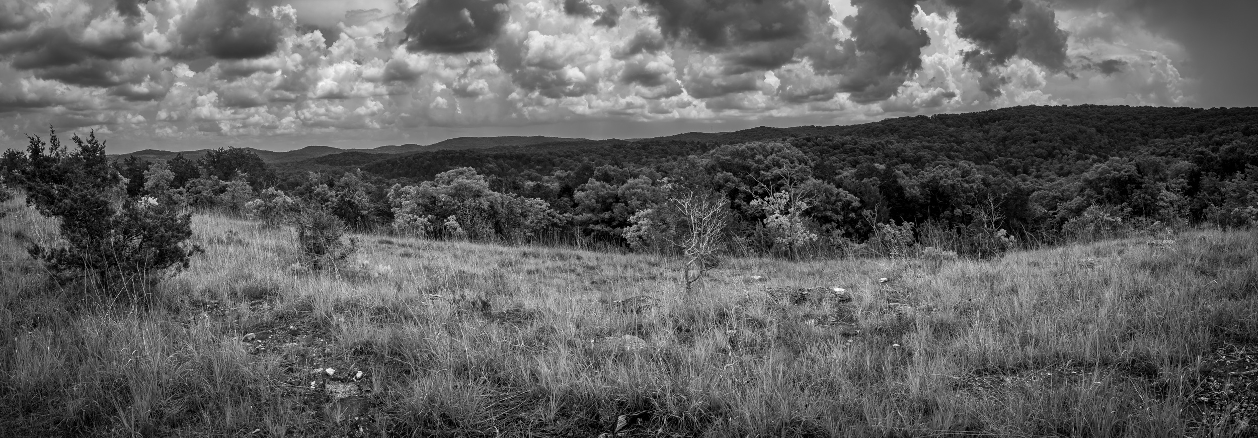
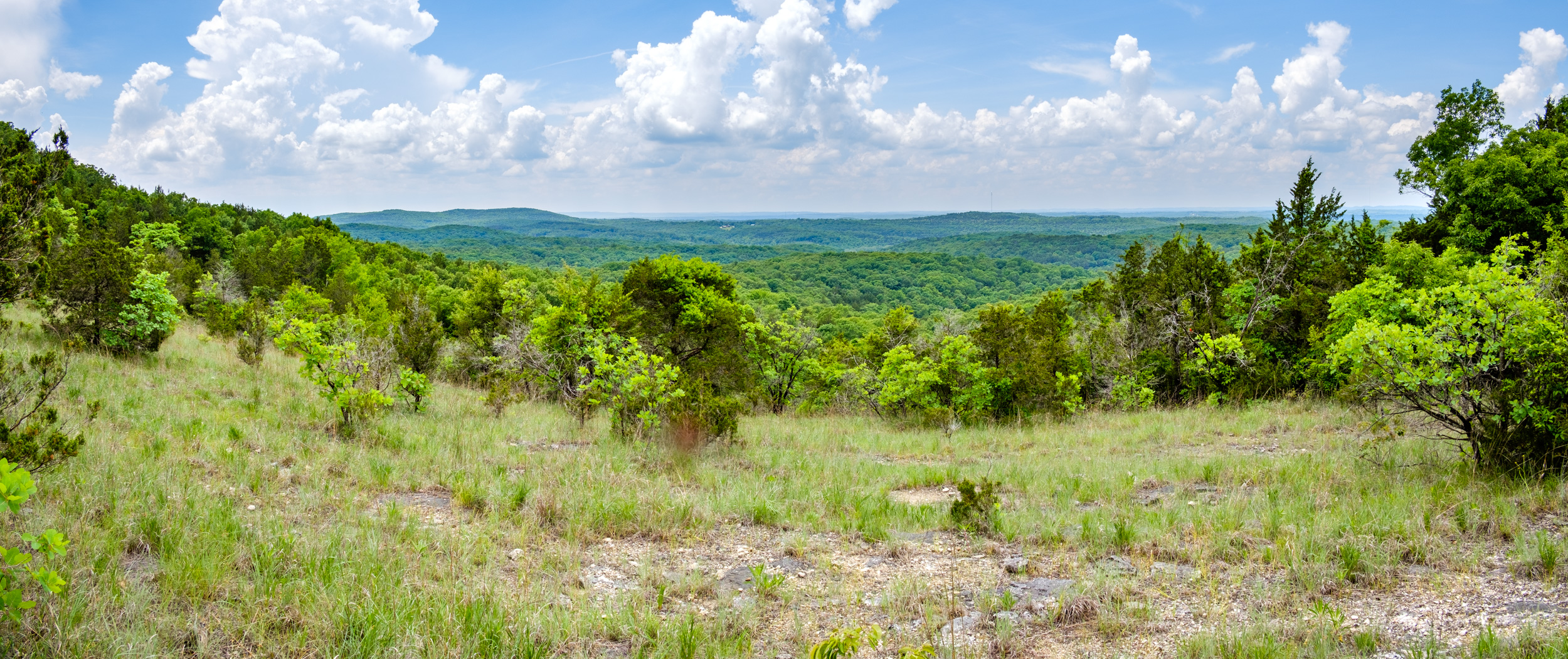
Coy Bald Trail Panorama

View to the South – Coy Bald Trail. Copyright © 2018 Gary Allman, all rights reserved. 
Looking East from The Glades – Coy Bald Trail. Copyright © 2018 Gary Allman, all rights reserved. Black and white version of a couple of the panoramas I took, each is 4-5 frames hand-held. I’m not sure if this says more about the stitching technology or my keeping the camera steady.
-
Another Trip To Hercules Glades

All Mod-Cons including a Flintstone-esque table at the campsite above The Falls on Long Creek. . Copyright © 2018 Gary Allman, all rights reserved. When I found out my new tarp and under quilt were going to be arriving on Monday (May 21), I couldn’t resist trying to work out ways to get out and field test them. The long-range forecast for the beginning of the week looked promising. There was also a good chance of thunderstorms according to the predictions, so I decided now was going to be a good time to get the wet weather gear (a Sea to Summit Nylon Tarp Poncho) I’d been promising myself for several months. I also ordered an inexpensive camera clamp for my mini tripod.
Checking online, both could be with me Monday, so I just had to work out how to get myself out with my new gear.
The Plan
First off, to be able to spend a couple of days hiking, I needed to work all weekend. Unfortunately, that was not as successful as I hoped, which means I’ll also be working the following long weekend too (sigh).
Ginger was very busy (she has a new ebook on the way and is obviously much more conscientious than I am) so it will be another solo hike. I didn’t fancy fighting with a massive tangle of snakey undergrowth, so Piney Creek was not an option. I wanted to get a few more miles under my belt on this trip, so I decided to stick with Hercules Glades, starting at Coy Bald, heading north to the Pilots, and then taking the Tower Trail East, before heading south down the Middle Trail to the Falls. I’d spend the night nearby and hike back via the Coy Bald Trail. Ten miles and a few reasonable climbs. The only problems I could think of were weather-based. A sudden storm (and we’ve been having a lot of them) could make the ford on the approach to the Coy Bald Trailhead impassable, and if Long Creek was running high I might have problems crossing it. So my backup plan was to either go in via the Blair Ridge Trailhead or (more likely) the further away Tower Trailhead. From either, I should still be able to fit in a nice 10-mile hike.
I must admit I felt guilty about bunking off mid-week (as it were), but I’m 80 hours in credit with my part-time gig, and while I have a couple of other urgent projects — not to mention the ever stagnating (whilst growing) ‘honey-do’ list — I convinced myself that I would work a lot better with some time out in the wilderness, and it’d stop thoughts of gear testing from distracting me from my work.
The only thing that didn’t arrive on Monday was the tripod camera clamp. It was showing as delivered on the USPS tracking system, but it hadn’t been delivered. We have a long and tedious history of our mail being misdelivered, so I wasn’t that surprised. Annoyed, but not surprised.
Day One

Arca Compatible Clamp Mounted on a Ultra-Pod mini Tripod. Copyright © 2018 Gary Allman, all rights reserved. My pack weighed in at 20lbs with food, but sans water. I need to check out some of the extras I’m carrying and cut it down again – I ought to be able to get it down to 18lbs. The weight of the Poncho shown on Amazon is an annoyingly inaccurate 3.52oz. It’s 14.6oz! which is still a lot less than my other waterproofs (27.5oz), but I was hoping it was going to be very lightweight.
Shortly after 9:00 a.m. I was sitting in the van mentally checking off what I’d packed prior to leaving. A pickup pulled into the drive, and the driver emerged clutching a padded envelope. He told me it had been delivered to his house the previous afternoon. How auspicious! Great timing, my tripod camera clamp had arrived. I was most grateful and took a couple of minutes to open the package and check it out before setting out.
An hour or so later I was crossing the ford on Cross Timbers road. The creek was running fast but not deep. Good news, I was not going to have any problems with creek crossings unless there was some heavy rain and flash floods.
There were a couple of vehicles at the Trailhead, but the occupants had obviously not signed in, so I had no idea where they might be in the wilderness, or how long they were going to be there. By 10:30 a.m. I had signed in, and was off down the trail. One problem with being the first person along the trail is having to deal with all the spider webs spread across the trail to capture unwary hikers. The good news is, that it also means that there’s no one ahead of you on the trail. Or does it?
 Trail Choices – Down the hill on the Long Creek Trail to the left, and the Coy Bald Trail on the right. Copyright © 2018 Gary Allman, all rights reserved.
 You know you are the first person down the trail when … you keep on walking into spider webs. Copyright © 2018 Gary Allman, all rights reserved.
Getting near Long Creek I could hear voices, and there were several people and a couple (or more, I didn’t look too closely) tents at the spot at the bottom of the hill, to the left of the trail. That explained the vehicles at the Trailhead. I said my “Good morning … ” and kept going. I dropped off the trail to go visit the bluffs that are by Long Creek just here, and I was rather put out by seeing dozens of small (and large) cairns littering — and I use the word advisedly — the place. They made it impossible to get some of the pictures I wanted, and I had to frame some pictures awkwardly to keep the darned things out of the frame.
Long Creek Bluffs. Copyright © 2018 Gary Allman, all rights reserved. 
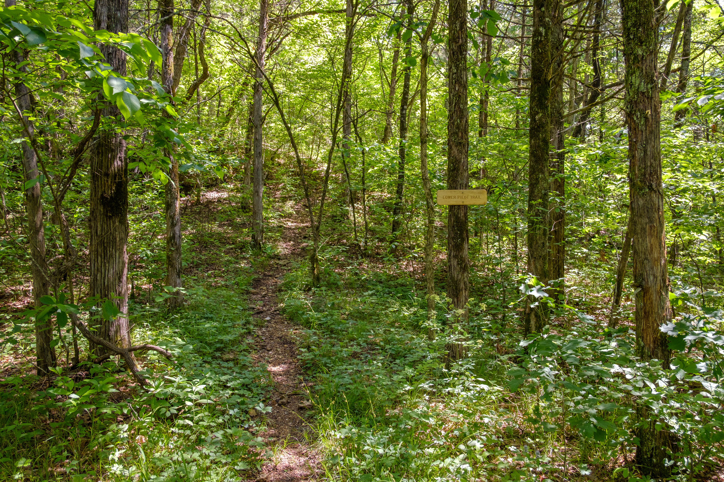
Looking East Towards Where The Trail Crosses Long Creek. Copyright © 2018 Gary Allman, all rights reserved. I have no problem with a bit of fun, but these cairns are popping up all over the wildernesses like a plague of mushrooms on steroids. It used to be that they only marked trail branches or points of interest, now they just appear at random. After having a grump and taking my pictures I high-tailed it across Long Creek and up that bloody hill that marks the southern end of the Lower Pilot Trail (and yes I was carrying water, though only two liters — 4.8lbs).

Southern End of the Lower Pilot Trail. Copyright © 2018 Gary Allman, all rights reserved. I must be getting better at this hiking thing, as I only stopped once to catch my breath, and it seemed like next to no time before I was emerging from the ridge onto the glades. Out in the sunshine it was hot. 86°F hot. I was thinking that some of those showers that were predicted might be quite welcome.

Coy Bald on the Left, Pilots on the Right. And here I am, stuck in the middle on the Lower Pilot Trail. Copyright © 2018 Gary Allman, all rights reserved. 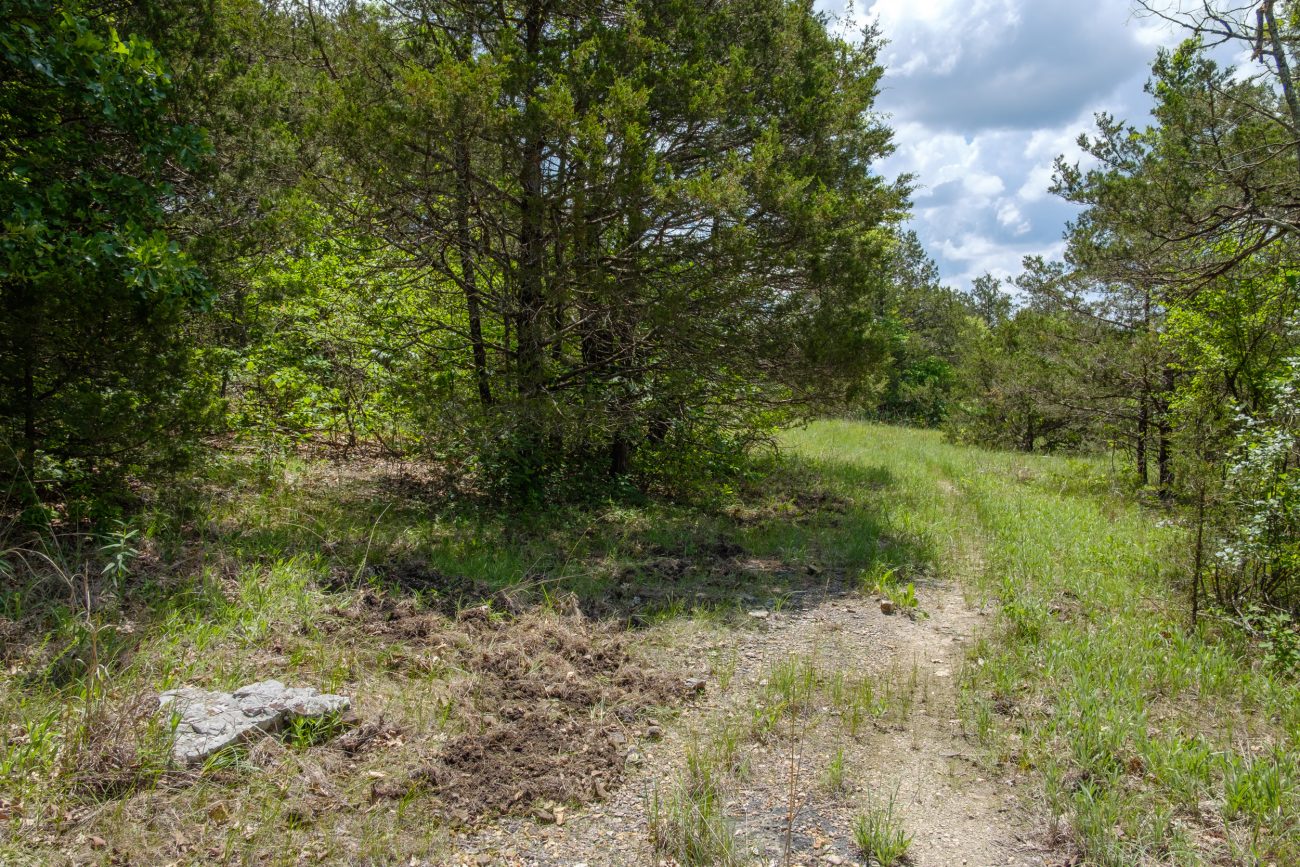
Hog Damage. Copyright © 2018 Gary Allman, all rights reserved. Near the northern end of the Lower Pilot Trail I spotted a lot of feral hog damage. It’s the first I’ve seen at Hercules Glades. I reported it to MDC when I got back, and I was told that they’ve been trapping hogs on the glades and on adjacent property. If you see signs of hogs report it to MDC so that they can get rid of them.
The hike east along the Tower Trail was uneventful, I was last on this trail in March. By 1:30 p.m. I’d arrived at the north end of the Middle Trail, and I set off downhill towards Long Creek and The Falls.
 Looking East on the Tower Trail. Copyright © 2018 Gary Allman, all rights reserved.
 Middle Trail Junction with the Tower Trail (Looking west). Copyright © 2018 Gary Allman, all rights reserved.
Along this trail I met up with three groups of students, complete with clipboards and compasses. The groups varied in size from around eight people to a single individual. They were all part of a group of geology students out of MSU on a field trip. I was told there was around 18 of them out on the trails.
 Glades on the Middle Trail. Copyright © 2018 Gary Allman, all rights reserved.
 Glades on the Middle Trail. Copyright © 2018 Gary Allman, all rights reserved.
 This is a Wilderness. Copyright © 2018 Gary Allman, all rights reserved.
 Cedars — Somewhere around here I met my first group of students. Copyright © 2018 Gary Allman, all rights reserved.
I was starting to think that any chances of being undisturbed on this trip were rapidly diminishing, especially as later on, while walking the last bit of the trail to The Falls, I noticed some people alongside the creek, and I could hear a dog and more people at The Falls.
I went straight past The Falls (which weren’t running) and carried on to what I call the ‘Upper Campsite’ I think we last stayed here in September 2011. There was no one around and after a bit of a reconnoiter further along the trail, I picked my spot and took my time setting my new tarp and underquilt up for the first time.
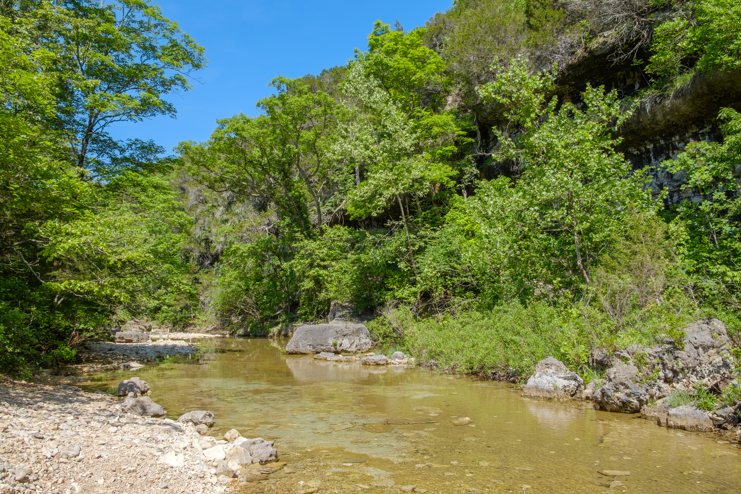
After hiking 6.3 miles I arrive at Long Creek. Copyright © 2018 Gary Allman, all rights reserved. 
After hiking 6.3 miles I arrive at Long Creek. Copyright © 2018 Gary Allman, all rights reserved. 
New Tarp and Under quilt. Copyright © 2018 Gary Allman, all rights reserved.  Hammock Camping. Copyright © 2018 Gary Allman, all rights reserved.
 Hammock Camping. Copyright © 2018 Gary Allman, all rights reserved.
The Falls are a really popular draw, and get very busy, so the impact on the area is huge. I was quite impressed by the lack of litter and mess, though it was obvious that many trees have been cut down — some to make furniture. One good thing about all the foot traffic was that it meant there was very little grass for the ticks to hide in. Even so they were out in legions, and I lost count of how many I eradicated. Despite using Deet and careful checking. I still managed to bring several home.
As the afternoon drew on the people disappeared until I finally had the place to myself. Which was good, as I filled up with water, and then had a (cold) bath. There was very little wood to be found (the word denuded springs to mind), but I managed a small fire to smoke some of the mozzies and bugs away.

Time for a quick bath. Copyright © 2018 Gary Allman, all rights reserved. 
Looking Down Long Creek Towards the West. Copyright © 2018 Gary Allman, all rights reserved. 
Some Mini Falls on Long Creek. Copyright © 2018 Gary Allman, all rights reserved. For this trip I experimented with transferring my Mountain House meal out of the packet and into a Ziploc bag. It was very effective, and something I’ll be doing in future. No sharp edges (the edges of the Mountain House packets are sharp — on our last trip they punctured the Ziploc bag holding our dessert!). The Ziploc bag was smaller and more flexible, so I could roll the top down, making eating the meal easier.
By 10:00 p.m. I was in bed. My first time in the hammock without a pad, and with an underquilt. Oh my, I was surprised how different it was. Not unexpectedly, the hammock wraps itself around you, and the underquilt keeps you toasty. laying on your side is fine, as is laying on your back. Laying diagonally keeps you surprisingly flat and straight. This set up gets a huge thumbs up from me, now I just need the chance to get out more often, though the unusually hot weather we are having seems to be against that.
The day’s total: 6.3 miles with 835′ climbed and 972′ of descent, all with the temps in the mid-eighties.
Day Two
I slept in, finally waking up just before 8:00 a.m. surprised to see someone out walking their dog. So surprised that I didn’t say anything, and they quickly turned around and went back the way they’d come. That’s another reason why I’d much rather bushwhack well off the trail and wild camp a long way from the popular haunts.

What a great spot to sit and have your coffee first thing in the morning. Copyright © 2018 Gary Allman, all rights reserved. All Mod-Cons including a Flintstone-esque table at the campsite above The Falls on Long Creek. . Copyright © 2018 Gary Allman, all rights reserved. 
All Mod-Cons including a Flintstone-esque table at the campsite above The Falls on Long Creek. Copyright © 2018 Gary Allman, all rights reserved. I spent a very leisurely morning sitting enjoying the view and playing with my gear. After I’d taken the tarp and hammock down I tried setting up my rain poncho as a tarp. Set high enough to sit under, I think the rain would be able to get under it quite easily. Set much lower and you’d have to lie down. From the sounds of distant (and not so distant) thunder I might well have a chance to try it out on my hike out.

Wet Weather Gear Test. Copyright © 2018 Gary Allman, all rights reserved. I was all packed up and on my way shortly before Midday. As the falls weren’t running I was tempted to not bother stopping there. However, I decided to get a few photographs of the area, even if pretty pictures of cascading water were out of the question.

Long Creek Falls Campsite. Copyright © 2018 Gary Allman, all rights reserved. 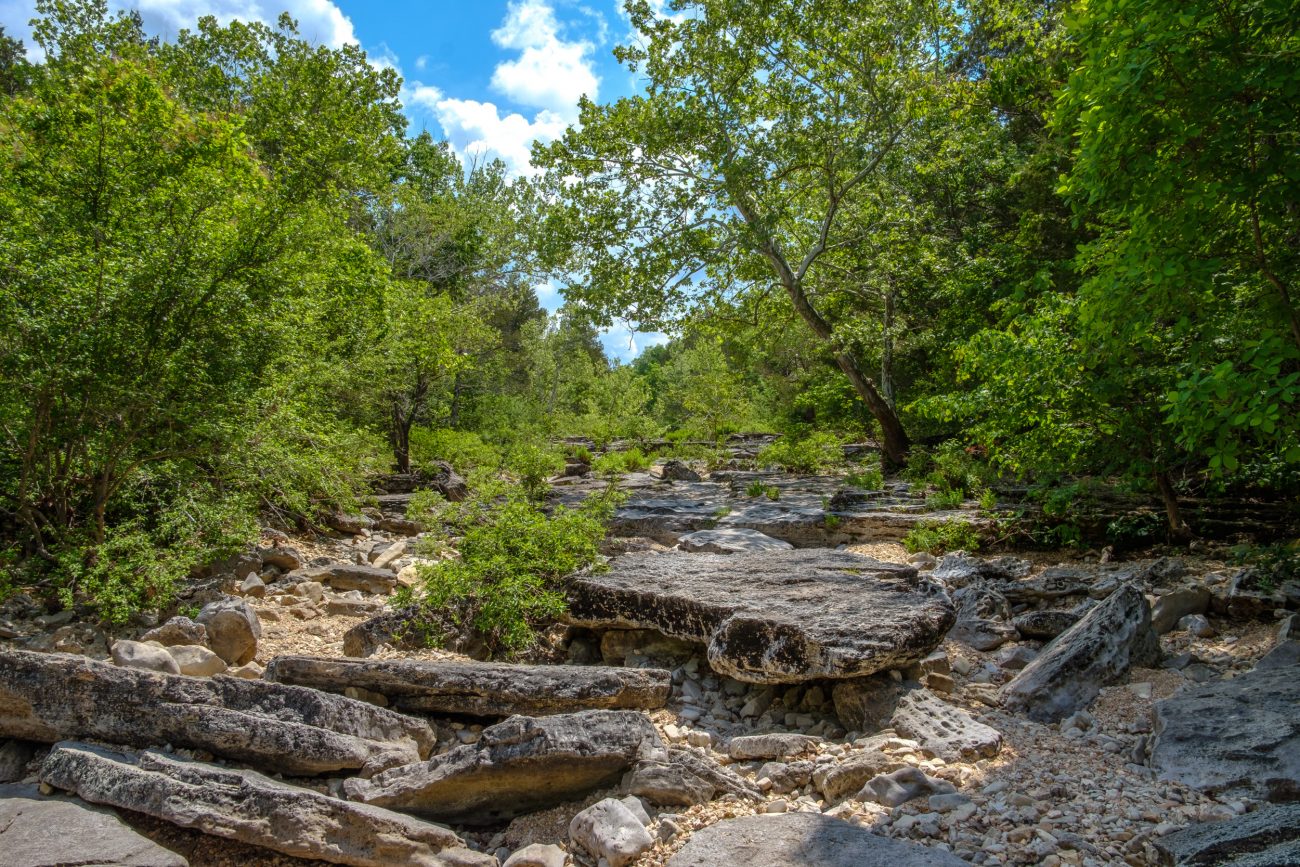
Long Creek Looking East From The Falls. Copyright © 2018 Gary Allman, all rights reserved. 
Looking West From Long Creek Falls. Copyright © 2018 Gary Allman, all rights reserved. 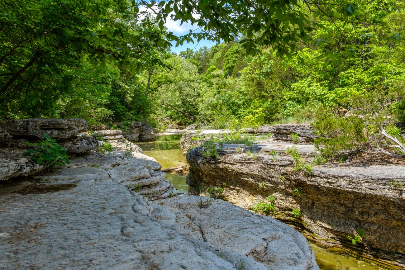
Long Creek Looking West From The Falls. Copyright © 2018 Gary Allman, all rights reserved. My trip back was as planned, via the Coy Bald Trail, which quickly rises out Long Creek’s hollow, and then goes along a ridge before skirting Coy Bald and returning to the trailhead. Hearing the thunder, I didn’t want to get caught on the top of the ridge if a thunderstorm hit, and planned to retreat rapidly downhill if that happened. The last time I sat out a storm near the Coy Bald trail, the weather radio gave us a tornado warning, and one passed by several miles to the north.
Back to the current hike, and again I surprised myself by being able to climb the hills with very few pauses. To try and keep ahead of the storms I was traveling quite quickly, though that was soon offset by stopping to take pictures along the way. I arrived back at the trailhead just after two. Four miles in two hours is fairly speedy going for me — I usually travel at an average of 1.1 miles per hour (that allows for photo stops, and other bits of exploring along the way).
 Storm Clouds Ahead. Copyright © 2018 Gary Allman, all rights reserved.
 The first two thirds of the trail runs along a ridge. Copyright © 2018 Gary Allman, all rights reserved.
 Crossing the glades. Copyright © 2018 Gary Allman, all rights reserved.
 Looking East from The Glades. Copyright © 2018 Gary Allman, all rights reserved.
 It’s Not All Glades. Copyright © 2018 Gary Allman, all rights reserved.
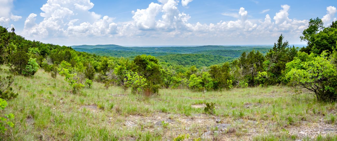
View to the South. Copyright © 2018 Gary Allman, all rights reserved. 
Ginger and I took a picture somewhere along here on December 31, 2010. I couldn’t recognize/remember the spot so this will have to do. Copyright © 2018 Gary Allman, all rights reserved. 
The Start/End of the Coy Bald Trail. Copyright © 2018 Gary Allman, all rights reserved. 
Finished! At the Wilderness Boundary. Copyright © 2018 Gary Allman, all rights reserved. The day’s total: 4 miles with 691′ climbed and 540′ of descent, with the temps mainly in the upper-eighties.
And the rain? It rained hard about twenty minutes after I’d started driving home, and lasted most of the (hour-long) drive back.
May 22, 23. Long Creek, Lower Pilot, Tower, Middle, and Coy Bald Trails. Final Thoughts
The tarp and underquilt were great, though I’ve yet to put any tarp through its paces in bad weather. However, I’m very glad to see the back of the big and heavy polypropylene tarp, and the sleeping pad.
I took a new 6′ x 3′ Tyvek ground sheet, and that was a great improvement over the smaller size I’ve been using up to now. I should have changed that up ages ago.
The jury is still out on the rain poncho, it’s a lot heavier than I expected. I had hoped that it was going to be a drop in my pack and forget item, but right now, I’m not too sure. We’ll see.
The camera clamp worked just as expected and it’s good to have a small tripod with me. I’ll probably use it more on the next trip. This time I forgot I had it until the start of the second day.
As I mentioned in the beginning, I’m going to have to take stock and see what else I can drop from my pack as I still want to reduce my pack weight and size further. As the amount I have to carry reduces, one way to save weight may involve a smaller pack. Reducing weight is one thing, but I’m not prepared to give up on my luxuries — though I’m not quite sure what classes as a luxury anymore, or even if I have any of those left! Indulgences might be a better term than luxuries at this point.
This is an edited and abridged version of a post that first appeared on Ozarks Walkabout.